A collective term for tools that map and analyze the earth and most things on it, geospatial technology is making significant strides. These technologies help us to understand spaces, and monitor changes and patterns in landscapes, cities, and even societies.
So, what is geospatial technology?
What Does Geospatial Mean?
To understand what geospatial technologies are, we must start with an understanding of the word 'geospatial'. In simple terms, geospatial refers to location-specific data. Geospatial information relates to features on the surface of the earth and their geographic locations.
So, when it comes to what geospatial means, it's really anything relating to a location.
What is Geospatial Data?
Geospatial data is any data that has a geographic component to it. It can describe features, objects, or even events that have a specific location. Geospatial data will combine information about the location and attributes of an object. Location information can be either dynamic or static.
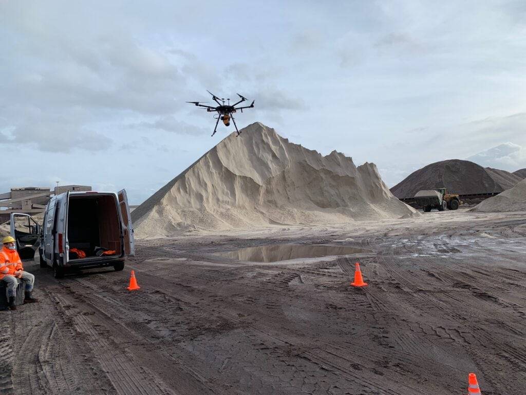
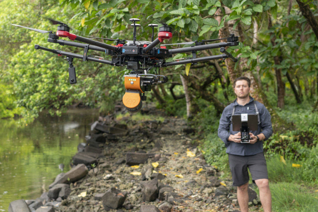
A variety of methods achieve this type of data collection, like using remote sensing to collect data without being near the area. For example, Unmanned Aerial Vehicles (UAVs) gather information quickly and effectively, allowing for the collection of vast amounts of data.
Examples of Geospatial Data
Geospatial technologies collect data, but the representation of this information is different depending on the technology chosen. Here are some examples of geospatial data:
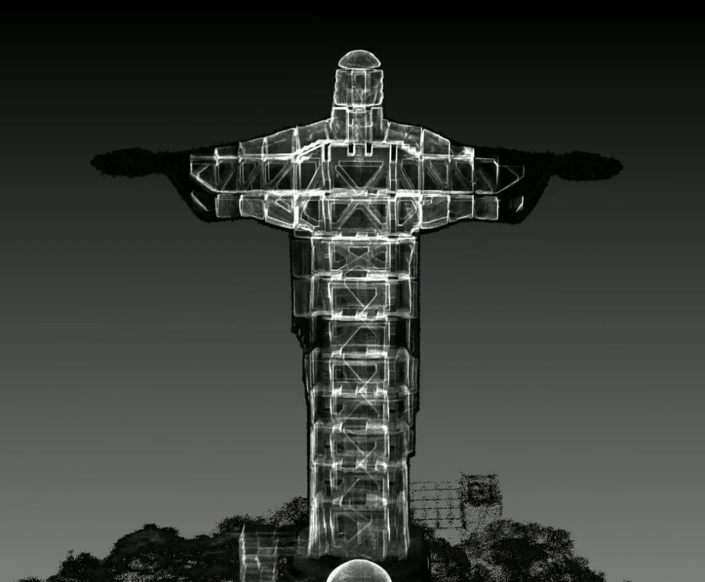
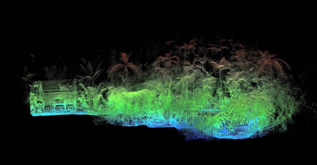
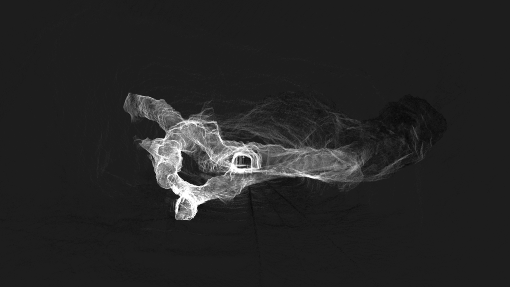
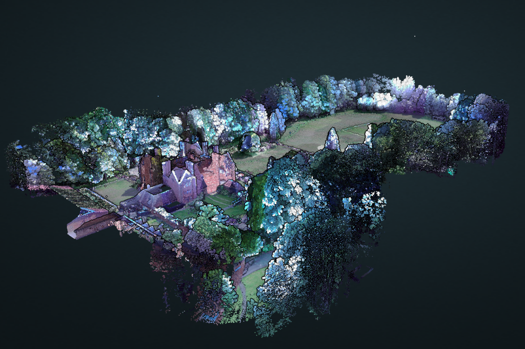
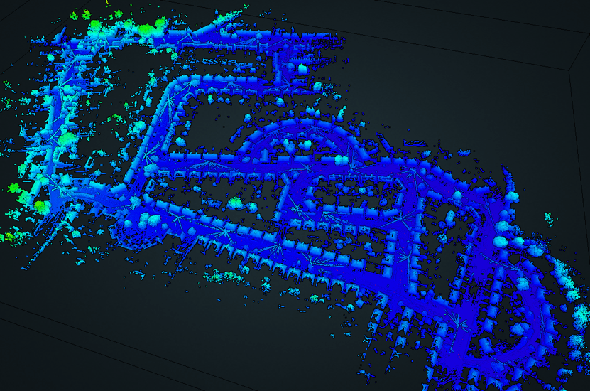
Point Cloud Data
Using remote sensing, laser scanners collect millions of digital data points within an environment. The vast collection of points is known as a point cloud. Each point has a location coordinate, and the set of points creates a 3D model of an area or object. The more points in an area, the denser the point cloud and the clearer the 3D representation of the real world.
Vectors
Vectors consist of points, lines, and polygons. Each point has a coordinate, and lines and polygons are formed by connecting them. These elements represent real-world features in any given environment. Each feature has a text or numerical attribute to describe them.
Satellite imagery
High-resolution satellite imagery is a type of geospatial data too. Satellites view our world from space, showing us a much larger picture of an area.
Census data
When census data links to a geographic area, it becomes a type of geospatial data. For example, city planners will use population data from a census to plan where they might build new roads, schools, or hospitals.
Who uses Geospatial Data?
There are a host of applications for geospatial data, which means a wide range of groups, companies, and people use it. Examples include:
- Military
- Intelligence agencies
- Retail
- Maritime
- Healthcare
- Finance
- Aeronautical
- Logistics and transportation
This data is ideal for analysis, modeling, simulation, and more. Geographic information is vast, rich, and can be powerful when used effectively.
So, what is Geospatial Technology?
Now that we've explained what geospatial means and what geospatial data is, it's time to consider how this translates into technology. Geospatial technology provides a way to collect and analyze geospatial data. It's a collective term for the various modern tools and systems that help us to map the earth's surface, understand societies, and interpret spatial patterns.
Examples of Geospatial Technologies
The term 'geospatial technology' is broad and covers a variety of components. Here are some examples of commonly used geospatial technologies:
Remote Sensing
LiDAR (Light Detection and Ranging) is a popular method of collecting spatial data using remote sensing. LiDAR emits a laser beam and measures the reflected light return time to the device after hitting a surface. By doing so, LiDAR generates hundreds of thousands laser beams per second, to create point clouds.
GPS
The global positioning system (GPS) is a common type of geospatial technology. Satellite data feeds into GPS and uses for global navigation and geolocation. Global positioning systems have been fully operational since 1993 and all modern smartphones contain GPS.
GIS
Geographic information systems (GIS) combine maps with a database of other descriptive information. Geographical information systems allow the management and analysis of location information. This type of spatial analysis has provided insight that has changed the way the world works.
Layering a base map with other data sources to create a powerful visualization, GIS information might include satellite imagery, aerial photography, point cloud, or vector data.
Why is Geospatial Technology Important?
Geospatial technology enables the collection of geospatial information, and this data collection is extremely valuable. It's important because it informs us about many different issues. From improving national security to urban planning, biodiversity conservation, providing humanitarian relief, and even forest fire suppression.
The benefits of geospatial information
Using geospatial technologies to gather location information provides us with data that can give a deeper understanding of many issues. This spatial data can answer questions, and help with predictions, analysis, and decision-making.
Who uses geospatial data?
There are many applications of geospatial data in society. Here are a few examples:
Urban Planning
Urban planning uses geographic information systems for spatial analysis and modeling of urban environments. Getting all the relevant data needed for land maps, planning applications, and site selection are complex. Advances in geospatial technology have improved data quality. Using a moving vehicle, it's possible to collect data about large areas or city blocks quickly and efficiently.
Natural Disasters
Managing the effects of extreme weather conditions like floods, earthquakes, or wildfires is easier with geospatial data. Weather data and forecasts coupled with satellite imagery, census data, and other GIS information can help to make predictions and keep the population safe. During a post-natural disaster event, LiDAR is ideal for identifying areas in need of help and support.
Improving the Environment with Geospatial Data
As well as human societies, geospatial data collection is vital for protecting our environment. Here are some of the benefits that such information can bring:
Land-use Changes
Changing land from agricultural to urban or deforestation can affect biodiversity, climate change, and much more. Geospatial data helps to predict geographic patterns, determine the suitability of land for changes in use and inform of potential effects.
Conservation
Geospatial information helps conservation efforts, informing large-scale projects like forest management and habitat protection. For example, the Australian National University uses mobile LiDAR to map trees, and forests, combining the data with high-resolution photography, aerial imagery, and meteorological data, to guide forestry research and habitat protection.
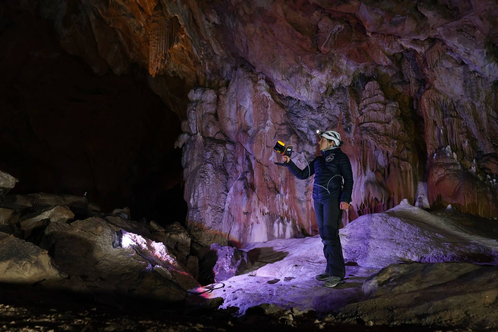
Geospatial data in Mining
Rapid scanning with LiDAR scanners helps those on-site to map tunnels, stockpile volumes, pits, and caves. Understanding these environments and the changes taking place and being able to collect the data quickly can help to keep people safe.
Often, technology like LiDAR scanners removes the need for a person to enter a potentially dangerous environment or limits exposure to that environment. With LiDAR, data collection is quick, creating 3D maps to understand, plan and find potential problems to create a much safer working environment.
Public Safety
Laser scanners are useful for mapping terrain, simulating battlefield environments, and planning routes for military operations, which helps with intelligence and decision-making.
Police and security personnel also use them to quickly capture geospatial data to record evidence or to create plans for entrance and exit routes for large venues, such as stadiums and schools, in case of emergency as part of their pre-incident planning.
AECO and Geospatial Data
In AECO there are many applications for geospatial data. Understanding sites, landscapes, and buildings help large-scale projects run smoothly.
Preserving Landmarks
Scanning a large landmark or historical site provides us with descriptive information about the area. This information is ideal for creating a digital replica of the site and aiding the preservation of heritage areas. Accurately keeping digital records of heritage landmarks or buildings periodically provides a source of truth for changes over time, whether man-made or natural.
Streamlining Construction Processes
In construction, large teams of people need to work closely together to complete complex projects. This is difficult without access to accurate information about sites, materials, and progress. Historically, different data formats left siloes and made it hard for teams to work together. Improvements in geospatial data collection are changing the game for the construction industry because spatial data works with other data and is objective.
Geospatial Data Touches Almost Everything
Without Geospatial information, our daily lives could be very different. We don't realize how much impact these technologies have on the development of spaces, buildings, natural resource management and much more. Geospatial data is vitally important to our world, and we hope we've managed to help you appreciate some of the reasons why.
Learn more about FARO's mobile mapping solutions here