Colorize My Data With ZEB Cam in GeoSLAM Hub

Overview
When using an RT system, your data will need to be re-processed before the adding video option is enabled. For other solutions, the video can be added immediately. A single scan may be broken up into multiple videos depending on the scan duration. Ensure that you add all the associated video files at once.
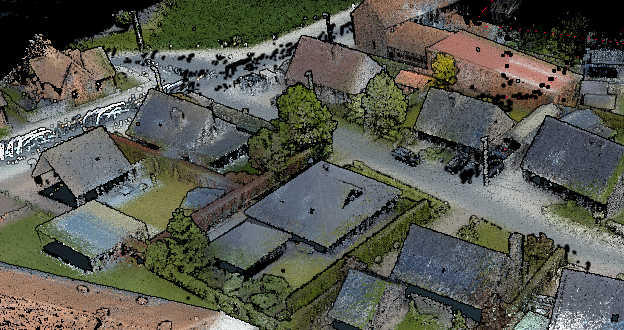
If the ZEB Cam was used during the survey, it is good to make the most of this data. Firstly, for capturing the data with the ZEB Cam please see the Capturing Colored Data article, if you haven’t done so already. Once camera data is captured and copied, it can be processed in Hub to colorize the point cloud and synchronize the video trajectories with the scan data. This allows you to see the video in Hub Viewer and online, and it makes it possible to simply use it in third party applications.
When wanting to colorize your point cloud you need to reprocess your data with the following steps:
- Add additional point cloud with ZEB Cam + Shaded for the color
- Import the video (if you have 2 videos for one scan, make sure the sequence of them is correct)
- Process
Procedure
- A video camera symbol appears underneath the dataset name if a ZEB Cam has successfully been used with a scan.
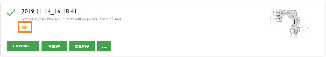
- Click on the options button
 .
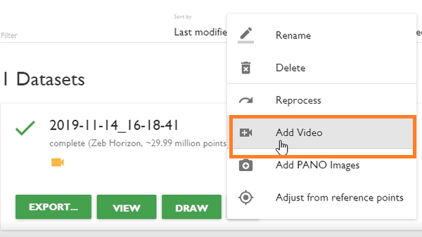
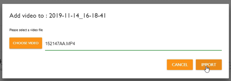
. - Click Add Video.
- Locate video file and click Import.
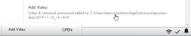
- Once colorization is complete, you will see a notification.
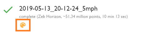
- You should see a colour palette symbol against the dataset now. If you don't see it, close and reopen GeoSLAM Hub.
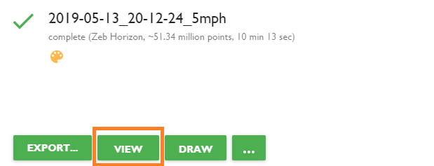
- Click the View button to open the scan in GeoSLAM Viewer.
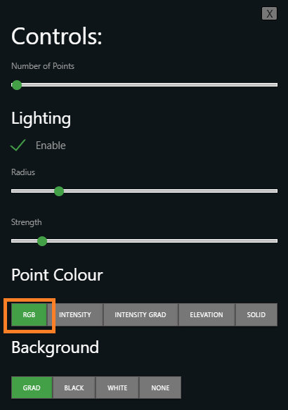
- Change the point colour to RGB to view your point cloud in colour!