What is Revit?
Autodesk Revit is a Building Information Modelling (BIM) software. Helping professionals design, build and maintain higher-quality, more energy efficient buildings.
Revit contains tools which allows for planning and tracking throughout the building’s lifecycle. The software allows multiple disciplines to collaborate more efficiently and make more informed decisions early in the design process.
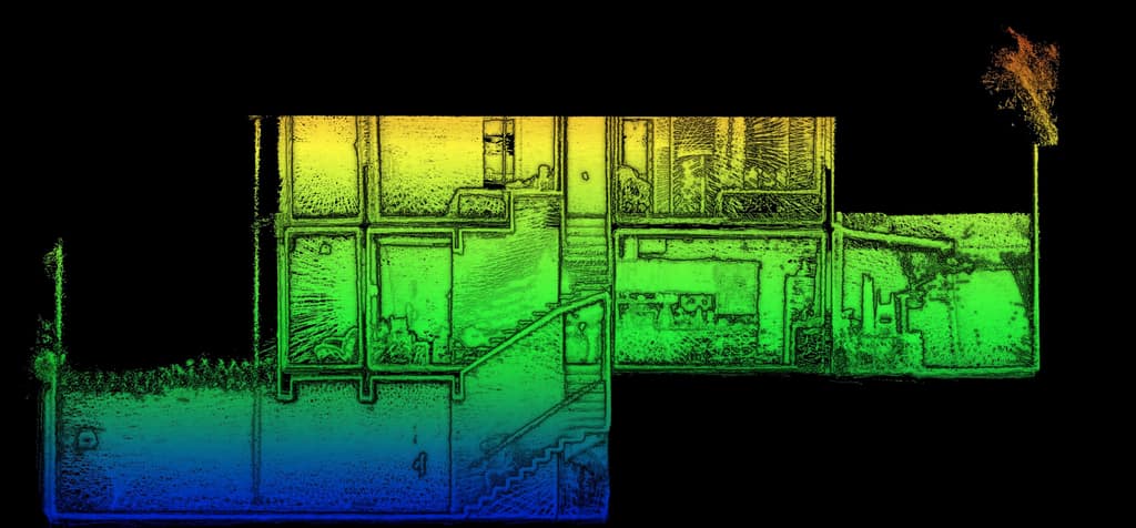
As GeoSLAM’s ZEB laser scanners allows for quick data capture, our solutions can be used to scan any existing buildings with the purpose of using the data to produce a digital twin.
What can you do with Revit?
What industries are using Revit?

Real Estate
Architecture

Education

Public Safety

Engineering

Government

Healthcare

Construction
Revit integration with GeoSLAM Draw
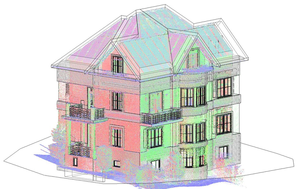
GeoSLAM Scan to BIM is a simple way of rapidly capturing essential information about a space, creating a point cloud and importing the data into a BIM software, like Autodesk Revit.
Revit directly integrates with GeoSLAM Draw for a simplified workflow to produce 3D models. Within the GeoSLAM Draw integration, users can create levels facades, internal walls, windows, doors, objects, stairs and roofs. A split screen view is used to generate elements, allowing users to work on both software simultaneously. GeoSLAM Draw also provides valuable vectorisation for custom modelling.
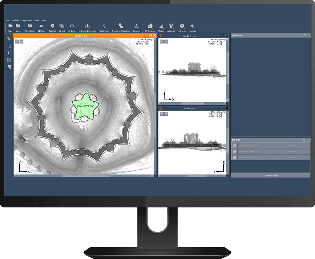
The Floorplans module in GeoSLAM Connect is also useful in the Revit workflow as it can contextualise areas of interest that have been scanned.
GeoSLAM to Revit Workflow

Collect data with a ZEB scanner
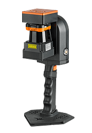
ZEB Go
Used mostly for scanning indoors or in underground mines and caves with an IP64 rating. Can be used outdoors and has a range of 30m. PAir with a number of accessories such as pole or cradle.
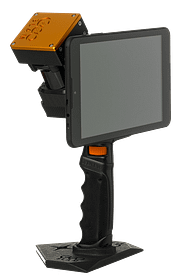
ZEB Revo RT
Real-time processing which means you can visualise the scan as you move. Has a range of 30m and IP51 rating. Used mostly for scanning indoors. Can be paired with a number of accessories such as a pole or cradle.
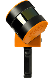
ZEB Horizon
The most flexible of the ZEB family with a range of accessories which makes it suitable for lots of different applications. Can be used to scan indoors and outdoors with a longer range of 100m. Collect data using a UAV or vehicle.
What’s included with a ZEB purchase
All the below comes as standard when you purchase any ZEB scanner.
Packed with automated tools, visualise your data in GeoSLAM Connect.
Create clean, georeferenced point clouds automatically. With the press of one button, your data will be automatically processed, saved in a folder of your choice, and prepared for the next step of your workflow.
The after sales package to get the most from your ZEB products
The comprehensive after sales package where you’ll be entitled to all the latest software updates and new features, unlimited software support and up to 3 years hardware warranty.
The home of all supporting materials for GeoSLAM products
With a single My GeoSLAM login, you’ll have access to:
1. GeoSLAM Academy – Get the most from your GeoSLAM products with training videos, best practice and user guides.
2. Knowledge Base – Search the Knowledge Base for troubleshooting articles and FAQs.
Want to know more?
If you’d like to know more about how GeoSLAM data can be used with ESRI software, submit the form below.


