Last Updated on 25th April 2022
Revealing the fascination of a unique historic treasure
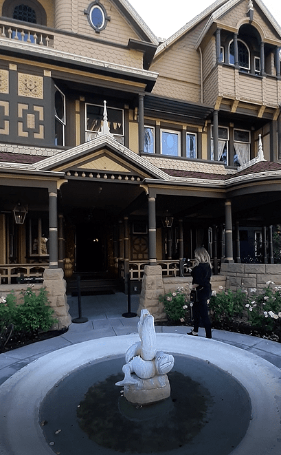
A famous historic Californian landmark, The Winchester Mystery House was once the personal residence of Sarah Winchester, the widow of firearm magnate, William Wirt Winchester. The mansion’s name derives from the claim that it is haunted by the ghosts of those killed with the Winchester rifles – and the house was Walt Disney’s inspiration for the Haunted Mansion at the Disney Parks.
Construction first started in 1886 and for almost the next forty years, Sarah devoted herself entirely to transforming a small farmhouse into one of the most architecturally creative mansions in the State. Spread over a massive 24,000 square feet, the four-story mansion features some 160 rooms, 40 staircases, 10,000 panes of glass, basements, attics and a myriad of passages, corridors, alcoves, and nooks and crannies.
 Scanning with the ZEB Go
When it came to surveying the mansion and grounds, Brian Rosensteel (Senior Solutions Architect) knew GeoSLAM’s mobile mapping systems could easily and quickly negotiate the confined and difficult to access places with a high degree of accuracy.
Mapping complex areas in record time
GeoSLAM’s lightweight handheld scanner, the ZEB Go, was selected to survey the interior residence. The robust ZEB Discovery was used for mapping the 4.5-acre estate and outbuildings. By recording 43,000 measurements per second with its rotating sensor, the ZEB Go enables you to create a comprehensive digital model of an enormous mansion, for instance, within ten minutes, just by walking between rooms at a normal speed.
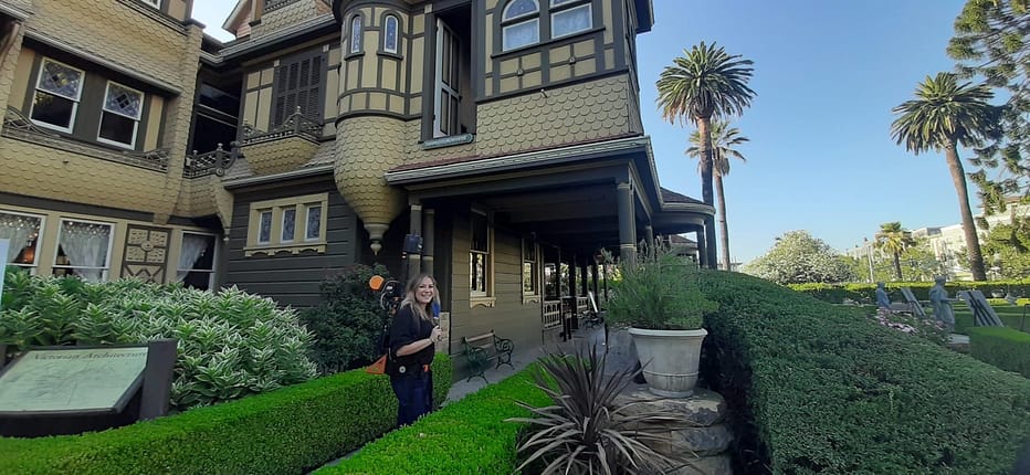
Scanning with the ZEB Discovery
A point cloud can be quickly processed via GeoSLAM Hub – enabling you to create 2D and 3D floorplans up to ten times quicker than traditional survey equipment. By gaining rapid insight into your scan, you can see the areas you’ve covered, or missed, and the route you’ve taken before you leave the site – so no time-wasting return visits.
Data can be exported from GeoSLAM Hub in all industry standard file formats. Collect your data once, then easily take it into a huge range of software suites such as Autodesk or Esri. Creating accurate as-built documentation for complicated structures has never been faster!
‘The Winchester Mystery House is one of the most complex buildings I have ever had the privilege to survey,’ said Brian. ‘However, with our mobile scanners it took only a few hours when it would have taken weeks using terrestrial survey tools. And with the intelligent point cloud processing software you can transform 3D data into actionable information in minutes.’
Brian concluded:
‘Even newcomers to digital surveying will be surprised at how quickly and easily they can map the space around them with the ZEB Go. They can literally get started in minutes, with minimal training. And at such an affordable price point, it will appeal to newbies and experienced surveyors.’
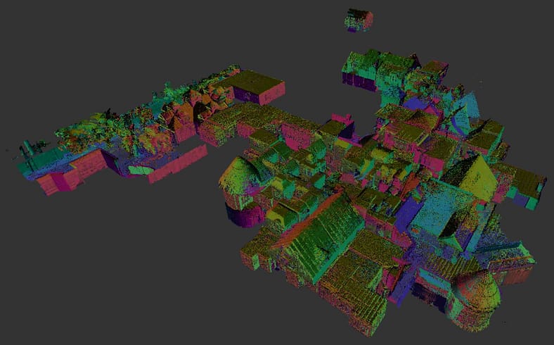
Point Cloud data of the site
Key stats
- Exterior scan: 172.3 million points and 820 high-resolution panoramic images captured in a 20-minute scan
- Interior scan: 7 data captures, 20 minutes per scan, 160 rooms scanned in 2.5 – 3 hours.
Handheld laser scanning for everyone
Robust and durable, GeoSLAM’s ‘go-anywhere handheld laser-scanners are ultra-light, splash-proof and dust-tight (with ratings up to IP64 level). They’re adaptable to any environment – inside or outside, in daylight and darkness – without the need for GPS. They’re so user-friendly that anyone can learn to use them in no time.
They are truly versatile; you simply walk and scan, or alternatively, they can be attached to a trolley, robot, drone or autonomous vehicle. Eliminating the need for laborious time-consuming set-ups – GeoSLAM provides a reliable way to rapidly map and understand spaces – however haunting they may be!


