Last Updated on 25th April 2022
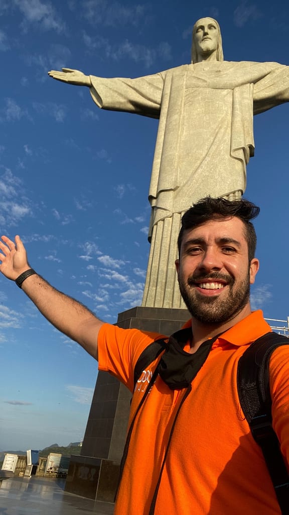
Gabriel de Praxedes, our Latin America channel manager, undertook the project of a lifetime when he scanned the Christ the Redeemer monument in Brazil’s Rio de Janeiro.
We sat down with Gabriel and talked through the project from its inception, right through to bringing one of the ‘Seven New Wonders of the World’ to life in digital form.
Read more below and see the video of Gabriel in action.
Why did you choose to scan Christ the Redeemer?
The idea was actually born way back in 2019. At that time, we had recently completed scans on historic monuments like the Lincoln Memorial in Washington and Arc de Triomphe in Paris, so there was tremendous room for potential on other structures of significance. Being from Brazil myself, I suggested we take on the Christ the Redeemer statue – it would have been our first ‘Wonder of the World’.
I contacted the GeoSLAM dealer in Rio, CPE Tecnologia, and we began mapping out plans to scan the statue.
As a Brazilian yourself, how special was this project for you?
There are no words to describe how proud I feel to have worked on this project.
I love my country, and after my hometown, Rio is by far my favourite place in Brazil – it’s vibrant and full of life. It’s a surveyor’s paradise. Of course, the biggest draw of all is the Christ the Redeemer – one of the ‘Seven New Wonders of the World’.
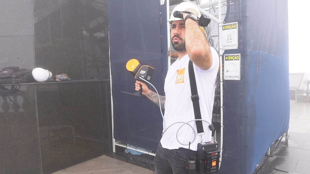
It was a real experience and blessing for me to be involved – from being stood at the summit soaring close to the clouds, to getting the chance to climb the internal staircase and sit atop the impressive monument. Almost no one has had the chance to do that, and there’s no other 3D scanning product that could navigate the space with ease so I feel an immense privilege.
What challenges did you expect to face?
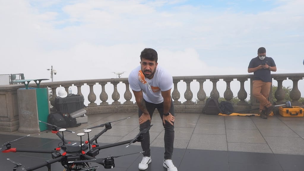
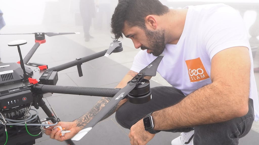
Our first challenge was the weather. Given its location, situated more than 2,300 feet above sea level, it should be no surprise that Christ the Redeemer has its own unique, localised weather system. At the foot of the mountain, it appeared to be clear and rain-free, but as we reached the summit on our first attempt at shooting, we were covered in thick fog.
The second challenge was to plan carefully to ensure we were able to execute the work in the best way possible as we knew there’d be a number of factors to consider – from its size and position atop a mountain, to the narrow internal structure of the staircase.
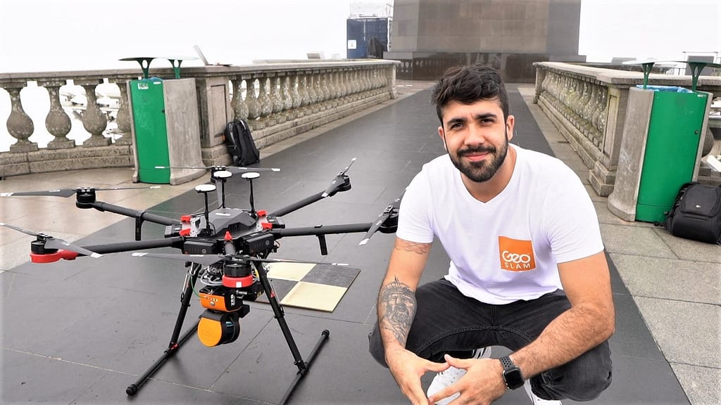
However, the ZEB Horizon gave us many advantages, from accessing the difficult-to-reach places with its UAV capabilities and handheld ‘walk-and-scan’ functionality, to enabling our team to carry the device up the steep staircase to the summit due to its lightweight yet robust nature.
Although we had the summit of the statue all to ourselves for a short time, we knew the scan had to be done as quickly as possible. The statue is visited by millions of tourists each year and is open from 8am – 6pm every day just to accommodate demand, so scanning the monument fast in the time we had allotted to us – while of course maintaining accuracy – was a major factor.
A traditional static scanner for example, simply wouldn’t have been able to meet the requirements for this particular project. So, without the ZEB Horizon’s versatility I’m certain this project would have not been possible.
From start to finish, how long did the project take?
It took our team just 45-minutes to map both the inside and outside of the statue – an incredible feat, given the size of the structure and the intricacy of its inside!
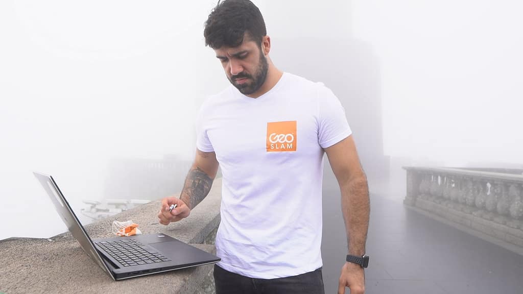
In your experience, how important is it to be able to review the scan on site?
This particular location only emphasised the importance of reviewing footage and scans on site.
With the space only closed off to the public for a short period of time, we had to work effectively with the statue’s on-site team to meet their timing requirements.
If we hadn’t reviewed the scan while at the summit, and had to wait until we’d left the site, it could have involved planning out the whole project again and finding a time to return back to the summit – not to mention the added inconvenience to the site, and costs involved. And, because GeoSLAM data can be re-processed, we were 100% confident we were leaving site with everything we needed.
What would be your dream project to work on?
This is a tough question! I’d say either the Pyramids of Giza, or Chichén Itzá in Mexico. There are always new projects around the corner, but whatever our next project is, we know that we have this incredible technology that just keeps defying all rules.
See Gabriel in action
Get in touch
Want to know more about this project?
Or working on a similar project and would like to know how GeoSLAM could help you?
Please fill out the form below and we will get back to you.


