Last Updated on 8th September 2023
Laser Scanning in Southern California
with Brian Rosensteel
SLAM Scanning
SLAM scanning is becoming more commonplace in the surveying industry due to the ease of use, accuracy, and versatility of the handheld devices. As the technology continues to grow, so do the benefits of handheld scanning compared to traditional means of capturing the measurements of a building. Documenting large spaces is now as simple as walking around the property to capture a pointcloud, saving both time and money for surveyors and their clients.
Back in December 2020 I was invited to demonstrate the potential of handheld SLAM scanning, by capturing a 45,000 square foot hotel in Southern California. The hotel was due to be renovated and the architects needed up to date measurements and a BIM model of the building. Over just 4 days, I was able to capture, process and model the entire hotel to LOD (level of development) 300.
Having examples like this is important because it shows the data that you get from a handheld scanner is more than enough to create an accurate digital model that can be used by industry professionals.
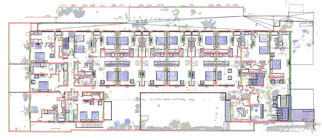
The Scan
The hotel has 3 floors, a parking garage, 40 suites and over 45,000 square foot of space to cover.
I decided that the ZEB Horizon was the best device for the job because it is suitable for both indoor and outdoor scanning, it has a 100m range and collects 300,000 points per second. After walking around the building, I decided that 5 scans would be enough to collect all the data I needed to model the building and got to work scanning. I captured 5 scans, each taking approximately 15-25 minutes, covering all of the hotel’s rooms, the parking garage and the exterior.
In just 2 hours, I had an accurate pointcloud of the hotel and enough data to begin the modeling process.
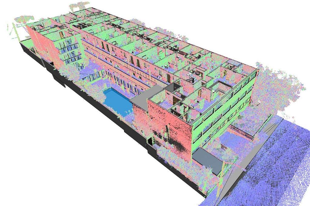
Processing
Once the scan was completed I imported the data into GeoSLAM Hub, where I used the merge tool to stitch the scans together completing the pointcloud. The merged data was then moved into GeoSLAMs Draw BIM software package to be aligned and prepared for use in Autodesk. I then exported the pointcloud as an Autodesk ReCap RCP project out of Draw, and then inserted into Revit to begin modeling.
Modeling
Over the next couple of days, I created the digital model of the hotel using the pointcloud as an underlay for accurate and detailed results. Using only the native tools in Autodesk Revit, I was able to create a complete model with an LOD (level of development) of 300.
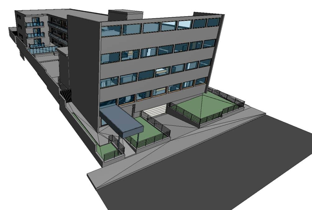
With the complexity of some of the rooms in this building, a static scanner would have needed 2-3 days in the field, plus multiple days modeling the data. With the GeoSLAM Horizon, I was able to scan, process and model the entire 45,000 square foot area in approximately 4 days with a similar level of overall accuracy.


