
The flexibility of handheld Lidar makes capturing difficult environments less challenging, safer, and quicker. Freedom from GPS opens opportunities to capture areas with no satellite coverage such as caves or mines. The versatility of the scanners allows for mounting on backpacks, poles, cradles, and UAVs, which improves accessibility.
This blog explores the use of handheld laser scanners for mapping difficult-to-access environments.
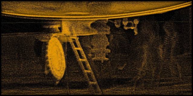
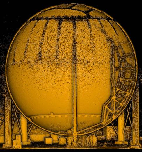
Scanning a Large Empty Gas Silo With Handheld Lidar
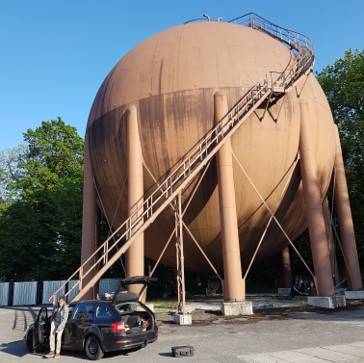
In one continuous scan, a handheld Lidar solution captured both the outside and inside of a large round empty gas silo. Using the walk and scan method, the operator mapped the outside of the silo, before transitioning inside through a small hatch underneath to generate a complete point cloud in just five minutes. The mobility of the scanner made transitioning simple and safe, and the speed of capture meant the team did not have to stay in the silo longer than necessary.
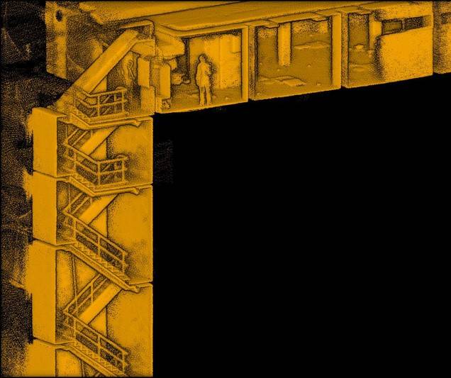
3D Laser Scanning the Staircase of a Derelict Building
When posed with the challenge of mapping a staircase in a derelict building, the team involved in this project chose to use a handheld laser for quick and efficient data capture. Like the silo, the stairwell has repetitive features, which did not prove difficult for the laser scanner, and it delivered a complete point cloud safely and in only 10 minutes. Handheld LiDAR looks at an environment in intricate detail to differentiate between the floors of the building.
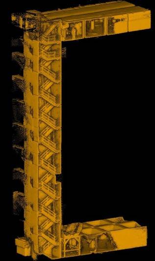
The team captured the staircase by simply walking at a normal pace from the bottom to the top and back down again. The speed of capture was a priority for the safety of the team, so the handheld laser scanner's short capture time to create an accurate point cloud was ideal.
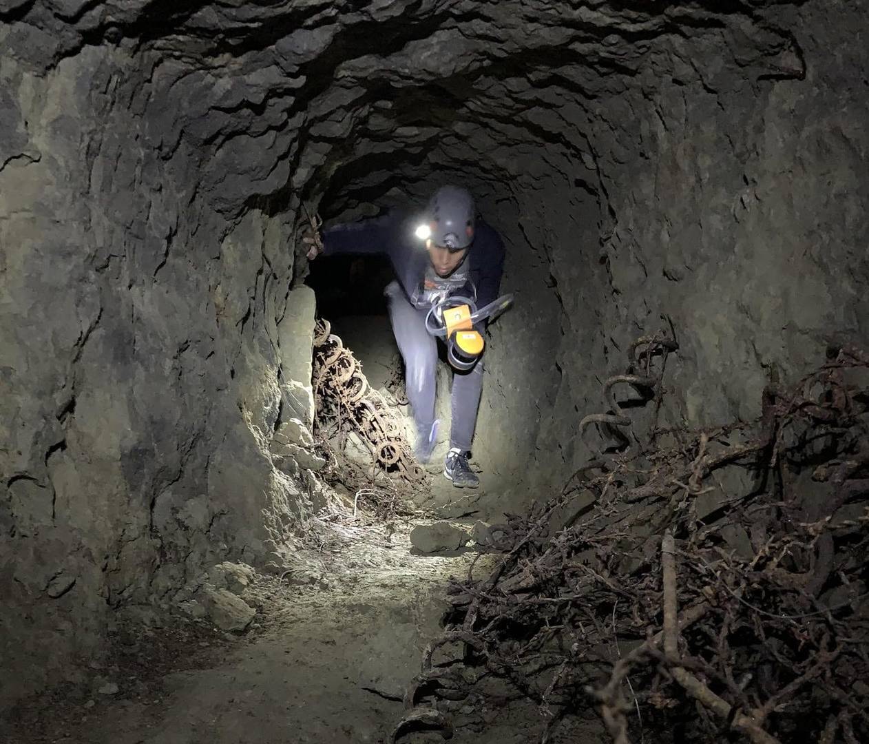
Mapping a Cave System
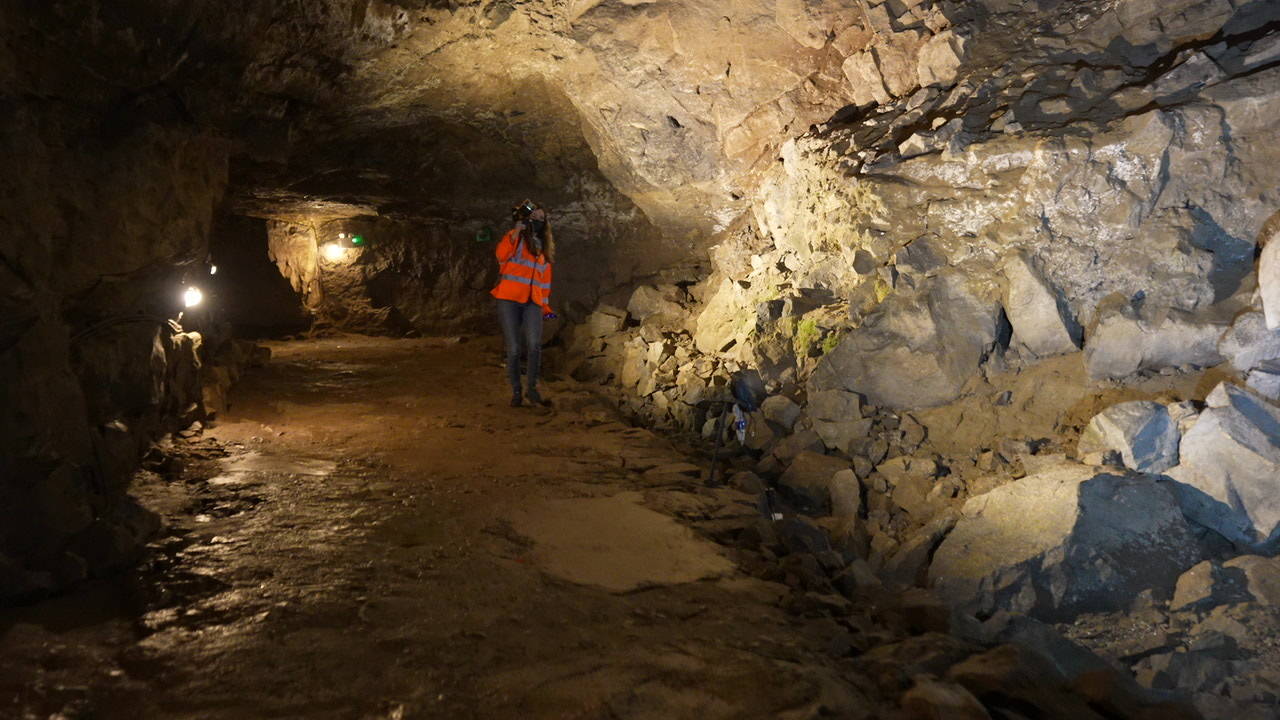
3D laser scanning underground can be difficult when navigating tough terrain in little to no light. Caves often have vast open rooms, but also small crawlspaces which can be difficult to access. Using handheld laser scanning, a team of surveyors captured the Caverns in the Peak District in the UK by walking from the entrance of the cave system to the end and back again, often crawling through small spaces along the way. In less than 20 minutes they had mapped a complete and accurate point cloud of the entire cave system.
The versatility of handheld laser scanners means users can efficiently capture data in confined environments without disrupting the scanning process. Additionally, as SLAM systems do not require GPS to create point clouds, this widens its usability in underground spaces.

The increased popularity of handheld laser scanning has opened opportunities for industry professionals to map spaces that would have proven difficult previously. The mobility of the scanners has made traversing rough and unsafe terrain easier, and the versatility of the devices has widened the scope for mapping hard-to-access spaces. Additionally, the speed of capture has not only improved safety but has proven to be a cost-effective way of 3D laser scanning.
Learn more about FARO's mobile mapping solutions here