Last Updated on 28th February 2023
GeoSLAM partner with Flyability
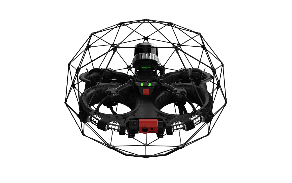
GeoSLAM partners with drone inspection specialists Flyability for the launch of their new drone, Elios 3.
Founded in 2014, Flyability has spent almost 10 years perfecting the inspection and exploration of indoor, inaccessible, and confined spaces. Designed to navigate previously inaccessible environments for humans, the Elios range of drones are collision-tolerant and protected by a cage, giving companies a flexible and cost-effective way to safely inspect truly difficult areas.
The latest product in Flyability’s range, Elios 3, supports LiDAR technology for the first time ever, providing even greater visualisation of hard-to-reach areas. Partnering with GeoSLAM, Elios 3 users can enhance their system with the ‘Survey Package’ integrating GeoSLAM Connect for survey-grade mapping data.
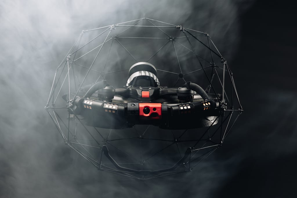
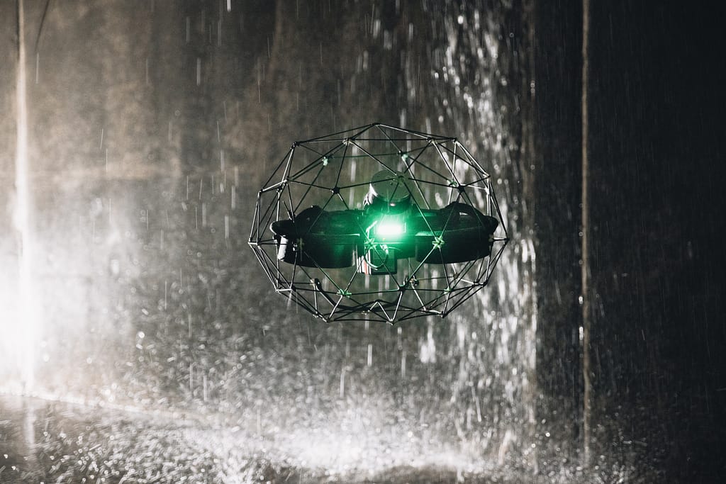
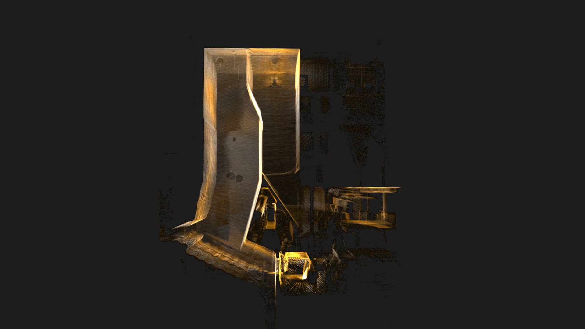
The LiDAR capabilities of the Elios 3
The Elios 3 is a versatile, easy to pilot drone and a powerful data harvesting tool. Its collision-resilient rugged design allows for close-up inspections of inaccessible areas. The addition of real-time LiDAR point cloud visualisation further improves in-flight navigation.
A SLAM-based proprietary stabilisation algorithm called FlyAware™ lets the drone hover in a stable location for a prolonged period, even in the toughest environments. This gives pilots of all skill levels a tool to undertake complex missions with minimal training.
The Survey Package, offering integration with GeoSLAM Connect, provides Elios 3 users survey-grade accuracy in their 3D models and maps. This offers users the ability to capture rapid floorplans in infrastructure mapping, underground monitoring and inspection, time-lapse construction progress management, volumetric stockpile management, and much more.


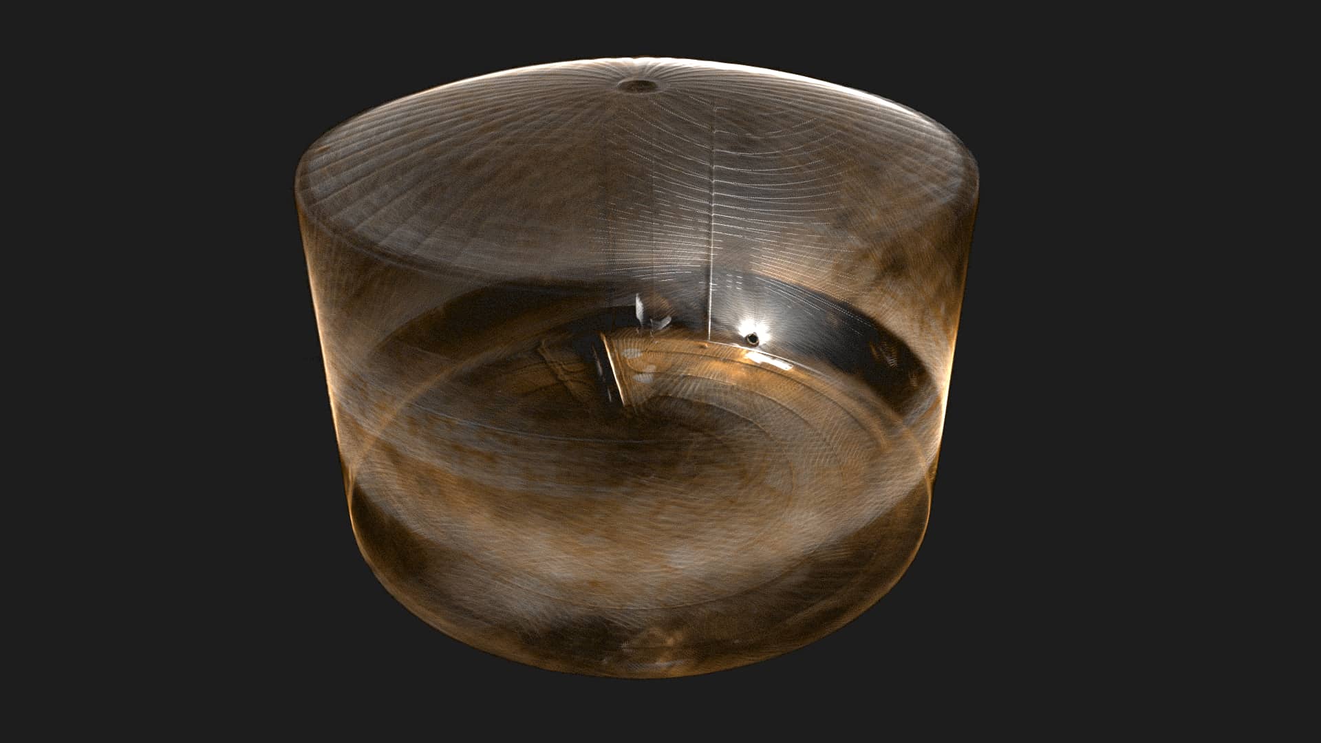
GeoSLAMs Survey Grade Package
Powered by GeoSLAM’s world-leading SLAM algorithm, GeoSLAM Beam, Connect offers a simple and automated way to process point cloud data. Processed data can be viewed in the easy-to-use 3D viewer and exported to industry-standard file types such as .LAZ, .LAS, .PLY, and .TXT for use in 3rd party software.
GeoSLAM Connect with the Elios 3 provides a mean local accuracy of 8mm, making the Survey Package offered by Flyability an ideal upgrade for those who need high accuracy point cloud data.
Hazardous Environments
The robustness and versatility of the Elios 3 makes it an ideal solution for capturing accurate data in almost any inaccessible environment, including:
Mines
Mines can be unpredictable and hostile environments for humans due to their hazardous nature. Rock bursts and poor air quality in confined spaces are just a couple of examples of the harsh conditions that cause a risk to employees. By removing the need for human exposure to these harsh environments, Flyability’s drones have been helping mining companies inspect their assets without risking human life.

Storage Tanks and Silos
Whether you are storing oil, gas, or solid materials in a tank/silo or stockpile, it is often unsafe and inaccessible for humans to perform regular inspections. The Elios range tackles this problem by sending drones into tight hazardous areas, mitigating the risk to humans. Users can monitor and map the volume of material stored whilst inspecting the condition of their storage asset. The imagery from the Elios allows users to flag potential issues like cracks in the tanks before they become an issue. This cost-effective method of inspection, monitoring, and mapping means that the surveys undertaken drive customer efficiencies by improving assessment quality, repeatability, and increased safety standards.
Power and Utilities
From utility corridors to coal-fired boilers, companies need to keep on top of the maintenance of their assets, for both cost-related reasons and for the safety of personnel. Why send somebody inside a furnace to assess potential damage, when a drone can safely perform the same task. Similar to storage tanks and silos, the Elios 3 can detect potential issues in extremely dangerous environments for humans, further increasing safety in hazardous workplaces.
The addition of LiDAR technology on the Elios 3 will only improve the versatility of the Elios 3 and increase its potential applications. Integration of the ‘Survey Package’ combining mobile mapping with the Elios 3 will allow for mapping of previously inaccessible environments to survey standards whilst driving efficiencies for the customer by improving the assessment quality and lowering costs.
The new partnership between Flyability and GeoSLAM is an exciting prospect for both companies. Flyability’s years of experience in inspecting unobtainable places and GeoSLAM’s extensive experience with LiDAR scanning using SLAM will give Elios 3 the best chance at providing users a complete package.
Learn more about Flyability and the Elios 3 here.


