Last Updated on 30th March 2023
The ever-growing popularity and accessibility of LiDAR technology is presenting new ways of approaching problems across various industries. Disaster management, typically broken into 4 stages known as the disaster management cycle, is an example of where LiDAR fits in to help streamline processes, saves lives, and protect communities. In this article, we’ll discuss the part LiDAR plays in the disaster management cycle.
What is the disaster management cycle?
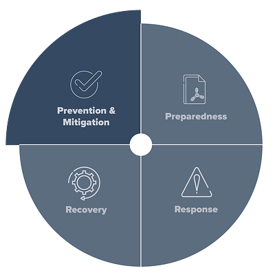
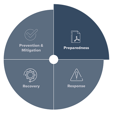
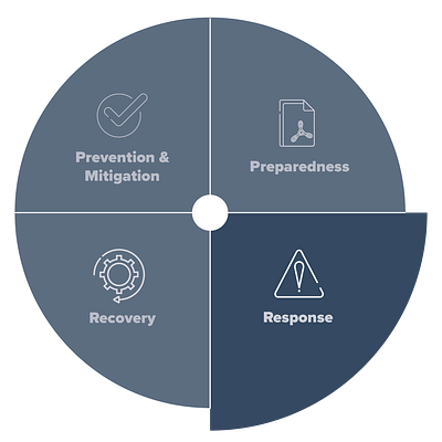
First, we should define the stages of the disaster management cycle and the individual importance they hold. Though the terms might occasionally differ, the disaster management cycle breaks down into 4 stages: Prevention & Mitigation, Preparedness, Response, and Recovery.
Prevention and Mitigation
An important stage of the disaster management cycle is prevention and mitigation. Both prevention and mitigation consider future disasters and aim to reduce potential damage. Avoiding disaster scenarios isn’t always possible, so the implementation of prevention and mitigation methods attempts to nullify or minimise impact. Prevention planning looks at hazard identification to pinpoint potential future disasters and a vulnerability assessment considers a community’s capacity to respond to a disaster.
Preparedness
Like prevention and mitigation, preparedness falls under the ‘before’ part of the disaster management cycle. Preparedness refers to the capacity to which people respond to a disaster and considers the mobilisation of personnel, training, or equipment. As with prevention and mitigation, the goal of being well-prepared is to reduce impacts. Preparedness coaching might include fire drills, evacuation procedures, or considering disaster management plans in the event of a disaster.
Response
The response phase is critical because it considers the immediate reaction after a disaster occurs. The execution of this step is fluid and requires fast but considered decision-making combined with the capability to remain orderly in the face of tough scenarios. During the response stage, the primary goals are to prevent the loss of human life, whilst containing ongoing issues in potentially hazardous areas. It’s also a time to set up safe zones, implement the expertise of personnel and utilise supplies.
Recovery
Recovery is the final stage of the disaster management cycle. Disasters, whether man-made or natural, often leave behind short and long-term devastation. The implementation of the recovery stage helps this process. Recovery can refer to the needs of the people involved in a disaster i.e. physical or mental trauma, but also considers the disaster area and efforts to rebuild the infrastructure or secure an area.
Completing the cycle, recovery feeds back into prevention and mitigation, assessing the triumphs and failures of the response for future disasters.

What is the most important phase in the disaster management cycle?
All stages of disaster management are critical, however, getting prevention and mitigation right can lead to a reduction in damage or fallout from the next crisis. Innovation and increased access to technology impact this stage, providing more conclusive data that results in better decision-making.
Furthermore, accessible technology leads to a wider audience, including communities in developing countries. The increased reach has the potential to save lives in a humanitarian crisis globally. It also provides safer means of gathering data.
Technologies such as UAV or mobile LiDAR are useful for capturing accurate data quickly. Investment in such technology is transforming both mitigation and relief efforts. For example, monitoring changing landscapes over time with frequent scans using LiDAR technology could lead to crucial decision-making around the type of infrastructure or repairs needed to prevent disasters like flooding.
How does LiDAR fit into the Disaster management cycle?
LiDAR, whether mobile, terrestrial, or airborne has a clear role to play in the disaster management cycle, especially prevention & mitigation, and preparedness. To start, we should look at what LiDAR is.
What is LiDAR?
Light Detection and Ranging (LiDAR) technology is a remote sensing method that emits light from a laser to collect measurements. Hundreds of thousands of laser pulses per second measure the distance between an object and the scanning device, creating millions of points. These points make up a dense and accurate 3D model of a real-world environment.
Types of LiDAR
Traditional methods of capturing data come from static scanning devices, known as terrestrial laser scanners (TLS). The data retrieved from this technology is extremely accurate, however, the equipment is cumbersome which restricts its use in certain key environments.
Modern iterations of LiDAR implementation include mobile, handheld, or airborne via UAV. Though less accurate than TLS, these forms of LiDAR scanning still offer high levels of accuracy, with the added benefits of speed of capture and ease of use. Combining data from all methods of capture usually yields fantastic results across a variety of industries.
Examples of disasters and ways LiDAR can help
Natural Disasters
From destructive earthquakes to devastating hurricanes, natural disasters of all kinds seem to be more frequent and unpredictable as the climate changes. Each disaster causes significant damage, often loss of life, and the economic fallout could be harmful to developing countries.
Here are a couple of examples where LiDAR could help with natural disasters, during the disaster management cycle.
Wildfires
Forest fires have the capacity to devastate thousands of hectares of land, ruin local infrastructure, and cause death. Pre-empting a forest fire is difficult, but with the help of LiDAR, not impossible.
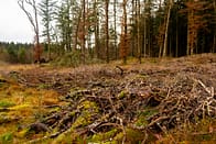
Ladder fuel detection
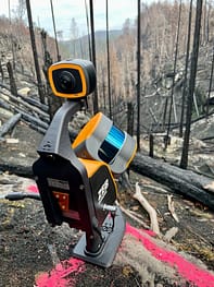
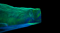
A common accelerant of forest fires is live or dead vegetation that allows a fire to climb from the forest floor to a canopy, often referred to as ladder fuel. Detecting and reporting this combustible material early can lead to better management of forests, decreasing the risk of forest fires. Mobile LiDAR is an ideal solution for this problem because it can effectively capture 3D elevation from floor to canopy and has the capacity & accuracy to identify woody debris early.
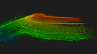
Monitoring forests post-fire
In the event of a forest fire, it’s key to understand a variety of issues including the severity of the fire. Fires don’t always move in a set pattern; therefore, some parts of a forest might burn significantly worse than others. Combining LiDAR with satellite imagery provides a more conclusive idea of the severity of the damage. Precise reporting leads to better fire impact studies and post-fire management plans.
Students from NAU monitored a forest using GeoSLAM’s ZEB Horizon scanner to report on potentially dangerous flammable material – NAU students determined to return Arizona forest to its former glory, one tree at a time (fox10phoenix.com)
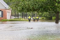
Floods
Floods are the most common weather-related natural disaster. Failure to correctly manage flood-risk areas can devastate properties, businesses, or lives. Ensuring these areas are correctly managed, on the other hand, reduces those risks significantly.
Flood mapping and monitoring
An effective way to mitigate the effects of a flood is by using digital models for flood mapping and monitoring. LiDAR is a highly accurate way of creating Digital Elevation Models (DEMs), which are ideal for creating the topographical information needed for a flood mapping report. DEMs obtained from LIDAR technology help to determine the watercourse or water depth in potentially affected areas.
Flood impacts on landscapes
Post-flood efforts to inspect the new landscape left behind from the disaster are key for understanding the level of devastation, as well as the change in terrain. Comparing older datasets with new datasets can be crucial. If an area has significant changes to the terrain, a similar level of rainfall could generate worse-than-expected results.
These are just a couple of examples of common natural disasters, but the implementation of LiDAR in the recovery phase for reporting on damage in other disasters like hurricanes or earthquakes is also relevant.
A lesser talked about natural disaster, but no less catastrophic, is avalanches. A recent user of GeoSLAM’s ZEB Horizon scanner mapped an area post-avalanche in the French Alps with the intention of comparing the data with satellite imagery. This would feed into research, reporting on the snow’s change in roughness, for determining radiative transfer modelling. Read the full case study here – GeoSLAM Avalanches in the Vanoise Massif Mountain Range
Man-made Disasters
Unlike natural disasters which are often unavoidable, but need managing, man-made disasters are avoidable if considering the correct safety precaution. Nuclear meltdowns, mining accidents, oil spills, and transport incidents are some examples of man-made disasters. LiDAR technology can assist prior to man-made disasters in both highlighting safety concerns and preparing relevant training models.
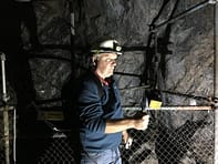
Mining
LiDAR, especially handheld SLAM, provides solutions to the mining sector for a variety of applications such as mapping production progress or calculating the volume of a stockpile. Surveyors have also found that LiDAR has the accuracy and capability to highlight potentially unsafe areas or walls.
Convergence analysis
Convergence analysis is the detection of any rock movement that could be an indicator of potential slope/rockface instability. Failure to deal with areas of displaced rock could lead to the mine walls collapsing, risking lives. Regular scans with handheld LiDAR technology provide quick and accurate 3D data of the mine and changes in the rockface are reinforced where necessary.
LiDAR’s response to a mining disaster
Unmanned LiDAR solutions like Flyability’s UAV with mounted LiDAR could be lifesaving in a collapsed mine scenario. In the unfortunate incident that humans are trapped in a collapsed mine, a UAV is the best option to assess the damage, without risking further human life. Providing a fast 3D replica of the damaged area could help with the rescue situation, alerting personnel to the severity of the collapse or potential safe routes through the mine.
Building modeling
Accurate, up-to-date floorplans or 3D models of a building could prove to be crucial information to a rescue team during a disaster scenario. Larger buildings like skyscrapers or hotels often have different entrances, exits, and complex passageways that a team may find difficult to navigate without up-to-date data.
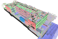
Disaster training in large buildings
In the event of a large-scale fire or other similar disasters in a large building complex, it’s important for rescue teams to understand the landscape. Relevant information like floorplans helps with decision-making on the best route to get victims to safety. Likewise, hotels use floorplans in rooms to illustrate to customers the closest exits and fire escapes, in the event of a fire. Furthermore, the creation of virtual reality 3D models using the data is perfect to use in training for a disaster scenario to create a much more realistic environment.
Given a commercial building is often bustling with people, it’s key that capturing data is less cumbersome. Handheld LiDAR is the fastest solution for this kind of data gathering because it’s less intrusive, seamlessly transitioning through stairwells, corridors, and rooms. If a hotel needs to temporarily close for a scan, handheld LiDAR will take days to complete the job, not months.
Integrating LiDAR into your disaster management cycle process
Live and accurate information is a key part of the disaster management cycle process. Research and innovation into new technologies over the past couple of decades have led to better information, therefore more conclusive disaster management plans.
The consideration of LiDAR technology in the disaster management cycle could save lives, prevent long-term damage, and prove to be a cost-effective solution.
Want to try GeoSLAM LiDAR for yourself?
Fill in the form below to register your interest.


