How is education embracing laser scanning technology?
Last Updated on 16th May 2023 How is education embracing laser scanning… Read More »How is education embracing laser scanning technology?
Last Updated on 16th May 2023 How is education embracing laser scanning… Read More »How is education embracing laser scanning technology?

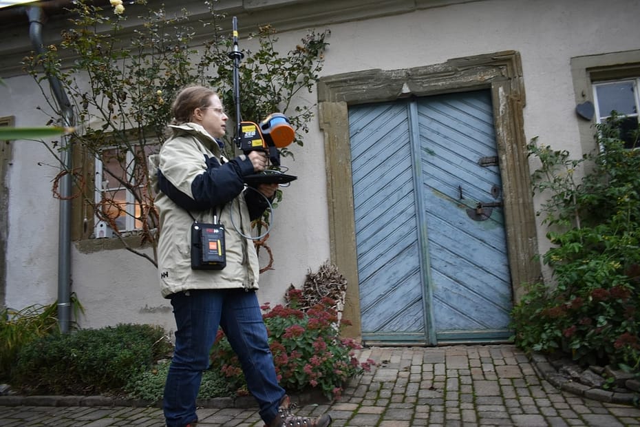
Savoie Region, France

2 hours

3000 sq/m

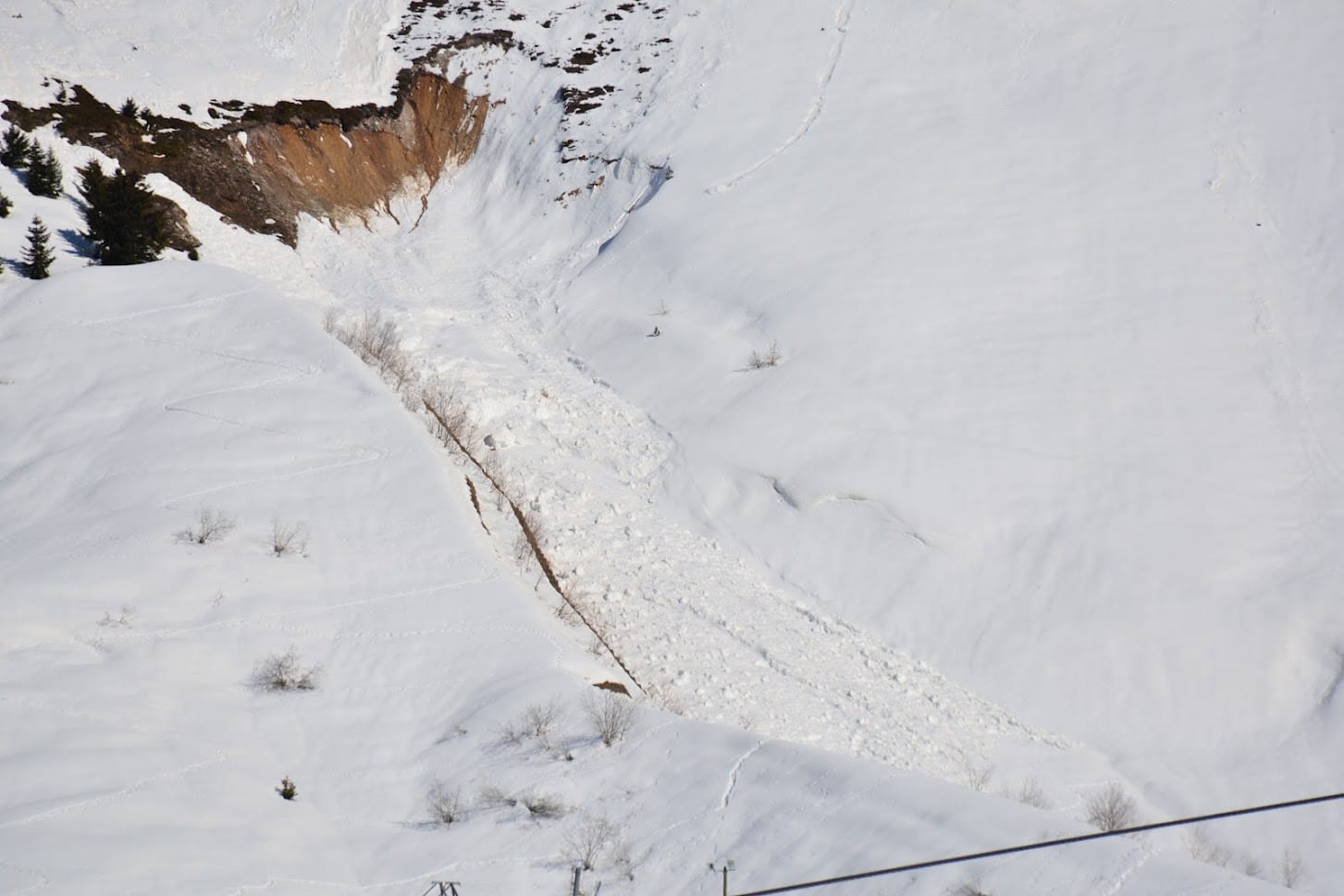
Avalanches and Snowpacks

Education
Climate Change is often attributed to greenhouse gases, however, there are also other factors that affect the Earth’s climate. One example of this is the ‘Earth’s radiation budget’. Earth’s radiation budget is energy that enters the earth’s atmosphere that is reflected, absorbed, or emitted by our planet. If the budget becomes out of balance, it can cause temperature increases or decreases in the Earth’s atmosphere.
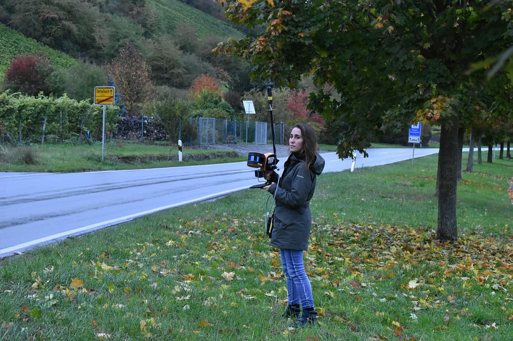
A team from the Institut de Physique du Globe de Paris (IPGP), a world-renowned geosciences organisation, have conducted research in this field. Their research focuses on how differences in surface roughness effect the amount of microwave radiation picked up by satellites.
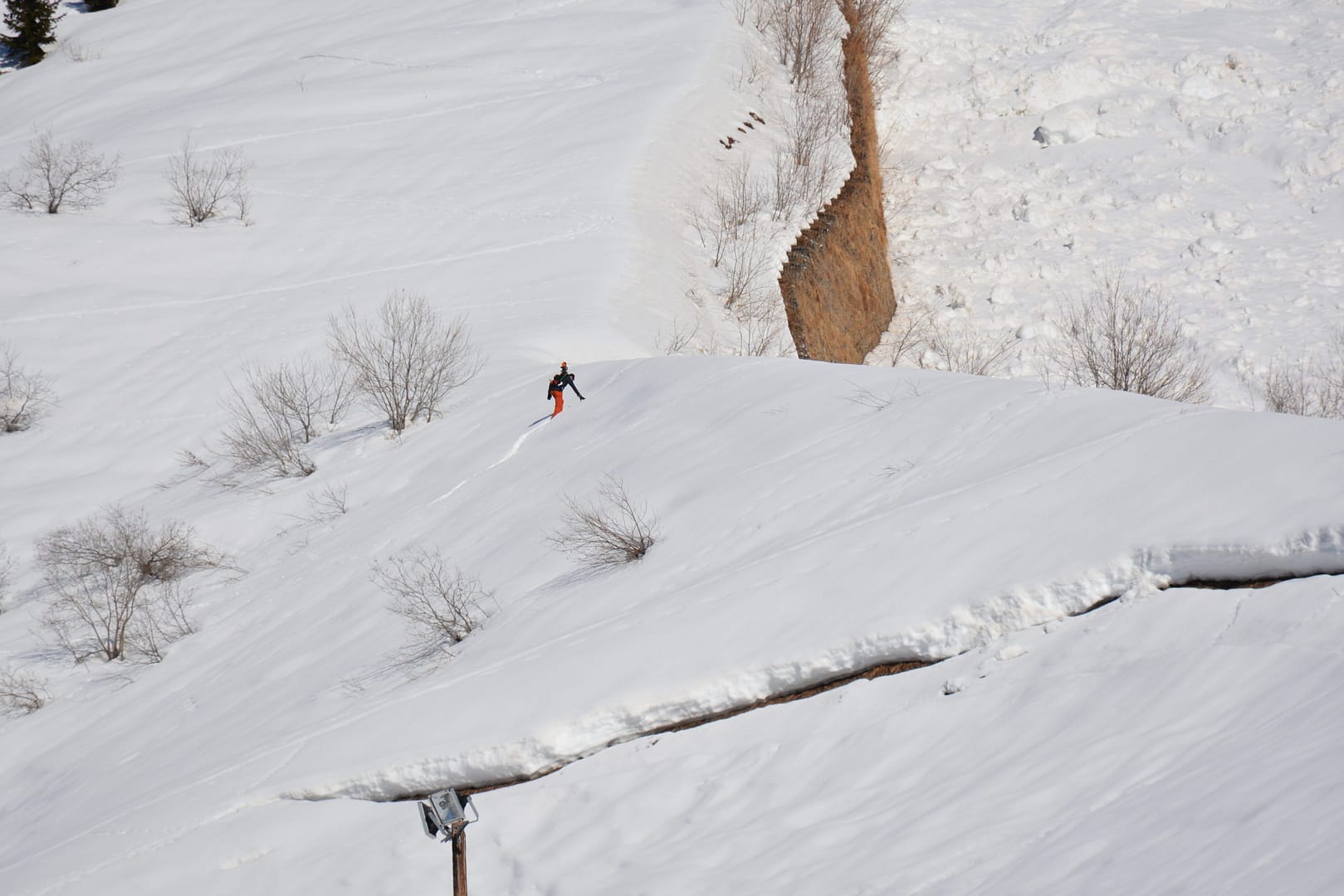
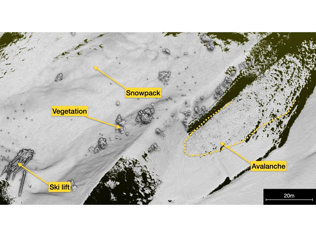
For their research, the team have been concentrating on snowpacks and avalanches in the Vanoise Massif Mountain range. They aim to compare the two satellite observations to assess the effect of the change in roughness when avalanches form using radiative transfer modeling. This is the process that measures radiation from the Sun into and out of the Earth. High levels of sun radiation can cause snow to melt which, in turn, can cause avalanches.
The Vanoise Massif Mountain range is in the Granian Alps, in the Savoie region of France. It is the third highest massif in France, sitting at 3,885 meters at the summit Grande Casse. The range is the location of France’s first National Park, the Vanoise National Park.
To collect data from the snowpacks and avalanches, the team needed an accurate 3D model of the area. Vanoise National Park is a no-fly zone which meant that UAVs were not an option. Additionally, the team did not want to spend extended periods of time on the mountain due to the risk of avalanches. This ruled out more time-consuming methods of scanning, like terrestrial laser scanners.
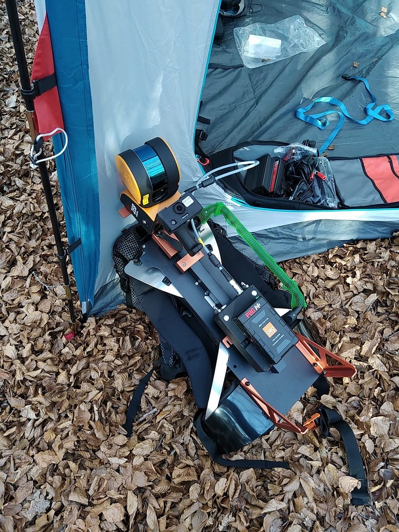
As a result, the team needed a more efficient way of mapping the difficult area. They decided SLAM was their best option and chose to use GeoSLAM’s ZEB Horizon with the backpack solution.
We were looking for a portable, versatile and affordable LiDAR scanner solution and GeoSLAM allows us to meet all our constraints.
The walk and scan method and versatility of the ZEB Horizon stood out to the team from IPGP. The specificity of the environment meant they needed to use technology that was easily movable and durable. In addition, the backpack solution was essential because it meant that the person carrying out the scan had their hands free to help them navigate the rough terrain.
Furthermore, the ZEB Horizon’s speed of capture meant the team were able to scan the 3000 sq/m area in approximately 2 hours. This ensured that they did not spend too long in the hazardous mountain range, whilst capturing the accurate data they needed.
The scan was processed using GeoSLAM’s software package. The resulting point cloud is being integrated in IPGP’s research analysis and modelling.
The ZEB Horizon’s ease of use and accuracy means the scan data can be compared with the data collected from the satellite observations. This is known as ground truth analysis and helps with clarity within the research. The scan data also aids with data calibration which allows for atmospheric effects and obstructions to be considered when analysing the final data.
The positive outcome of the data has encouraged the Institut de Physique du Globe de Paris to plan additional surveys in this area.
Monitoring environmental changes are just one of the ways GeoSLAM customers are using their mobile mapping devices, alongside more common everyday uses like measuring buildings or construction sites.
Thanks to the team at Institut de Physique du Globe de Paris for sharing their story with us.
If you’d like to learn more about how GeoSLAM solutions can help you, submit the form below.
Last Updated on 25th April 2022 How can we use laser scanning… Read More »How Can We Use Laser Scanning For Historic Preservation?
Virginia
12 minutes
500 meters
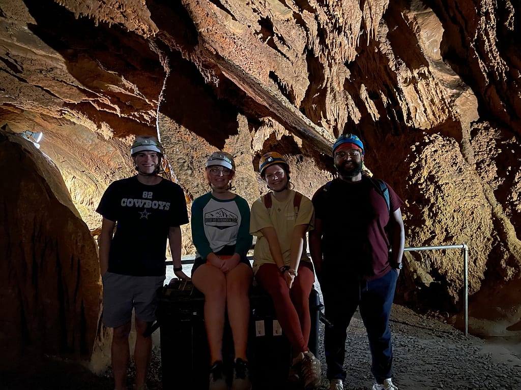
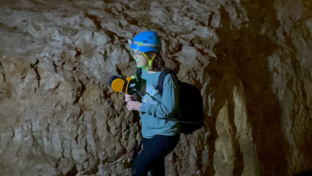
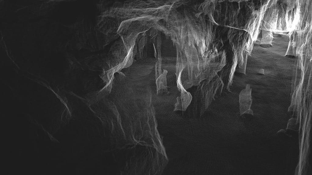
Grand Caverns

Education
Grand Caverns | History, geotourism & science
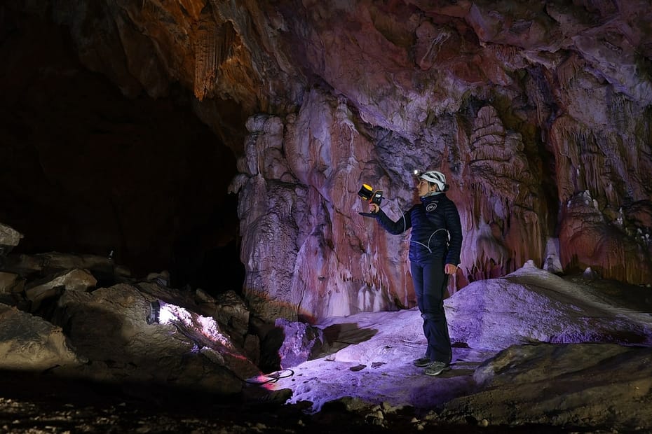
Discovered in 1804 by Bernard Weyer in the heart of Virginia, Grand Caverns (formerly Weyer’s Cave) is the oldest show cave in the USA. During the US civil war, the cave was used by both Confederate and Union soldiers as part of the Valley campaign, during which time over 230 soldiers signed their names on to the cave walls. More recently, the cave has become a huge tourist attraction, due to its beauty, location and being surrounded by scenic trails for hiking, running, and biking, but it has also captured the attention of the scientific community because of recent discoveries of new passages and the rock formation changes over time.
The town of Grottoes (where the show cave is located) partnered with Angel A. Garcia Jr. and his students from James Madison University to create a 3D map of the cave. The 3D point cloud is being used to measure Speleothems, monitor the human impact on the cave, create 3D printed models and to celebrate the show cave’s extensive history, shining a light on its geoheritage. In addition, it is a fantastic opportunity for the undergraduate students of JMU to get hands on experience with the handheld LiDAR scanner and the data it outputs.
Angel A. Garcia Jr. chose GeoSLAM’s ZEB Horizon scanner to take on the task of mapping both the parts of the cave open to the public and the recently discovered, vast passages. He and his students capitalise on the speed of capture and accuracy of the scanner to review and analyse data in a quick and efficient manner.
With the LiDAR we’ll be able to get into corners and see what hasn’t been looked at for a long time.
Mobile Mapping with the ZEB Horizon
Having originally purchased the ZEB Horizon back in February 2021 to collaborate and share data with partners scanning caves using ZEB devices in Puerto Rico, Professor Garcia began to see the potential and opportunities the scanner offered. Fast, accurate and handheld data capture opens a way to map an area without the need to GPS or complicated setups. In addition, the scanners ease of use means that undergraduate students can be involved in the project with limited to no training.
Since beginning to use the ZEB Horizon, interest in Professor Garcia’s work with the SLAM scanner has escalated, and he has subsequently been invited to other universities to run workshops. In April 2021, he was approached by Grand Caverns to map the historic show cave.
The public area of the cave is approximately 500 meters in length, 30 meters high and has stairways in places, so it is quite a large area to capture. Professor Garcia and his students were able to capture the entire public area in approximately 12-15 minutes, by simply walking and scanning. He pointed out that a terrestrial laser scanner would be able to capture the public part of the cave, but it would take days, not minutes, and due to the uneven surfaces of the non-public area of the cave, it would be impossible to get a tripod-based system down there. Alternatively, you could measure a cave using a distometer, but this could take months, if not years to complete.
The ZEB Horizon was able to give them a quick accurate scan in 12 minutes, so the students could get to work reviewing the data for their various projects.
It’s going be able to detect the stalagmites, the stalactites and it’s even going to be able to detect the cave shield because it’s that precise.
The data is being processed using GeoSLAM Hub, and Draw is being utilised by the team to accurately measure the speleothems over time. The students can see the orientation, thickness and gather measurements using the LiDAR information alone. They are also hoping to use Draw to understand accurate dimensions of the cave. Furthermore, the 3D point cloud is being used as a base to 3D print the cave within a rectangular block, for further research purposes.
The team continued to scan the cave over the summer, and Professor Garcia is working with the caving/spelunking community of experts to begin capturing the more problematic and recently discovered new passages of the cave. These areas have not designed for the public at the moment, so there are uneven surfaces and narrow corridors, but due to the ZEB Horizons mobility, capturing previously unseen parts of cave will be quick and safe.
Professor Garcia concludes by saying that the 3D model will provide an opportunity for those who can’t physically enter the caverns, to learn what they are all about.

If you’d like to learn more about how GeoSLAM solutions can help you, submit the form below.


Industry
Education
Scan time
3.5 hours
Location
Franconia, Germany
Size
3 hectares
Scanned
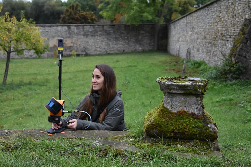
Cistercian Landscapes
Professor Hess and Carla Ferreyra | University of Bamberg
Background
With the adoption of digital technologies such as laser scanning, photogrammetry and other digital tools becoming ever more prevalent in conservation and preservation; it is easy to see why, in 2017, the University of Bamberg launched a new master’s degree, ‘Digital Technologies in
Heritage Conservation’. Spearheaded by Professor Mona Hess, the course covers the integration and adoption of digital technologies in heritage conservation and its further development, as well as raising the profile of this research topic. In addition to running the course, Professor Hess and her team often employ their skills and expertise in the field, creating 3D digital models for preservation purposes, to build knowledge of certain areas or to educate a wider audience about a new culture.
“The 3D recording is a methodological tool for the representation and interpretation of cultural heritage, landscape and architecture, to build knowledge, create meaning and make culture accessible to all.“
The Scan
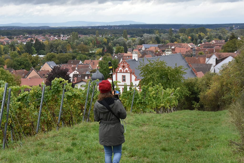
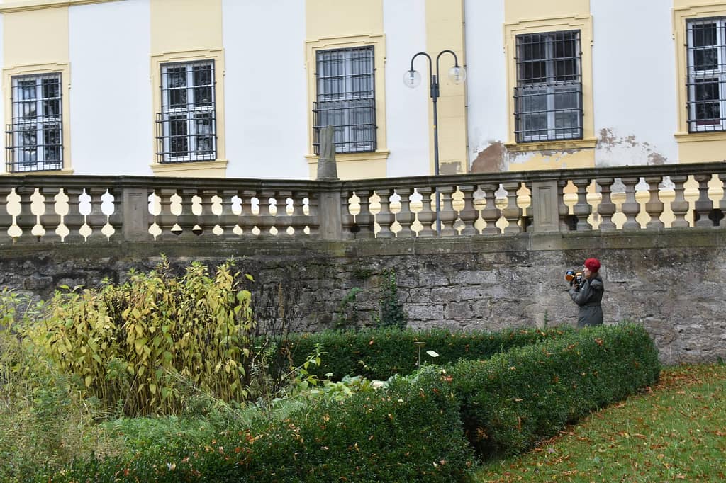
In 2020, Professor Hess was approached by ‘Cisterscapes | Cistercian Landcapes in Central Europe’ and was tasked with contributing to the digital recordings of 2 gardens. The scan would focus on the baroque agricultural buildings with designed gardens; Ebracher Hof in Mainstockheim and Ebracher Hof in Oberschwappach, both properties of the Ebrach Monastery.
The aim of the scan was to create reliable information, assess the landscapes development status and design management plans for maintenance and conservation. Professor Hess, accompanied by PHD student Carla Ferreyra, visited the sites in October 2020 to conduct the scans. With approximately 3 hectares of land to cover, the team needed a SLAM scanning solution that was quick, easy to use, suitable for both indoor/outdoor use and a solution with reliable results. Professor Hess chose GeoSLAMs ZEB Horizon with the ZEB Pano, because of the rapid data acquisition throughout the site up to 100m.
Other laser scanning techniques were considered in the planning process, however none quite provided the freedom the ZEB Horizon did, often
with restrictions around mobility and time. In September 2020, a similar scan had taken place using a terrestrial laser scanner (TLS) of a specific
area of the Mainstockheim garden. In comparison, the GeoSLAM scanner reduced the time and labour costs when completing the scan. The team were able to complete their scan of Mainstockheim (including an interior space of the baroque building) in just under 3 hours.
In Oberschwappach, the total scan time was approximately 30 minutes. Their only concern during the scan was encountering the general public, however due to the lightweight nature of the ZEB Horizon and Pano, it was easy to avoid busier parts of the garden. Where they did encounter other guests (due to their curiosity over the scanner) Professor Hess and Carla simply repeated the scan of that specific area. All in all, the scan was a success, and Professor Hess and Carla were able to deliver on their task.

The Results
With the completion of the scan, not only does Professor Hess have fresh scan data that can be used to educate the next generation on how
digital technologies can be used in heritage conservation, but they are also being used to extract 2D information, such as orthophotos, plans
and sections in 1:50 scale and BIM models. Furthermore, videos of the scan were created – these serve as informational and educational
pieces of content. Finally, the scans serve to raise awareness of these historic gardens, promote a scientifically accurate recording and also makes the heritage accessible to all. Professor Hess is currently using the scanner and scans for research & teaching, and she has observed that a lot of her students are enthusiastic about the speed of the process.
Looking Forward
In 2021 Professor Hess is looking to extend the project further at Ebrach Abbey and the gardens, to contribute to the Cistercian Cultural Heritage
project. Additionally, she is looking to create a digital twin model of a historic city using the ZEB Horizon, to research semantic 3D city models with
information about urban heritage in the project ‘BIM to Twin’.

For 40 days, 15 participants set up camp in the Lombrives cave in southwestern France with no clocks or sunlight, and zero contact to the outside world.
Vauquois, France
Three times faster than terrestrial scanners
Several Kilometers
Battlefield Tunnels
Education
The Vauquois battlefield in France tells a little-known story of mining warfare during World War I. This area went through 4 years of combat which saw the hilltop village of Vauquois completely destroyed. In addition, French and German troops dug miles of tunnels under each other’s positions. This meant they could plant explosive mines to ‘bomb’ the enemy from below. Consequently, this bombing left underground WWI tunnels in Vauquois.
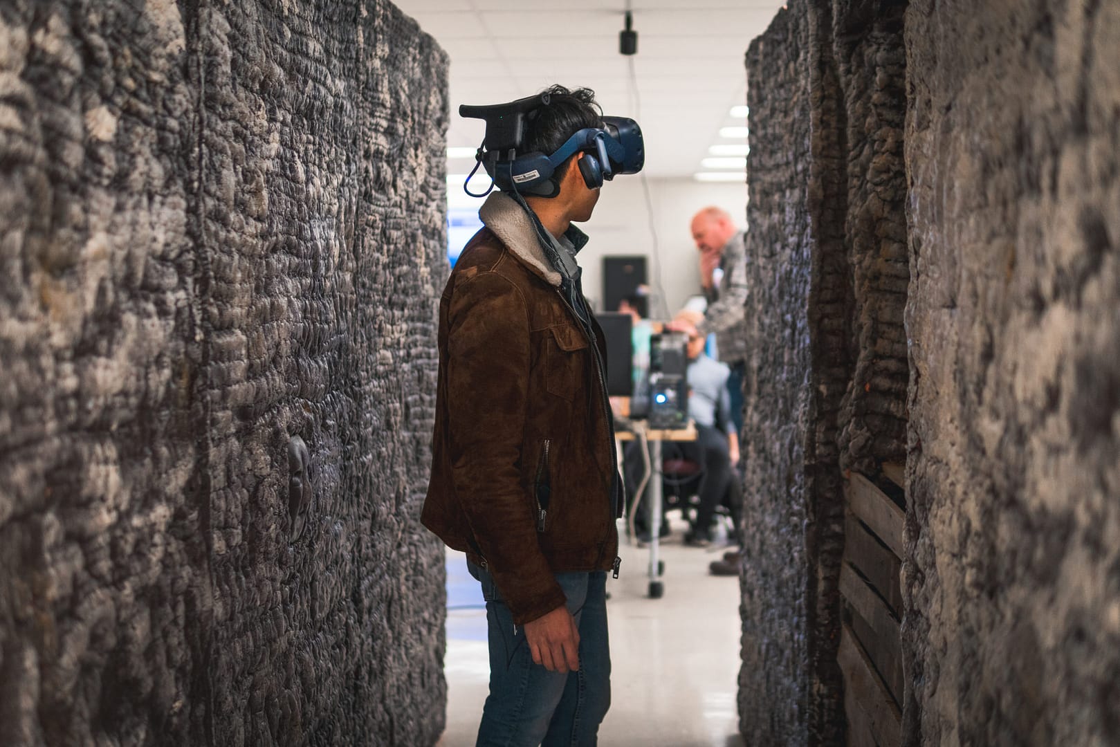
The WWI tunnels in Vauquois must be experienced first-hand to understand the difficulties and despair of living deep underground. Moreover, in wet, cold and cramped conditions for days at a time. Of course, not everyone can travel to France and crawl through the remaining tunnels in person. A group of researchers at Virginia Tech brought the battlefield to classrooms and museums with the help of reality capture and virtual reality (VR) technologies.
Combining efforts of the University Libraries, the Department of Visual Arts and numerous other disciplines, the Visualising History team travelled to Vauquois with funding from a federal grant in 2016. Over 10 days, they used traditional static scanning methods to capture details of the battlefield terrain.
However, when they attempted to scan inside the tunnels, their progress slowed down considerably as there were tight spaces that their scanners could not get into, which made the data capture process extremely time-consuming.
Before their next trip to France, the team acquired a 3D handheld laser scanner, GeoSLAM’s ZEB Horizon, with the hopes of making their time on-site more time efficient.
Due to the ZEB Horizon’s ease of use and speed of capture, the team collected scan data inside the tunnels more than three times faster than with the traditional stationary scanner. The time it took to scan the tunnels was crucial, as they were working on a budget, and the ZEB Horizon enabled them to do more with the time and money they had available. They also used the ZEB Horizon above ground, scanning the narrow trenches, wide bomb craters, and a church foundation.
The ZEB Horizon also proved to be more efficient as its software processes the data into a point cloud quickly. This meant that the team where able to see where data was missing, and go back and collect it, whilst still on-site. This created a much more accurate and complete virtual environment.
The ZEB Horizon was a gamechanger in terms of the speed of data acquisition.
The Virginia Tech team engaged the expertise of students and faculty from numerous departments – Visual Arts, History, Education, Computer Science, Mining, Engineering, and Cinema – to build a life-size model of a tunnel and generate the virtual environment of the battlefield. This allows students wearing VR headsets to ‘walk’ through the scene, experiencing it with both sight and touch.
The speed and accuracy of the ZEB Horizon are game changers for educational and historic preservation VR projects like this because of time and budgetary restraints. VR data processing is extremely time consuming, which means time saved scanning in the field makes grant money go farther in the computer lab. The result is a more realistic and believable experience.
The Virginia Tech Visualizing History team is not stopping with creating educational experiences from their 3D data collection. They are beginning to apply their VR capabilities to other commercial applications of mobile laser scanning.

Industry
Surveying
Scan time
30 mins per
scan
Location
Oxford, UK
Size
12,000 sq/m
Scanned
University
Words by David Johnson | Midland Survey
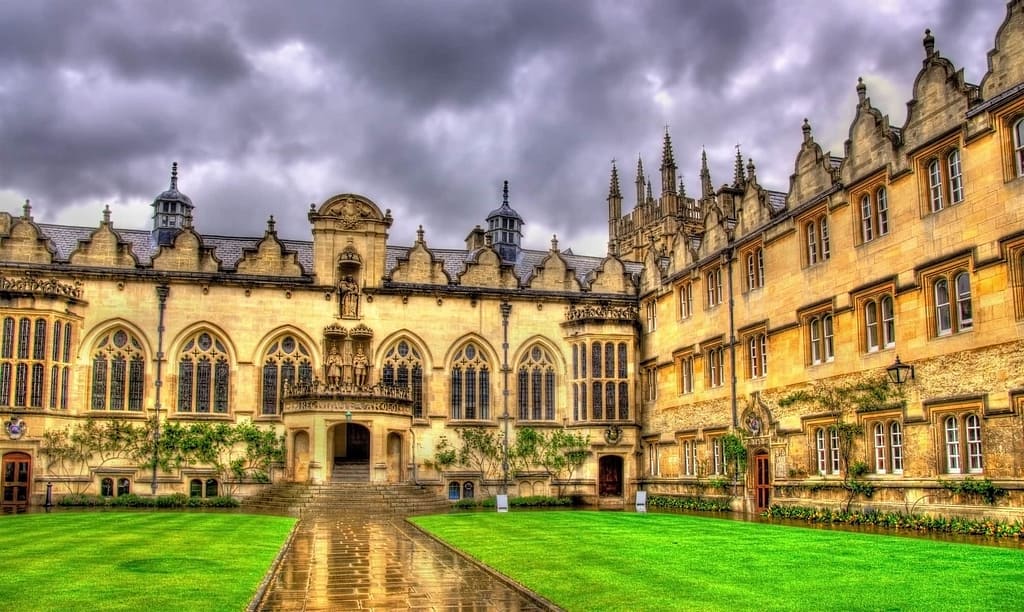
“Midland Survey are experts in surveying complex and difficult to access spaces where there is limited or no GPS, but Oriel College with its labyrinthine network of historic buildings brought a particular set of challenges.
Oriel College, part of the prestigious University of Oxford in the UK, is nearly 700 years old, with around 200 rooms across five stories including an “island site”, accessible only via tunnel. The structure has been extended over the years and no accurate floor plans or elevation drawings exist.
As a world-class institute, it is occupied 24/7 and opportunities to accurately scan with minimal disruption are few. Traditional tools were not an option due to the network of rooms spread across 5 stories.
Due to the lack of GPS coverage in the tunnel, the only option was to use GeoSLAM’s ‘go-anywhere’ ZEB Revo. The unusual shape of the building, with its unconventional layout and complex network of rooms, meant it was too difficult and time-consuming to survey with traditional static scanning methods (as this would require multiple individual set-ups and increased post-processing work). We needed a lightweight, mobile tool that works well in enclosed environments.
“The entire project was completed in around half of the total time that would have been required using static equipment. The ZEB Revo is a real game-changer for us.“
Using the ZEB Revo around 200 rooms were scanned, amounting to 12,000m². Across 5 days, 12 individual rapid ZEB Revo scans were completed each taking just 30 minutes. The entire project was completed in around half of the total time that would have been required using static equipment.
We frequently work in hazardous environments, as well as in complex and difficult to access spaces where there is limited or no GPS coverage such as heritage buildings with thick stone walls. We often have limited time on site to accurately create a 3D model. Access to user-friendly technology such as the ZEB Revo that scans multi-level environments and produces accurate and high-quality 3D survey data, is a real game-changer for us.
Last Updated on 25th April 2022 How GeoSLAM’s mobile technology collates forest… Read More »Mapping Trees on the Move

Known control points are captured during a scan and automatically compared and matched to the associated coordinates during the processing stage in Connect. A rigid and/or a non-rigid adjustment can be made to the dataset and an accuracy report is exported, highlighting how successful the transformation was. Users can now view and manipulate the processing parameters to ensure a more accurate match between points.

Align multiple scans using a combination of manual and automatic processes. This workflow can be performed on two or more scans in the same project. Users have a choice to export the aligned scans separately or as a single merged point cloud.

Common data capture scenarios, such as UAV, outdoor, indoor, linear, and vehicle, have been characterised in Connect and data processing pre-sets for each environment have been defined. These can be selected at the beginning of the data processing stage allowing this process to be highly simplified.

Both methods match the scan data from a ZEB Locate system with the GPS data collected from the antenna to georeference the point cloud. When a scan starts and ends in the same place, this is classed as “closed loop”. “Open loop” is when the start and end position of a scan are in different locations. Standard SLAM practices apply to both methods of data collection.
Open Loop SLAM for the ZEB Locate is available on request – let’s talk about it.

Common static points are captured during several scans meaning that these datasets can be automatically aligned. A single point cloud is then exported as if the data was captured in a single scan.

Horizontal and vertical slices can be taken from any location within the point cloud. Horizontal floor slices can also be automatically taken at a given height above the floor as defined in the processing stage.

Mostly used in the construction industry, multiple point clouds can be compared and any areas that have changed are automatically highlighted. Point clouds can also be compared with CAD models – for instance to track progress on a construction site – and PDF reports can be generated to present this information.


Some SLAM software algorithms have been made available as open-source on the internet, but they are purely algorithms and not a product that you can take and use off-the-shelf. SLAM is most successful when it is tightly coupled and designed with specific hardware in mind. A generic SLAM cannot perform as well as one that has been specifically designed for a purpose.

Visual SLAM is closer to the way humans navigate the world, which is why it’s popular with robotic navigation. But in the same vein, vSLAM will have the same image-capture challenges as humans do, for example not being able to look into direct sunlight, or not having enough contrast between the objects picked up in the image. These can be overcome indoors, however, you may need to map a forest, tunnel or urban canyon. While SLAM technologies don’t rely on remote data (meaning you can scan areas where there is no GPS), you do need to ensure the SLAM technology you chose operate well inside, outside, in daylight and darkness.

Mapping a property is time-critical. Ideally, you want to make a single visit and gather sufficient data to create a highly accurate 3D model. Ensure the software you choose transforms 3D point cloud data into actionable information in real-time. This allows you to view and interrogate your data whilst still in the field, and make any adjustments, or collect missed data, then and there.

If you’re trying to map an enclosed environment (e.g. tunnel, mine) or a complex, difficult-to-access space such as a heritage building with tight stairwells and uneven floors, you need to use fully-mobile, adaptable technology. Wheel-based systems, often used with the vSLAM camera, will struggle with access. Handheld devices or LiDAR scanners that can be attached to a drone or pole and still deliver accurate results in a rugged environment are best for navigating hazardous spaces.

While vSLAM is able to provide a qualitative high-level map and sense of the surrounding features, if you’re needing survey-quality accuracy and rich-feature tracking at a local level, you’ll need to consider LiDAR. Cameras require a high-frame-rate and high processing to reconcile data sources and a potential error in visual SLAM is reprojection error, which is the difference between the perceived location of each setpoint
and the actual setpoint.

In order to deliver the depth required for high-quality data, a number of depth-sensing cameras are needed with a strong field of view. In most cases, this isn’t possible, especially as cameras with high processing capabilities typically require larger batteries which weigh down airborne scanners, or limit the time of flight. LiDAR is both faster and more accurate than vSLAM, and can deliver detailed point clouds without expensive (and timely) camera processing.