Skip to content

How mobile LiDAR transformed and expanded a small business

Location

Washington State, USA

Scan time

5-15 minutes per scan

Size

Various interior and exterior sizes

Scanned

A range of large environments

Industry

Surveying

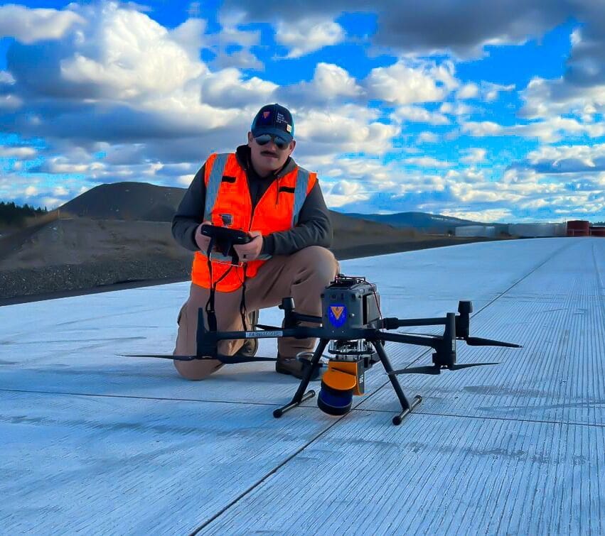
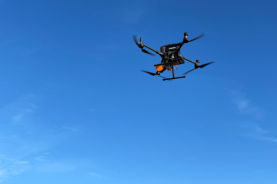
Scout Aerial Solutions is a US-based drone and geospatial service provider. The company helps construction businesses, land surveyors, and engineers capture data faster, provide deliverables efficiently, and increase project productivity. Scout Aerial Solutions use drones, alongside mobile LiDAR, and other Multimedia Collection methods so its clients do not have any informational gaps in their data.

This case study explores the applications Scout Aerial Solutions use mobile LiDAR for and how it benefits data capture and clients’ projects.

Mobile LiDAR’s use in adverse weather conditions

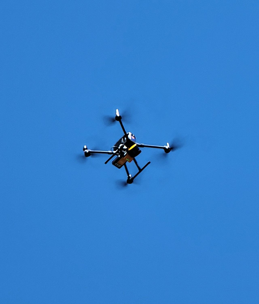
Scout Aerial Solutions is based in Washington State, USA, and primarily used photogrammetry alongside drones as its main data collection method. However, the team have found that during the winter months, adverse weather conditions make scanning from the air more difficult. As a result, they decided to adopt a new data-capturing method, handheld mapping, to use alongside drones.

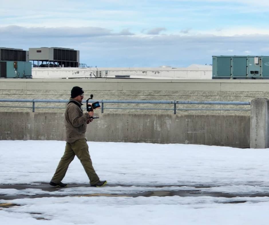
After considering the options, Scout Aerial Solutions opted to work with GeoSLAM’s mobile LiDAR scanners and acquired a ZEB Horizon, alongside the ZEB Vision and Car Mount accessories. Since acquiring the laser scanner, it has proved beneficial for the team and their projects. As an additional collection resource, it allows Scout Aerial Solutions to scan on the ground and inside buildings during the snowy months.

Using the ZEB Horizon for a variety of applications

The scanner’s capabilities have continued to impress Scout Aerial Solutions and they now use it for a range of solutions. Over the course of 6 months, the team has completed 72 scans, testing for different applications and customer projects. Each scan, lasting approximately 5-15 minutes, contributes to the growing tally of uses with GeoSLAM’s mobile LiDAR scanner. This includes training with the ZEB Horizon to understand how to best suit the customers’ needs and minimise errors on the job site.

As Scout Aerial Solutions capture data from interior and exterior environments the size of scans varies from project to project. However, the largest area they have scanned internally is a 400,000 sq/ft parking garage and externally, around 68 acres, captured with a drone.

How Scout Aerial Solutions use mobile LiDAR

Additionally, Scout Aerial Solutions provide testing, training, and demos to its clients demonstrating the potential of handheld laser scanners.

University of Idaho: Centre for Forest Nursery and Seedling Research

The biggest project that Scout Aerial Solutions are working on is collaborating with one of its clients to scan forestry nurseries, using the ZEB Horizon. The aim of this scan is to be able to scan forest plots more easily to measure sapling growth and ID trees on site.

Although Scout Aerial Solutions is a company initially set up to service the AEC sector, mobile LiDAR has proven to be an asset in other sectors, helping them to branch out into forestry.

Camber detection

Scout Aerial Solutions carried out a scan using mobile LiDAR for a company that needed to detect the camber of concrete beams over several thousand sq. ft. Previously, the only data collection method available to the company was a total station, alongside already existing model calculations from before a floor pour. However, they wanted to evaluate whether mobile LiDAR can more effectively measure the beams. With the ZEB Horizon, Scout Aerial Solutions proved to their client that mobile LiDAR is a more efficient method of data capture.

Scout Aerial Solution’s growing use of mobile LiDAR

Scout Aerial Solutions are continuing to introduce mobile LiDAR to its clients, including in the environmental and archaeological sectors, that have produced very promising results.

Furthermore, the company has found that GeoSLAM Draw is beneficial for its construction clients as it is possible for clients to integrate deliverables into regularly used third-party software, such as Bluebeam, via an array of export options.

As Scout Aerial Solutions use mobile LiDAR more and discover the full capacity of the ZEB Horizon and accessories, their productivity and client fulfilment will also increase. The ZEB Horizon is designed with accessories in mind, which means adding required accessories to the scanner for future uses is cost-effective. Additionally, unlike other methods of capture which might demand several units, the ZEB Horizon has the capability to be an all-in-one solution.

Scout Aerial Solutions are currently trialing usage of the new carry-case backpack to see how it will benefit their projects.
Exploring narrow passageways and underground spaces in Belfast

Location

Belfast, Northern Ireland

Scan time

5-17 minutes per scan

Size

1km2 block

Scanned

Belfast City Centre

Industry

Surveying

The threat of flooding has become more prominent for coastal cities and centres as sea levels continue to rise. To mitigate the risk to these areas, research by the UrbanArk project intends to improve the resilience and preparedness of urban centres and communities. The project focuses on underground spaces including car parks, storage areas and public facilities, as priority risk areas during a flood. Typically, these underground areas are not considered in flood models, which makes UrbanArk’s work even more important. To gain a better understanding of these spaces and how best to prepare them for risk, UrbanArk aims to create flood inundation models. The models track the severity and rate of the flood as well as the path that the water will travel as the flood occurs.


Research for UrbanArk’s project took place across three universities: Queen’s University Belfast, University College Dublin, and New York University. Dr. Aaron Miller completed his PhD thesis as part of this project at Queen’s University. His goal was to focus on the collection and analysis of required data ahead of the model’s creation. In Belfast specifically, there is a considerable amount of subsurface parking and below-grade office space, which Dr. Miller also planned to scan from street level.

Comparing different methods of LiDAR scanning

For his thesis, Dr. Miller analysed the benefits of handheld LiDAR for mapping underground spaces in Belfast. In particular, he aimed to survey basements as well as the streets of Belfast to assess where basements and underground spaces may exist. When deciding on the methodology for his thesis, Dr. Miller compared multiple LiDAR data collection methods. This included reviewing previously collected data of an area of Belfast, using the FARO Focus.


Whilst static data was more accurate, UrbanARK’s project required a scanning method that was cost-efficient, repeatable and specifically capable of capturing street-level and underground, as well as transitioning easily. Furthermore, as the project specialised in underground spaces and the surrounding narrow streets of Belfast, they required a versatile scanner to capture these hard-to-access areas.

Scanning Belfast city centre with the ZEB Horizon

Consequently, Dr. Miller opted to use GeoSLAM’s ZEB Horizon as its maneuverability and speed of capture were invaluable for his work. During his comparison, the ZEB Horizon had high enough accuracy for the needs of his thesis and UrbanARK’s project.


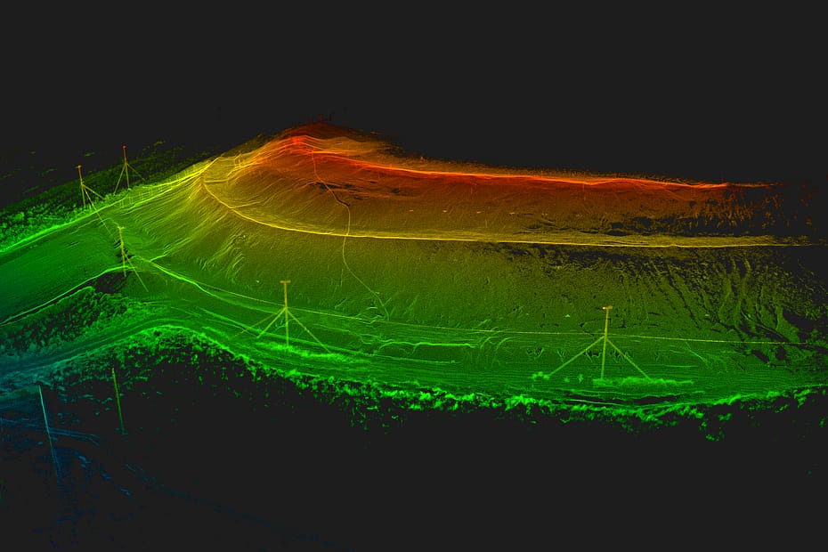
Dr. Miller’s data collection spanned a 1 km2 area around Belfast, split into several blocks, which covered most of the city centre. He scanned each block separately, georeferencing and merging them into one final point cloud. Dr. Miller georeferenced by identifying features within the point cloud and matching them to their real-life location. These areas in Belfast include tight passageways and streets, which the ZEB Horizon’s handheld capabilities provided easy and quick access with little disruption. Additionally, the speed of capture of the ZEB Horizon meant data collection was efficient, with 50 scans carried out, lasting 7-15 minutes each.


Georeferencing the data was vital for UrbanArk as it means they can scan certain blocks again, as often as required and merge the new data into the existing point cloud. The repeatability of the scans allows for updated information as the environment inevitably changes over time.

Understanding flood patterns with GeoSLAM data

Dr. Miller used GeoSLAM software to process the ZEB Horizon data and merge the individual datasets into one coherent point cloud. He also used third-party software, Cloud Compare, to analyse the point cloud and collect the required data.


With this data, UrbanArk calculates information on potential flood heights and rates to share as 2D maps and VR walkthroughs within communities. Educating communities contributes to UrbanArk’s aim to increase the resilience and preparedness of urban centres in the event of a flood.


Dr. Miller also explored the volumes of basements and parking lots to understand the amount of water they would hold in the event of a flood. Additionally, the inclusion of underground spaces and small street features have proven to impact the inundation rates and floodwater flow within the output flood models.

The GeoSLAM ZEB Horizon proved itself to be an efficient tool for urban mapping, due to its combination of manoeuvrability and accuracy. The user-friendly nature of the scanner promotes widespread use, from novice to expert level surveyors.

To find out more about UrbanArk and their project, visit: A Joint Research Project under the US-Ireland Research and Development Programme (urbanark-project.org)

This work was supported by a research grant from the Department for the Economy Northern Ireland under the US-Ireland R&R Partnership Programme.

Digitising 163 apartments in the heart of Hamburg

Location

Hamburg, Germany

Scan time

25 minutes per scan

Size

163 apartments and 13 staircases

Scanned

Apartment Building

Industry

Surveying

Danish-based digital modelling company, Eseebase, works to digitise building assets globally. They collect relevant, accurate data and information, with the aim to make the maintenance of buildings more effective. During the lifespan of the company, they’ve created digital assets for more than 9 million square meters of space and over 400,000 flats within the housing sector.

This case study will dive into a recent project, that required the need for fast and accurate data capture, using GeoSLAM handheld scanners.

Mapping a residential apartment block in Hamburg

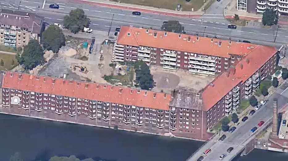
SAGA, controlled by the State-City of Hamburg, is Germany’s 3rd largest housing company and has nearly 140,000 residential units. They required up-to-date information and measurements of a large apartment building. Upcoming renovations to the apartment block meant that the information needed to be accurate and returned in a timely manner.

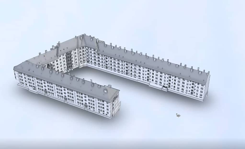
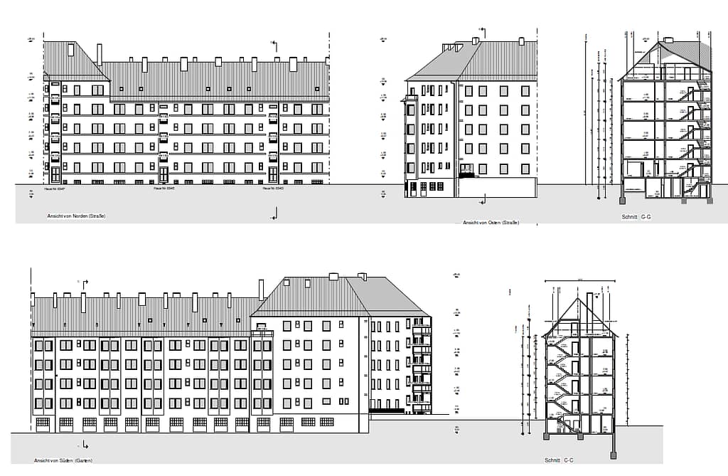
SAGA tasked Eseebase to capture the data. The team’s goal was to create up-to-date CAD drawings and a 3D model (BIM) of the apartment block.

The residential building has 163 apartments and 13 staircases that span across 7 floors. Furthermore, residents currently live in the apartments, so speed and professionalism were a priority. To limit disruption, the team had a few hours per day to scan the building. As a result, a requirement for an accurate and time-efficient method of data capture was essential.

Finding an effective solution in handheld LiDAR

Eseebase opted to work with GeoSLAM technology, as they are familiar with the solutions and workflows. For this project, the team obtained a ZEB Horizon scanner. They also made use of the ZEB Vision camera claiming the bubble walk-through feature from the 360o panoramic images were a useful reference when modelling.

The ZEB Horizon’s walk and scan method was a simple way of capturing an environment without any difficult setups. It also was a less intrusive way of obtaining data, benefitting the residents in the apartment blocks.

Additionally, the laser scanner transitioned well between apartments to hallways and stairwells, as well as from indoors to outdoors. The ZEB Horizon’s ease of use meant training was minimal, and there was a reduction in time spent in the apartment block.

The ZEB Horizon’s speed of capture also allowed Eseebase to scan the building’s interior in under three days, carrying out 7-10 scans per day that lasted 25 minutes each.

With the interior captured, the team focused on the exterior of the building. A close-up walk around the building gathered the necessary data, and a wider loop helped to capture the roof. A large body of water surrounds one side of the building, therefore Eseebase had to get creative and scan from a small boat they hired. The mobility of the scanner overcame this problem, whereas other mapping solutions would struggle due to their cumbersome nature.

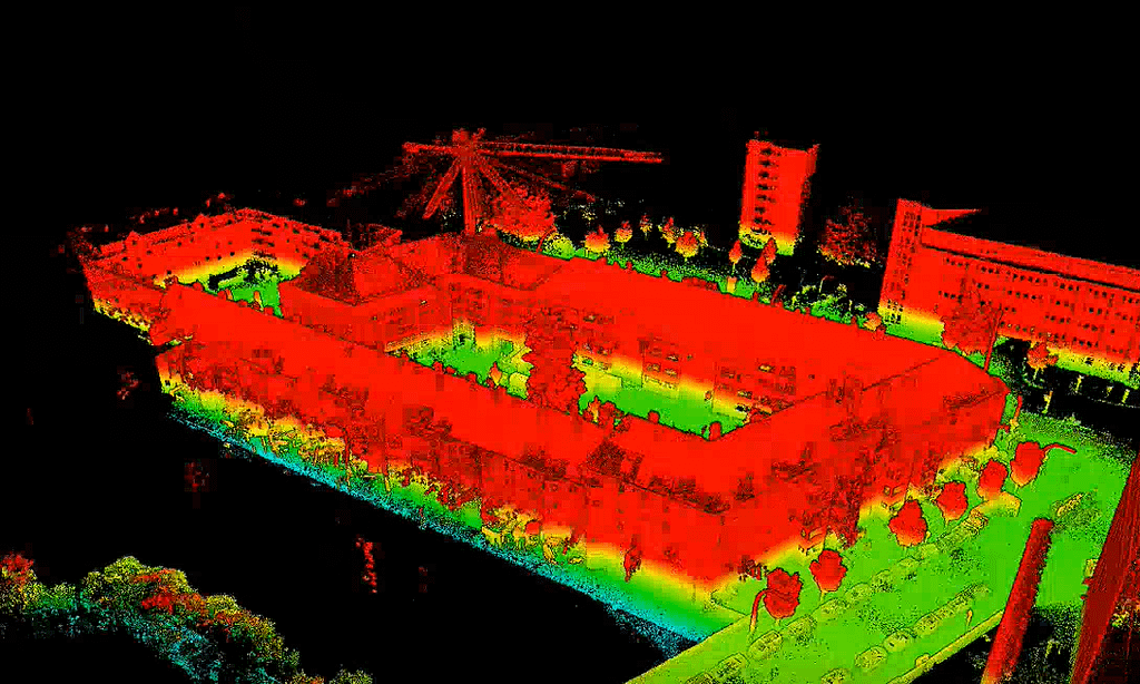
Essebase used GeoSLAM Connect to process the final point clouds and they automatically merged the 23 individual datasets into one large point cloud.

Autodesk ReCAP produced RCP files from the point cloud, which was then imported into Revit where the CAD Drawings and 3D model was created.

Conclusion

In just three weeks Eseebase had presented the final deliverables back to SAGA. The speed of capture the ZEB Horizon provided cut down the overall delivery time, and the mobility saw that the process didn’t largely affect the residents.

Eseebase found GeoSLAM’s technology so efficient and beneficial that they have recently acquired the ZEB Horizon RT. They plan to use it, with the ZEB Vision, for future projects in Germany following similar workflows.

Ernst Koppensteiner, Head of Data Registration and Quality Assurance at Essebase, says “Capturing a building of this size comes with its difficulties, especially when scanning multiple staircases and rooms over several floors. The ZEB Horizon allows us to easily capture the necessary data quickly and with no issues”.

The ZEB Horizon is the most versatile scanning device we have found when it comes to using one system for Outdoor scanning, Indoor scanning and scanning in very confined spaces like cellars and attics”
– Ernst Koppensteiner, Head of Data Registration and Quality Assurance, at Eseebase