Skip to content

How mobile LiDAR transformed and expanded a small business

Location

Washington State, USA

Scan time

5-15 minutes per scan

Size

Various interior and exterior sizes

Scanned

A range of large environments

Industry

Surveying

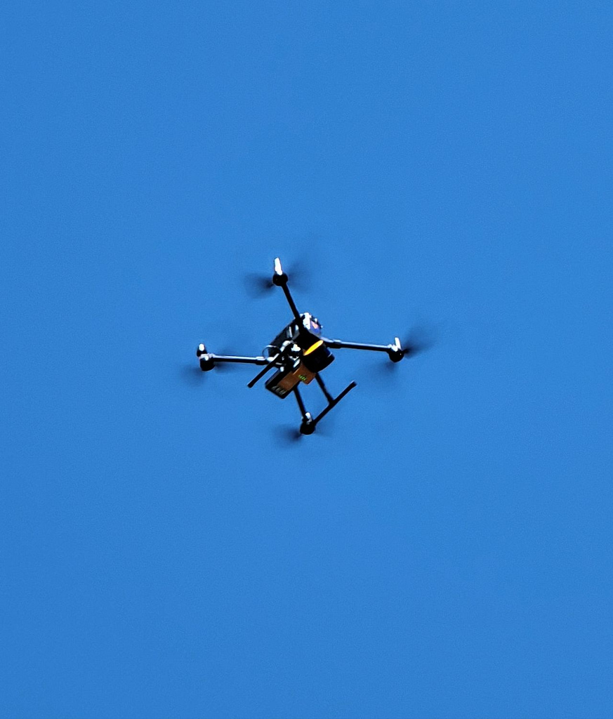
Scout Aerial Solutions is a US-based drone and geospatial service provider. The company helps construction businesses, land surveyors, and engineers capture data faster, provide deliverables efficiently, and increase project productivity. Scout Aerial Solutions use drones, alongside mobile LiDAR, and other Multimedia Collection methods so its clients do not have any informational gaps in their data.

This case study explores the applications Scout Aerial Solutions use mobile LiDAR for and how it benefits data capture and clients’ projects.

Mobile LiDAR’s use in adverse weather conditions

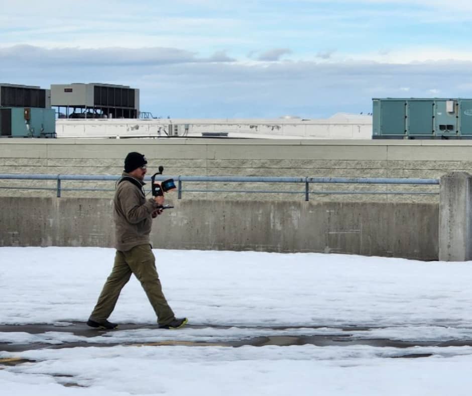
Scout Aerial Solutions is based in Washington State, USA, and primarily used photogrammetry alongside drones as its main data collection method. However, the team have found that during the winter months, adverse weather conditions make scanning from the air more difficult. As a result, they decided to adopt a new data-capturing method, handheld mapping, to use alongside drones.

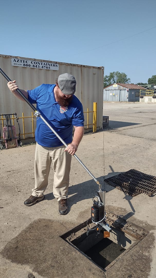
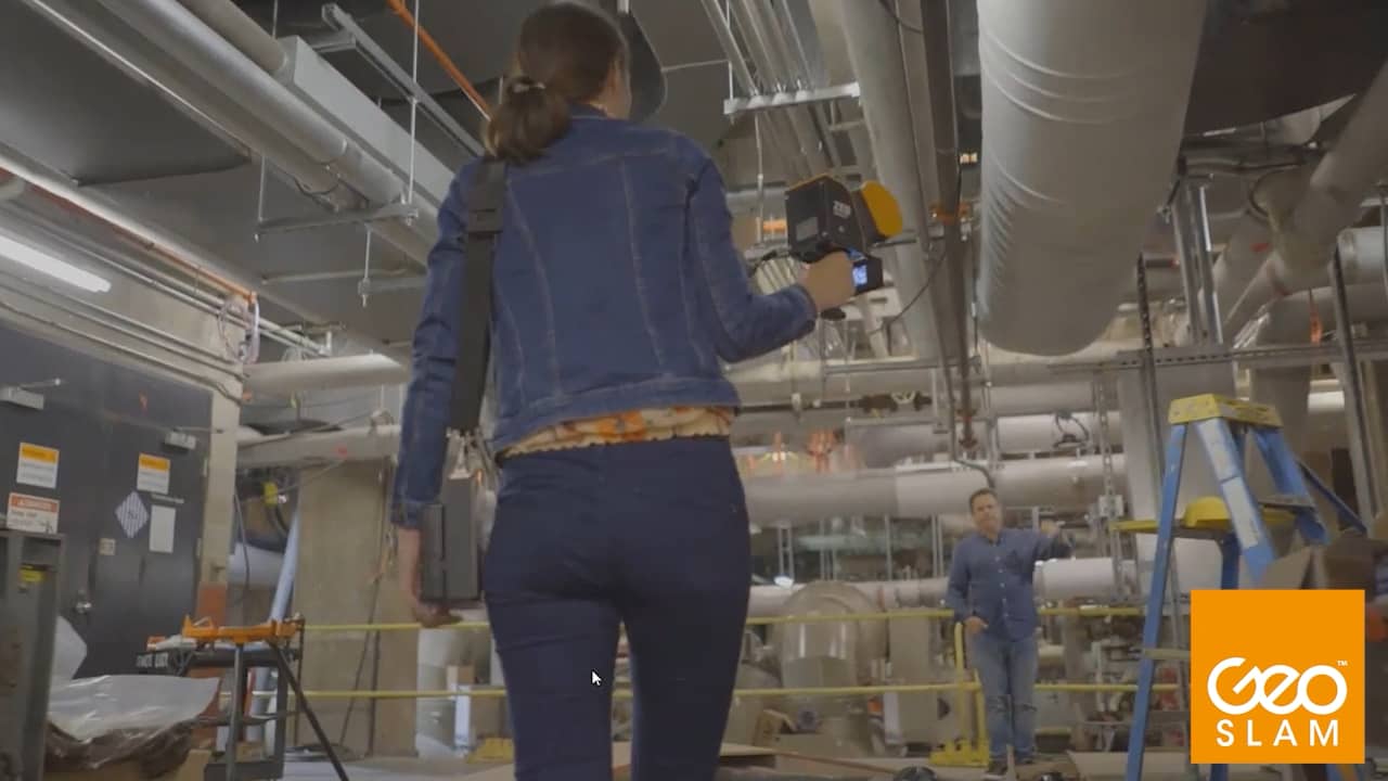
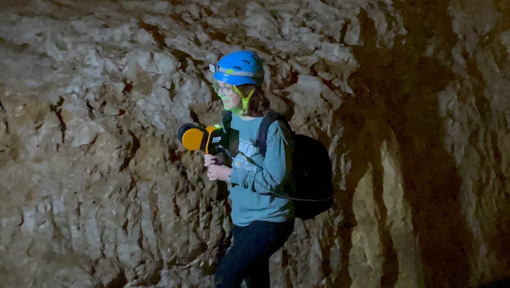
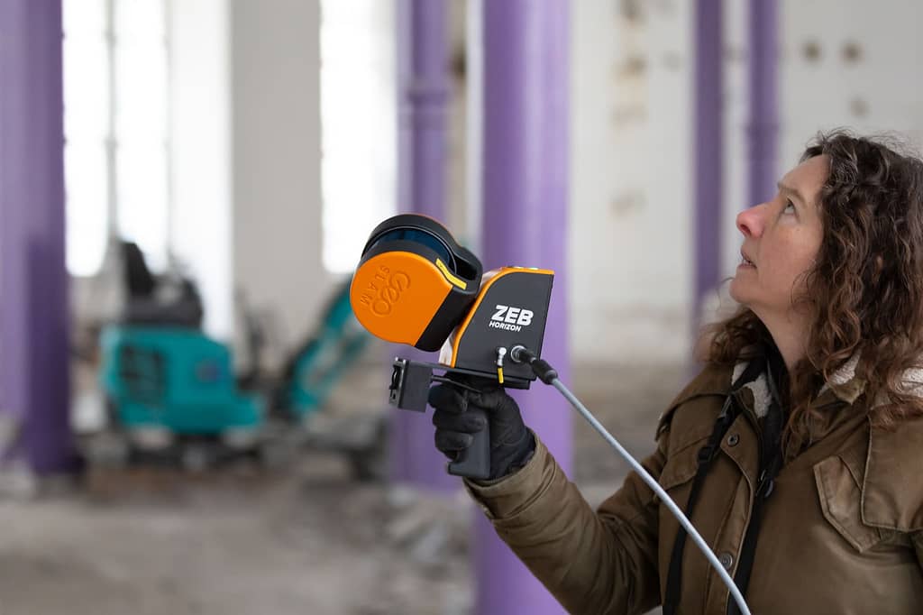
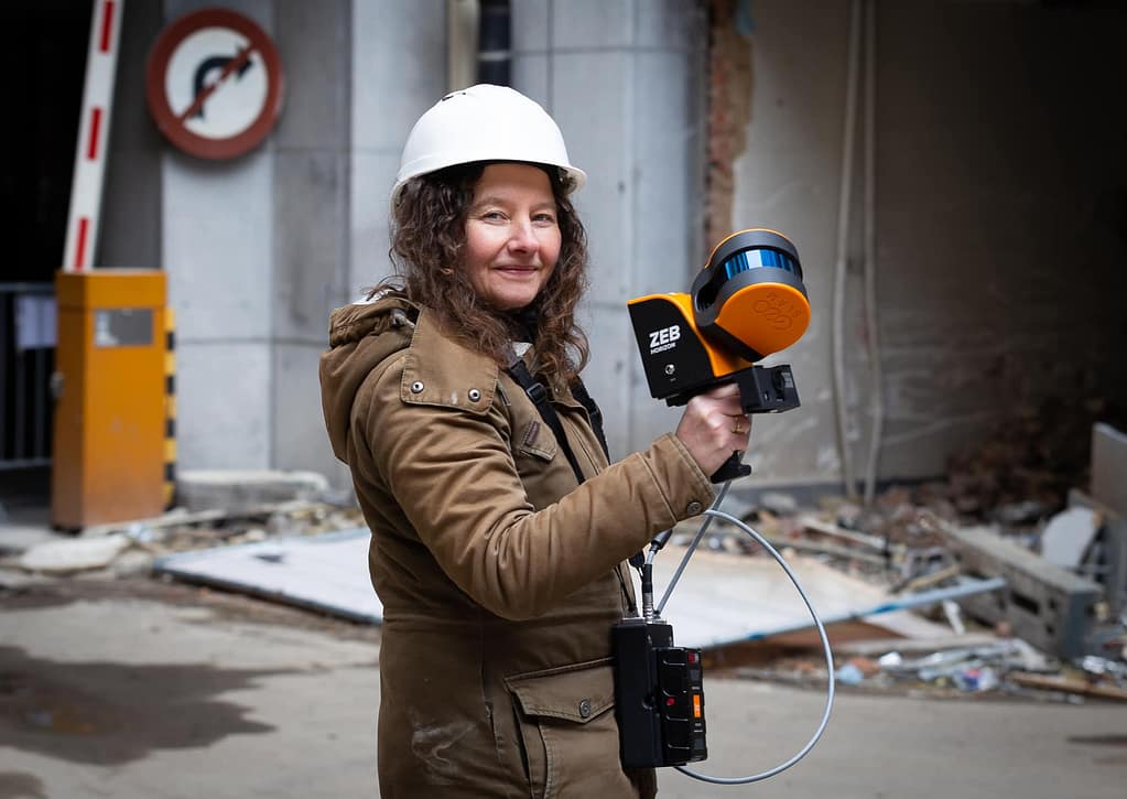
After considering the options, Scout Aerial Solutions opted to work with GeoSLAM’s mobile LiDAR scanners and acquired a ZEB Horizon, alongside the ZEB Vision and Car Mount accessories. Since acquiring the laser scanner, it has proved beneficial for the team and their projects. As an additional collection resource, it allows Scout Aerial Solutions to scan on the ground and inside buildings during the snowy months.

Using the ZEB Horizon for a variety of applications

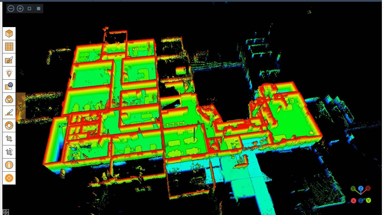
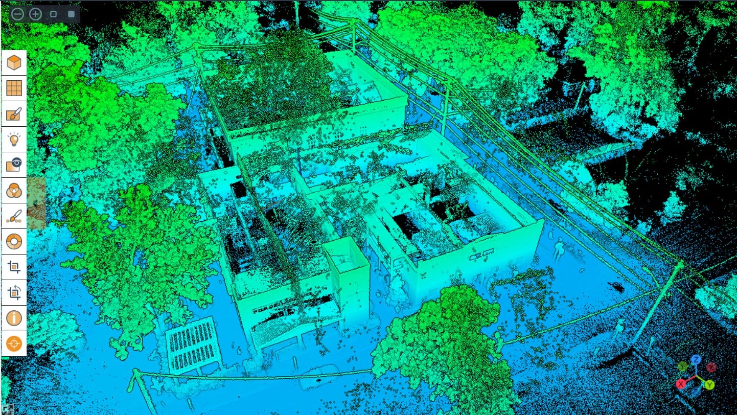
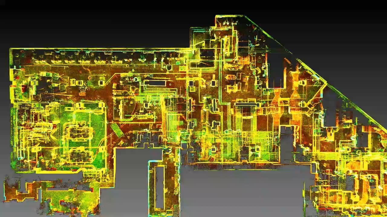
The scanner’s capabilities have continued to impress Scout Aerial Solutions and they now use it for a range of solutions. Over the course of 6 months, the team has completed 72 scans, testing for different applications and customer projects. Each scan, lasting approximately 5-15 minutes, contributes to the growing tally of uses with GeoSLAM’s mobile LiDAR scanner. This includes training with the ZEB Horizon to understand how to best suit the customers’ needs and minimise errors on the job site.

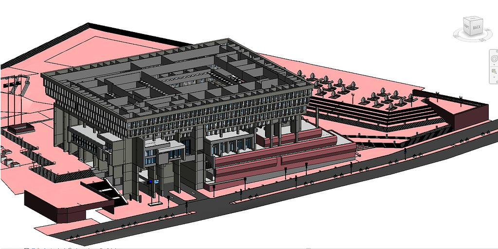
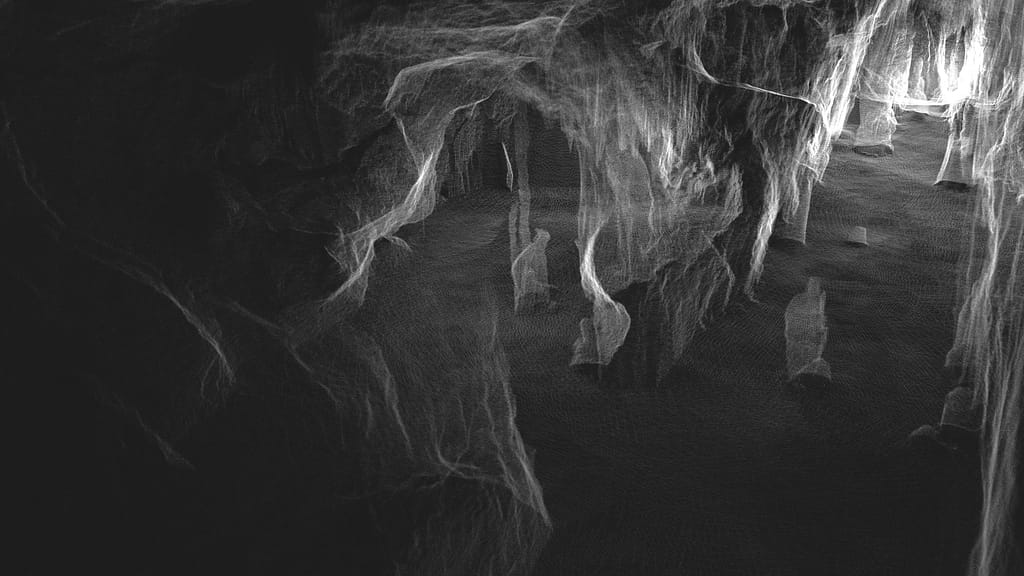
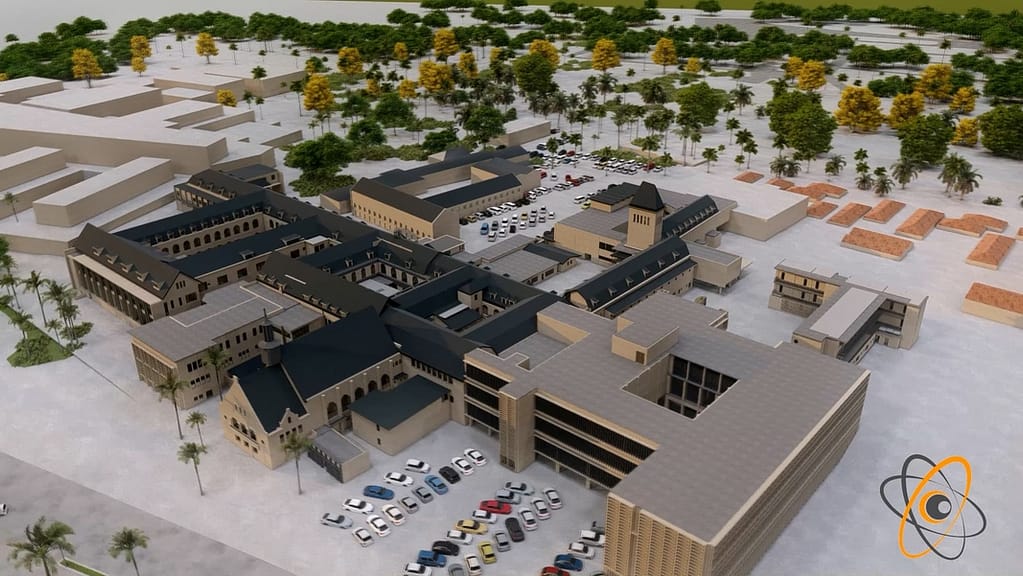
As Scout Aerial Solutions capture data from interior and exterior environments the size of scans varies from project to project. However, the largest area they have scanned internally is a 400,000 sq/ft parking garage and externally, around 68 acres, captured with a drone.

How Scout Aerial Solutions use mobile LiDAR

Additionally, Scout Aerial Solutions provide testing, training, and demos to its clients demonstrating the potential of handheld laser scanners.

University of Idaho: Centre for Forest Nursery and Seedling Research

The biggest project that Scout Aerial Solutions are working on is collaborating with one of its clients to scan forestry nurseries, using the ZEB Horizon. The aim of this scan is to be able to scan forest plots more easily to measure sapling growth and ID trees on site.

Although Scout Aerial Solutions is a company initially set up to service the AEC sector, mobile LiDAR has proven to be an asset in other sectors, helping them to branch out into forestry.

Camber detection

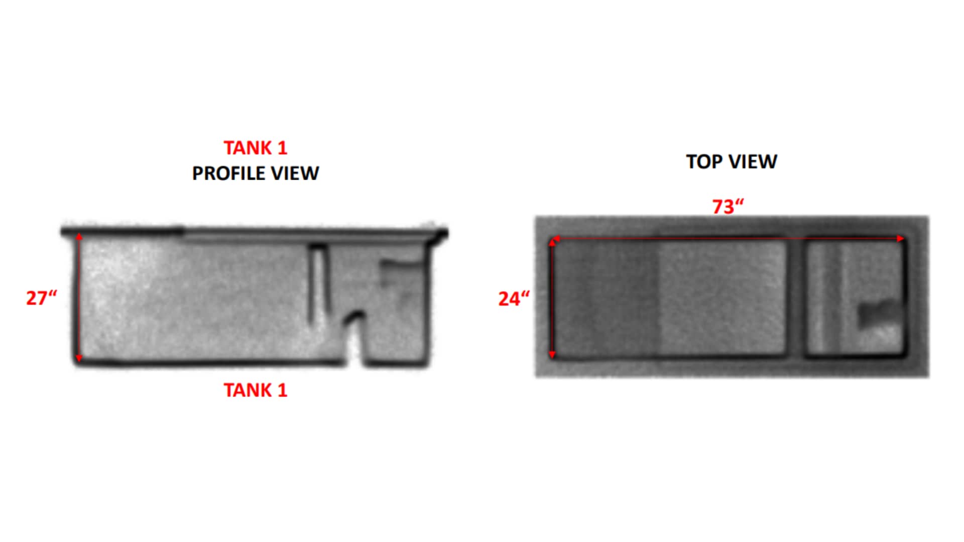
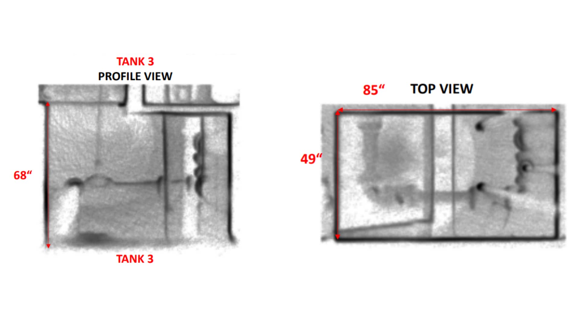
Scout Aerial Solutions carried out a scan using mobile LiDAR for a company that needed to detect the camber of concrete beams over several thousand sq. ft. Previously, the only data collection method available to the company was a total station, alongside already existing model calculations from before a floor pour. However, they wanted to evaluate whether mobile LiDAR can more effectively measure the beams. With the ZEB Horizon, Scout Aerial Solutions proved to their client that mobile LiDAR is a more efficient method of data capture.

Scout Aerial Solution’s growing use of mobile LiDAR

Scout Aerial Solutions are continuing to introduce mobile LiDAR to its clients, including in the environmental and archaeological sectors, that have produced very promising results.

Furthermore, the company has found that GeoSLAM Draw is beneficial for its construction clients as it is possible for clients to integrate deliverables into regularly used third-party software, such as Bluebeam, via an array of export options.

As Scout Aerial Solutions use mobile LiDAR more and discover the full capacity of the ZEB Horizon and accessories, their productivity and client fulfilment will also increase. The ZEB Horizon is designed with accessories in mind, which means adding required accessories to the scanner for future uses is cost-effective. Additionally, unlike other methods of capture which might demand several units, the ZEB Horizon has the capability to be an all-in-one solution.

Scout Aerial Solutions are currently trialing usage of the new carry-case backpack to see how it will benefit their projects.

GeoSLAM Sample Data

View and download data in our free point cloud viewer

Here’s some helpful tips for the best viewing experience

  • If your internet connection allows, move the Point Budget slider to the maximum amount available to view all the points in the cloud.
  • Making the point size smaller using the Point Size slider makes the data easier to view and interpret.
  • In the tools section of the viewer, you can measure the distance and angles of features within the pointcloud.
  • Using the materials section of the viewer, you can use the Select Attributes dropdown to view by intensity, elevation and RGB (if point cloud is coloured).

Nall’s pumpkin hill

Location: Washington, USA
ZEB Scanner: ZEB Vision
Scan time:
2 Minutes

Would you like to see a specific dataset that’s not on this page? Contact [email protected]

Providing innovative solutions using UAVs

and LiDAR scanners

Location

Savannah,
USA

Scan time

From 10-30 minutes

Size

Varies depending on scan

Scanned

Large exterior spaces

Industry

Surveying

Delivering accurate representations of built environments

Shamrock+, based in Savannah Georgia, provides creative and visual solutions to individuals and businesses through photography and 3D data collection services. Using UAVs, cameras, sensors and software, Shamrock+ delivers accurate representations of built environments for their clients.

Shamrock+ largely works within Architecture, Engineering and Construction (AEC), however, they also assist professionals with projects in the Real Estate sector. Their solutions include photography, progress documentation, creating 3D data visualisations, and as-built.

Shamrock+ originally used a static-based LiDAR solution to produce their 3D point clouds. Though highly accurate, they needed a faster solution for collecting data. Additionally, they needed a versatile scanner that can be mounted to UAVs and cars to capture larger areas.

As a result, Shamrock+ chose to work with GeoSLAM’s ZEB Horizon scanner.

What used to take hours to scan, is now taking us significantly less time to cover more areas.

Using the ZEB Horizon laser scanner on UAVs

The ZEB Horizon has significantly reduced the time needed to scan, whilst simultaneously delivering accurate data. The easy-to-use solution and simple setup mean the team could immediately begin scanning.

Many of the areas Shamrock+ capture are large exterior spaces, and the 100m range of the ZEB Horizon make it the ideal solution. The team carried out an architectural scan of an approximately 10,000 sq. ft Community Bible Church (CBC) in Savannah, GA. This project consisted of 3 individual scans of the interior building and its surrounding area, with the scan time ranging from 10 to 30 minutes.

Shamrock+ uses the ZEB Horizon laser scanner on UAVs, handheld and with GeoSLAM’s car mount accessories. The versatile solution provides Shamrock+ with the ability to switch from air based data capture to scanning large areas in a very short amount of time.

Creating 3D BIM files, floorplans and more with GeoSLAM technology

Shamrock+ has completed more than a dozen projects to date, each with its own challenges. From scanning building interiors for renovation, to mapping acres of land for topographical data, the ZEB Horizon has proven to be a tool that can overcome the challenges it has faced so far.

Shamrock+ processes the ZEB Horizon’s data using GeoSLAM Connect. They also internally integrate the point clouds into other software platforms to create 3D BIM files, floorplans, elevations, contours, and much more.

By using GeoSLAM’s technology, Shamrock+ can capture large acres of land in a short period of time. This speeds up their data collection process without sacrificing accuracy, which allows them to spend more time on creating high quality visual solutions for their clients.

If you’d like to learn more about how GeoSLAM solutions can help you, submit the form below.


    Industry

    Primary Application Interest

    Primary Application Interest

    Country

    State

    State

    State

    State

    State

    State

    State

    State

    State

    State

    State

    State


    GeoSLAM and its authorised partner network will use the information you provide to contact you about products and services. You may unsubscribe from these communications at any time. For information on how to unsubscribe, as well as our privacy practices and commitment to protecting your privacy, please review our Privacy Policy.

    Opt in to the FARO mailing list for updates and offers.


    Surveying Interior and Exterior Environmental Features

    Location

    Kansas,

    USA

    Scan time

    Approx. 20 minutes per scan

    Size

    Over 1 million sq/ft per year

    Scanned

    Buildings and Underground Oil Tanks

    Industry

    Surveying

    Collecting Accurate Measurements of Buildings for the Military

    The Kansas Adjutant General’s Department coordinates resources for local, state, and federal use. They also develop internal use documents for the military, including surveying building interiors to create up-to-date and accurate floorplans for military members within Kansas.  

    They have about 35 sites throughout the state, with some locations 100s of miles away from the headquarters. Further, the Adjutant General’s Department manages approximately 250 buildings state-wide, totaling around 2 million sq. ft. of interior space. These factors have led to some difficulties in keeping up with projects, and any changes to the buildings and layouts.

    The team found that when remodelling buildings, they were having issues getting as-builts completed in time. As-builts are documents that are used to compare a building’s design plan versus its final measurements. They also provide accurate blueprints of the building, and the surrounding land, as actually constructed at the end of the project.

    Being able to have one person go out to capture all of the data and have the most current floorplans, along with the accuracy of the scanners is a gamechanger

    Kansas Adjutant General’s Department Use of the ZEB Revo

    Scanning Properties to Keep on Top of Changes Made

    To tackle these issues, the team decided to adopt LiDAR laser scanning technology to aid them in their projects and found GeoSLAM’s ZEB Revo to be the best option. By acquiring GeoSLAM’s technology, the Kansas Adjutant General’s Departments’ goal was to scan over half of their 2 million sq. ft. of interior space every year.

    The ZEB Revo is handheld, accurate and fast, providing the team with a perfect tool. In addition, the simplicity and ease of use means only one team member needs to travel to a site, when necessary. Previous methods of data capture were not as quick or accurate. The ZEB Revo data capture leads to a faster return on projects, higher levels of accuracy, and a high return on investment.

    By using the ZEB Revo, the Kansas Adjutant General’s Department have updated over 1 million sq. ft. of interior space, achieving their overall goal, with just one technician visiting half of the sites per year. The speed of capture of the ZEB means that the average time it takes the team to carry out a scan is just 20 minutes. By collecting accurate measurements, they can now regularly update their GIS database, which provides up to date floorplans throughout the state.

    Data from the ZEB Revo is also used to create ‘X-Ray’ views of their properties for future plans and layouts.

    team member collecting accurate measurements with the ZEB Revo

    Collecting Accurate Measurements with the ZEB Horizon

    Recently, they have expanded their use of handheld LiDAR technology by acquiring a ZEB Horizon, which they use for a variety of reasons. The increased range and data capture points make the ZEB Horizon a great option for large exterior scanning. This is important to the Adjutant General’s Department as they cover land of up to 50 acres.

    Scanning Environmental Features to Work out Contour Lines

    The Kansas Adjutant General’s Department also have tanks that contain hazardous material which they need to track carefully. Using the ZEB Horizon, they scan exterior environmental factors to figure out contour lines within their complex. This helps them work out where any spillages of hazardous material would be, should one occur.

    Using the ZEB Horizon to Ensure Current Asset Management

    With the ZEB Horizon, the team also carry out exterior scans for asset management. Due to the scanners ease-of-use, one engineer can attach it to a truck and drive around their complex. This enables Kansas Adjutant General’s Department to scan their entire site and keep on top of their buildings and resources.

    The team are also looking to expand this by attaching the ZEB Horizon to a UAV in the future.

    Collecting Accurate Measurements of Underground Oil Tanks

    The ZEB Horizon’s time saving, and accurate scans have proven to be a cost-effective method of data capture. For example, scans of underground empty oil storage tanks showed that the Kansas Adjutant General’s Department had been over estimating the tanks collection capacity, leading to an adjustment of the servicing contract.

    Processing Data into Point Clouds and Third Party Integration

    Since The Kansas Adjutant General’s Department acquired GeoSLAM’s technology four years ago, they have carried out approximately 2000 scans, and this number continues to rise.

    Further, the contractors and architects that create as-builts are now using The Kansas Adjutant General’s Department to quality check their work for accuracy. Using GeoSLAM laser scanners, they help find errors in specifications and relay that information to the contractors.

    floorplans created after collecting accurate measurements

    With the help of Seiler Geospatial Division, Kansas Adjutant General’s Department have been able to significantly improve their workflow. To find out more about Seiler, click here.

    seiler logo

    If you’d like to learn more about how GeoSLAM solutions can help you, submit the form below.


      Industry

      Primary Application Interest

      Primary Application Interest

      Country

      State

      State

      State

      State

      State

      State

      State

      State

      State

      State

      State

      State


      GeoSLAM and its authorised partner network will use the information you provide to contact you about products and services. You may unsubscribe from these communications at any time. For information on how to unsubscribe, as well as our privacy practices and commitment to protecting your privacy, please review our Privacy Policy.

      Opt in to the FARO mailing list for updates and offers.


      Surveying Boston City Hall

      Location

      Boston, USA

      Scan time

      Approx. 20 minutes per scan

      Size

      Over 1 million sq/ft

      Scanned

      Boston City Hall

      Industry

      Surveying

      Boston City Hall was built in 1968, to help boost the city’s economy after years of stagnation. The building and surrounding plaza sought to modernize the city’s urban centre, reinvigorating the run-down neighbourhood of Scollay Square.

      Despite the public investment project being welcomed by the people of Boston, the buildings ‘brutalist’ style of architecture created debate amongst the locals, with some suggesting you either love or hate the concrete design. In spite of the concerns from the public, the city
      hall has been home to the mayor of Boston and the city council for over 5 decades, and the ‘brutal’ style of architecture has become part of Boston’s rich history.

      To encourage more people to use Boston City Hall and to increase accessibility, it was decided in 2017 that the City Hall would be renovated to serve a more modernized purpose. The infrastructure upgrades include better access to utilities, plants and fountains in the plaza area, with the intention of encouraging more people to visit.

      The Horizon was a gamechanger…it’s just amazing in terms of the scanning distance, power of the sensor and the ability to easily capture the entire plaza.

      Peter Garran and his team, from Aerial Genomics, were appointed by The City of Boston and Sasaki with the task of scanning both the interior and exterior of the City Hall, in anticipation of the renovation project. Spanning 9 floors and housing multiple individual rooms, as well as a busy plaza area, the task of mapping the building threatened to take several months to complete. Also, the City Hall is an active office that contains confidential rooms and Aerial Genomics did not want to disrupt everyday operations too much. Considering their options, the team decided the fastest and most cost-effective way of mapping the building and its surrounding area would be to use mobile LiDAR scanners.

      They chose a ZEB Horizon to scan the exterior and inside the Main Hall. The ZEB Revo RT was used to map the buildings vast interior. These scanners were chosen due to their speed, accuracy and mobility. By simply walking around the building, Peter and his team captured the large layout, saving them time.

      As they were scanning during the pandemic, it was key for Peter and his team to spend as little time as possible in the building and compared to other scanning methods, GeoSLAM’s scanners were able to deliver on that goal. With the ZEB Horizon, Aerial Genomics captured both the exterior and interior of the Main Hall in just 4 scans, and in less than 2 hours. This scanner was specifically chosen to scan the Main Hall due to its 100m range being able to capture the high walls. To help combat getting in the way of the City Halls’ day-to-day business, the team were given limited amounts of time in the evening to scan a multitude of rooms inside the Hall. Using the ZEB Revo RT, the team could scan the almost 1 million square feet interior, in just 4 nights, consisting of 5 hours each night.

      The scans were processed using GeoSLAM Hub and merged to create one point cloud, by Aerial Genomics. The manoeuvrability, ease of use and accuracy that the ZEB scanners provided meant the data collected was ready within a week, to be created as a BIM model to send to the architects. The simple, easy to use solution meant the architects could start thinking about the redevelopment and renovation, without the need to visit the hall during a pandemic. The final BIM model, created in Autodesk Revit, is still referred to today.

      Video courtesy of Aerial Genomics
      Surveying Boston City Hall

      If you’d like to learn more about how GeoSLAM solutions can help you, submit the form below.


        Industry

        Primary Application Interest

        Primary Application Interest

        Country

        State

        State

        State

        State

        State

        State

        State

        State

        State

        State

        State

        State


        GeoSLAM and its authorised partner network will use the information you provide to contact you about products and services. You may unsubscribe from these communications at any time. For information on how to unsubscribe, as well as our privacy practices and commitment to protecting your privacy, please review our Privacy Policy.

        Opt in to the FARO mailing list for updates and offers.


        Scanning in America’s oldest show cave

        Location

        Virginia

        Scan time

        12 minutes

        Size

        500 meters

        Scanned

        Grand Caverns

        Industry

        Education

        Discovered in 1804 by Bernard Weyer in the heart of Virginia, Grand Caverns (formerly Weyer’s Cave) is the oldest show cave in the USA. During the US civil war, the cave was used by both Confederate and Union soldiers as part of the Valley campaign, during which time over 230 soldiers signed their names on to the cave walls. More recently, the cave has become a huge tourist attraction, due to its beauty, location and being surrounded by scenic trails for hiking, running, and biking, but it has also captured the attention of the scientific community because of recent discoveries of new passages and the rock formation changes over time.

        The town of Grottoes (where the show cave is located) partnered with Angel A. Garcia Jr. and his students from James Madison University to create a 3D map of the cave. The 3D point cloud is being used to measure Speleothems, monitor the human impact on the cave, create 3D printed models and to celebrate the show cave’s extensive history, shining a light on its geoheritage. In addition, it is a fantastic opportunity for the undergraduate students of JMU to get hands on experience with the handheld LiDAR scanner and the data it outputs.

        Angel A. Garcia Jr. chose GeoSLAM’s ZEB Horizon scanner to take on the task of mapping both the parts of the cave open to the public and the recently discovered, vast passages. He and his students capitalise on the speed of capture and accuracy of the scanner to review and analyse data in a quick and efficient manner.

        With the LiDAR we’ll be able to get into corners and see what hasn’t been looked at for a long time.

        Having originally purchased the ZEB Horizon back in February 2021 to collaborate and share data with partners scanning caves using ZEB devices in Puerto Rico, Professor Garcia began to see the potential and opportunities the scanner offered. Fast, accurate and handheld data capture opens a way to map an area without the need to GPS or complicated setups. In addition, the scanners ease of use means that undergraduate students can be involved in the project with limited to no training.


        Since beginning to use the ZEB Horizon, interest in Professor Garcia’s work with the SLAM scanner has escalated, and he has subsequently been invited to other universities to run workshops. In April 2021, he was approached by Grand Caverns to map the historic show cave.


        The public area of the cave is approximately 500 meters in length, 30 meters high and has stairways in places, so it is quite a large area to capture. Professor Garcia and his students were able to capture the entire public area in approximately 12-15 minutes, by simply walking and scanning. He pointed out that a terrestrial laser scanner would be able to capture the public part of the cave, but it would take days, not minutes, and due to the uneven surfaces of the non-public area of the cave, it would be impossible to get a tripod-based system down there. Alternatively, you could measure a cave using a distometer, but this could take months, if not years to complete.

        The ZEB Horizon was able to give them a quick accurate scan in 12 minutes, so the students could get to work reviewing the data for their various projects.

        It’s going be able to detect the stalagmites, the stalactites and it’s even going to be able to detect the cave shield because it’s that precise.

        The data is being processed using GeoSLAM Hub, and Draw is being utilised by the team to accurately measure the speleothems over time. The students can see the orientation, thickness and gather measurements using the LiDAR information alone. They are also hoping to use Draw to understand accurate dimensions of the cave. Furthermore, the 3D point cloud is being used as a base to 3D print the cave within a rectangular block, for further research purposes.


        The team continued to scan the cave over the summer, and Professor Garcia is working with the caving/spelunking community of experts to begin capturing the more problematic and recently discovered new passages of the cave. These areas have not designed for the public at the moment, so there are uneven surfaces and narrow corridors, but due to the ZEB Horizons mobility, capturing previously unseen parts of cave will be quick and safe.


        Professor Garcia concludes by saying that the 3D model will provide an opportunity for those who can’t physically enter the caverns, to learn what they are all about.

        If you’d like to learn more about how GeoSLAM solutions can help you, submit the form below.


          Please select your Country

          How did you hear about GeoSLAM?

          Opt in to the GeoSLAM mailing list for updates and offers

          Your information will be used by FARO Technologies Inc. and third parties such as affiliates, marketing partners, and product partners to contact you about products and services. You may unsubscribe from these communications at any time. For information on how to unsubscribe, as well as our privacy practices and commitment to protecting your privacy, please review our Privacy Policy.

          GeoSLAM Sample Data

          View and download data in our free point cloud viewer

          Here’s some helpful tips for the best viewing experience

          • If your internet connection allows, move the Point Budget slider to the maximum amount available to view all the points in the cloud.
          • Making the point size smaller using the Point Size slider makes the data easier to view and interpret.
          • In the tools section of the viewer, you can measure the distance and angles of features within the pointcloud.
          • Using the materials section of the viewer, you can use the Select Attributes dropdown to view by intensity, elevation and RGB (if point cloud is coloured).

          Christ the Redeemer

          Location: Rio De Janeiro, Brazil
          ZEB Scanner: ZEB Horizon
          Scan time:
          45 Minutes

          The external of this scan was captured with the DJI M600 using GeoSLAM’s UAV mount, and the internal was captured handheld using the ZEB Horizon.

          Would you like to see a specific dataset that’s not on this page? Contact [email protected]

          GeoSLAM Sample Data

          View and download data in our free point cloud viewer

          Here’s some helpful tips for the best viewing experience

          • If your internet connection allows, move the Point Budget slider to the maximum amount available to view all the points in the cloud.
          • Making the point size smaller using the Point Size slider makes the data easier to view and interpret.
          • In the tools section of the viewer, you can measure the distance and angles of features within the pointcloud.
          • Using the materials section of the viewer, you can use the Select Attributes dropdown to view by intensity, elevation and RGB (if point cloud is coloured).

          Richmond Tunnel

          Location: California, USA
          ZEB Scanner: ZEB Horizon
          Scan time:
          6 Minutes

          This data was captured with the ZEB Horizon mounted to a vehicle using our car mount.

          Would you like to see a specific dataset that’s not on this page? Contact [email protected]

          Scanning a Caribbean hospital with the ZEB Horizon to create a BIM model

          Location
          Location

          Otrobanda,
          Curaçao

          Scanned
          Scanned

          St. Elisabeth
          Hospital

          Size
          Size

          22,346
          Square Meters

          Scan time
          Scan time

          20 minutes
          per scan

          Industry
          Industry

          Surveying

          Constructed in 1855, with the help of the Franciscan sisters, the St. Elisabeth hospital has played an important role in the Otrobanda City district on the Caribbean island of Curaçao, for over 160 years. The large hospital served as the main hub for medical care, and was historically used as a place of healing for other island nations nearby.

          Having been deemed no longer fit for purpose according to international standards in 2011, it was decided that a new hospital would be constructed next to St Elisabeth’s, and in 2019 the Curaçao medical center was opened to the public. St. Elisabeth hospital was closed in November 2019, after 164 years of service to the island.

          In 2021, Ellen de Brabander, from Urban Studio, was appointed by the survey bureau ‘Landmark’ with the task of scanning the hospital, in anticipation of renovation projects. Ellen chose the ZEB Horizon for the task, and later created an accurate BIM model using the point cloud data. In addition, Ellen is working on creating a virtual tour of the hospital, so it can be entered and explored from anywhere in the world.

          Due to the large complex nature of the building, with several floors and many individual rooms, the task of capturing and measuring the hospital was an enormous one, in terms of time frame. Originally Ellen was going to scan the building using a total station, however because the hospital is broken into 6 sub-buildings, an average of 3 floors per sub-building and many individual rooms per floor, the total station was quickly ruled out. Furthermore, with difficult to access areas, the bulky nature of a tripod-based system would not be ideal for capturing the hospital in its entirety, or fast enough.

          After assessing the options, the team decided the best way to capture the building would be to use a mobile 3D scanner, due to the lightweight nature, speed of capture and ease of use. Ellen chose a ZEB Horizon for the job and was able to seamlessly walk through the hospital’s complex buildings, capturing data as she moved.

          The 3D scanner of GeoSLAM was able to reduce the time of the measurement and as a result the delivery time was met. The measurement time would normally take several months, which was reduced to days

          Having decided on the ZEB Horizon, she was able to capture both the interior and exterior of St Elisabeth’s hospital in just 6 full working days, which was an extremely short amount of time compared to traditional measuring equipment. 52 scans were conducted in total, at approximately 20 minutes per scan and the area covered (including exterior and interior) was 22,346 square meters. The complex nature of some of the spaces were captured effortlessly because of the manoeuvrability and compactness of the scanner.

          The scans were processed and merged using GeoSLAM Hub before they were converted in Autodesk Recap and taken into Autodesk Revit to be modelled. The model of the hospital was sent to the client and the process from capture to model was documented in a video, which can be seen here:

          3D BIM model of Caribbean hospital

          If you’d like to learn more about how GeoSLAM solutions can help you, submit the form below.


            Please select your Country

            How did you hear about GeoSLAM?

            Opt in to the GeoSLAM mailing list for updates and offers

            Your information will be used by FARO Technologies Inc. and third parties such as affiliates, marketing partners, and product partners to contact you about products and services. You may unsubscribe from these communications at any time. For information on how to unsubscribe, as well as our privacy practices and commitment to protecting your privacy, please review our Privacy Policy.

            GeoSLAM Sample Data

            View and download data in our free point cloud viewer

            Here’s some helpful tips for the best viewing experience

            • If your internet connection allows, move the Point Budget slider to the maximum amount available to view all the points in the cloud.
            • Making the point size smaller using the Point Size slider makes the data easier to view and interpret.
            • In the tools section of the viewer, you can measure the distance and angles of features within the pointcloud.
            • Using the materials section of the viewer, you can use the Select Attributes dropdown to view by intensity, elevation and RGB (if point cloud is coloured).

            Stadium

            Location: Brazil
            ZEB Scanner: ZEB Horizon
            Scan time:
            30 minutes per scan

            Would you like to see a specific dataset that’s not on this page? Contact [email protected]

            GeoSLAM Sample Data

            View and download data in our free point cloud viewer

            Here’s some helpful tips for the best viewing experience

            • If your internet connection allows, move the Point Budget slider to the maximum amount available to view all the points in the cloud.
            • Making the point size smaller using the Point Size slider makes the data easier to view and interpret.
            • In the tools section of the viewer, you can measure the distance and angles of features within the pointcloud.
            • Using the materials section of the viewer, you can use the Select Attributes dropdown to view by intensity, elevation and RGB (if point cloud is coloured).

            Baton Rouge

            Location: New Orleans, USA
            ZEB Scanner: ZEB Horizon/ ZEB Discovery
            Scan time:
            30 Minutes

            Colourised data was captured using the ZEB Discovery backpack solution.

            Would you like to see a specific dataset that’s not on this page? Contact [email protected]