Jim Foster has worked in the surveying industry for over 18 years, building a well-respected company with high profile clients from all over the United States. Originally the owner of a product design company, Jim saw the opportunity to begin a new adventure in the world of surveying and has never looked back.
In this Q&A, we speak with Boaz Teixeira, laser scanner specialist at CPE Tecnologia, our Brazil dealer, about how the geospatial market in Brazil is developing and their involvement in one of our recent projects, a scan of Rio de Janeiro’s Christ the Redeemer.
SLAM scanning is becoming more commonplace in the surveying industry due to the ease of use, accuracy, and versatility of the handheld devices. As the technology continues to grow, so do the benefits of handheld scanning compared to traditional means of capturing the measurements of a building. Documenting large spaces is now as simple as walking around the property to capture a pointcloud, saving both time and money for surveyors and their clients.
Smarter Spaces use GeoSLAM to scan hydroelectric dam
Industry
Asset Management
Time
1 hour scanning total
Location
New Brunswick, Canada
Size
3,000 ft
Scanned
Hydroelectric dam
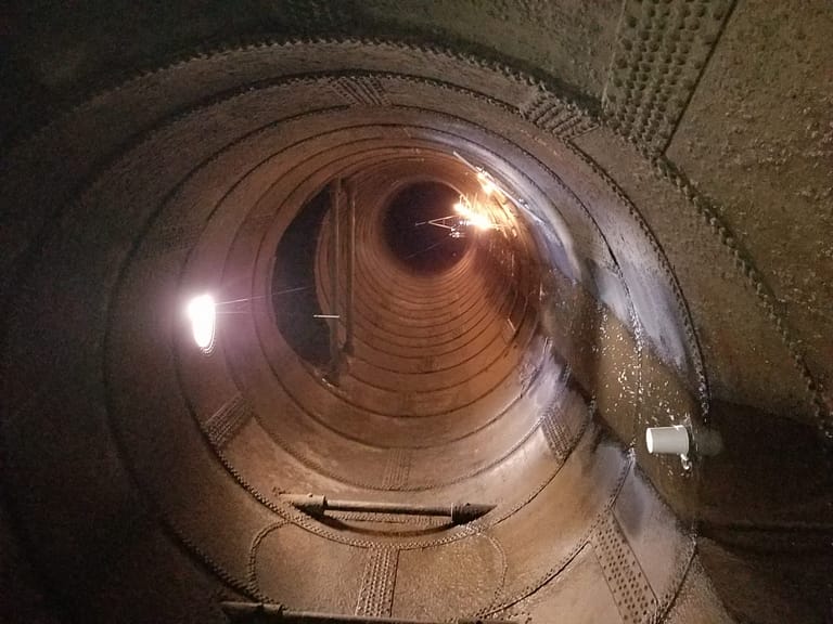
Canadian 3D geospatial experts Smarter Spaces engaged in a partnership with the University of New Brunswick (UNB) to laser scan a tunnel in a hydroelectric dam – producing a point cloud model to be overlaid with photogrammetry.
The Grand Falls Generating Station is a hydroelectric dam built in 1931 on the Saint John River in the Canadian province of New Brunswick and is operated by the NB Power corporation. The dam’s tunnel is shut down every 4 years for maintenance, inspection, and future life cycle planning.
This presented Smarter Spaces with the opportunity to utilise the mobile, handheld GeoSLAM ZEB Revo to scan the tunnel – creating an accurate point cloud model. In four years’ time the process will be repeated – allowing for the first side-by-side comparisons of the tunnel’s performance to be made.
In addition to this, NB Power has started exploring whether to build a 100-megawatt generating station in Grand Falls to produce more clean energy. The corporation is carrying out environmental and geotechnical studies, site tests, and consultations with First Nations and local residents before applying for an Environmental Impact Assessment later this year.
“It was a simple case of ‘walking and scanning’ through the tunnel environment“
The tunnel is approximately 3,000 linear feet in length and, because of its unique geometry, proposed an interesting set of challenges to scan. The tunnel environment was found to contain a lot of moisture – with a small stream running through the base. The IP67-rated ZEB Revo – which began life in mining environments – is rugged enough for such environments. The tunnel was dark, visibility was low, and walking conditions were slippery and wet. Smooth-sided surfaces also cause data collection issues for mobile scanners.
Tunnels can often prove challenging environments for SLAM given they are low on features. The SLAM used by GeoSLAM performs even in this difficult condition.
To overcome the risk of data slippage, 4 foot-high pylons were placed every 10 feet in random locations throughout the tunnel. This has the effect of ‘breaking up’ the monotony of the smooth-sided tunnel walls, ensuring that no data slippage occurs.
The scan data was processed in GeoSLAM Hub software to filter, subsample and merge multiple data sets together. The final models and datasets were sent to the University of New Brunswick to support an engineering graduate with their thesis research.
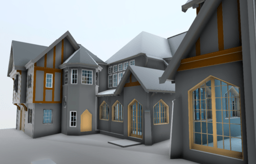
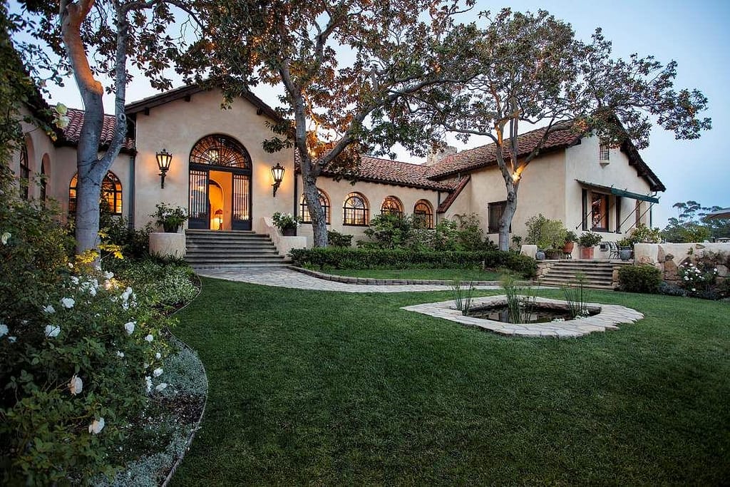
Precision Property Measurements | Words by Greg Davis
“We were tasked with surveying a vast private house in order to generate accurate as-built construction drawings for renovation. The unique challenge was that the 20,000 sq. ft Santa Barbara residence was occupied at the time, requiring the survey to be completed quickly and in an unobtrusive manner.
PPM (Precision Property Measurements) chose the ZEB Revo over other terrestrial scanners for our residential projects because of the speed and volume of data acquisition at exactly the level of accuracy required by our clients.
In order to keep disruption to residents to a minimum, we decided to tackle the task in two swift scans over two days. The first scan consisted of data collection of the extensive ground floor and communal areas, and took around 90 minutes to complete. The private, bedroom wing was off limits on this day.
The second scan incorporated these sleeping quarters, as well as gathering plenty of overlap from the lower floors to enable the 2 scans to be merged. After just 140 minutes of scanning, the entire house had been surveyed.
“We’ve always been confident in our ability to keep our projects to the nearest inch or less. In bringing the ZEB REVO into our arsenal of tools, we’ve kept the accuracy we’ve always had, but introduced an efficiency that allows our experts to get out there and do more for our clients“
A typical residential property of this size would have usually taken around 4 days on-site for one surveyor. PPM were able to slash this time and complete the majority of the survey work in less than 2 and a half hours with the ZEB Revo.
The use of GeoSLAM Hub software for post-processing and merging of the two datasets allowed the project team to generate a complete digital twin of the complex structure. GeoSLAM’s cutting edge mobile mapping technology was able to deliver an accuracy down to the nearest inch.
Handheld mapping reduces skyscraper scan time by 30 hours
Industry
Architecture
Time
10 hours
Location
Belo Horizonte, Brazil
Size
8,357 sq/m
Scanned
Skyscraper
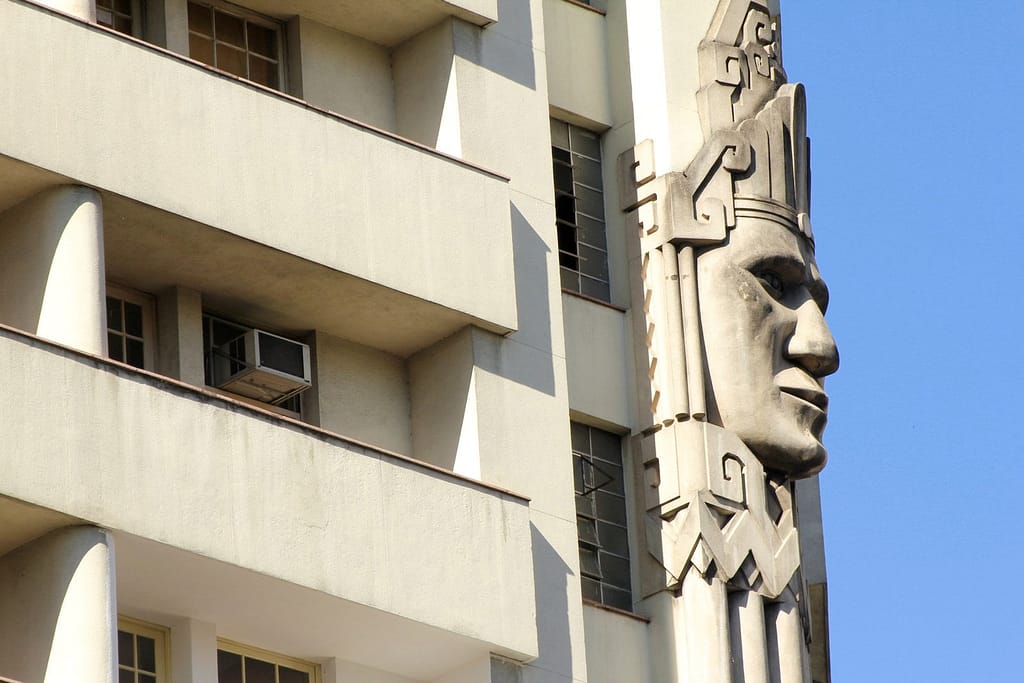
Paragram | Words by Jose Vargas
“In the city of Belo Horizonte, there is a distinct mix of contemporary, classic and historic buildings on display, making it a really attractive destination to visit. What comes with the architecture on offer however, is the need to preserve it for tourists and future generations to enjoy.
Often the fragility of buildings or lack of resources means that many buildings go untouched for decades, leaving them to crumble. It’s my job to ensure these relics remain.
When the chance to retrofit electrical installations and a fire prevention plan to a 130-metre art deco skyscraper, the Acaiaca Building, became available, the team at Paragram knew we had to be involved.
“We were very impressed with the quality of information captured by the ZEB Revo.“
Built in the 1940s and once used as a nightclub, cinema, shops and air-raid shelter, the building required some attention in order for it to meet safety standards. Having initially planned to measure the 8,357 square metre building using manual survey methods, estimates told us this would have taken three employees over 40 hours to complete an as-built structure.
Working alongside contractors at Criar Projetos E Consultoria, Paragram decided to use GeoSLAM’s ZEB Revo, known for its ability to quickly generate images to within a few centimetres of accuracy. With the handheld device, the job was expected to take around 10 hours in total, reducing the workload dramatically.
Acaiaca Building
With just two operatives and in under 10 hours, we managed to complete a scan of the building’s interior, with one walking through the building holding the device and another taking a photographic record. This innovative way of working meant we were able to gather much more information than first anticipated, including the registration of beams and roof trusses, electrical installations and engine room areas.
“The ZEB Revo is a real game changer for the architecture industry.“
As a team, we were very impressed with the quality of information captured by the ZEB Revo, which was easily incorporated into a BIM representation using Revit software.
Almost every renovation project is governed by strict time constraints, but with GeoSLAM’s device and its ability to rapidly scan large areas, it is a real game changer to our industry. With products like this at our disposal, I am excited about what the future will hold for heritage buildings in need of a little TLC.
University of Arizona GIS Program | Words by Prof. Chris Lukinbeal
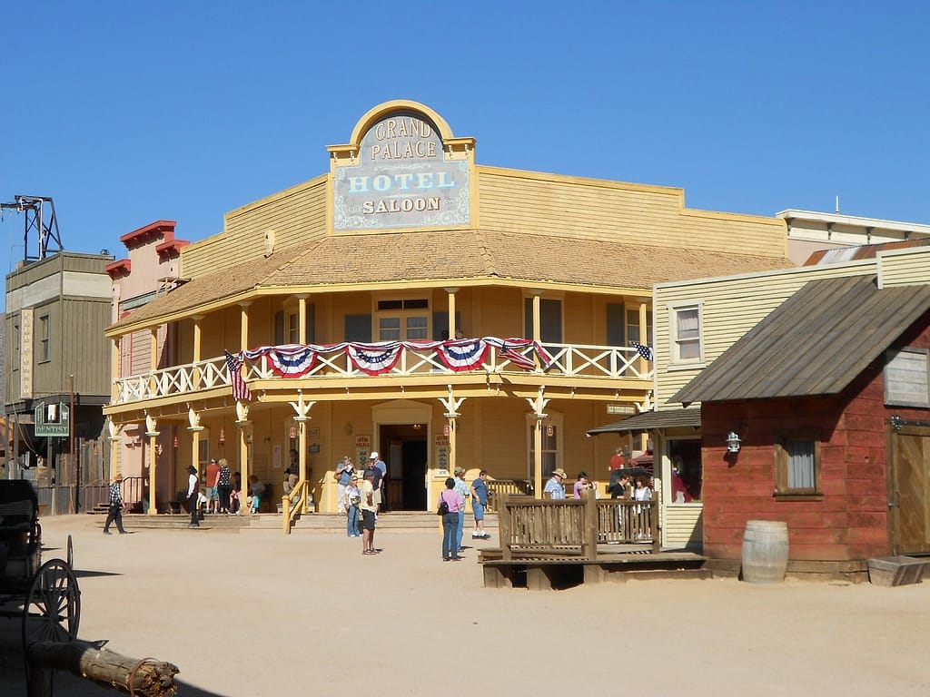
Between tours and filming, Old Tucson Studios is a dynamic environment that couldn’t shut down to accommodate our University of Arizona 3D scanning team. With the equivalent of four city blocks and dozens of building exteriors and interiors to scan, we had to move fast. The team relied on the ZEB Horizon mobile scanner equipped with the ZEB Cam to quickly and accurately capture the geometry, architecture and appearance of the film set.
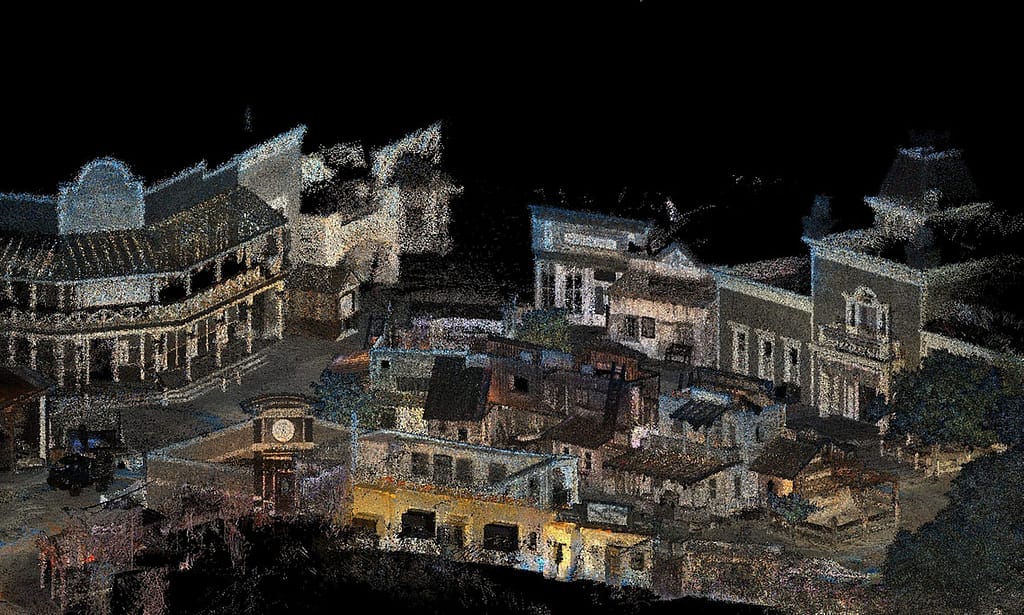
We want film buffs to experience Old Tucson Studios the way it looked during its heyday when some of Hollywood’s biggest Western movies were filmed there. The colorized point clouds generated with the GeoSLAM devices will serve as the core data set upon which 3D models, and eventually, Virtual and Augmented Reality experiences will be created. Archived air photos and drone imagery, as well as photogrammetric measurements pulled from original films, will also help us create digital versions of the movie studio at key points in its history.
The ‘Downtown Tucson’ main street and plaza stretch almost a quarter mile. Stationary scanners may seem like the obvious choice for long-range data capture, but there wasn’t time to set up and take down those types of devices. And we needed richer detail. Our scan technician held the mobile ZEB Horizon and moved quickly through the streets, dodging studio personnel and vehicles. She entered those buildings with real interiors and scanned them as well.
Scanning with the ZEB Cam adds context to the point cloud. The scanner with mounted camera was held steady at chest level. At each building, the technician stopped and pointed the device directly at the façade as if snapping a still photo, and then slowly turned around to scan the surroundings. This captured a rich 3D scan data set for each structure along with its context on the movie set.
“I’ve seen the quality of the point cloud and it’s amazing“
The entire Downtown Tucson portion of the studio was scanned in two hours. Afterwards, the technician processed the scans and video footage into a colorized point cloud running the ZEB Hub software on a standard laptop. Extraneous people and vehicles were filtered from the point clouds later with an open-source third-party software.
Downtown Tucson with the saloon on the left
We will build 3D representations of the studio at major periods of its history – 1938 when it was built for the film Arizona, the 1950s and 60s when four John Wayne Westerns were shot there, and the mid-1990s just before a devastating fire. This will require merging the 3D models of today with archived air photos and film photogrammetry to re-create buildings that no longer exist.
In the future, you will be able to walk the Old Tucson Studios lot wearing a VR headset and ‘see’ how the site looked during filming of epic motion pictures such as Rio Bravo, Gunfight at OK the Coral, and Tombstone. Who knows? John Wayne himself might swagger out of the saloon doors right in front of you.
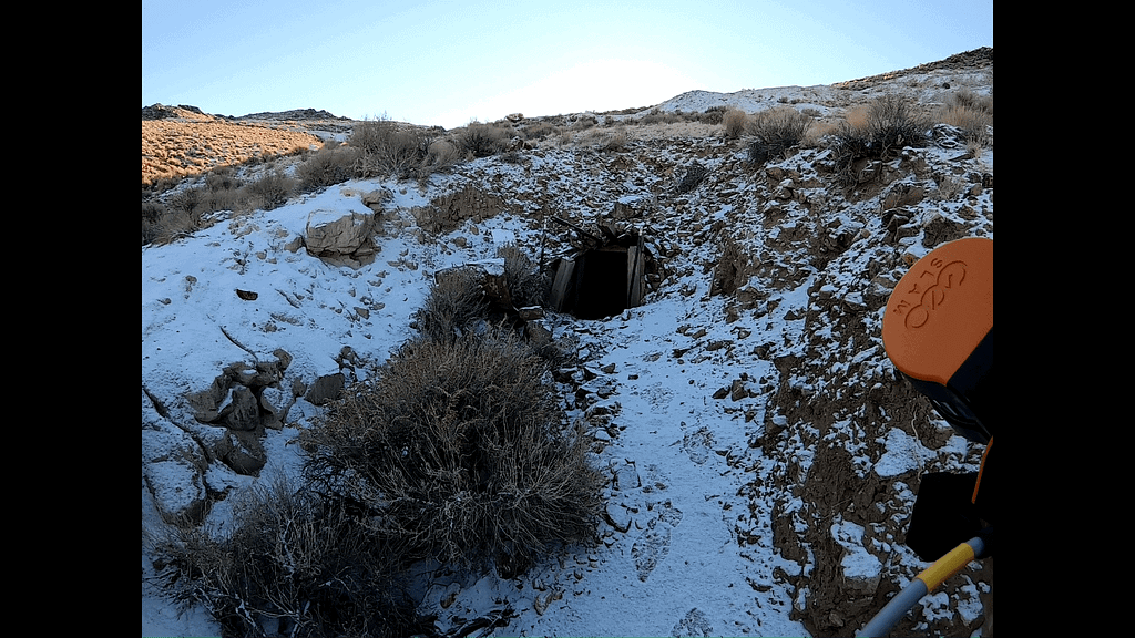
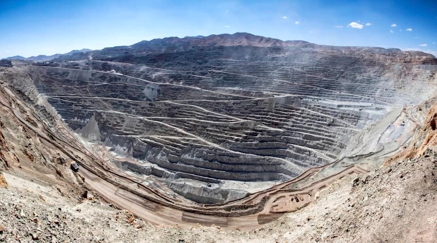
The state of Nevada is currently the fifth largest gold producer in the world. First discovered in 1849 by prospectors on their way to the California gold rush, gold and later silver caused several booms, with production really picking up in the 1960s thanks to new metallurgical techniques which meant recovery of more gold than ever before. Looking at old mines from the 1800s with our modern perspective provides great opportunities.
Newrange Gold is bringing new things to old places at the Pamlico project, which was one of the highest-grade gold districts in Nevada in the 1880s. Records of the mine workings are lost and the workings have never been systematically studied, leaving an enormous opportunity to map, survey, and sample the old exposures. With 5 miles or more of historic mine tunnels dating from the period of 1884 to about 1928, you can understand why no-one has done it before: it would be too time-consuming and costly to do with conventional surveying.
My company, Carrington Consulting, invested in the ZEB Horizon to expedite surveying, mapping and sampling at our client company, Newrange Gold Corp., at the Pamlico project. Systematically scanning the complex, interconnected workings has generated an unprecedented 3D map of the mine workings and has resulted in greater than 50% savings to date over conventional surveying and mapping techniques.
“Our experience with the ZEB Horizon so far is vastly superior to traditional methods and is an indispensable part of my exploration toolkit.“
In addition to revealing very subtle structural details of the geology, this mapping will form an essential part of modelling historic production and the remaining gold resource at the project going forward. This revolutionary hand held LIDAR scanning technology allows us to complete extremely accurate underground geological and sampling maps, volume analysis of material moved, and careful planning of exploration drilling to better calculate mineral resources in preparation for possible resource definition and mining at Pamlico.
Carrington Consulting’s team is scanning more than 5 miles of tunnels at Pamlico for Newrange. These workings extend over an area more than 1,500 feet long and 800 feet wide with a vertical depth of roughly 300 feet and form an extensive network of adits, tunnels, stopes and raises with at least 30 major entrances that are largely interconnected. Scanning is tied to established surface survey control for registration and orientation so the scan can be accurately carried underground. Underground survey control points are established using a series of spheres to allow Newrange’s geologists to later reoccupy the points to complete the geological mapping.
Many of the mine workings are less than a metre wide and in some cases, they are also less than a metre high following the gold vein, wherever it goes, forming a very irregular, complex network of tunnels and stopes. It would be prohibitively slow and expensive to do this essential mapping with conventional surveying or terrestrial scanning, but the ZEB Horizon makes it realistic for Newrange to accomplish this ambitious goal.
As always safety is paramount, especially when entering old mine tunnels and stopes. With the 100 meter distance capability of the Horizon no one needs to go into unsafe areas. In addition virtually every timber, ladder, and detail are recorded.
We have produced highly accurate data of mine workings up to ¼ mile in length in less than 15 minutes, which changes the game for Newrange at Pamlico. As Newrange gathers information on gold grades from sampling throughout these workings, we are integrating additional layers of information to build a comprehensive 3D model of the geology across the entire area of old underground workings.
Minnesota Manholes– Scanning Safely and Quickly in Confined, Hazardous Spaces
Industry
Civil Engineering
Location
Minnesota, USA
Size
4,500 manholes
Scanned
Sewer pipe network
Public works and energy utilities are continually looking for new ways to protect the safety of their personnel in the field. With the help of the GeoSLAM ZEB Revo mobile laser scanner and the specially designed GeoSLAM Cradle, the cramped and hazardous spaces in manholes can now be captured in 3D without putting field workers at risk.
“An engineering survey firm scanned the interiors of 4,500 manholes with the ZEB Revo for a Minnesota municipality,”
What lies beneath the manhole covers found in nearly every city and town varies considerably. Some are access points to extensive storm water and sewer pipe networks. Others are entries into utility conduits through which water mains and electric lines are run. A few manholes are simply tight underground spaces where key pieces of municipal infrastructure reside.
Regardless of their function, manholes and the assets they contain are difficult and sometimes hazardous to map. Not only are the interior spaces dark, dirty, confined and usually wet, they pose potential risks related to cave-ins, poor ventilation and rodent infestations. Above ground, the manhole access points are often in the middle of busy streets requiring set-up of a cone zone to try and protect workers from passing traffic.
“You capture the data you need for one job and then have information someone else might need for another without a second site visit.“
This combination of hazards compels workers to spend as little time inside the manhole as possible. As a result, they have traditionally captured only the measurements they need for the project at hand – usually with a surveying level rod.
You capture the data you need for one job and then have information someone else might need for another without a second site visit. One of the most common applications is measuring the elevations of pipe inverts to map a water supply or drainage network in preparation for system expansion or maintenance. Personal hazards aside, making accurate asset measurements in a tight underground space with a long level rod can be challenging.
The ZEB Revo is increasingly being turned to for these jobs because the handheld laser scanner is fast, accurate, and captures comprehensive point clouds. Most importantly, it keeps personnel out of harm’s way. Favoured for manhole environments because of its high IP rating, which means it can be used in dirty and wet conditions, the ZEB Revo can be lowered into the underground space with the GeoSLAM Cradle.
manhole cover replacement, sewer system repair, sewerage; roadworks, traffic cones
In just a few minutes, the lightweight device can capture 360-degree scans inside the space regardless of available lighting. Even if the assets being surveyed are offset from the opening or several meters down tunnels, the ZEB Revo captures the 3D scan data needed to generate an accurate point cloud of the subsurface space.
“The first benefit of laser scanning [in manholes] is safety. The second is you collect a very comprehensive and complete data set. You capture the data you need for one job and then have information someone else [in the organization] might need for another…without a second site visit.
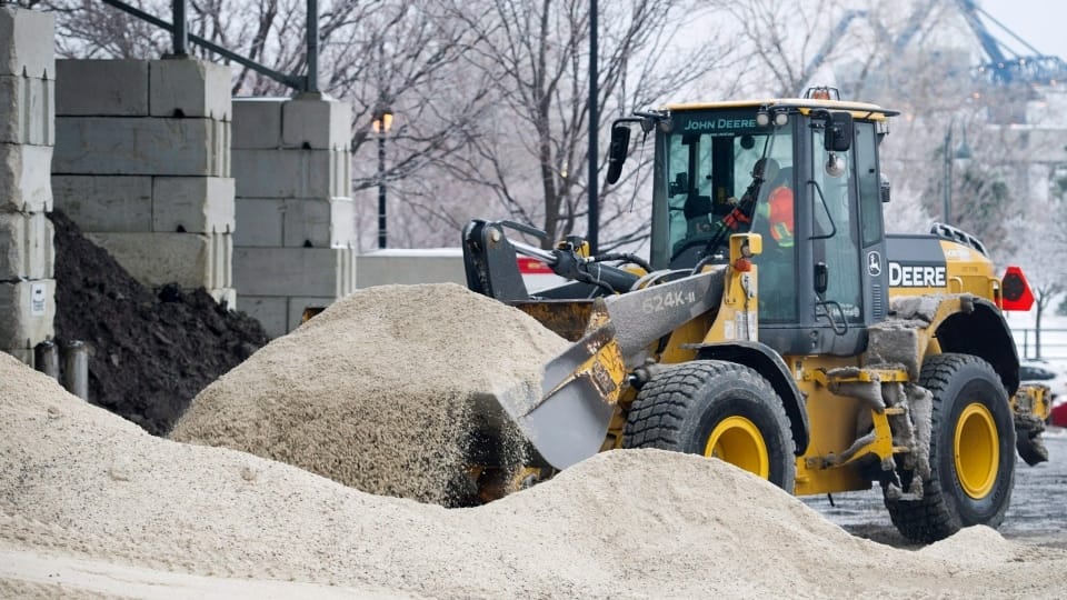
Iowa Department of Transport uses SLAM to create 3D models of salt stockpiles
Industry
Mining
Scan time
10 mins per scan
Location
Iowa, USA
Size
109 stockpiles
Scanned
Salt stockpiles
Words by Tina Greensfield | Iowa DOT
At Iowa State DOT (Department of Transport) it is our job to make sure over 24,000 miles of road remains clear and safe to use in winter. We have 109 maintenance areas across the state where stockpiles of salt are kept for distribution. Each facility can each hold up to 1200 tonnes.
Throughout winter salt is loaded onto trucks and spread on roads to stop the surface from freezing. Pay loads are measured in weight as salt is loaded onto spreading trucks and supplies are depleted. But as the salt is used, there is a clear discrepancy between the volume of salt in the shed and the paper records – it is not reliable to just look inside a half-empty shed and assess how much material remains.
If volume of salt is too low or we don’t know how much is available, we may find ourselves forced to make snap decisions about redistribution which is both costly to the state and inconvenient to residents and businesses alike.
We needed another solution and following a few severe winters where salt reserves around the country ran out, the Great Lakes froze and shipments were halted we were determined to invest in a reliable measuring process for managing stockpiles in future, which led us to a GeoSLAM volumes solution.
“In terms of speed and accuracy, this was a real game changer for us!“
Using the handheld SLAM device, we can produce a three-dimensional model of the stockpile in just a few minutes. We have never experienced this level of accuracy before and capturing data was as easy as surveying the site with the naked eye.
The surface of the stockpile is very uneven with lumps on one side and big cliffs on the other where loaders have dug-out salt for spreading, in the past our ‘best guess’ used to involve looking at the stockpile against some markers on the walls of the shed which provided limited accuracy to say the least, so this was a real game changer for us.
Data is then processed using GeoSLAM Hub and imported to the volumes software. As the granules vary in size, we apply a bulk density value as well as defining a floor and perimeter of each pile calculate the total volume of the stockpile in tonnes.
From start to end, the entire process took around twenty minutes. We now have depot staff going out and scanning the stockpiles regularly. This new level of insight means we don’t have to worry about compromising road users’ safety across the state of Iowa as we always know what volume of salt we have available to use.
Glencore uses GeoSLAM to assess risk in underground base metal mine
Industry
Mining
Scan time
15 mins per scan
Location
Savannah, Georgia
Scanned
Base metal mine
Kidd Mine, Glencore | Natural resource company
When creating underground mapping for mines, mining engineers are often faced with having to work in hazardous and rugged environments, in difficult-to-access spaces and without GPS coverage. In order to address these challenges, mining companies are continuously searching for ways to plan efficient site operations, streamline tunnelling processes and optimise production and personnel safety.
Kidd Mine, an underground base metal mine in Canada and the world’s deepest copper/ zinc mine, epitomises this by adopting new and advanced survey technology. With the aid of GeoSLAM’s 3D mapping technology, the mine is able to assess risk associated with ground and support systems failure, magnitude seismic events, large-scale deformation or rock bursts associated with mining at extreme depths.
Built for harsh and demanding environments, GeoSLAM’s handheld laser scanners are robust, splash-proof and dust-tight (with ratings up to IP64 level). They’re adaptable to any environment – inside or outside, in daylight and darkness – without the need for GPS.
Lightweight and easy-to-use, you can walk and survey accessible areas quickly and easily – even those which are normally off-limits. For more confined or unreachable places, they can be attached to trolleys or mine vehicles for remote monitoring.
“It’s critical data that will help us lower the risk to personnel and keep mines safer“
David Counter, a senior ground control engineer at the Kidd Mine, emphasised the importance of using a hand-held laser scanning device to map the underground areas at the mine. “It produces a continuous 3D animation image of whatever underground areas are being scanned as the user walks along the drift. This allows the mine to map out problem areas and to carry out ground support rehabilitation in those areas.”
“The ZEB Revo provides a background dataset that can be used for comparative purposes if a future high-magnitude seismic event occurs or for determining how much static deformation has been occurring due to regional mine closure over time.”
Despite needing to rapidly map mines under intense time constraints, traditional underground survey techniques have proved to be slow. Mine engineers and surveyors all need access to user friendly technology that is easy to install and use, but is robust and reliable enough to do the job quickly and accurately. Within minutes anyone can be using a GeoSLAM scanner and immediately start creating a 3D point cloud of the area. Data is collected continuously while walking the survey area – with no time-consuming or cumbersome set-up required.
GeoSLAM’s award-winning software instantly turns data into actionable 3D information. So, you can rapidly gain insight into rock mass behaviour and map out deformations in rock walls & complex tunnel profiles. Plus, accelerated survey workflows help you deliver productivity and efficiency improvements, at the same time as helping you hit your zero-harm targets.
“There is a sound basis for SLAM laser technology to define areas where the ground support systems need to be replaced or rehabilitated,” Counter concluded.
Creating floorplans to cut incident response times
Industry
Security
Time
Response time reduced by 21%
Location
California, USA
Size
98,200 institutions
Scanned
Schools across the USA
Entropy Group | Words Robert W. Myers J.D.
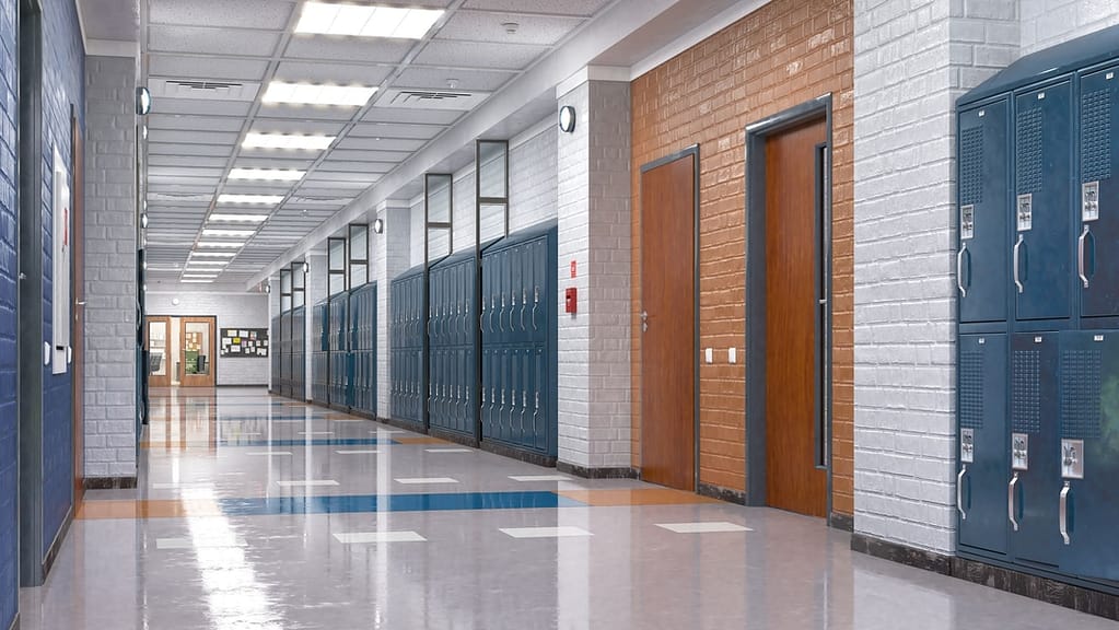
Active shooter incidents are a growing concern in the United States, with death tolls, most predominantly in schools, rapidly rising and law enforcement resources stretched beyond breaking point.
With the unpredictability of these incidents, both in scale and location, our team at Entropy Group LLC has been working alongside law enforcement and US attorneys nationwide in order to compress response times, by utilizing 2D floor plans and 3D models developed from GeoSLAM ZEB Revo RT data sets, a program that is patent pending.
“ZEB Revo RT provides us with the necessary accuracy and is much more time efficient than other laser scanning technologies.“
The significance of the problem is evidenced by the recent publication of a National Standard for response to active shooters. The National Fire Protection Association, (NFPA), published NFPA 3000(PS), a provisional national standard, titled, “Standard for an Active Shooter / Hostile Event Response (ASHER) Program“, published April 11, 2018.
According to scanning professionals, to map just the K-12 public schools in the U.S., it would take a scanning team, scanning 100,000 square feet per day, seven days a week, a total of 181 years to complete. This estimate addresses only the public schools and does not address any of the many private schools, let alone the post-secondary school facilities.
When confronted with the magnitude of the effort it was immediately obvious to Entropy Group LLC staff that we needed to join forces with GeoSLAM because their ZEB REVO line of scanners provide the necessary accuracy and are much more time efficient than other laser scanner technologies.
To finalize the proof of efficacy of the patent pending filing, Entropy Group LLC recently completed a simulated active shooter incident where six law enforcement officers were tested by responding to a fictitious scenario. Officers were provided a detailed floorplan of the two story building which is currently used as a church and parochial school facility. The structure is quite complex with many classrooms, counselling rooms, worship sanctuary, multi-media studios, café area and church offices.
The results of the exercise indicate that officers which have access to the 2D floor plans ahead of time, improve their situational awareness, their confidence in responding to a facility that they have never been to previously, by gaining “facility familiarity” through review of floor plans and other data prior to their response. Additionally, response times were documented to decrease by up to 21%. This improvement in response will directly result in fewer deaths and casualties.
Entropy Group LLC is a full-service Forensics and Security Consultancy firm providing services for Executive Protection, Accident Reconstruction, Security Threat Assessments, Building Information Modelling, Security Design Reviews, Security Program Reviews / Audits,Litigation Support, Pre-Travel Security Front Team Assessments, and Access Control Assessments.
We value our relationship with GeoSLAM and California Surveying and Drafting Supply (CSDS) and their support of our mission by providing premier instrumentation for the improvement of societal ability to address and respond to active shooter events.”
1 Springer. “Rapid rise in mass school shootings in the United States, study shows: Researchers call for action to address worrying increase in number of mass school shootings in past two decades.” ScienceDaily, 19 April 2018
Bloom Cloud Engine is a powerful on-premise point cloud editor ideal for use in Design, Fabrication, and Construction applications. Easy to deploy across your project team, BloomCE allows users to optimize and condition the point cloud data from all reality capture modalities, providing the fundamentals for Asset Management and Digital Twin project requirements.
Blacklight, based in Romania, focuses on information technology that captures, measures and visualises data used in various fields of activity through providing valuable solutions.
Cybernetech Corporation, based in Japan, is a specialised trading company that offer advanced information and communication equipment and geospatial information technology.
Seiler Instrument is an American company that specialises in distributing surveying software and instruments serving industries such as surveying, engineering and construction.
Favre, Développement & Foresterie, based in Switzerland, are experts in geomatics and work with public and private landowners for forest management and environmental heritage.
3DT Digital Manufacturing is an Australian company that use the latest technology to adapt to changes in real time. It aims to help their customers become more efficient and productive.
Sigma Mascot, based in Hong Kong, provides solutions for 3D Laser Scanning, Geospatial systems and BIM services for industries such as Forestry, Construction and Real Estate.
Precision Laser & Instrument is an American company that offers comprehensive positioning solutions for the Construction, Survey, and GIS industries. They ensure high returns on investments and business success.
Export your point cloud into a range of formats, including LAZ, LAS, PLY and TXT. Datasets can also be exported as structured or unstructured E57 files, both of which include embedded panoramic images.
Surface normals at each point can now be computed from PLY and E57 formats, allowing users to export colourised data and create a high-quality polygonal mesh in third party software .
Stop and Go Georeferencing
Known control points are captured during a scan and automatically compared and matched to the associated coordinates during the processing stage in Connect. A rigid and/or a non-rigid adjustment can be made to the dataset and an accuracy report is exported, highlighting how successful the transformation was. Users can now view and manipulate the processing parameters to ensure a more accurate match between points.
Manual Alignment
Align multiple scans using a combination of manual and automatic processes. This workflow can be performed on two or more scans in the same project. Users have a choice to export the aligned scans separately or as a single merged point cloud.
JP Interactive Viewer
Leverage your GeoSLAM data by integrating JP Interactive Viewer into your workflows. JPIV allows you to unlock the full potential of your reality capture data and distribute actionable insights across your teams.
Our support team will be available for GeoSLAM Care customers on:
Monday 26th, 8 am – 4 pm (GMT)
Tuesday 27th, 8 am – 4 pm (GMT)
Wednesday 28th – 31st December – standard support hours
Monday 2nd January, 8 am – 4 pm (GMT)
From Tuesday 3rd January – standard support hours resume
Test pop-up
fsikajntgfitdshagklndsakj;gnjkdasklngklsa
Click here to view the release notes.
Autodesk Recap
Autodesk Recap contains tools for the manipulation and interpretation of high quality point cloud data and to aid designers and engineers in their creation of 3D models for real-world projects and assets (e.g. buildings and other infrastructure). It’s integrated design features help to streamline workflows, for example Scan to BIM. Recap is used to create initial design projects that users can then take into other Autodesk modules (e.g. Revit, Navisworks, AutoCAD).
Autodesk Navisworks
Autodesk Navisworks is a comprehensive project review solution that supports co-ordination, analysis and communication of design intent and constructability. The software can be used as a common data environment (CDM) for multidisciplinary design data created in a broad range of Building Information Modelling (BIM) packages. Using the tools within Navisworks, users can anticipate and minimise and potential problems between the physical building and the structural model.
Autodesk Revit
Autodesk Revit is a building information modelling (BIM) software. It contains tools which allows for planning and tracking throughout the building’s lifecycle. The software also allows multiple disciplines to collaborate more efficiently and make more informed decisions early in the design process. As GeoSLAM’s hardware allows for quick data capture, the equipment can be used to scan any existing buildings with the purpose of using the data to produce a digital twin.
Orbit GT allows users to capture and manage available 3D data (LiDAR data and imagery), extract a range of features for map production and make data sharable. All Orbit modules are ready to be used with 3D data from indoor, oblique, UAS and mobile mapping projects with other extensions that can be added to the Publisher and Orbit Cloud. Orbit can be used with the ZEB Discovery solution.
ContextCapture
ContextCapture is a reality modelling tool, allowing for the import of any point cloud and imagery data for the creation of high resolution reality meshes. These realistic meshes are accurate representation in 3D with high resolution RGB values of any scanned environment. By using GeoSLAM data in ContextCapture the users are able to create indoor reality meshes, which has been never possible before.
Microstation
Microstation is a 2D/3D software for designing building and infrastructure projects. It includes building information modelling (BIM) tools to document and assess any type of asset throughout its lifecycle. GeoSLAM solutions are often used in Microstation in the underground mining sector and to assess the current stage of any built environment, update the design model, and generate BIM information.
Deswik
With the GeoSLAM Connect stop-and-go georeferencing feature, users can easily georeference headings from known positions and map for analysis of overbreak, underbreak, undercutting and blast roughness calculations. This information is used within Deswik Mapping to analyse headings and levels.
Esri
Outputs from GeoSLAM’s solutions can be input to Esri’s GIS programs and apps, including ArcPro, ArcDesktop, ArcGIS Online and ArcScene. Join point clouds with local geodata or classify and edit scans based on their geography and statistics.
Micromine is a detailed and diverse mining software that provides solutions including modelling, estimation, design, optimisation and scheduling. Once data is exported from Connect it can be imported into Micromine and easily converted into wireframes. These can be used in Micromine for further studies into volumetric slicing, over and underbreak analysis, geologic modelling, face mapping and many more.
Terrasolid provides tools for data processing of airborne and mobile mapping LiDAR data and imagery. It includes different modules for tasks like data manipulation, calibration, georeferencing, point cloud classification, modelling and many more. It is a very powerful tool for a variety of industries, surveyors, civil engineers, planners, designers. Full, UAV or lite versions of Terrasolid modules are available for both MicroStation or Spatix software. All GeoSLAM products are compatible with Terrasolid and GeoSLAM data can be enhanced and edited with this software.
Floorplanner
Floorplanner allows you to draw accurate 2D floorplans within minutes and decorate with over 150,000 items from kitchen appliances to tables and chairs. Data is exported from GeoSLAM Connect in PNG file format with a scale of 1cm per 1 pixel and can be taken into Floorplanner.
Unity
GeoSLAM 3D point cloud data can be imported into Unity 3D Game Engine to generate interactive 3D scenes, where users can create 3D BIM models with textures and explore the space in 3D photorealistic environments.
Unreal Engine
Although Unreal Engine is mainly built for developing games, increasingly users are starting to use it to develop VR applications for understanding the current conditions of buildings, infrastructure and similar. Unreal Engine with a point cloud plugin can be used to visualise GeoSLAM point clouds in VR, which allows for collaboration, simulation and the understanding of current conditions of any scanned environment. Additionally, Unreal Engine tools are completely free.
Veesus Arena4D
Arena4D is a software package for marking up, annotating and editing 3D point cloud data containing a various export capabilities. It has a powerful and simple to use animation package which allows users to visualise massive point clouds in a simple way. GeoSLAM data can be simply uploaded and used in this package for the assessment of the current conditions of any structure, comparing differences between captured data (as built) to designed model (as designed).
Pointfuse
Pointfuse generates 3D meshes from point cloud data and classifies them to building ceilings, walls, windows and other features in IFC format. By using GeoSLAM data with Pointfuse users can very quickly create a classified BIM model with minimal manual input or expertise needed.
MineRP
MineRP has a Spatial DB that uses GeoSLAM data to represent visually the real environment of the underground mine. The software uses other data layers to overlay information on the digital landscape for decision making and tracking.
Pointerra
Pointerra provides a powerful cloud based solution for managing, visualising, working in, analysing, using and sharing massive 3D point clouds and datasets. Pointerra allows users to simply visualise and interrogate GeoSLAM data from anywhere.
Nubigon
Nubigon is a software solution that allows users to seamlessly interact with large point clouds and create visualisations and animations. Take your GeoSLAM point cloud data into Nubigon to create eye-catching flythrough videos.
Here is an example of a visualisation created in Nubigon using GeoSLAM point cloud data:
SLAM Environmental Pre-sets
Common data capture scenarios, such as UAV, outdoor, indoor, linear, and vehicle, have been characterised in Connect and data processing pre-sets for each environment have been defined. These can be selected at the beginning of the data processing stage allowing this process to be highly simplified.
Closed and Open Loop Georeferencing
Both methods match the scan data from a ZEB Locate system with the GPS data collected from the antenna to georeference the point cloud. When a scan starts and ends in the same place, this is classed as “closed loop”. “Open loop” is when the start and end position of a scan are in different locations. Standard SLAM practices apply to both methods of data collection.
Open Loop SLAM for the ZEB Locate is available on request – let’s talk about it.
Stop and Go Alignment
Common static points are captured during several scans meaning that these datasets can be automatically aligned. A single point cloud is then exported as if the data was captured in a single scan.
Floor Slices
Horizontal and vertical slices can be taken from any location within the point cloud. Horizontal floor slices can also be automatically taken at a given height above the floor as defined in the processing stage.
Change Detection
Mostly used in the construction industry, multiple point clouds can be compared and any areas that have changed are automatically highlighted. Point clouds can also be compared with CAD models – for instance to track progress on a construction site – and PDF reports can be generated to present this information.
Queued Processing
Import multiple .geoslam files into Connect for processing and the scans will be processed in the order they were imported. The size of the queue can be defined by the user.
Enquire about the ZEB Horizon RT
Error: Contact form not found.
If your internet connection allows, move the Point Budget slider to the maximum amount available to view all the points in the cloud.
Making the point size smaller using the Point Size slider makes the data easier to view and interpret.
In the tools section of the viewer, you can measure the distance and angles of features within the pointcloud.
Using the materials section of the viewer, you can use the Select Attributes dropdown to view by intensity, elevation and RGB (if pointcloud is coloured)
UK payment plan
UK payment plan info
USA Payment Plan
Coupling with hardware
Some SLAM software algorithms have been made available as open-source on the internet, but they are purely algorithms and not a product that you can take and use off-the-shelf. SLAM is most successful when it is tightly coupled and designed with specific hardware in mind. A generic SLAM cannot perform as well as one that has been specifically designed for a purpose.
Usage in multi-environments
Visual SLAM is closer to the way humans navigate the world, which is why it’s popular with robotic navigation. But in the same vein, vSLAM will have the same image-capture challenges as humans do, for example not being able to look into direct sunlight, or not having enough contrast between the objects picked up in the image. These can be overcome indoors, however, you may need to map a forest, tunnel or urban canyon. While SLAM technologies don’t rely on remote data (meaning you can scan areas where there is no GPS), you do need to ensure the SLAM technology you chose operate well inside, outside, in daylight and darkness.
Real-time data capture
Mapping a property is time-critical. Ideally, you want to make a single visit and gather sufficient data to create a highly accurate 3D model. Ensure the software you choose transforms 3D point cloud data into actionable information in real-time. This allows you to view and interrogate your data whilst still in the field, and make any adjustments, or collect missed data, then and there.
Flexibility and deployment
If you’re trying to map an enclosed environment (e.g. tunnel, mine) or a complex, difficult-to-access space such as a heritage building with tight stairwells and uneven floors, you need to use fully-mobile, adaptable technology. Wheel-based systems, often used with the vSLAM camera, will struggle with access. Handheld devices or LiDAR scanners that can be attached to a drone or pole and still deliver accurate results in a rugged environment are best for navigating hazardous spaces.
Speed and accuracy
While vSLAM is able to provide a qualitative high-level map and sense of the surrounding features, if you’re needing survey-quality accuracy and rich-feature tracking at a local level, you’ll need to consider LiDAR. Cameras require a high-frame-rate and high processing to reconcile data sources and a potential error in visual SLAM is reprojection error, which is the difference between the perceived location of each setpoint
and the actual setpoint.
Quality and distortion
In order to deliver the depth required for high-quality data, a number of depth-sensing cameras are needed with a strong field of view. In most cases, this isn’t possible, especially as cameras with high processing capabilities typically require larger batteries which weigh down airborne scanners, or limit the time of flight. LiDAR is both faster and more accurate than vSLAM, and can deliver detailed point clouds without expensive (and timely) camera processing.