What are the benefits of LiDAR in Civil Engineering?
From the roads that we travel on to the buildings we live and work in, civil engineering is all around us. The centuries-old profession has shaped the way we interact and connect with the world. Relatively new to civil engineering is Light Detection and Ranging (LiDAR) technology. Recent development and the commercialisation of LiDAR has made it an invaluable asset to a civil engineer’s arsenal of tools. In this blog, we will explore the benefits of LiDAR in civil engineering.
What is Civil Engineering?
Civil engineering is a specialist discipline that serves the design, construction, and maintenance of both the natural and built environment. Outcomes include roads, airports, canals, sewage systems, railway lines, and bridges.
Civil engineers take projects from conception to completion, for example, creating structures that are safe and comply with government regulations. It is a skilled field of work and requires high levels of practical knowledge. LiDAR in civil engineering can help to aid engineers throughout the lifecycle of a project.
What is LiDAR?
Although NASA and other organisations have implemented LiDAR since the mid to late 20th century, it has only really been practical for commercial applications since the 1990s. LiDAR research and development, and its applications in the past 20 years, have paved the way for new opportunities, that many sectors are still discovering. Civil engineering is one sector that has benefitted, and still benefits from, this rapid change in LiDAR technology.
LiDAR technology creates digital 3D representations of real-world environments, with high levels of detail and accuracy. The data is useful for visualisation of features, extracting important information such as measurements, or generating 3D models using specialist software. The creation of Computer-Aided Design (CAD) or Building Information Modelling (BIM) are common examples of where the data is valuable.
The variety of LiDAR scanners has expanded over time, and each development brings new opportunities. LiDAR sensors are used in terrestrial laser scanning (TLS) for extremely dense and accurate data, mounted to drones for coverage from the sky, or attached to handheld devices for accurate information from hard-to-reach areas. More recently LiDAR sensors have been included in smartphones, reaching even more people interested in the technology, albeit at a cost to accuracy.
The benefits of LiDAR in Civil Engineering
LiDAR technology has a number of applications for civil engineers during the tenure of a project, and beyond. Some examples include:
A DEM is used as a digital depiction of the topography of surveyed terrains. Scanning an area with a LiDAR sensor quickly yields results, showing imperfections in the terrain such as slopes, which can then be considered in the planning process by civil engineers. This is ideal for detecting potential issues when building infrastructure like roads or railways.
Digital Elevation Model (DEM)
A DEM is used as a digital depiction of the topography of surveyed terrains. Scanning an area with a LiDAR sensor quickly yields results, showing imperfections in the terrain such as slopes, which can then be considered in the planning process by civil engineers. This is ideal for detecting potential issues when building infrastructure like roads or railways.
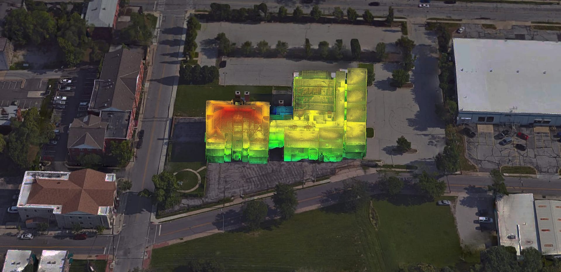
A large project has many stakeholders that need regular progress updates. Scans using LiDAR technology show change over time and create clear reports on the progress of a project. Additionally, 3D point clouds can be compared with planned CAD drawings to show live progress of the real-world structure and the plans.
Progress Updates
A large project has many stakeholders that need regular progress updates. Scans using LiDAR technology show change over time and create clear reports on the progress of a project. Additionally, 3D point clouds can be compared with planned CAD drawings to show live progress of the real-world structure and the plans.
Keeping accurate records of a project throughout it’s lifecycle is important. Access to plans may be needed in the future to settle disputes, for extension work, or for reference if the structure suffers damage. Conducting regular scans using LiDAR technology provides 3D models of a project before, during and after completion.
Record Keeping
Keeping accurate records of a project throughout it’s lifecycle is important. Access to plans may be needed in the future to settle disputes, for extension work, or for reference if the structure suffers damage. Conducting regular scans using LiDAR technology provides 3D models of a project before, during and after completion.
ELC surveys provide the biological and physical information of a landscape. LiDAR gives civil engineers a thorough map of the land, which can be combined with an ELC survey for the sustainable management of the area being surveyed.
Ecological and Land Classification (ELC)
ELC surveys provide the biological and physical information of a landscape. LiDAR gives civil engineers a thorough map of the land, which can be combined with an ELC survey for the sustainable management of the area being surveyed.
LiDAR is an ideal solution for capturing data from tunnels. Accurate and detailed 3D point clouds can be used to analyse, assess, or model a tunnel ahead of construction of railway tracks or roads. Additionally, 3D LiDAR data can depict imperfections in a tunnel, highlighting potential structural issues.
Tunnel Surveying
LiDAR is an ideal solution for capturing data from tunnels. Accurate and detailed 3D point clouds can be used to analyse, assess, or model a tunnel ahead of construction of railway tracks or roads. Additionally, 3D LiDAR data can depict imperfections in a tunnel, highlighting potential structural issues.
LiDAR use cases for civil engineering
Here are just a few examples of where LiDAR is a useful resource in civil engineering.
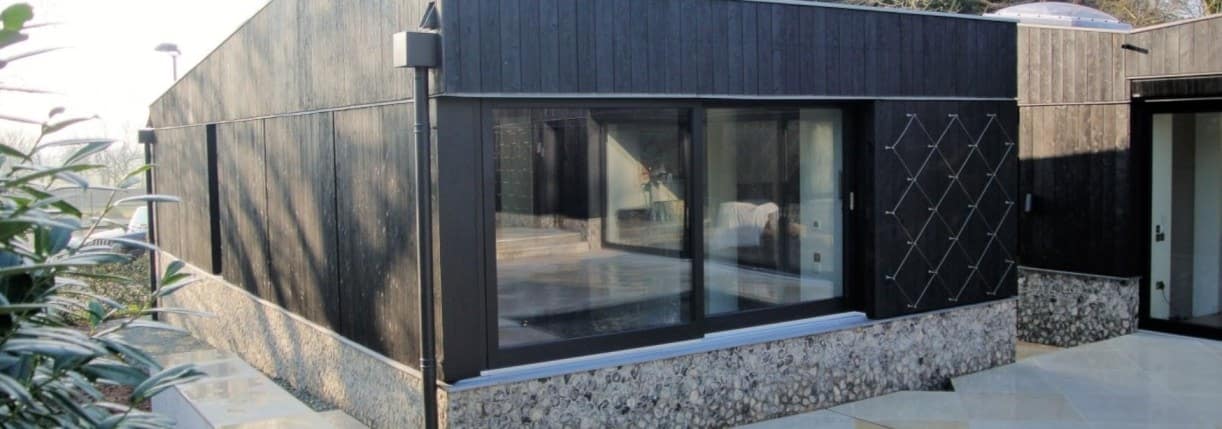
Builders by Design, UK
Industry: Construction, engineering and architecture Scanned: Residential property Scan time: 6 – 8 scans per day
Handheld LiDAR solutions, like GeoSLAM’s ZEB Horizon system, are ideal tools for civil engineers. Rapid and accurate data acquisition makes the process of mapping repeatable, which is perfect for many of the applications listed above. Additionally, the handheld nature of the scanner makes mapping difficult-to-access areas possible, and the versatility of the scanners gives way for the use of accessories (e.g. UAV data capture).
Mobile LiDAR in civil engineering has provided the profession with a less labour-intensive way of gathering accurate geospatial information fast.