Surveying Avalanches in the French Alps

Location
Savoie Region, France

Scan time
2 hours

Size
3000 sq/m

Scanned
Avalanches and Snowpacks

Industry
Education
Assessing Levels of Energy Radiation through Differing Conditions
Climate Change is often attributed to greenhouse gases, however, there are also other factors that affect the Earth’s climate. One example of this is the ‘Earth’s radiation budget’. Earth’s radiation budget is energy that enters the earth’s atmosphere that is reflected, absorbed, or emitted by our planet. If the budget becomes out of balance, it can cause temperature increases or decreases in the Earth’s atmosphere.
A team from the Institut de Physique du Globe de Paris (IPGP), a world-renowned geosciences organisation, have conducted research in this field. Their research focuses on how differences in surface roughness effect the amount of microwave radiation picked up by satellites.
Comparing Surface Roughness of Snowpacks and Avalanches in the Vanoise Massif Mountain Range
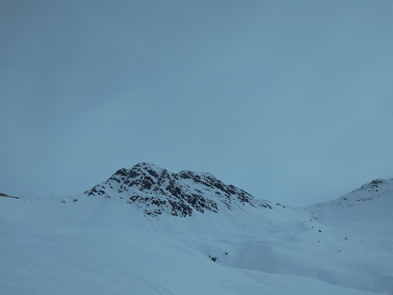
For their research, the team have been concentrating on snowpacks and avalanches in the Vanoise Massif Mountain range. They aim to compare the two satellite observations to assess the effect of the change in roughness when avalanches form using radiative transfer modeling. This is the process that measures radiation from the Sun into and out of the Earth. High levels of sun radiation can cause snow to melt which, in turn, can cause avalanches.
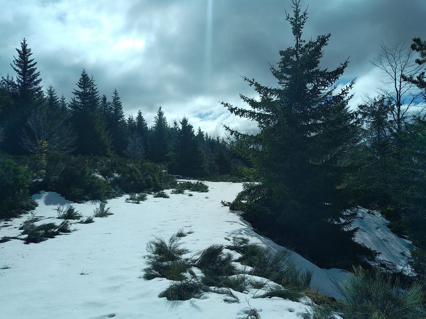
The Vanoise Massif Mountain range is in the Granian Alps, in the Savoie region of France. It is the third highest massif in France, sitting at 3,885 meters at the summit Grande Casse. The range is the location of France’s first National Park, the Vanoise National Park.
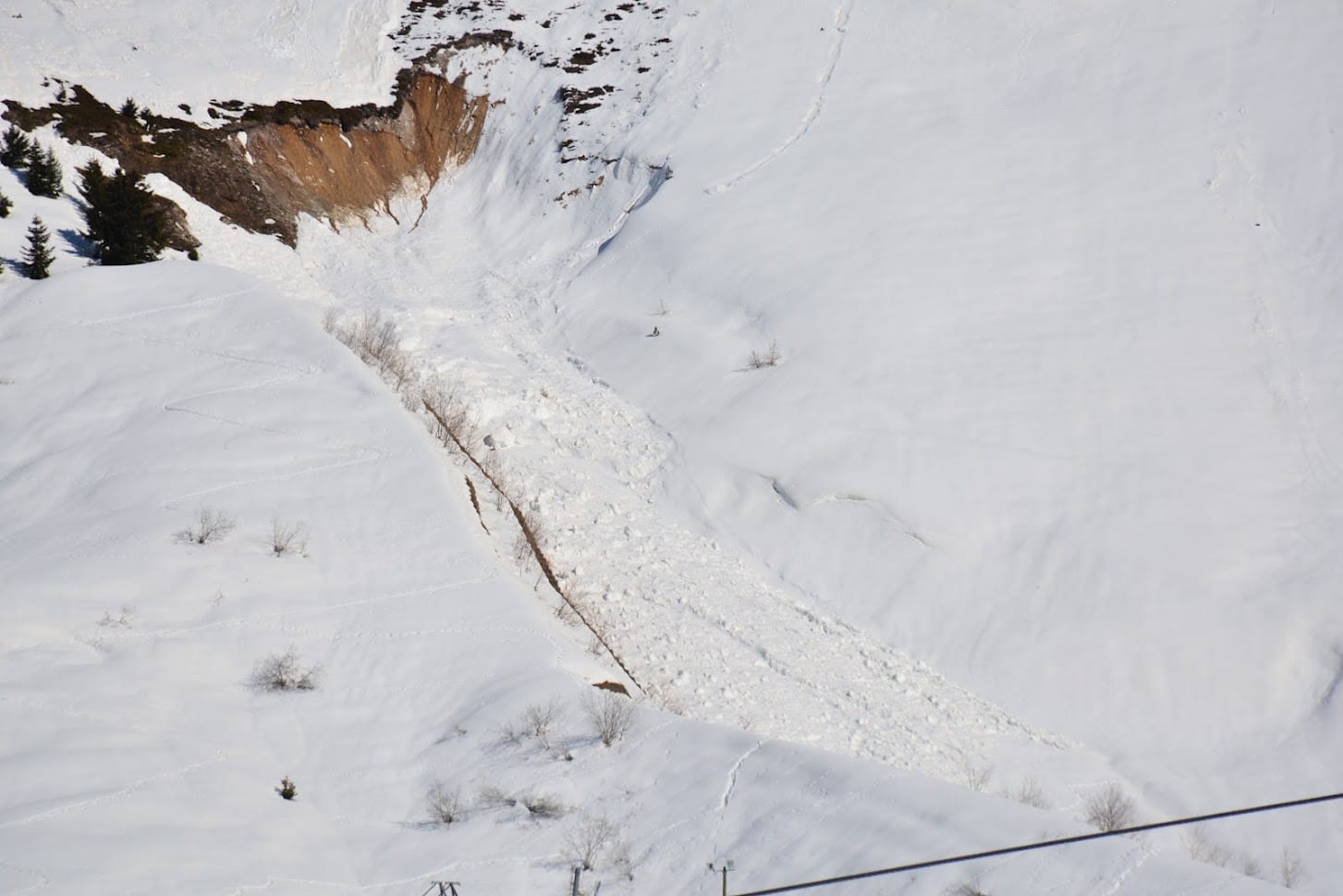
The Mountain Range’s Dangerous and Difficult to Access Environments
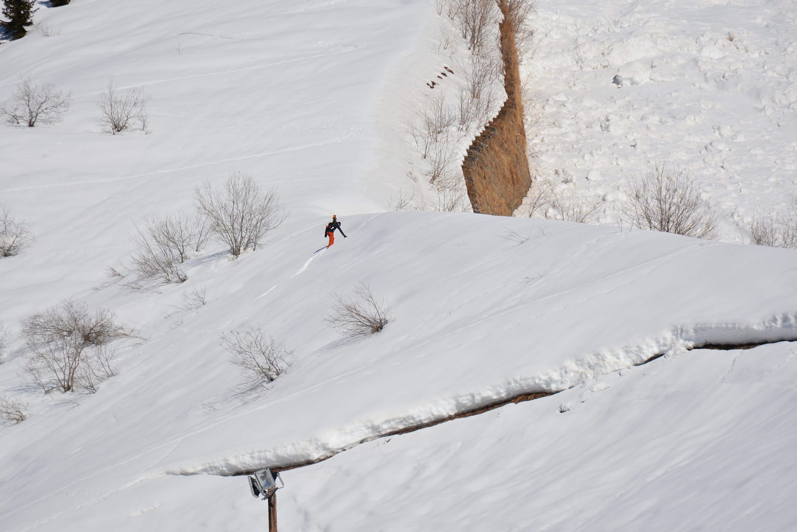
To collect data from the snowpacks and avalanches, the team needed an accurate 3D model of the area. Vanoise National Park is a no-fly zone which meant that UAVs were not an option. Additionally, the team did not want to spend extended periods of time on the mountain due to the risk of avalanches. This ruled out more time-consuming methods of scanning, like terrestrial laser scanners.
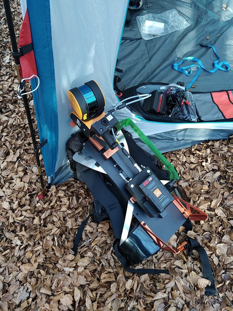
As a result, the team needed a more efficient way of mapping the difficult area. They decided SLAM was their best option and chose to use GeoSLAM’s ZEB Horizon with the backpack solution.
We were looking for a portable, versatile and affordable LiDAR scanner solution and GeoSLAM allows us to meet all our constraints.
Using ZEB Horizon to Safely Map Avalanches in the Vanoise Massif Mountain Range
The walk and scan method and versatility of the ZEB Horizon stood out to the team from IPGP. The specificity of the environment meant they needed to use technology that was easily movable and durable. In addition, the backpack solution was essential because it meant that the person carrying out the scan had their hands free to help them navigate the rough terrain.
Furthermore, the ZEB Horizon’s speed of capture meant the team were able to scan the 3000 sq/m area in approximately 2 hours. This ensured that they did not spend too long in the hazardous mountain range, whilst capturing the accurate data they needed.
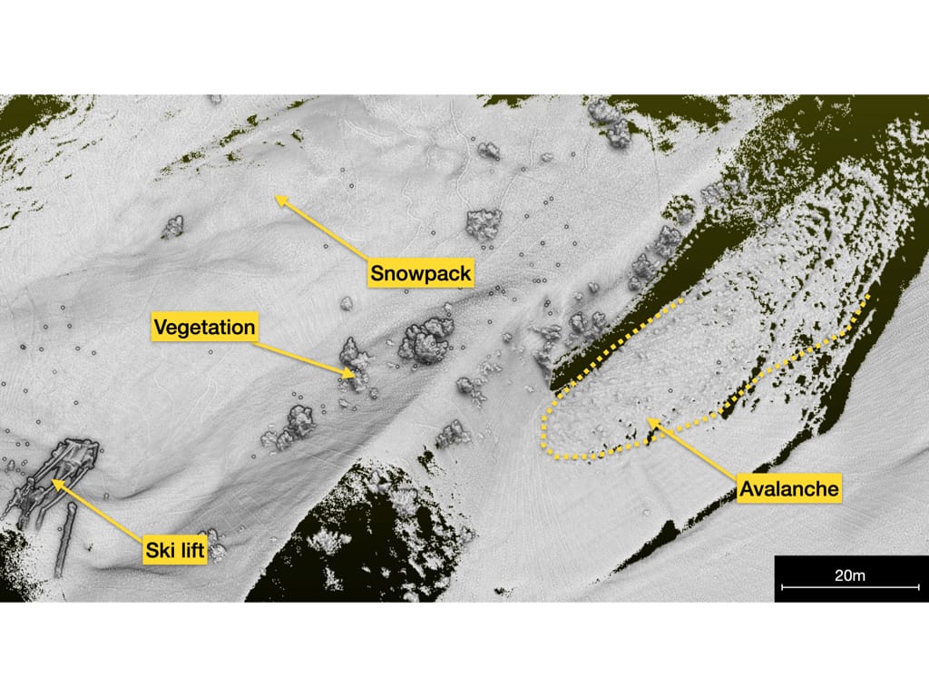
Creating Accurate Data to be used in IPGP’s Research
The scan was processed using GeoSLAM’s software package. The resulting point cloud is being integrated in IPGP’s research analysis and modelling.
The ZEB Horizon’s ease of use and accuracy means the scan data can be compared with the data collected from the satellite observations. This is known as ground truth analysis and helps with clarity within the research. The scan data also aids with data calibration which allows for atmospheric effects and obstructions to be considered when analysing the final data.
The positive outcome of the data has encouraged the Institut de Physique du Globe de Paris to plan additional surveys in this area.
Monitoring environmental changes are just one of the ways GeoSLAM customers are using their mobile mapping devices, alongside more common everyday uses like measuring buildings or construction sites.
Thanks to the team at Institut de Physique du Globe de Paris for sharing their story with us.
Get in touch
If you’d like to learn more about how GeoSLAM solutions can help you, submit the form below.


