
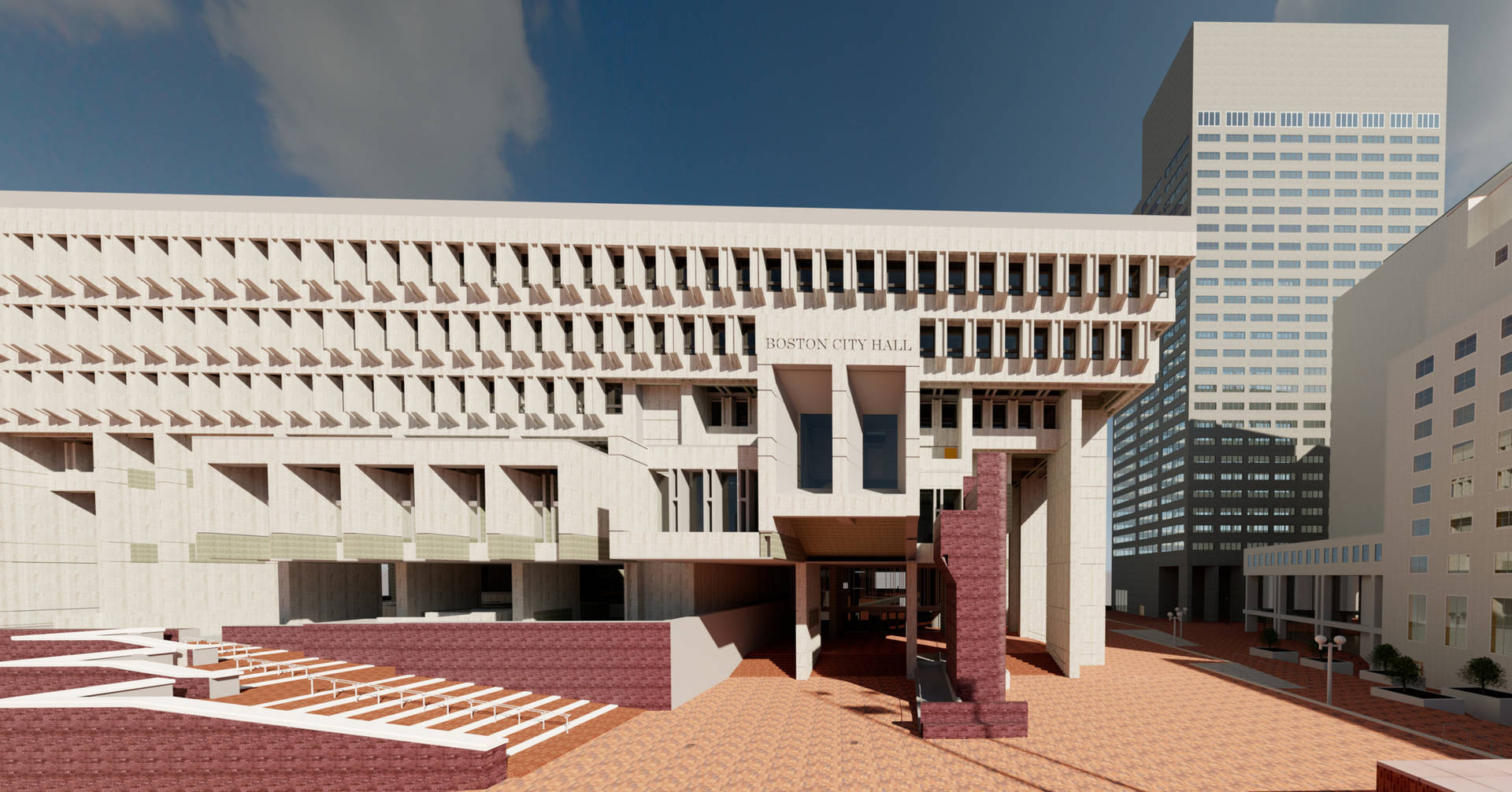
Built-in 1968, Boston City Hall helped boost the city's economy after years of stagnation. The building and surrounding plaza sought to modernize the city's urban core, reinvigorating the run-down neighborhood of Scollay Square.
Despite the welcomed response from the public investment project by the people of Boston, the brutalist style of architecture (popularized in the UK, featuring rough surfaces, massive forms, and unusual shapes) created debate among locals. Despite the concerns from the public, the city hall has been home to the mayor of Boston and the city council for over 5 decades, and the brutal style of architecture has become part of Boston's rich history.
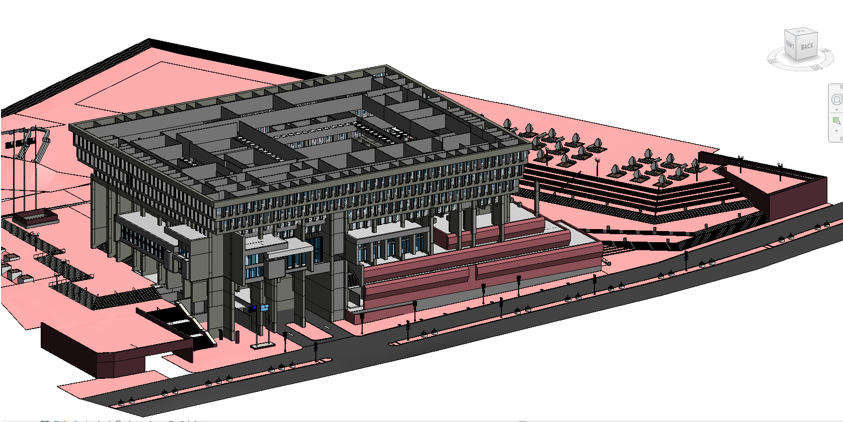
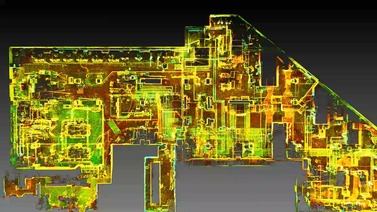
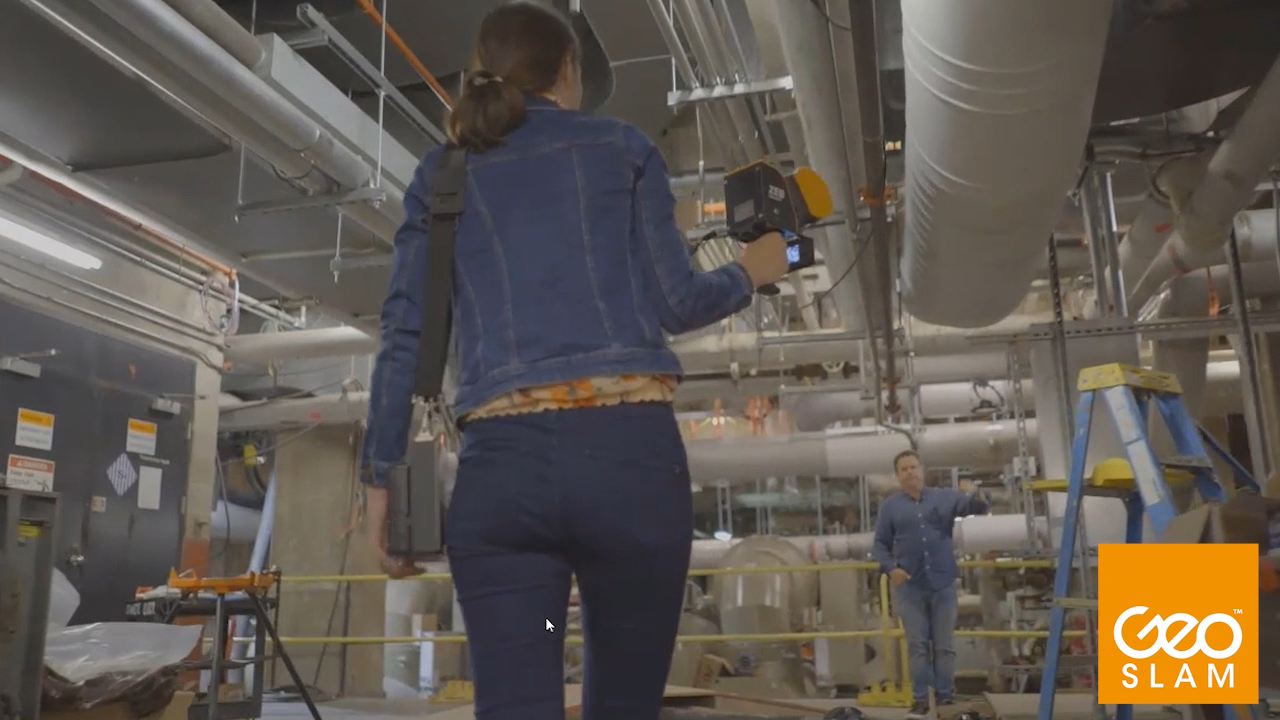
They chose a SLAM solution to scan the exterior and inside of the main hall. The scanners were chosen due to their speed, accuracy, and mobility. By simply walking and scanning, Peter and his team captured the large layout in a much shorter period of time.
As they were scanning during the Covid-19 pandemic, it was key for Peter and his team to spend as little time as possible in the building. Compared to other scanning methods, the mobile solution was able to deliver on that goal.
BIMstream captured both the exterior and interior of the main hall in just 4 scans and in less than 2 hours. To help combat disrupting the day-to-day business of the hall, the team was granted a limited window of opportunity in the evening to scan several rooms. During this time, they mapped almost 1 million square feet of interior space, in just 4 nights, consisting of 5 hours of scanning per night.
The maneuverability, ease of use and accuracy that the mobile scanners meant the data collected was ready within a week to be created into a 3D model and sent to the architects. This meant the architects could start thinking about the redevelopment and renovation, without the need to visit the hall during a pandemic.
“The SLAM scanner was a game-changer. It's just amazing in terms of the scanning distance, power of the sensor, and the ability to easily capture the entire plaza.” – Peter Garran, BIMstream founder