Using LiDAR to understand complex forest environments


Industry
Conservation
Scan time
10 mins per
scan
Location
Cornwall,
UK
Size
1km in
length
Scanned
Eden Project
University of Leicester | Eden Project
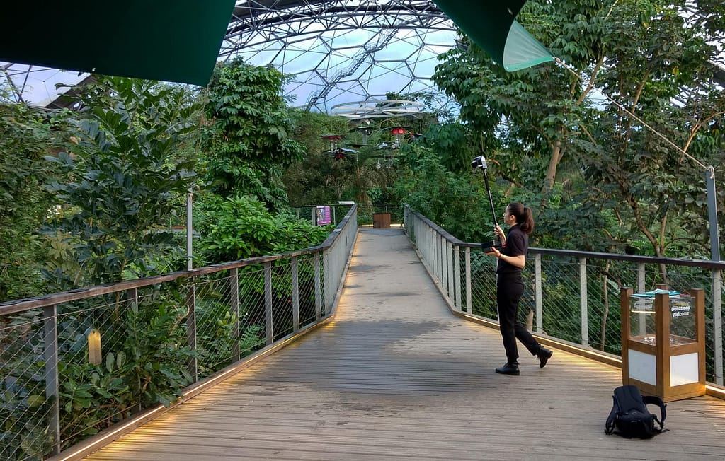
Monitoring and understanding our environment has never been more important as the threat of climate change looms and governments step up to better manage their greenhouse gas emissions. Tom Potter, a doctoral researcher at the University of Leicester, UK, set out to further develop a technique to estimate biomass and carbon more efficiently using state-of-the-art, mobile LiDAR sensors across multiple, complex forest environments.
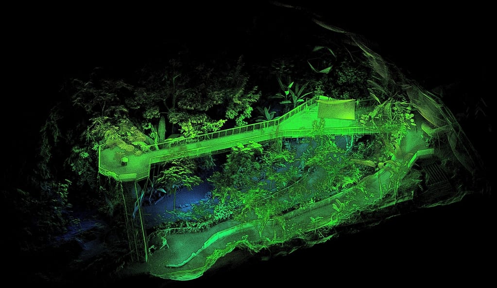
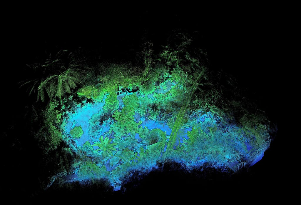
To do so he visited the Eden Project in Cornwall, UK which reflects a true tropical forest – representing different forests from around the world with a rainforest ‘biome’ of over 1,000 tropical trees and plans. However, he had to work around several challenges. For fixed point scanners, the high-density plots of specimens created a problem of shadows – known as ‘occlusions’ – whereby the nearest features will block out features behind. This also limits the ability to acquire accurate measurements to create a comprehensive 3D model. And with the biome being open to the public and a popular tourist destination, Tom only had a few hours each day before opening hours – insufficient time for a traditional static survey.
“Using GeoSLAM’s local processing software, the raw scan data was processed on site, with no internet connection required – useful when in an actual rainforest!“
Mobile surveying equipment that was able to take readings easily and quickly from even the densest areas was needed to ensure precise scans were taken to accurately calculate biomass and carbon storage potential.
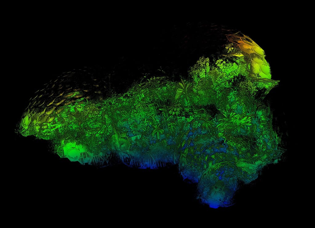
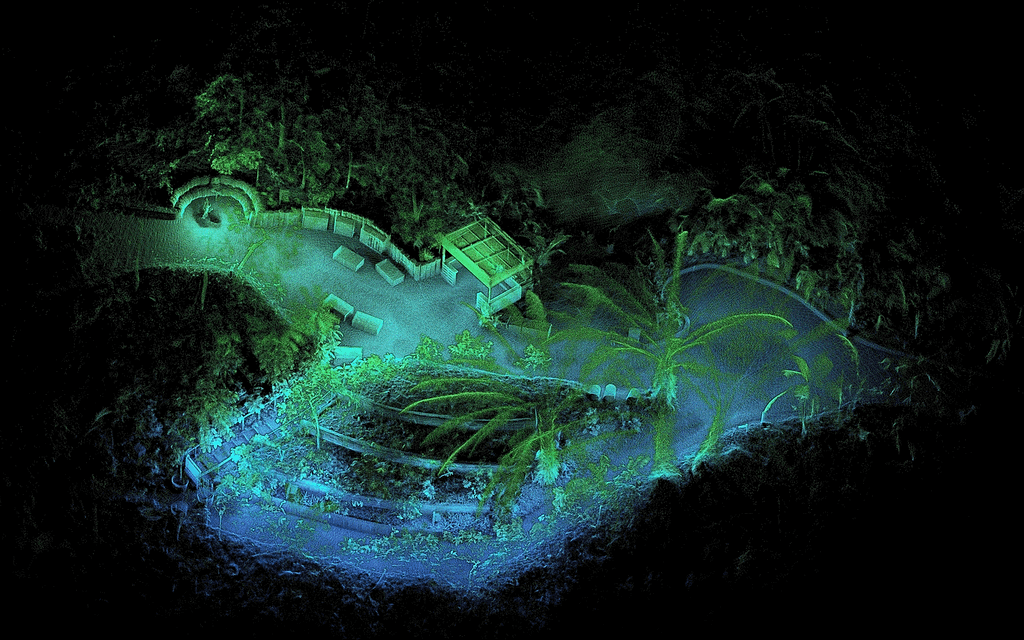
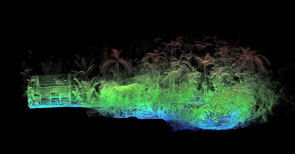
Tom found the mobility and speed of GeoSLAM’s ZEB Revo to be the perfect solution. The lightweight scanner can be pole mounted, handheld or even attached to a vehicle or drone – collecting over 43,000 measurement points per second. Instead of hundreds of time-consuming static scans, Tom captured all angles by simply walking in a loop around the rainforest environment.
He then converted the point cloud data into 3D volume-based plots to derive above-ground biomass and carbon densities for multiple types of tropical forest. A comprehensive dataset was built, containing information for any type of forest that scientists can use to make calculations with minimal survey effort or expertise. And all at considerably less expenditure than traditional survey methods.