SFI SmartForest and LiDAR in Norwegian forestry
The SFI SmartForest is a part of the Centres for Research-based Innovation scheme of the Research Council of Norway. It aims to position Norway's forestry sector at the forefront of digitization by 2028. The primary goal of the 8-year research facility is to improve the efficiency of the Norwegian forestry sector by enabling a digital transformation, using innovative technologies, such as LiDAR. They aim to increase productivity, reduce environmental impacts, and review other significant climate benefits.
SmartForest are focusing on silviculture, forest operations, wood supply, and the overall digital information flow. The hope is to bring Industry 4.0 to the Norwegian forestry sector by having a free flow of information and real-time communication, through innovative and enabling technologies.
The interconnectivity of data and technology will not only result in the long-term success of the forestry sector in Norway but also contribute to limiting potential environmental impacts.
LiDAR is one of the enabling technologies that will help them collect accurate data for ground truthing. The point cloud is forming a basis for deep learning models that can eventually be applied to much larger mapped areas.
Why is mobile LiDAR required?
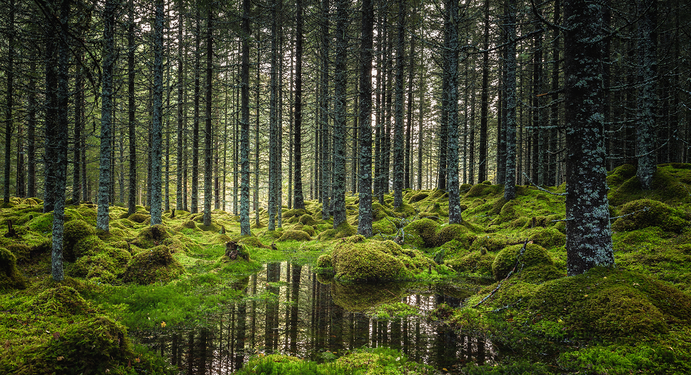
The forest is dense with trees forming a thick canopy, the floor is often rough terrain with thick ground vegetation. To capture 3D models of the forest, SmartForest required a LiDAR solution with versatility and mobility. The goal is to combine mobile LiDAR data with UAV LiDAR data, for more complete datasets.
Data acquisition is only one part of a larger workflow that can include segmentation algorithms, allowing for further exploration of the physical attributes of individual trees such as tree height and distribution. It's important for the data to be precise, to ensure accurate monitoring of the forest.
An obvious solution was a static-based terrestrial laser scanner (TLS), however, despite the high accuracy level, repeatability is critical and TLS requires several scans in one area. As the project progresses and the need for scanning larger areas increases, TLS becomes a less viable option.
Another choice was a UAV-based solution that can capture large areas in a short period of time. Though SmartForest works with UAVs to capture the forest canopy, it's less effective at penetrating thick vegetation to collect forest floor and trunk data than it is from the ground.
After surveying the market, SmartForest opted for a mobile LiDAR solution that could quickly capture ground data to an accuracy high enough for their needs.
Working with Mobile LiDAR
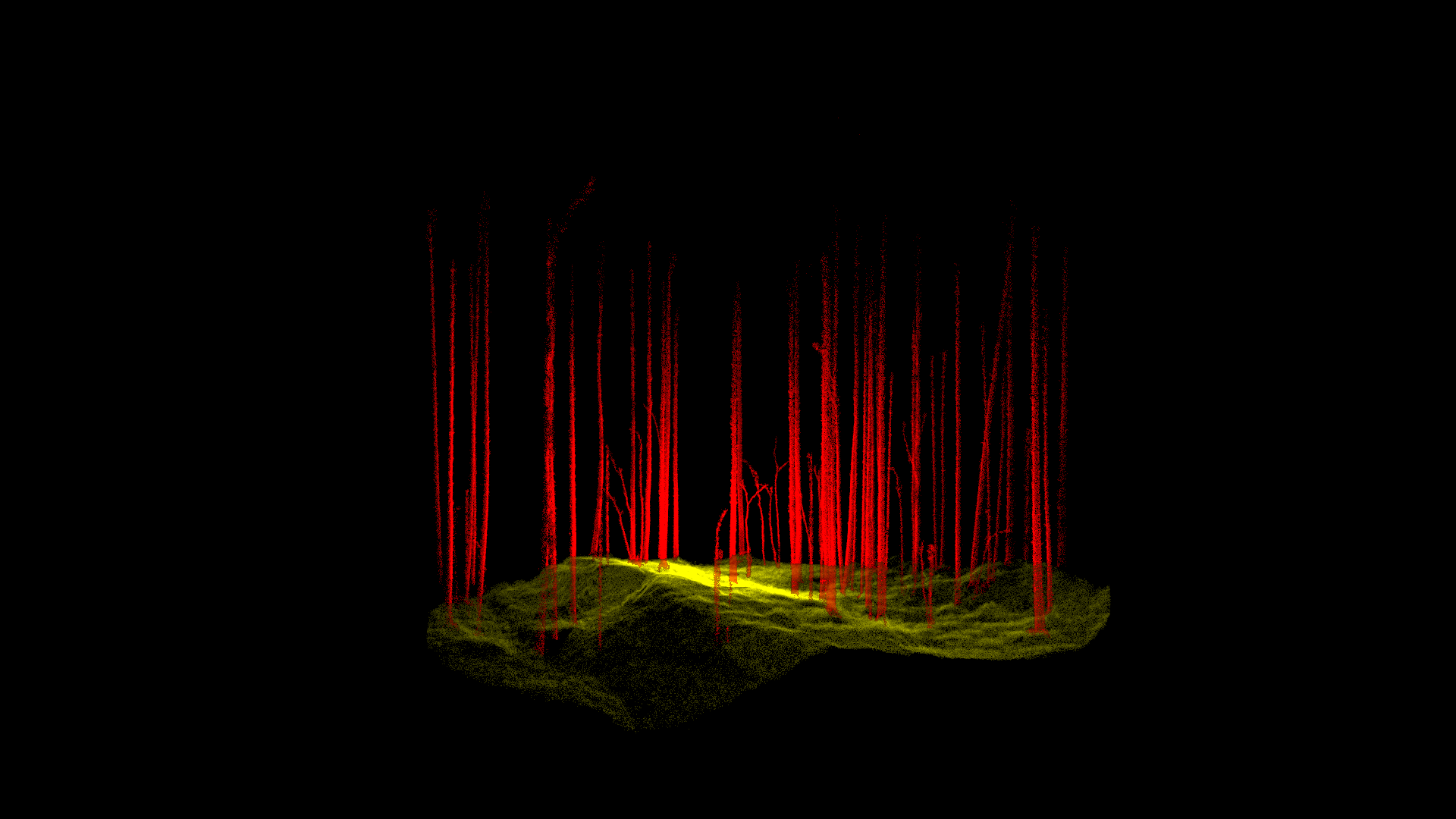
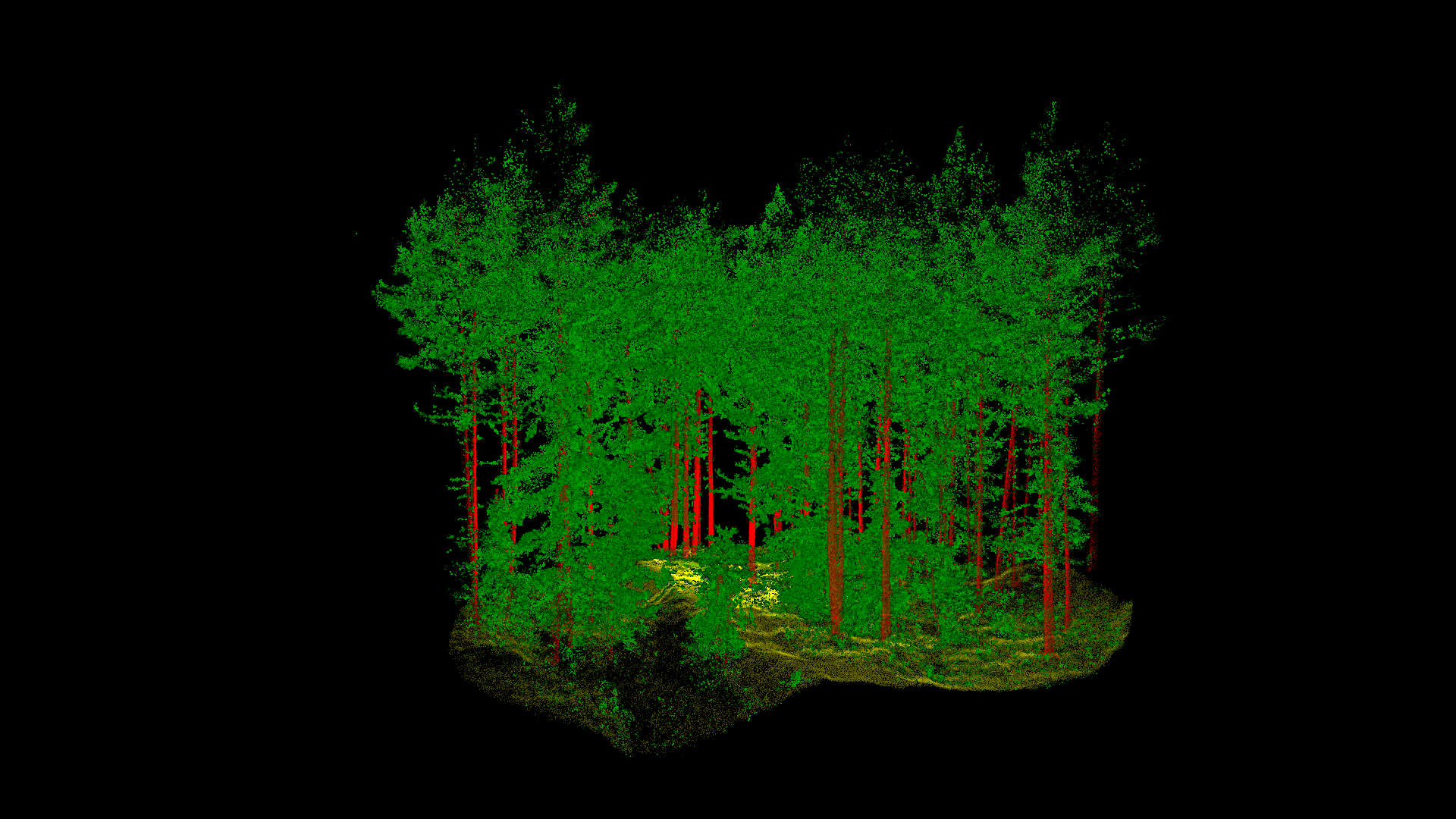
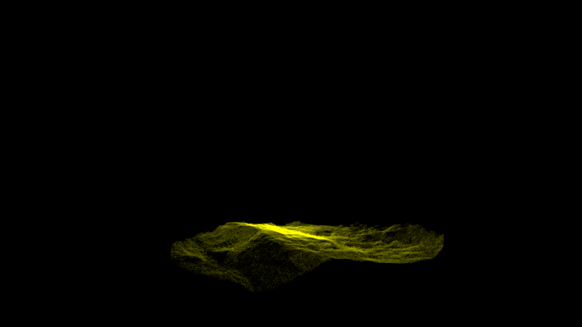
SmartForest selected Mobile LiDAR for its speed of capture, ease of use, and mobility. Projecting 300,000 laser points per second with a relatively long range, a mobile scanner produces dense point clouds of large areas, in a short period of time. The accurate point cloud includes the forest floor, debris, tree trunks, and thick vegetation.
Frequent data acquisition is a key part of SmartForests plans and the mobile LiDAR scanner, alongside UAV data captured, helps to achieve this aim. Data acquisition is repeatable, and the high accuracy information provides a foundation for deep learning models.
The processed point clouds are imported into 3rd party solutions, where sophisticated algorithms are applied to segment the data. Automatic segmentation of the tree trunks allows for easier tree counts and tree segmentation provides precise forest inventory, down to the individual tree. The digital separation of trees will lead to the extraction of features such as wood quality, biomass, and other ecologically relevant variables.
“Scanning with a SLAM solution is a very efficient way to collect ground truth. Eventually, we want to use it for large-scale mapping applications.” - Stefano Puliti, Research Scientist for NIBIO
Conclusion
The long-term plan for the SFI SmartForest team is to bring Industry 4.0 to the Norwegian forestry industry, using emerging and enabling technologies. Mobile LiDAR scanning has been identified as an efficient way to map the forest from the ground, providing accurate point clouds which serve as the basis for deep learning research opportunities.