With an ever-growing array of Lidar technology readily available, anyone can effortlessly map the environment around them. For newcomers to Lidar, this presents a variety of opportunities but requires the surveyor to understand point clouds. What is it, how is it created, and how is it used?
In this article, we'll look at the frequently asked questions about point clouds and get you started with all the information you need.
What is a point cloud?
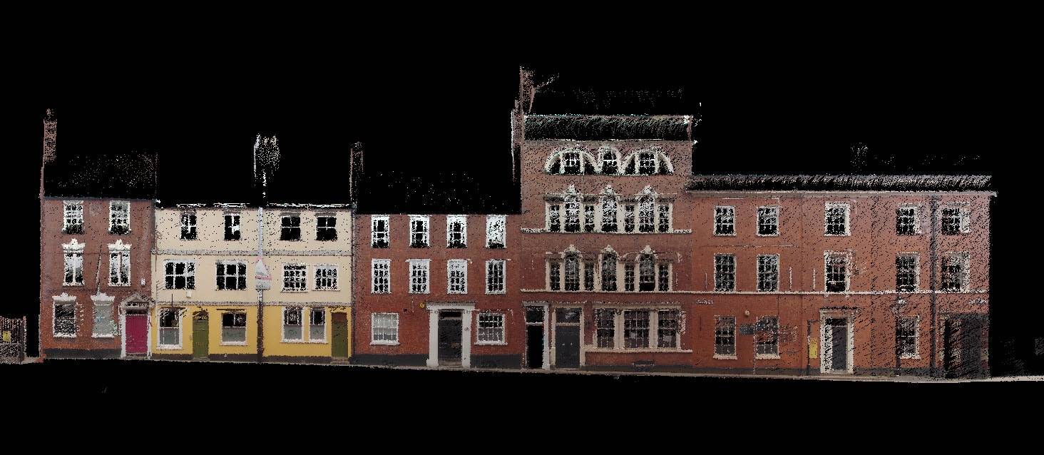
A point cloud is a collection of points of data plotted in 3D space, using a 3D laser scanner. If you're scanning a building, for example, each virtual point would represent a real point on the wall, window, stairway, metalwork, or any surface the laser beam meets.

What measurements are in a point cloud?
A scanner automatically combines the vertical and horizontal angles created by a laser beam to calculate an X, Y, and Z coordinate position. Each point produces a set of 3D coordinate measurements which often includes its color value stored in RGB and intensity.
Are point clouds clear representations of the real world?
The denser the points, the more detailed the representation, clearly defining smaller features and texture details. If you were to zoom in on a point cloud, you'd see tiny points creating the whole 3D model. More points in an area equal a clearer visualization of the scanned environment.
What is Point Cloud Scanning?
Point cloud scanning is the process of using a 3D laser scanner to capture different points to measure an area. You can generate a point cloud at speed with a mobile mapping device, static-based Lidar, or Lidar enabled mobile phones.
How do you create a point cloud?

Simply scan an object or environment with a laser scanner and process the data will generate a point cloud.
Static scanning
Scanning using a Terrestrial Laser Scanner (TLS) is static, usually mounted to a tripod. A point cloud is generated by scanning a series of locations, with overlap, ensuring all angles of a mapped area are covered. During the post-processing stage, the individual datasets merge to create one accurate point cloud.
Mobile mapping
Mobile mapping achieves a similar result, albeit less accurate. However, unlike TLS, mobile mapping conducts scans on the move. Either handheld or mounted to a vehicle or drone, mobile-based scanning is at its best when in motion. A single point cloud is the result of post-processing or larger scans automatically merging when taking reference points overlapped places of both scans.
How long does it take to create a point cloud?
It depends on what requires scanning or the type of scanner you're using.

Speed
If the requirement for your scan is to be fast and less disruptive, then a mobile mapping solution will be ideal. This comes at a slight cost to accuracy, typically generating point clouds with up to 6mm accuracy. This is ideal for environments like mines, where speed, safety, and a lack of disruption to production are key to a successful scan.
Accuracy
A static-based solution is best for accuracy, with most delivering sub 1mm results. Point clouds generated from TLS are perfect for industries like Architecture, Engineering, Construction, and Operations (AECO), or BIM that require higher levels of detail.
In some cases where there is a requirement for repeatability, a combination of point clouds from mobile mapping devices and TLS is the solution.
Visualizing a point cloud
Since a point cloud is a fully 3D format, you can view it from any perspective. You can view any part of the point cloud, including objects and rooms, from any angle as required. Additionally, there are different ways to visualize a point cloud. Some of these include:

Intensity:
Intensity values are typically Lidar sensor-dependent and identify parts of a point cloud that are brighter than others through the strength the laser beam returned. This is ideal for making parts of the point cloud easily identifiable like road markings or reflective targets.
Elevation
Elevation is classifying the data based on the height of the points within the point cloud. Often represented by a gradual change in color (red representing the highest point and blue the lowest), elevation is ideal for giving context to the environment represented and great for Digital Elevation Maps (DEMs).
RGB:
When you look at a colorized point cloud, you're seeing both the dimensional measurements and the RGB value. The effect is that users (both new and experienced) can better contextualize the point cloud because it looks more like a 3D photograph.
Point cloud formats to use?
Different scanners produce raw data in multiple formats and each piece of software has different exporting capabilities. Output formats are determined by data requirements and who needs them. If you wanted to store the data away for a long period, you'll probably be best packaging the point cloud as an ASCII file. Other popular formats are LAS, PTS, PTX, XYZ, and Fast Binary.
Certain data is compatible with software that works with universal file formats (LAZ/LAS/PLY/TXT/e57). Examples of these types of software are Deswick for mining solutions and Revit for building information modeling.
Equipped with this knowledge, we hope you learn to embrace 3D laser scanning technology. Creating point clouds is both easy and simple - and anyone can do it.
Learn more about FARO's mobile mapping solutions here