Using LiDAR for site documentation

Location
Rovinj, Croatia

Scan time
20 minutes per scan

Size
1110m x 700m

Scanned
Campsite
Industry
Surveying
The Maistra group and using LiDAR for site documentation
Whether you are cruising down the Adriatic coast, visiting the famous Game of Thrones filmsets in Dubrovnik or experiencing some of Croatia’s famous cities; with visitors to Croatia more than doubling since 2010, tourism has become an important part of the Croatian economy.
In the North sits the Istrian peninsula, a place known for its beauty, history, amazing food, and a place tourists flock to year on year both domestically and internationally. A sharp increase in visitors has meant that tourism sector has needed to adapt to the exponential growth.
The Maistra group is one of Croatia’s leading tourist companies. They manage 18 hotels, 11 tourist villages and 6 campsites in sought out destinations such as Rovinj, Vrsar, Zagreb and Dubrovnik. With so much property to manage, they need quick and efficient ways to keep their site documentation up to date. In early 2021 they approached GeoSLAMs Croatian dealer, Geocentar, requesting a scan of one of their campsites in Rovinj on the Istrian peninsula.
Working with the ZEB Horizon in Rovinj
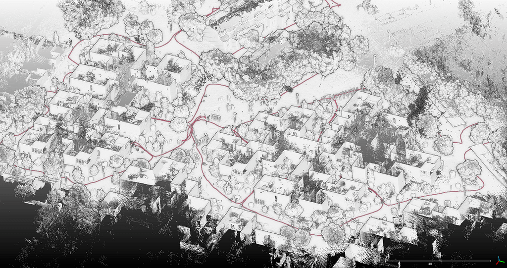
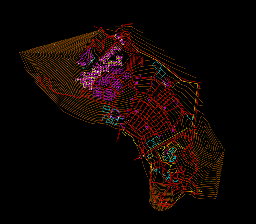
Due to the size of the site, 1100m x 700m, the team at Geo-Centar opted to tackle the scan using GeoSLAMs ZEB Horizon, plus aerial photogrammetry. The aim of the survey was to create up to date campsite documentation in the form of 2D vector maps, high resolution 2D raster maps, georeferenced imagery, and a digital terrain model with contours. As a result of the campsites age and need to modernisation, the documentation will serve as a reference for design purposes.
Combining both high resolution orthophotos of the area with the point cloud from the ZEB Horizon, the team were able to capture data quickly, accurately and without disruption. By utilising the walk-and-scan method of capturing data, they were able to make light work of the task.
Being able to walk and scan is a true blessing in such situations since any other scanning method is either much slower or much more expensive.
In total, 10 scans were conducted which mainly focused on buildings, terrain covered with vegetation and other objects that would be tough to capture with aerial photography. Each scan took approximately 20 minutes, so the team were able to cover the entire 1100m x 700m in just over 3 hours. Using the scans, the team were able to extract roads, sports fields, fences, stairs buildings and roads.
Post Scan
During the scan, the team used a survey grade GNSS receiver to georeference the data. The team used GeoSLAM software to accurately georeference the scans which enabled them to correct any trajectory drifts that may have occurred during the scan. This further ensured that accurate and quality data was delivered to the client.
In addition, the team were able to georeference images taken alongside the scan and open them in GeoSLAM Draw. The software was then used to export the web version (HTML) of the top view layout containing the location of the images. This HTML was easily shared with investors and engineers working on the same project, providing a visual impression.
The pointcloud data was exported to 3rd party software, where the team were able to create the documentation and maps for their client.
Results
The team were successfully able to map the campsite and extract the data needed to create high quality survey maps, a digital terrain model and contours, which will now be used to modernise the campsite.
Get in touch
If you’d like to learn more about how GeoSLAM solutions can help you, submit the form below.


