Last Updated on 8th September 2023
Mobile mapping tour of the Czech Republic
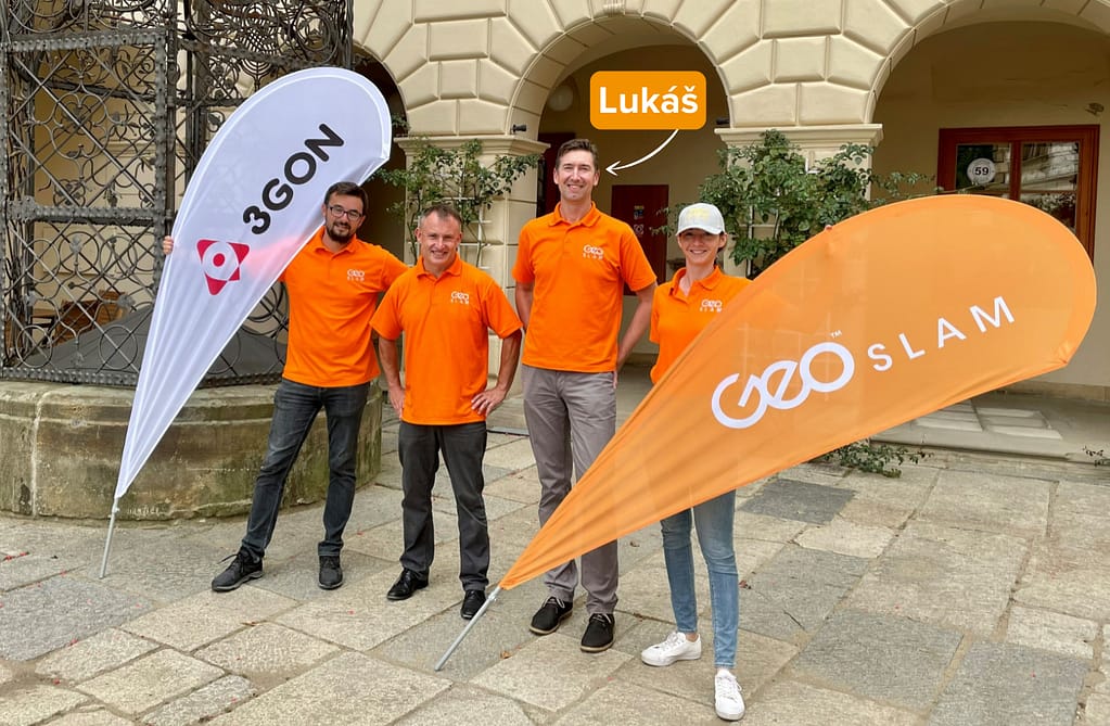
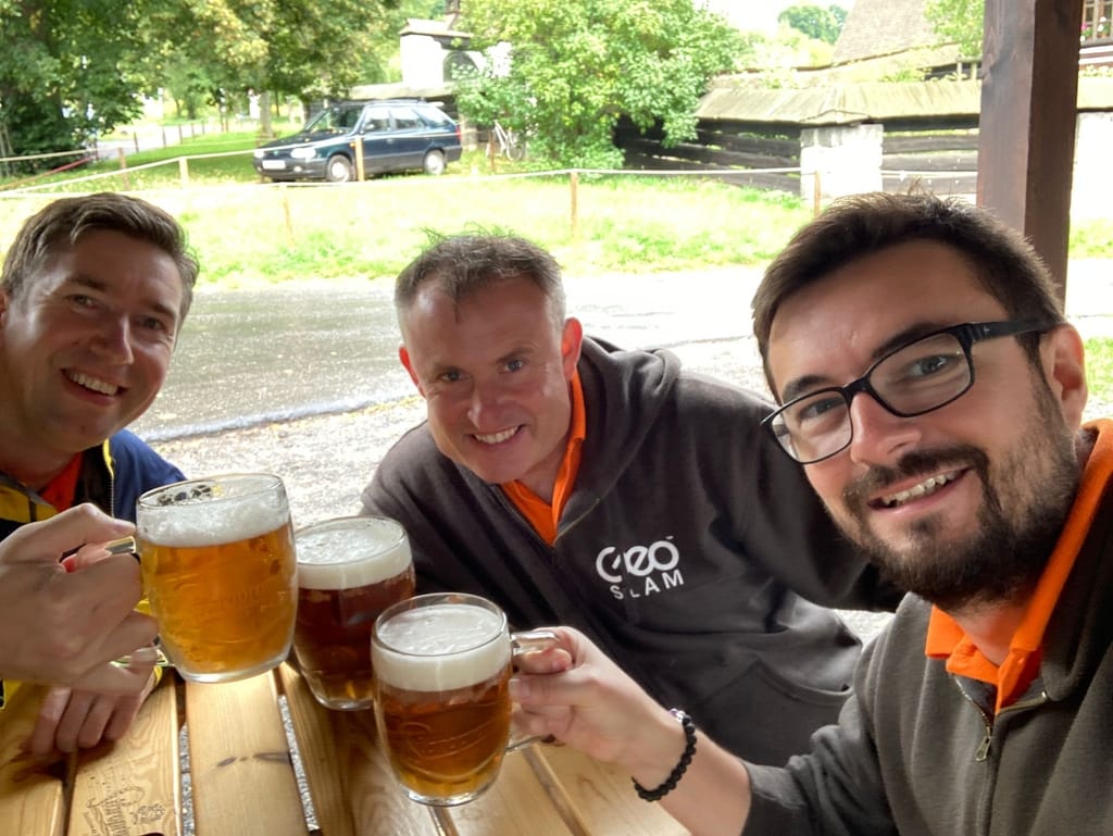
Words by Lukáš Loula, GeoSLAM Solutions Architect
During September 2021 my colleagues and I travelled around my home country (the Czech Republic) to meet and present to people interested in our handheld SLAM scanners.
In this blog I am going to talk about the various locations we visited, and show the data we captured from historic locations around the country.
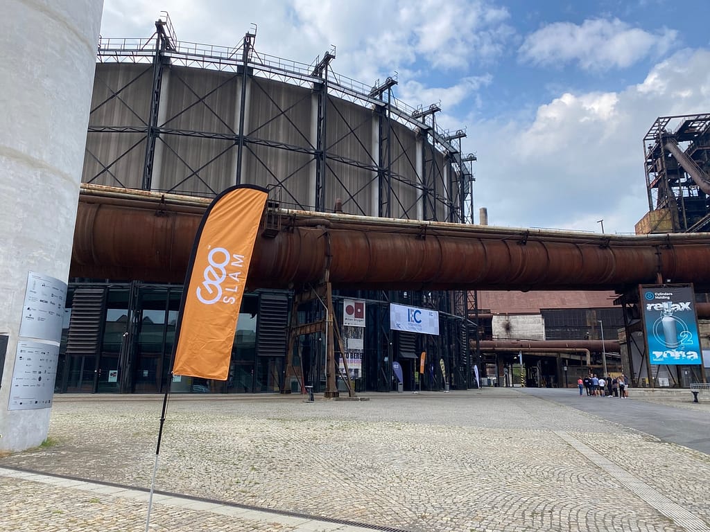
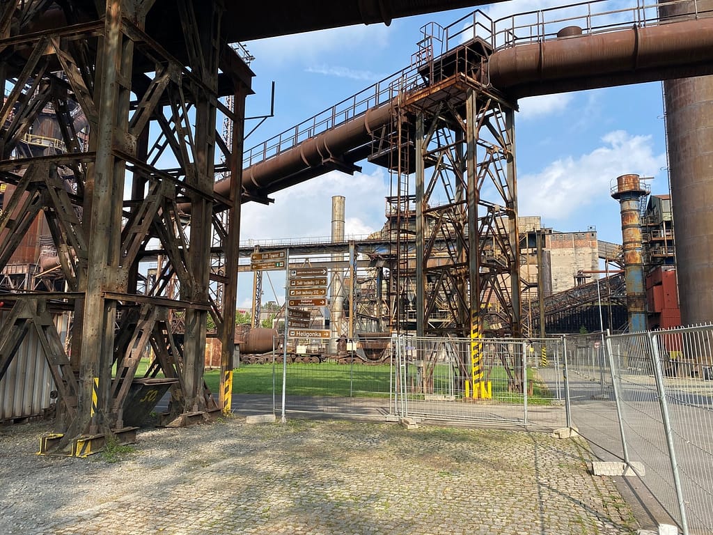
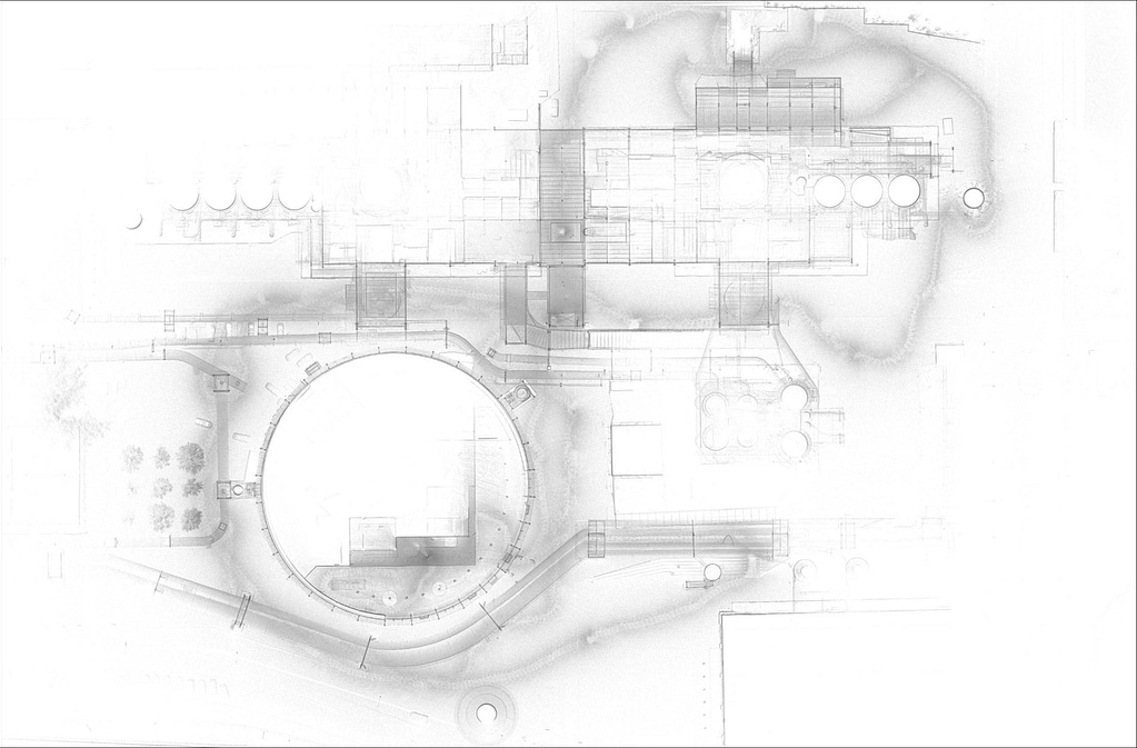
Ostrava
Scanner: ZEB Horizon
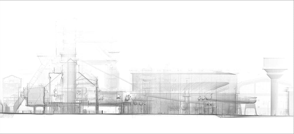
Scanned: Dolní Vítkovice
Our first stop was the North-East city of Ostrava, near the Polish border. Coined the ‘Steel Heart of Czechoslovakia’ in the 20th century, due to its history in industry, Ostrava is surrounded by remnants of an industrious past. Since the last coal mine was closed in 1994, Ostrava has been adapting to a modern way of creating economic growth. Changing old factories into metropolitan bars and restaurants is one of the ways the city is embracing its historical past.
We were invited to scan an old factory which is now a public space for exhibitions, concerts, and congresses. Using the ZEB Horizon, we were able to mobile map the area in just 8 minutes, capturing 69.8 million points. Processing the scan in GeoSLAM Connect, the data was transferred to GeoSLAM Draw, where we could make accurate measurements.
Moravian Karst
Scanner: ZEB Hoirzon
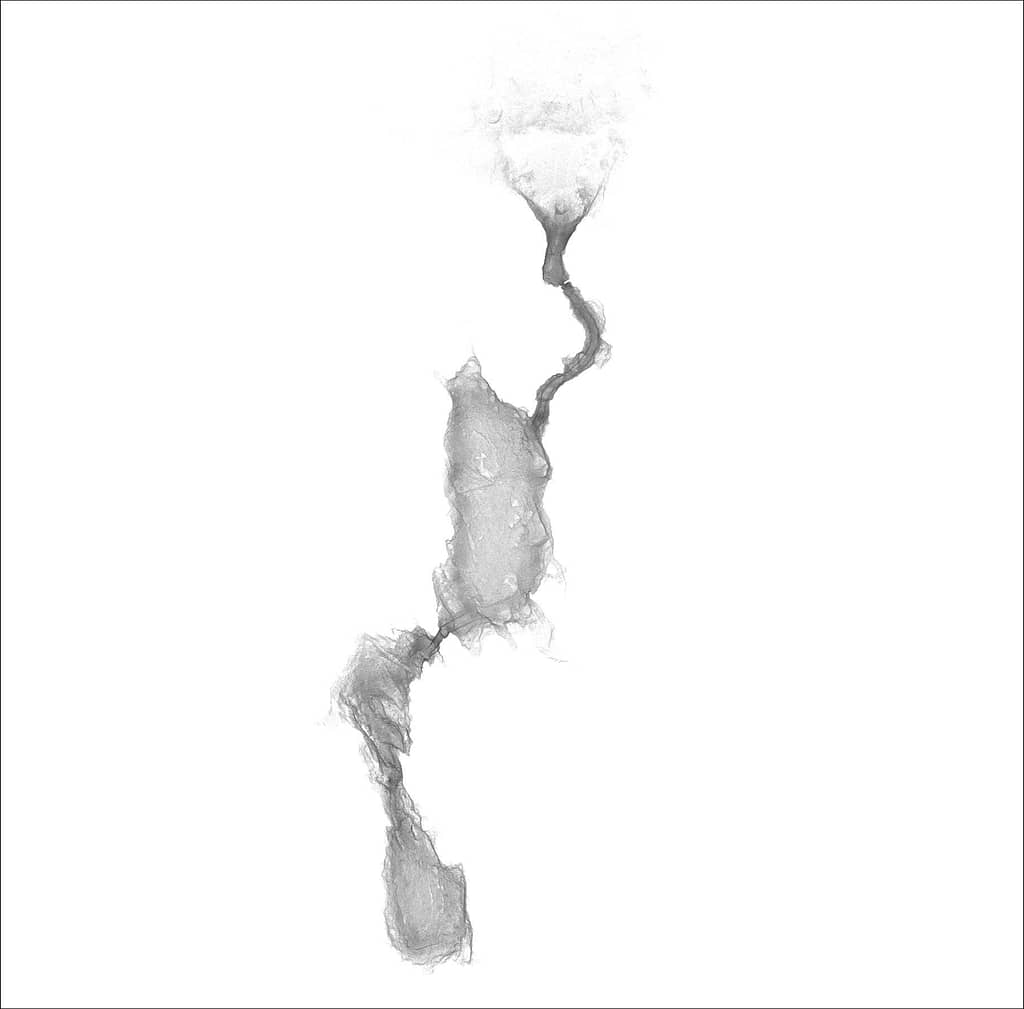
Scanned: Catherine’s Cave
We travelled further in land, to Moravský kras (a nature reserve north of the city of Brno), where we visited Catherine’s Cave. The cave dates to the early stone age, and its name (Kateřínská cave) comes from the legend of Katerina, which was told among the local people. Open to the public since the early 20th century, the cave and surrounding area is a a place tourists flock to year on year. The main dome is often used for concerts due to the natural acoustics. The cave has a wide-open entrance, is approximately 580 meters long, and can get down to 7 degrees Celsius.
In 16 minutes we had walked and scanned the length of the cave, capturing 163 million, as well as mapping the surrounding entrance. The data was processed on site so we could preview the point cloud in the 3D viewer, showing off the data to those that visited us on this leg of the tour.

Žďár nad Sázavou
Scanner: ZEB Horizon
Scanned: Zelená Hora
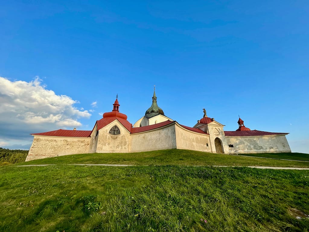
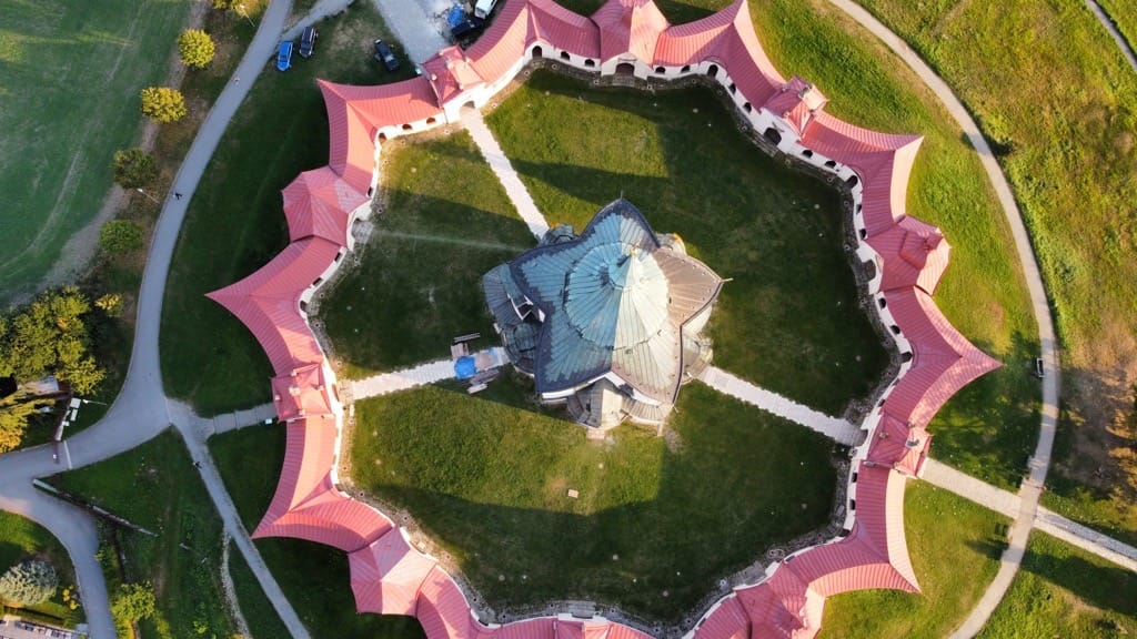
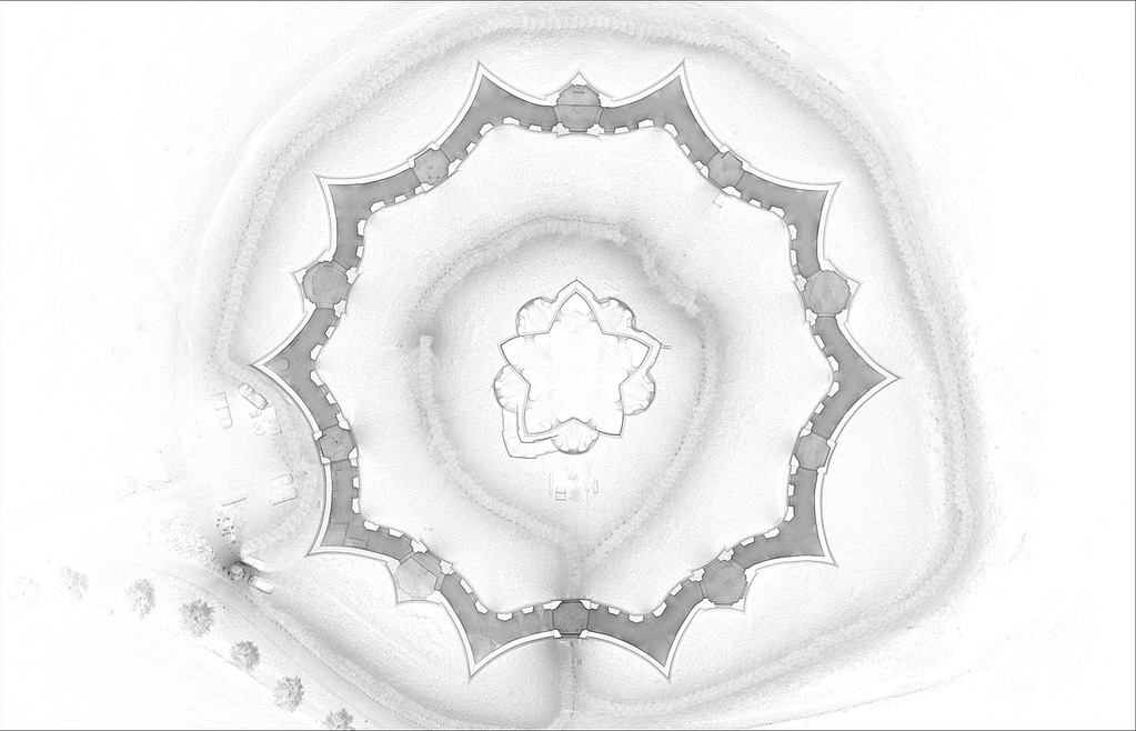
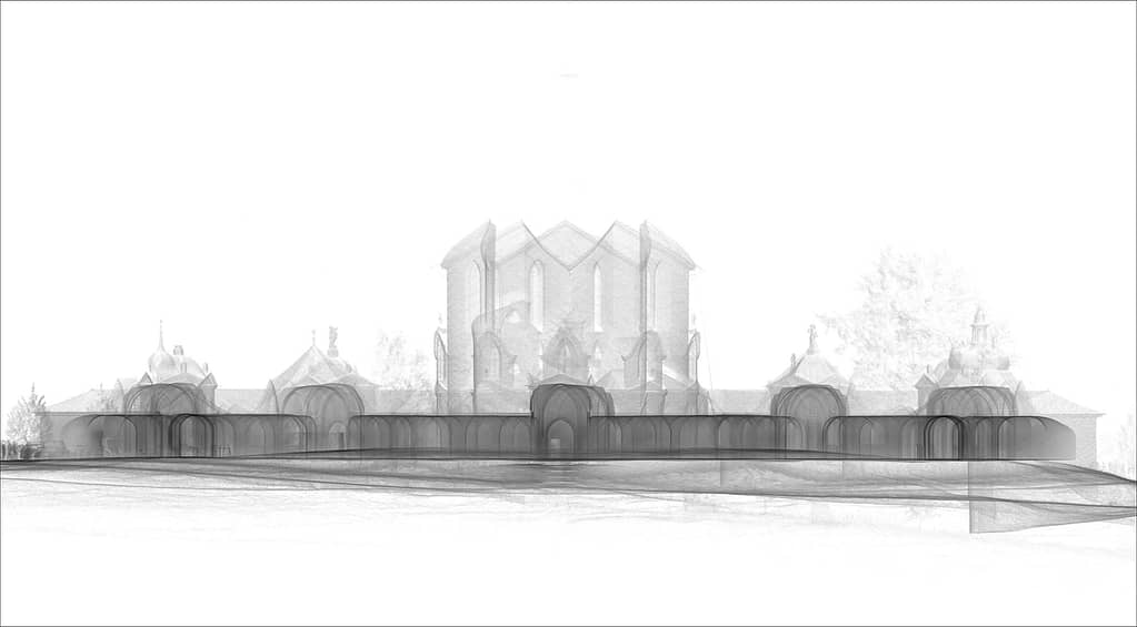
Our next destination was further West to the small town of Žďár nad Sázavou, where we visited a UNESCO world heritage site. The Pilgrimage Church of St John of Nepomuk at Zelená Hora was the final work of architect Jan Santini Aichel. Santini combined the Borrominiesque Baroque style with references to Gothic elements in both construction and decoration. The church sits upon a green hill (where the name ‘Zelená Hora’ derives) that overlooks the town and beautiful scenery.
Using the ZEB Horizon we captured 153.1 million points in 19 minutes, by simply walking around the church and surrounding walls.
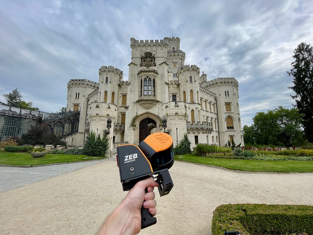
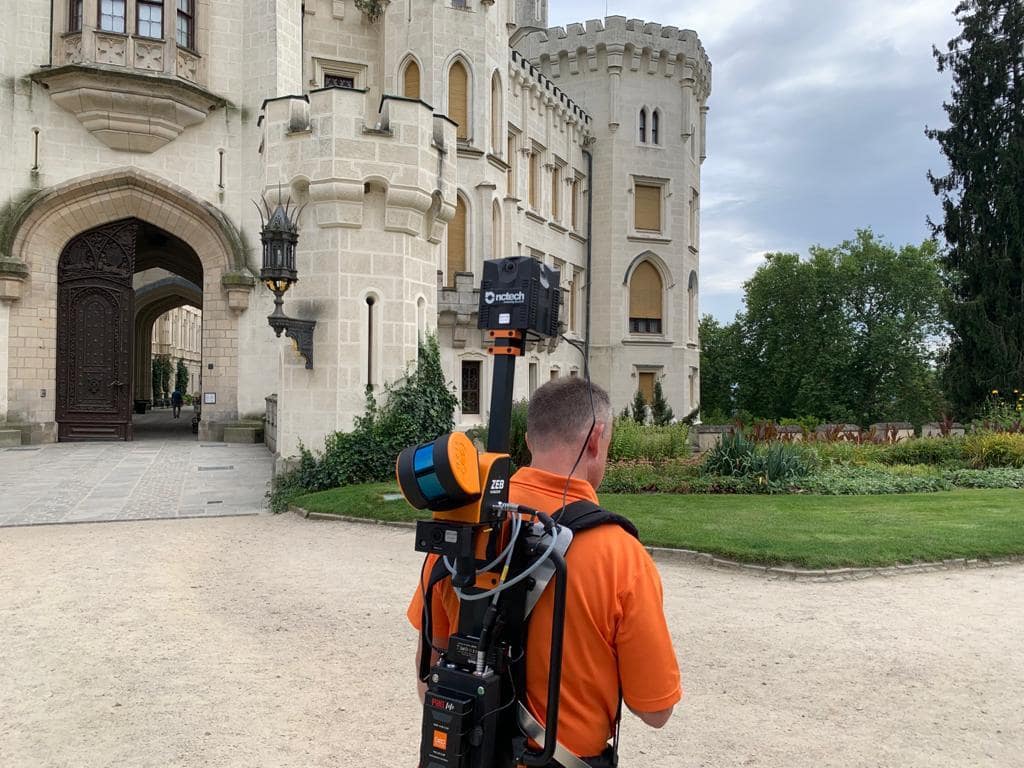
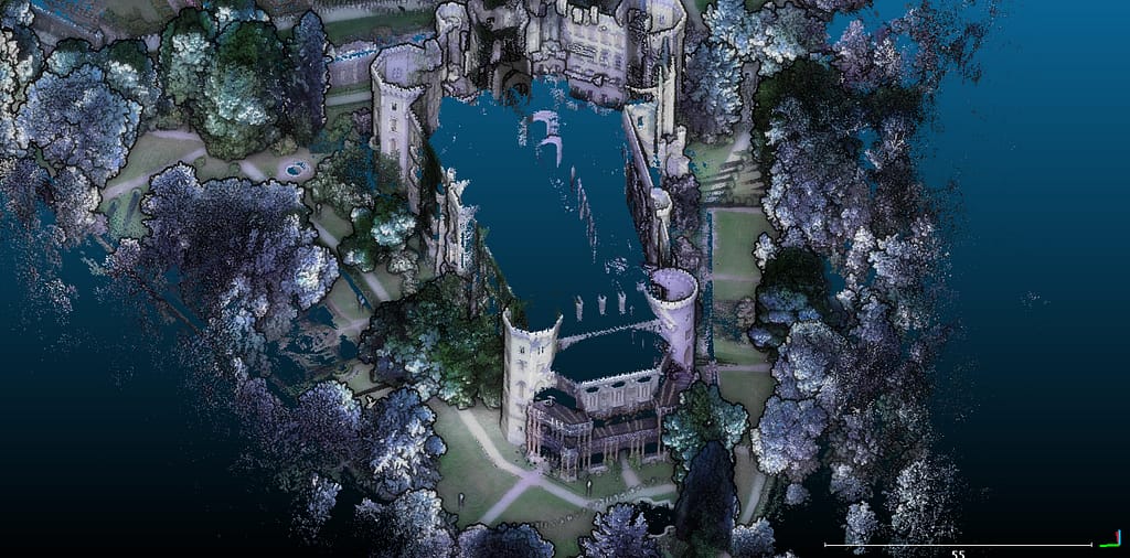
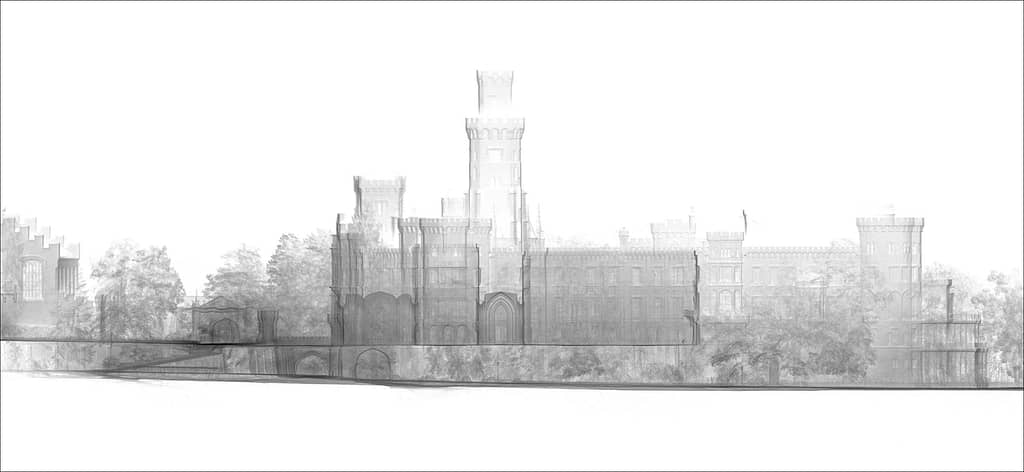
Hluboka Nad Vltavou
Scanner: ZEB Discovery
Scanned: Hluboká Castle
The next stop on our journey was further south to the small town of Hluboka Nad Vltavou and the home to Hluboká Castle. The Castle was originally built in the 13th century but has been expanded and reconstructed over 100s of years. The history and architecture attracts tourists all year round and it is considered to be one of the most beautiful castles in the whole of the Czech Republic.
In 19 minutes, we mapped the entire exterior of the castle using the ZEB Discovery, capturing 149.7 million points. The data was processed and colourised.
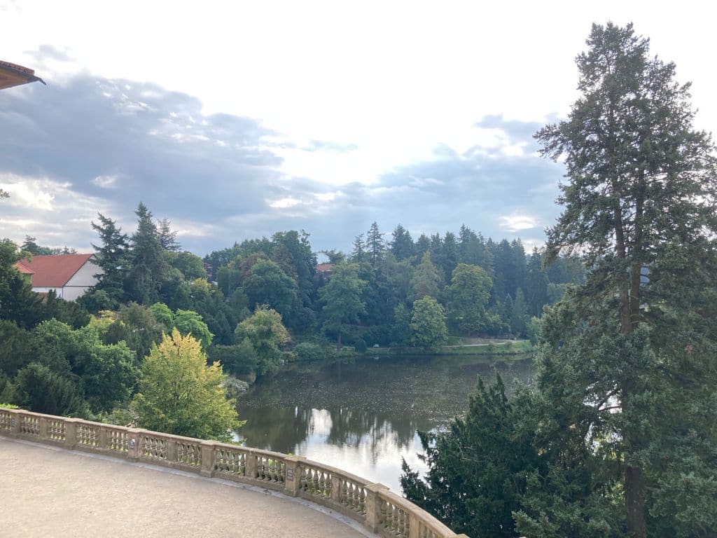
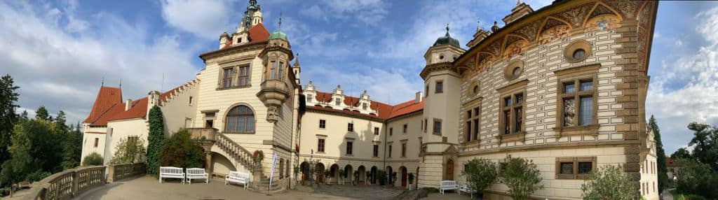
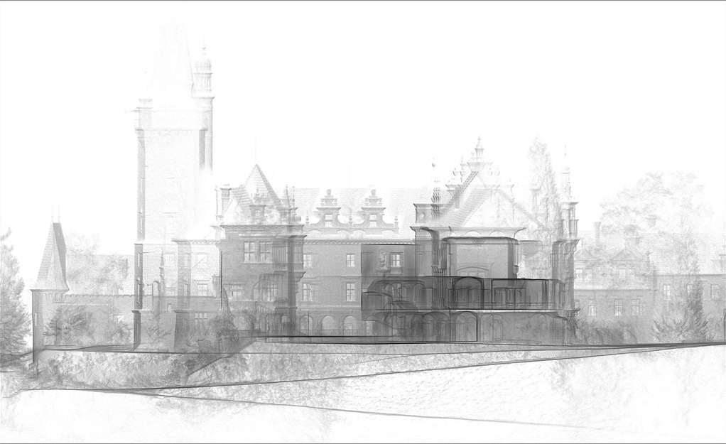
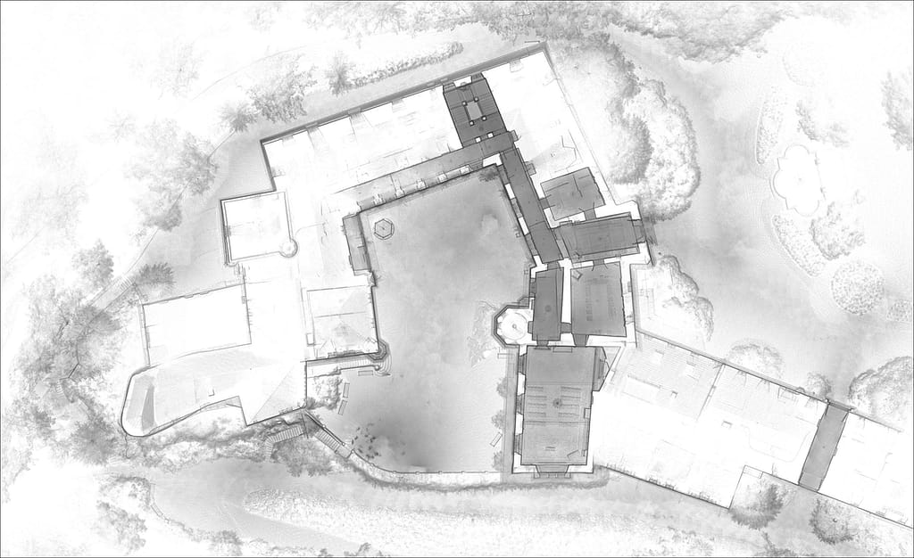
Průhonice
Scanner: ZEB Horizon
Scanned: Průhonice Chateaux
We made our way to the outskirts of the country’s capital, Prague on our next leg. We planned a visit to scan the former castle, turned chateaux in Průhonice. The chateaux was originally built in the 15th century and boasts a beautiful gothic style. Over the years it has been passed through many owners, including the Czech government, where it has been restored and expanded. The grounds surrounding the castle were built in the early 20th century, and after the second world war the building and area was transferred to the Botanical Institute of the Academy of Sciences of the Czech Republic.
We conducted 2 scans of the chateaux , both interior and exterior. By overlapping control points within both scans, we were able to automatically merge both datasets in GeoSLAM Connect. The exterior scan took 12 minutes to complete, by walking around the site, capturing 87.3 million points. The interior took 9 minutes to complete, capturing 81.7 million points.
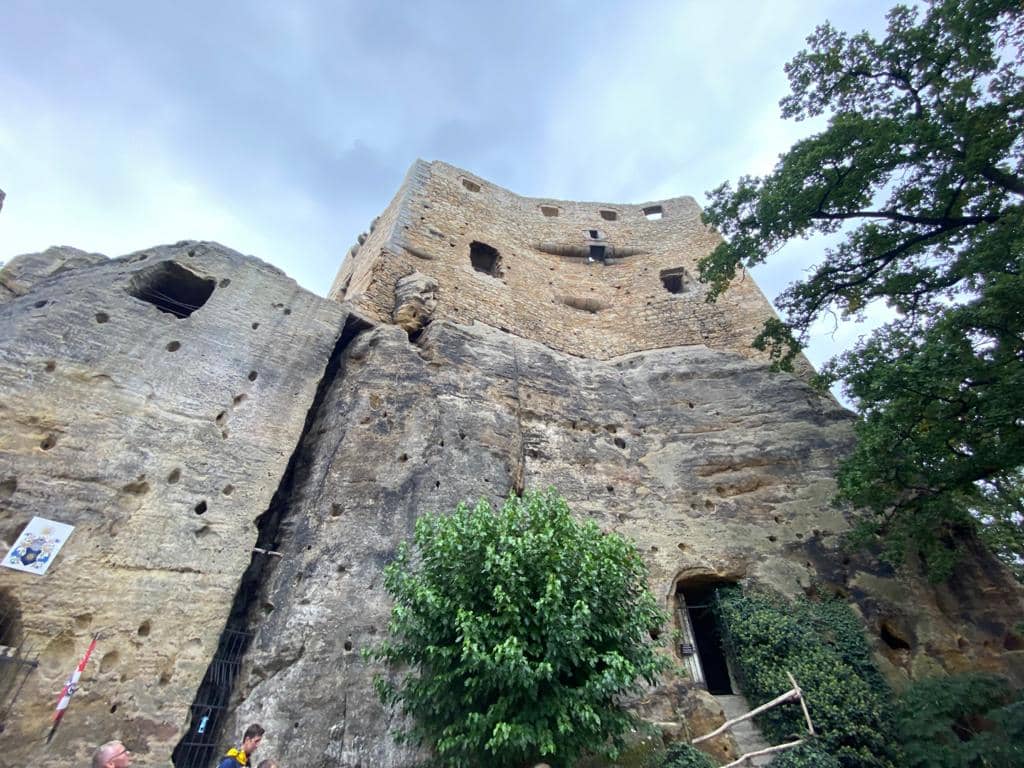
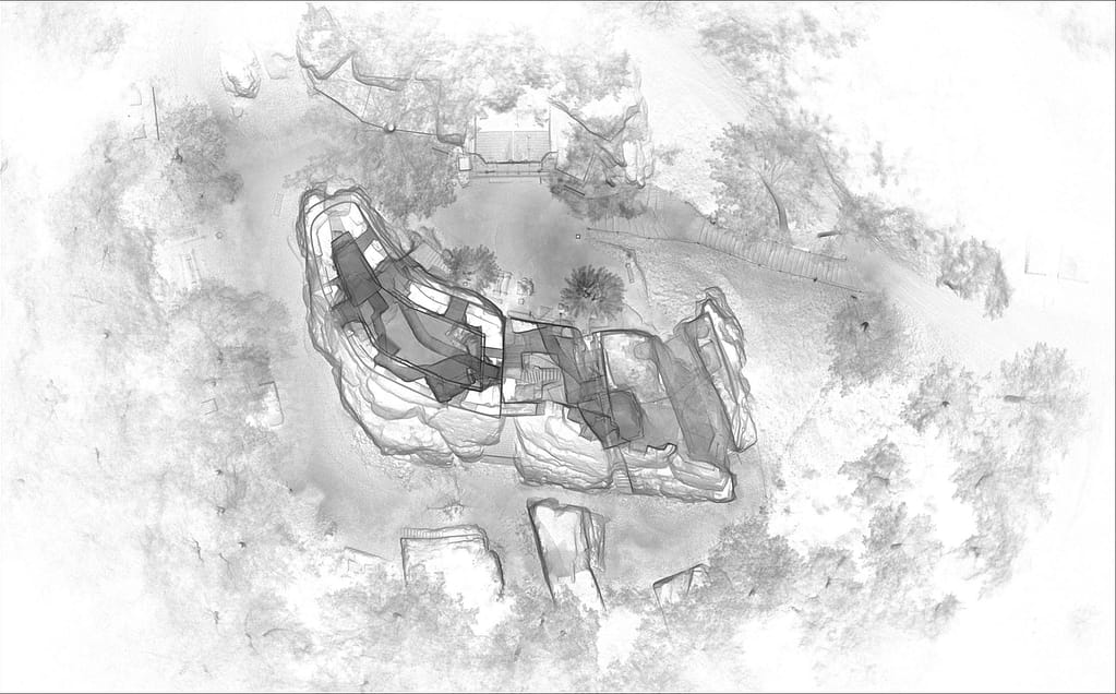
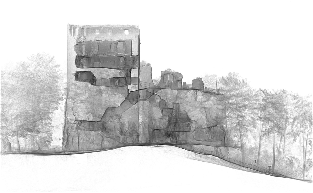
Bosen
Scanner: ZEB Horizon
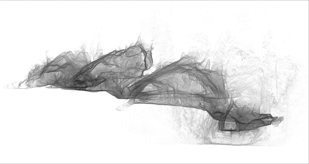
Scanned: Castle Ruins of Valecov
With picturesque views of the surrounding forests, the Castle Ruins of Volecov in the north of the Czech Republic was a fantastic location to visit and scan. The castle/fort stands tall above the forest, at an altitude of 320 meters. The ruins are made up of many rock rooms, which originally served as wintering grounds for the Hussite field troops.
We scanned the exterior and Interior of the ruins and surrounding areas with the ZEB Horizon, in one loop. Overall, we were scanning for 20 minutes, capturing 151 million points. The data was processed in GeoSLAM Connect where we could clearly see the elevation between the surrounding areas and the ruins. We also imported the point cloud into GeoSLAM Draw where you can clearly visualise the internal cave rooms and corridors.
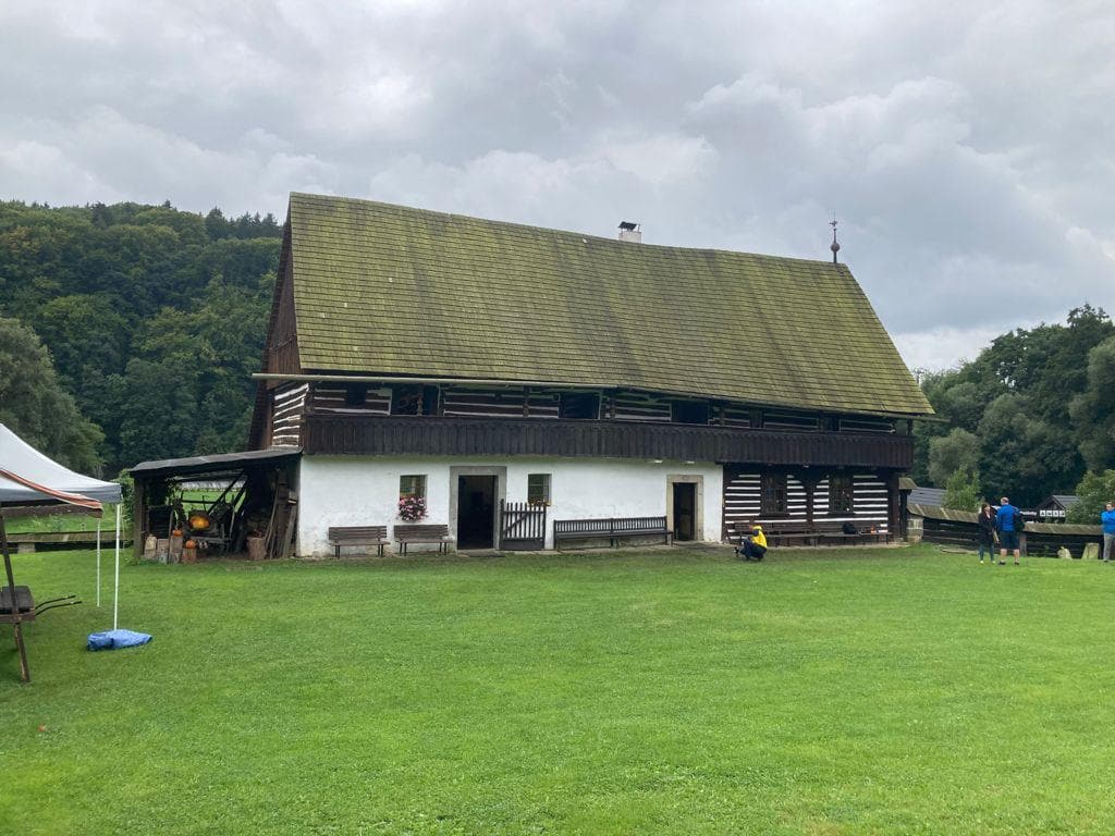
Turnov
Scanner: ZEB Revo RT
Scanned: Dlaskuv Statek
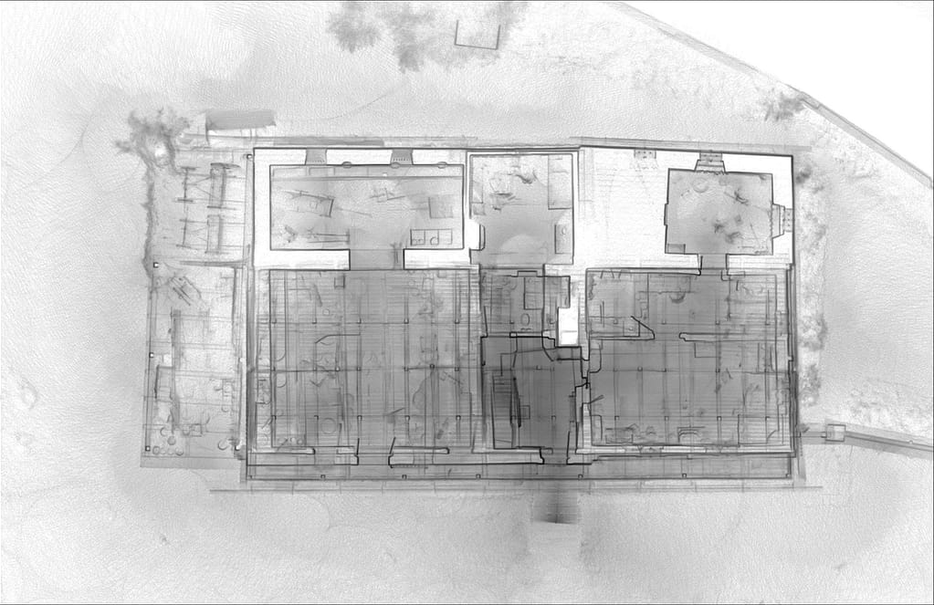
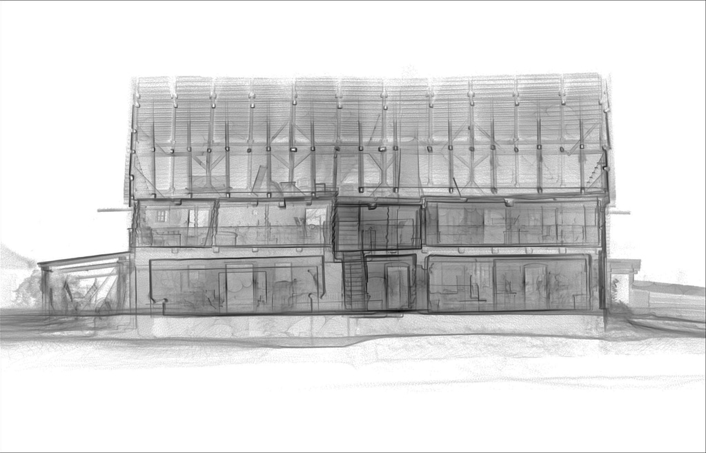
Our final destination was to the farm museum of Dlaskuv Statek, a few kilometres outside of Turnov in the North. The museum farmhouse is a typical example of traditional architecture in the region of the Jizera river. The farmhouse is surrounded by a wooden fence with two gates: the upper one consists of a brick block and a little wooden belfry, and the lower one is wooden.
Using the ZEB Revo RT, we mapped the interior and exterior, processing the data in real time. 20.7 million points were captured in 14 minutes.
We had a fantastic week meeting great people who are interested in our technology and previewing the versatility of our ZEB scanners. Whether it was large, complex or tough terrain, the ZEB scanners stood up to the challenge, and the data shown above reflects that.
Sign up to our newsletter to learn more about our ZEB scanner range and how they could be a cost-effective solution for your business or contact GeoSLAM for more information.
Get in touch
If you’d like to learn more about how GeoSLAM solutions can help you, submit the form below.


