Creating a digital twin of Cistercian Landscapes


Industry
Education
Scan time
3.5 hours
Location
Franconia, Germany
Size
3 hectares
Scanned
Cistercian Landscapes
Professor Hess and Carla Ferreyra | University of Bamberg
Background
With the adoption of digital technologies such as laser scanning, photogrammetry and other digital tools becoming ever more prevalent in conservation and preservation; it is easy to see why, in 2017, the University of Bamberg launched a new master’s degree, ‘Digital Technologies in
Heritage Conservation’. Spearheaded by Professor Mona Hess, the course covers the integration and adoption of digital technologies in heritage conservation and its further development, as well as raising the profile of this research topic. In addition to running the course, Professor Hess and her team often employ their skills and expertise in the field, creating 3D digital models for preservation purposes, to build knowledge of certain areas or to educate a wider audience about a new culture.
“The 3D recording is a methodological tool for the representation and interpretation of cultural heritage, landscape and architecture, to build knowledge, create meaning and make culture accessible to all.“
The Scan
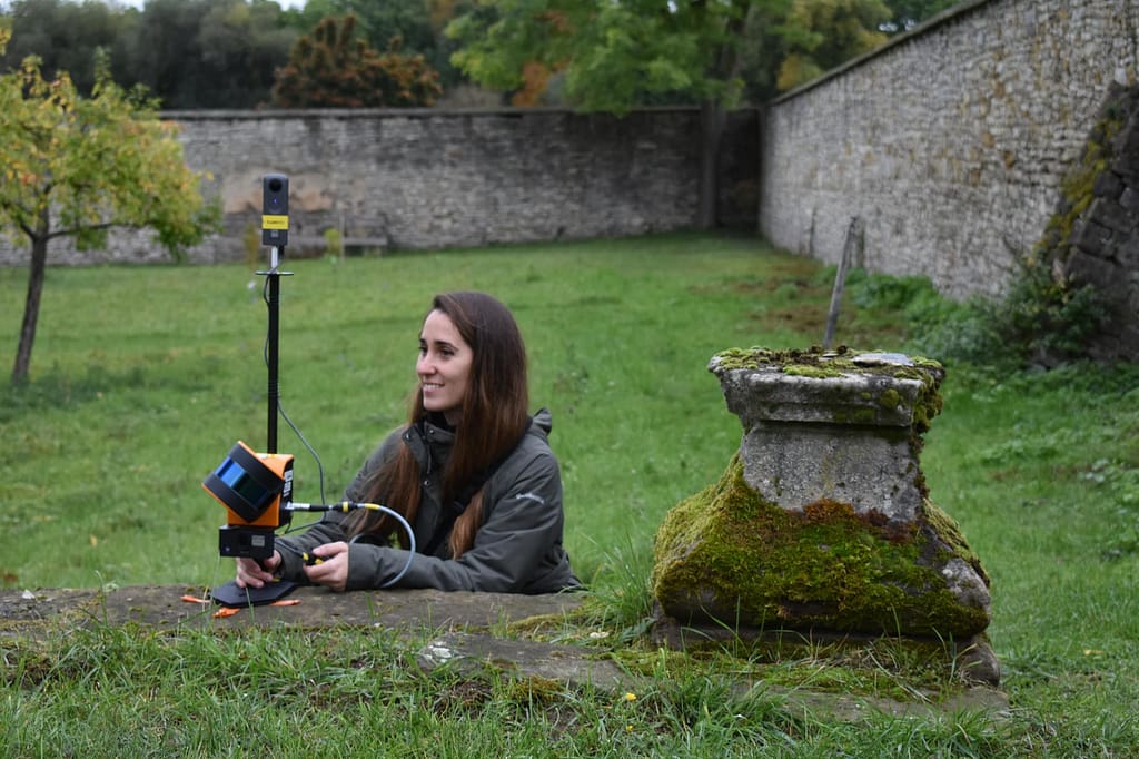
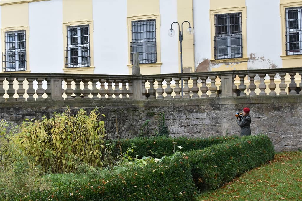
In 2020, Professor Hess was approached by ‘Cisterscapes | Cistercian Landcapes in Central Europe’ and was tasked with contributing to the digital recordings of 2 gardens. The scan would focus on the baroque agricultural buildings with designed gardens; Ebracher Hof in Mainstockheim and Ebracher Hof in Oberschwappach, both properties of the Ebrach Monastery.
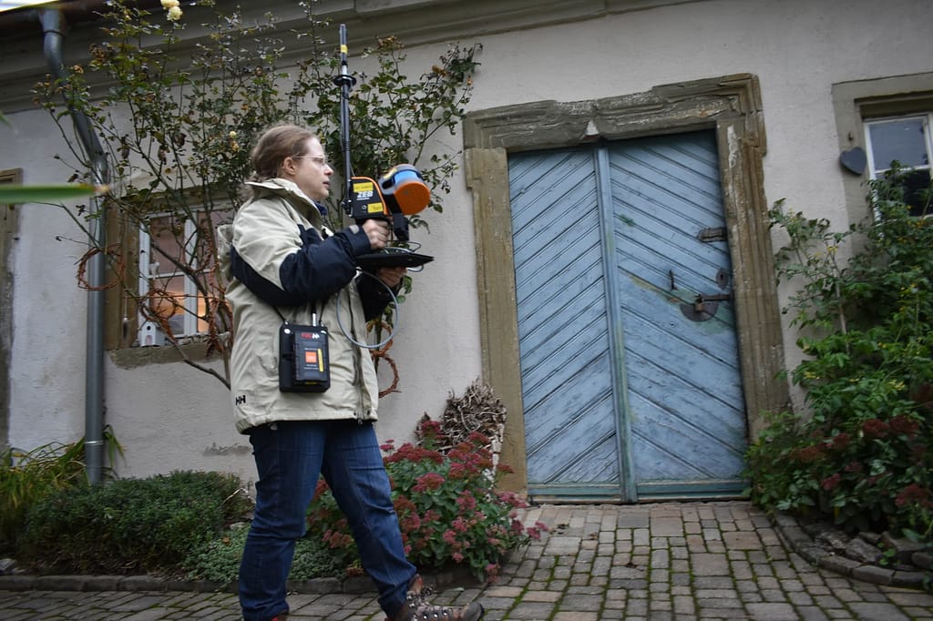
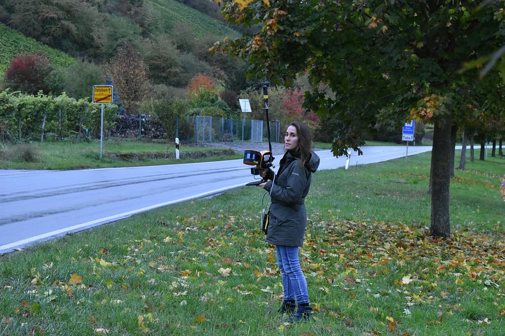
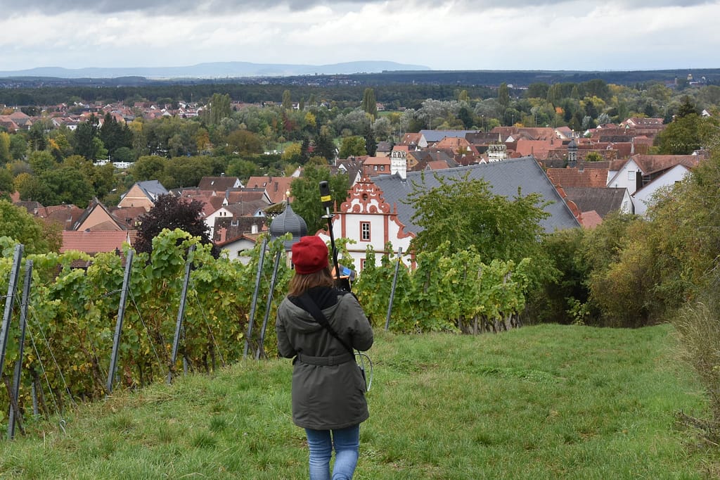
The aim of the scan was to create reliable information, assess the landscapes development status and design management plans for maintenance and conservation. Professor Hess, accompanied by PHD student Carla Ferreyra, visited the sites in October 2020 to conduct the scans. With approximately 3 hectares of land to cover, the team needed a SLAM scanning solution that was quick, easy to use, suitable for both indoor/outdoor use and a solution with reliable results. Professor Hess chose GeoSLAMs ZEB Horizon with the ZEB Pano, because of the rapid data acquisition throughout the site up to 100m.
Other laser scanning techniques were considered in the planning process, however none quite provided the freedom the ZEB Horizon did, often
with restrictions around mobility and time. In September 2020, a similar scan had taken place using a terrestrial laser scanner (TLS) of a specific
area of the Mainstockheim garden. In comparison, the GeoSLAM scanner reduced the time and labour costs when completing the scan. The team were able to complete their scan of Mainstockheim (including an interior space of the baroque building) in just under 3 hours.
In Oberschwappach, the total scan time was approximately 30 minutes. Their only concern during the scan was encountering the general public, however due to the lightweight nature of the ZEB Horizon and Pano, it was easy to avoid busier parts of the garden. Where they did encounter other guests (due to their curiosity over the scanner) Professor Hess and Carla simply repeated the scan of that specific area. All in all, the scan was a success, and Professor Hess and Carla were able to deliver on their task.
The Results
With the completion of the scan, not only does Professor Hess have fresh scan data that can be used to educate the next generation on how
digital technologies can be used in heritage conservation, but they are also being used to extract 2D information, such as orthophotos, plans
and sections in 1:50 scale and BIM models. Furthermore, videos of the scan were created – these serve as informational and educational
pieces of content. Finally, the scans serve to raise awareness of these historic gardens, promote a scientifically accurate recording and also makes the heritage accessible to all. Professor Hess is currently using the scanner and scans for research & teaching, and she has observed that a lot of her students are enthusiastic about the speed of the process.
Looking Forward
In 2021 Professor Hess is looking to extend the project further at Ebrach Abbey and the gardens, to contribute to the Cistercian Cultural Heritage
project. Additionally, she is looking to create a digital twin model of a historic city using the ZEB Horizon, to research semantic 3D city models with
information about urban heritage in the project ‘BIM to Twin’.