Research and development of digital technologies for the forestry sector are transforming the industry and the way humans impact forests around the globe. With approximately 20.93Mha annual tree loss in 2018 worldwide, due to deforestation and forest degradation, it’s important that companies adopt sustainable ways of working. LiDAR in forestry is one example of modern technology that is helping to transform the industry.
Other industries such as mining, construction and real estate often rely on LiDAR too, due to its versatility and ability to capture useful and accurate data. As the technology develops, specialists are finding new ways to capture and use the data for a variety of LiDAR forestry applications — here, we will explore how it’s being used, and the changes it has already made to the sector.
Ways of Capturing Data in a Forest
- Satellite Imagery
- Terrestrial Laser Scanning (TLS)
- Unmanned Aerial Vehicles (UAV)
- Handheld LiDAR Scanning
- Controlling Deforestation
- Forest Planning and Management
- Identifying Tree Stem Attributes
- Measuring Carbon Absorption
- Wildlife Conservation
- Forest Fire Management
- SFI SmartForest
- The Eden Project
Satellites are a popular tool for capturing big datasets over vast areas. NASA scientists use high-resolution satellites to measure tree height and canopy thickness in forests, as well as to assess damage and change from actions such as logging and fires. When compared to other methods of data collection however, satellite imagery is limited in its ability to provide small, finer details so it is better for achieving a broader overview of large areas.
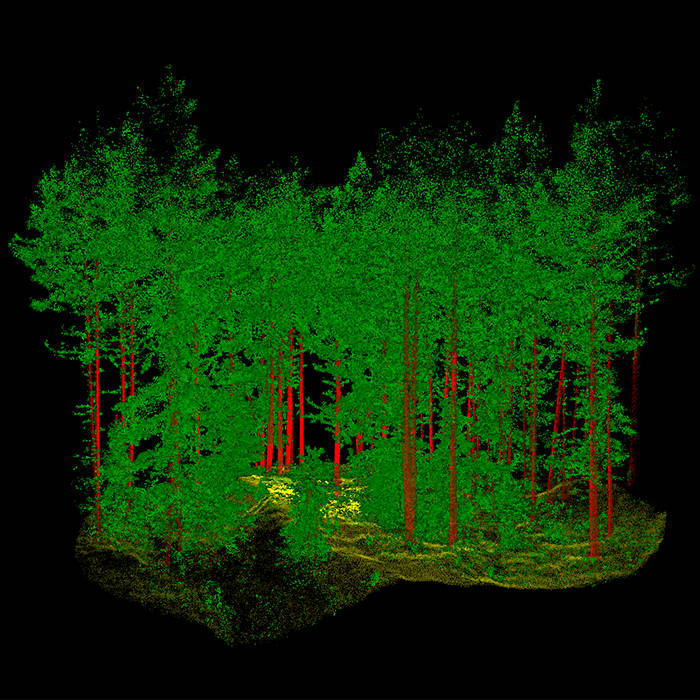
TLS is a useful tool for capturing forestry data. It’s commonly used for capturing highly accurate data beneath the tree canopy. With TLS, it’s possible to create high-resolution point clouds to measure parameters such as tree height and other structural information.
As Terrestrial Laser Scanners are positioned on a tripod, it can be challenging to use them effectively on uneven terrain and to gather data from above the tree canopy. Additionally, it can take longer to scan large areas using TLS, as multiple scans need to be captured and overlapped to accurately showcase the whole environment.
Mounting a laser scanner to a UAV or adopting photogrammetry gives specialists more versatility over the area that can be scanned. This method can capture detailed datasets from above the tree canopy, but it will struggle to penetrate through to the ground when flying over dense forests. Merging captured UAV information with other forms of data from the ground is useful when trying to gather a whole picture of the area.
Using a laser scanner that’s handheld or mounted to a pole or vehicle is one of the easiest ways to capture data. Handheld mapping systems can map large areas in a short amount of time, and across tough terrains. The data accuracy is high enough for many forestry applications, and the ease of use of the data capture makes it repeatable.
The versatility of handheld mapping solutions, combined with other mapping methods like UAV, gives users accurate data quickly and efficiently. This data is starting to be used across the sector in applications to help with deforestation, forest planning and wildfire prevention.
Applications for LiDAR in Forestry
LiDAR in forestry has a range of practical applications, from providing data to aid precision forestry or forest mapping, to biodiversity applications such as pollution modelling and to assist carbon absorption estimations.
Aerial LiDAR can quickly assess the volume of trees that have been chopped down and can compare it to predicted volumes so specialists can determine discrepancies.
A drone-mounted laser scanner could be used for powerline scanning, to detect any tree canopy clashes, or to help with forest planning and management. With the ability to map digital elevation, laser scanning can also be used for topography purposes and to document complex forest environments.
After capturing the data, specialist algorithms can be used to detect individual trees and to identify tree position. Algorithms help to segment individual trees for easy tree counts in large areas, which is also good for forest management.
LiDAR data can be analyzed to determine carbon absorption. Scientists will look for individual stand attributes such as the tree or crown diameter to help learn more about its carbon absorption properties.
Post-processing analysis can show specialist measurements ranging from biomass to dendrometric data of trees. This can assist with everything from assessing the suitability of forests for certain species of wildlife, such as birds, to strategic forest planning.
As world leaders battle to mitigate the impact of climate change, many people working in forestry are also using aerial LiDAR technology to predict the risk of forest fires and monitor the impact when they happen.
LiDAR data can map out and identify wood debris on the ground that might be the tinder, posing a wildfire risk. It can use this to track wildfire patterns, while change over time can suggest previous fire paths.
Examples of Mobile LiDAR in the Forestry Sector

The SFI SmartForest program, from the Centers for Research-based Innovation scheme of the Research Council of Norway, aims to position Norway’s forestry sector at the forefront of digitization by 2028. Its goal is to facilitate a free flow of information and real-time communication, which can help to increase productivity and reduce the environmental impact of the sector.
The program’s team knew it wanted to use LiDAR to inform its research. As well as needing versatility, the team required highly precise measurements to ensure they were monitoring the forest accurately.
Although TLS offered high levels of accuracy, the team required a solution that allowed them to complete data collection in a time-efficient manner. They also considered a UAV-based solution, but it was less effective at penetrating thick vegetation and couldn’t capture the required data range.
SFI SmartForest chose a handheld mobile mapping system, to scan the dense and rough terrain. It enabled the team to quickly capture large volumes of data from the ground and from the air, collecting highly accurate datasets and creating point cloud models to extract features including wood quality and biomass.
Following a successful initial period, the research program will continue to use the mobile scanner to create accurate point clouds which serve as the basis for deep learning research opportunities.
Tom Potter, a doctoral researcher at the University of Leicester, UK, set out to develop a technique to estimate biomass and carbon more efficiently using state-of-the-art mobile LiDAR sensors across multiple, complex forest environments.
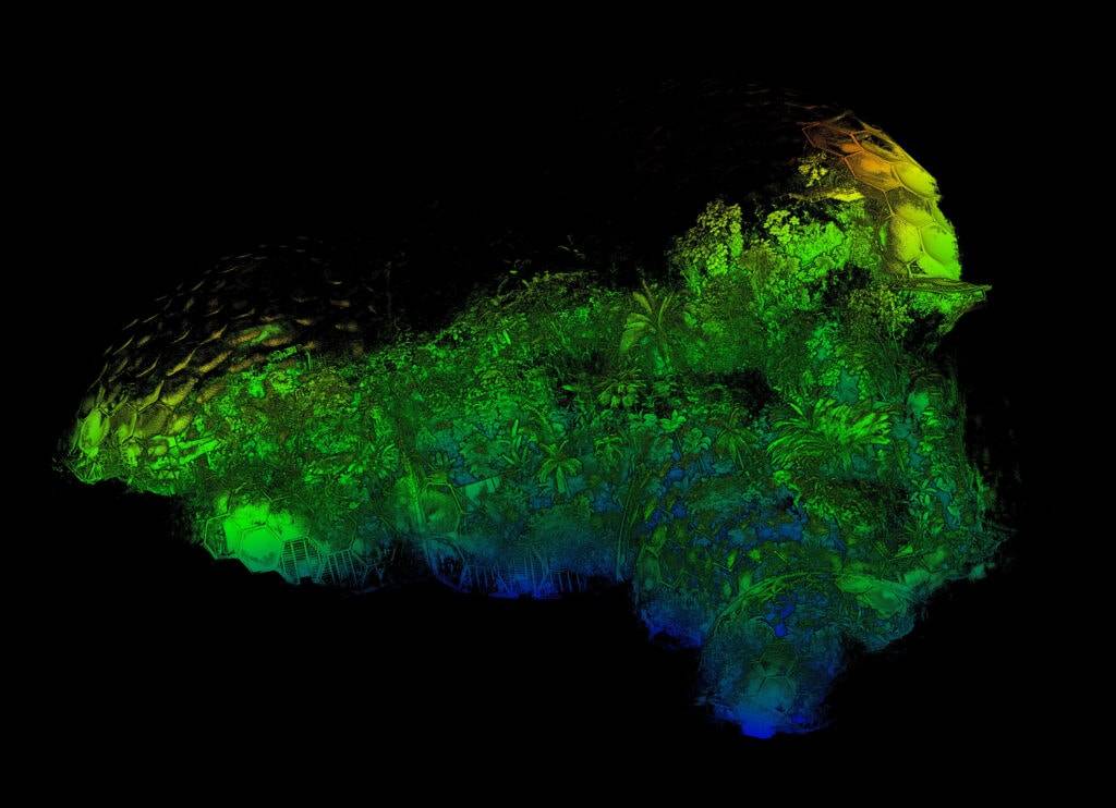
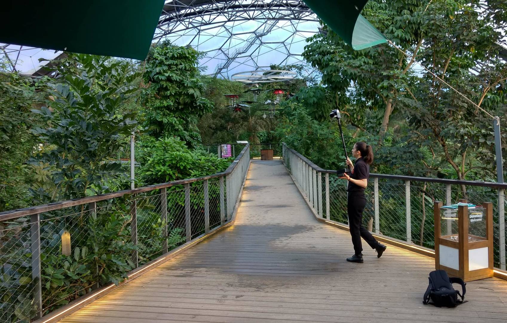
The Eden Project in Cornwall, UK, houses the world’s largest rainforest and species from the Mediterranean, North America and Chilean terrains, as well as a “rainforest” biome of more than 1,000 trees and plants. Tom chooses to gather data here to take advantage of the diverse datasets he could capture.
The portable SLAM scanner was chosen because of its ability to collect data quickly. After collecting over 43,000 measurement points per second the whole environment was scanned by walking in a simple circular loop.
Read more about the use of mobile LiDAR sensors across complex forest environments.
How Is LiDAR Changing the Forestry Sector?
Forest landscapes are typically rural spaces, with uneven and challenging terrain. They’re densely populated, which can make it hard to capture measurements for individual trees without obstructing objects or creating problematic shadows.
Mobile mapping LiDAR scanners overcome these challenges. It captures data up to 100m from the scanner and can be used as a handheld scanner or mounted to a pole, backpack, drone or vehicle, offering multiple ways to capture hard-to-reach areas with high levels of accuracy.
The time savings offered by mobile LiDAR are transforming the forestry sector. Now, taking measurements and surveying an area can take a couple of hours, rather than days on site, meaning it’s possible to make important decisions much quicker.
Additionally, with deep learning models and algorithms constantly improving, the data provided from LiDAR systems will only become more and more useful over time.