Last Updated on 26th July 2022
8 Things you didn’t know about LiDAR
LiDAR (light detection and ranging) scanning is being used across the world with all kinds of innovative, interesting and unexpected applications. A recent report by Technavio estimates that the LiDAR market will grow by $1.5 million by 2025, making it clear that there is increasing demand for this disruptive technology.
GeoSLAM is proud to be a part of the advances LiDAR technology is making in the way we live, so we thought we’d highlight some of the hidden uses (and successes) this technology is achieving every single day.
It Helps us Preserve the Wonders of the World
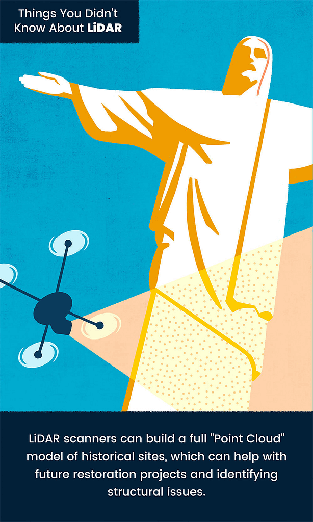
LiDAR scanning is already proving an invaluable tool in the field of historical preservation. The highly-detailed data sets created by LiDAR scanning can later be used to create 3D models of at-risk historical sites. This can then be used to keep any restoration work accurate.
This technique was used by the team behind a recent restoration project on the Christ the Redeemer statue. Scans were taken before the work started, so they could identify problem areas and make sure that none of the restoration work altered the look of the statue from its historic origins.
Similar scans have also been used on Notre Dame cathedral, which is being restored after a devastating fire in 2019. Large swathes of the building were destroyed by flames, but reference LiDAR scans are being used to make sure the renovations return the building to its exact original design.
One of the best parts of these scans is the resulting 3D models that can be made with the generated point cloud. These are already being used to create digital versions of historic monuments and artefacts which can be accessed and admired by people who can’t reach their geographic location. Read more about laser scanning for historic preservation.
It Can be Used to Recreate Crime Scenes
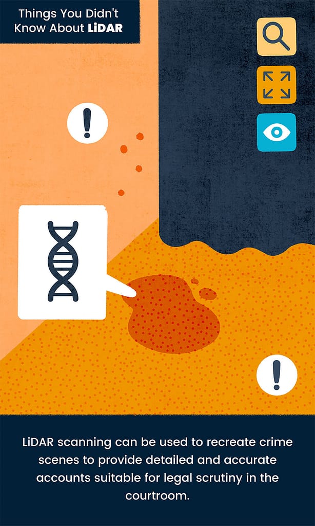
One unexpected area that LiDAR is revolutionising is the courtroom. The painstaking process of documenting a crime scene can be carried out in minutes using LiDAR scanners, with incredible detail and accuracy.
There’s no need to worry about vital details being missed with a LiDAR scanner – the exact positioning of every incidental item will be captured.
This intricate point cloud data is being used to create full 3D reconstructions of crime scenes that are used in the courtroom itself. Rather than relying on static photos, jurors are now able to consider clean, complex crime scene recreations that present every last piece of evidence clearly.
Beyond just saving time or effort, the use of LiDAR in forensics will ensure the accuracy of all collected data. In future, this even has the potential to reduce wrongful convictions and miscarriages of justice.
You can find out more about using LiDAR to rebuild crime scenes here.
We Can Use It To Create New Realities
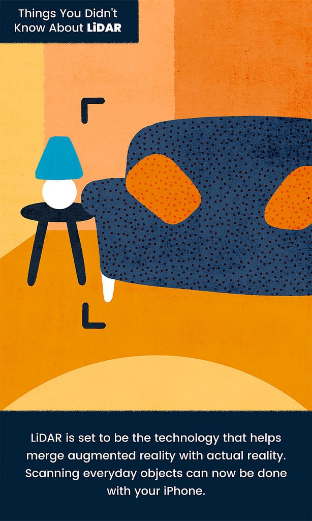
Believe it or not, low-fi LiDAR sensors are already being included in new smart phones. On a day-to-day basis, this technology is already helping to increase the quality of their cameras, improving autofocus and night vision images.
But the real potential for mobile phone and LiDAR integration lies in augmented reality. Plenty of apps are already taking advantage of the possibilities, allowing users to create digital versions of their own environments to play with.
There is talk that one day these digital worlds could even be crowdsourced to create intricate 3D worlds taking online maps (like Google Maps) to the next level.
Discover more about using LiDAR to blur the lines between reality and AR here.
It Helps Emergency Responders Deliver Aid After Natural Disasters
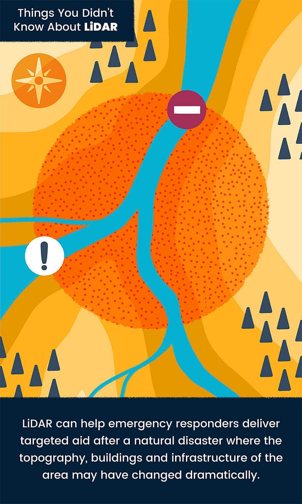
From wildfires that flatten whole forests to landslides that destroy entire villages, a natural disaster can completely transform a landscape. They leave existing maps less than useless and make already hazardous response missions even more terrifying as responders are left going in blind.
LiDAR technology can take super quick scans of dramatically different landscapes. These scans can be used to create new maps, understand the altered terrain and identify where response efforts should focus.
Read more on the use of LiDAR for disaster response and to help speed up the rebuilding of structures after hurricane damage.
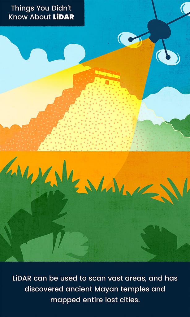
LiDAR Can Rediscover Lost History
As well as helping to preserve sites and artefacts for future generations, LiDAR is helping us rediscover lost history too. LiDAR makes scanning at scale simple, which means vast areas can be covered easily. Being able to map such expansive areas reveals patterns or features that would be missed without being able to see smaller sections as a whole.
Picking these features out takes a trained eye, and archaeologists are excited about the ways that LiDAR could open up forgotten worlds to them. In 2016, a group of archaeologists mapped out a Mayan city in Guatemala and not only did they discover lost areas of the city, but they were also able to learn more about the society that lived there.
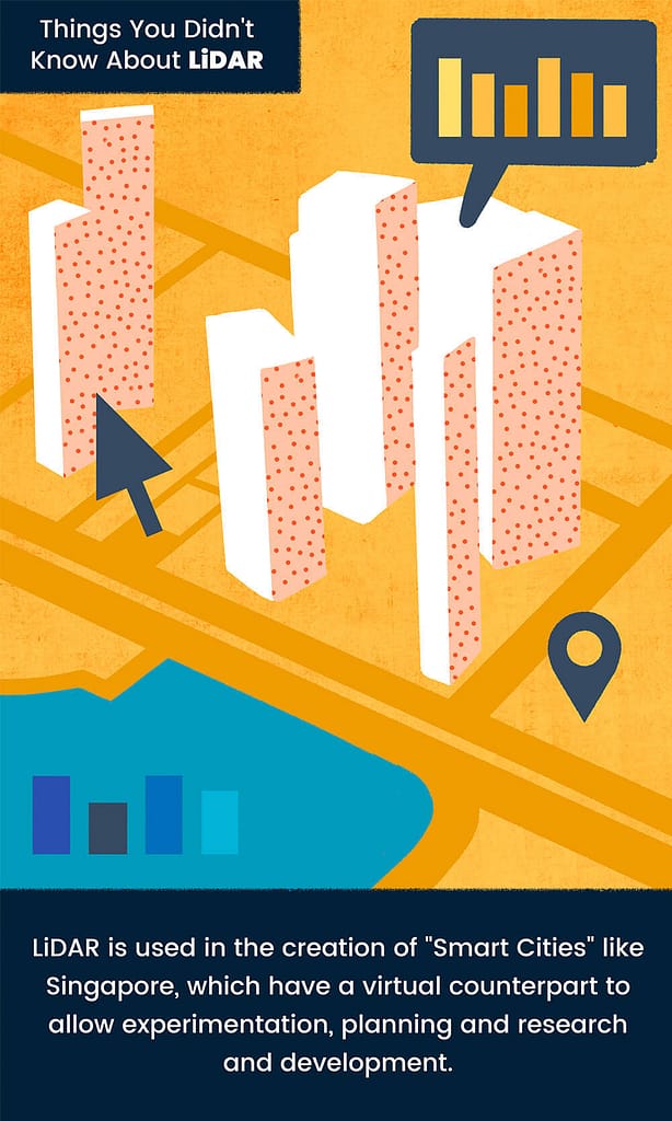
It’s A Key Component in Creating ‘Smart Cities’
LiDAR scanners proved invaluable in the creation of Virtual Singapore – a dynamic 3D digital model of the country. Perhaps, the most ambitious digital twin project in the world, Virtual Singapore is a fully realised virtual recreation of the city. It is accessible to the public, businesses, and government agencies and can be used to plan out anything from emergency evacuations to a lively night out with friends.
A variety of scanning methods were used to create this digital model, but LiDAR turned out to be essential when it became apparent that aerial images were missing massive chunks of the city. The lower floors of Singapore’s soaring apartment blocks were missed by other scanning methods but were considered vital to capture as they are popular community hubs and essential spots for city culture.
Thanks to the use of handheld scanners, quick, accurate scans could be taken that allows these important sections of these buildings (and society) to be easily included in the digital twin with absolute accuracy.
Read more about Virtual Singapore.
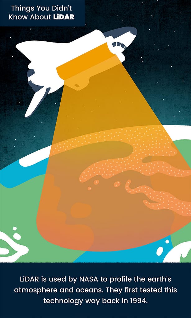
It’s Used By NASA to Profile the Entire Earth
As well as exploring space, one of NASA’s key jobs is measuring the earth’s atmosphere and oceans. They monitor the air pollution that humans create through traffic, machinery and fossil fuel burning. This helps them (and us) better understand the impact of this pollution, as well as identify the areas suffering most.
Using LiDAR allows NASA to monitor the conditions around the entire world, and their essential research is used to inform climate change policies in many countries.
As already mentioned, NASA were actually early adopters of LiDAR technology too, using it for ground-based research as far back as 1970. Their first major space project began in 1994, using an instrument called ‘LITE’ (Lidar In-Space Technology Experiment). As with their modern LiDAR systems, this was used to measure cloud cover as part of the Space Shuttle Discovery.
Learn about how NASA uses LiDAR.
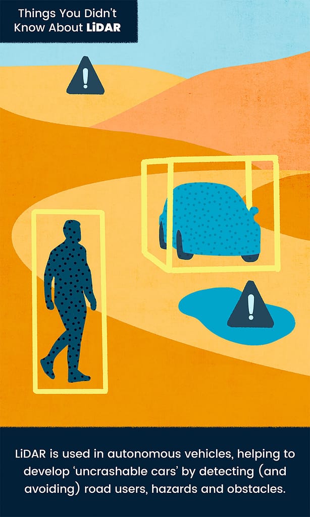
LiDAR Detection Makes ‘Uncrashable Cars’ Possible
LiDAR is a key component in self-driving or autonomous cars. Sensors are mounted to the front of cars, with projects lasers sending pulses of light to detect potential hazards including other vehicles, pedestrians and obstacles.
The further LiDAR technology evolves, the safer and more reliable these autonomous vehicles will become. One company is already using an advanced system that emits laser waves that are 50% longer than standard, greatly increasing the LiDAR sensitivity and range. With this technology available, the chances of developing an ‘uncrashable car’ are moving from possible to probable.
Read about LiDAR’s application in the development of autonomous vehicles.
LiDAR: What’s Next?
Of course, though we call it ‘modern’ technology, LiDAR is not all that new. In the early days, it was not widely used, but the development of handheld scanners and improvements in the software that support them have seen its use soar over the last couple of decades.
The applications for LiDAR scanning are endless. As this technology develops, we’re likely to hear much more about LiDAR in our everyday lives. But as you can see, it’s already out there doing so many exciting things across the globe.
Want to try GeoSLAM LiDAR for yourself?
Find your local dealer to arrange a demonstration.


