The ultimate mobile
mapping solution
Your versatile tool to capture, process and understand the world around you.

Effortless data capture
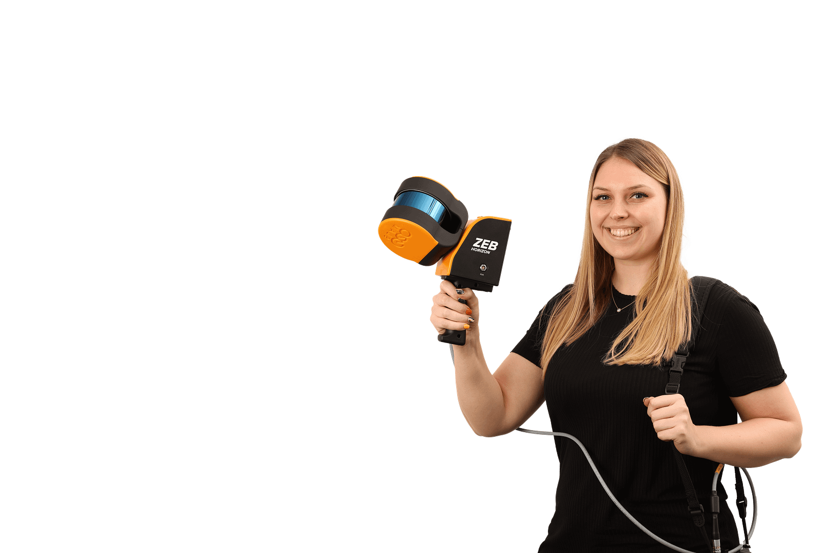
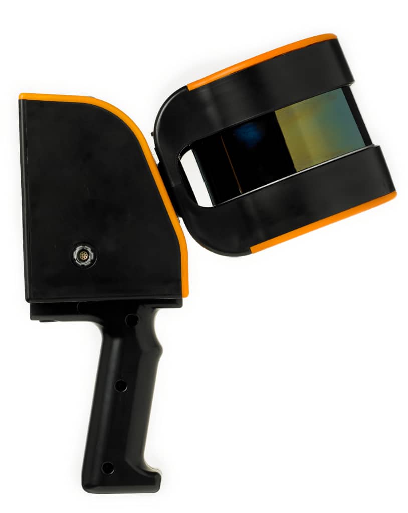
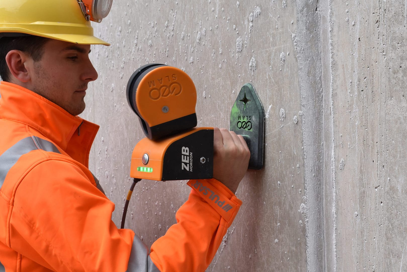
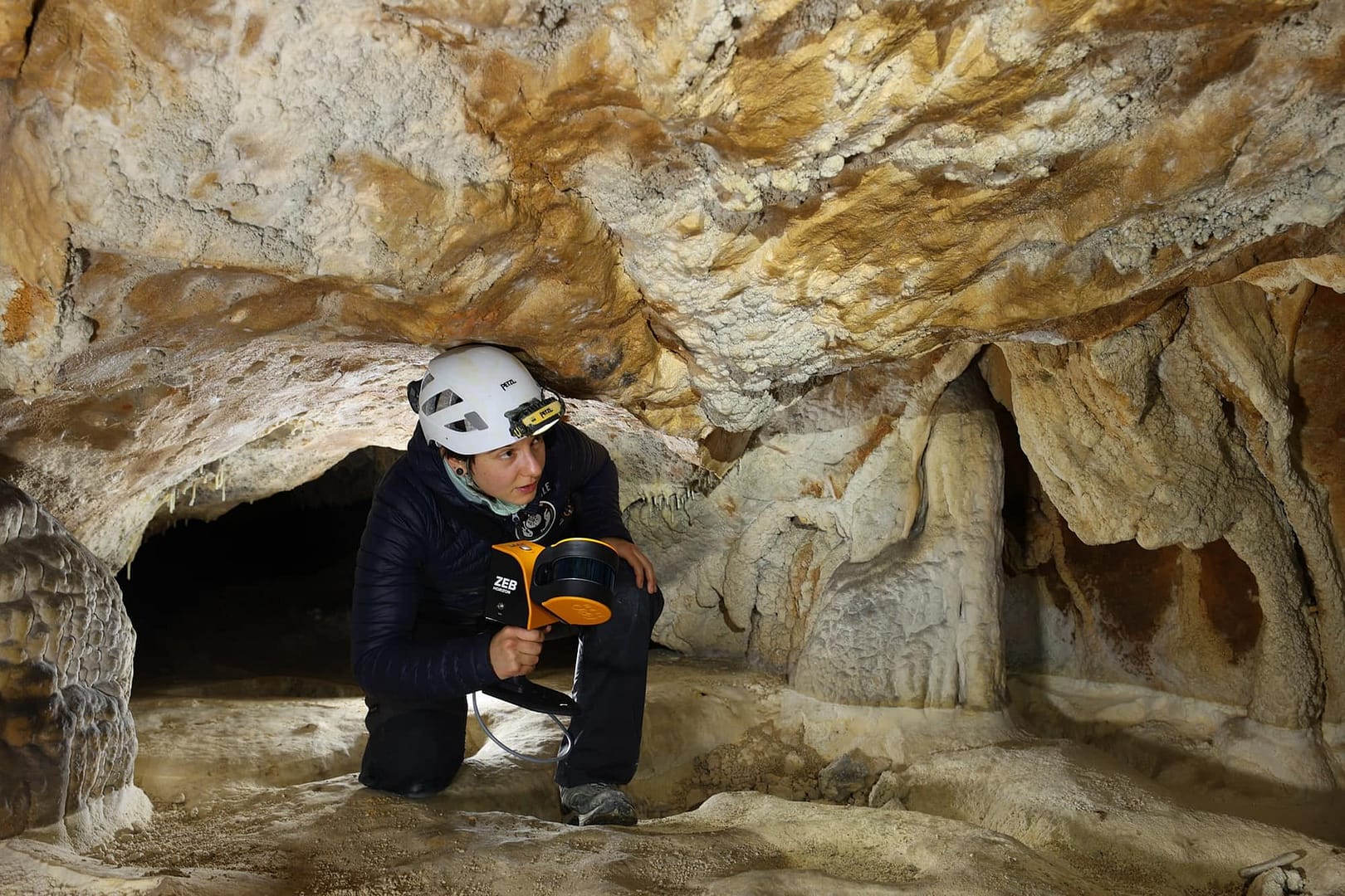
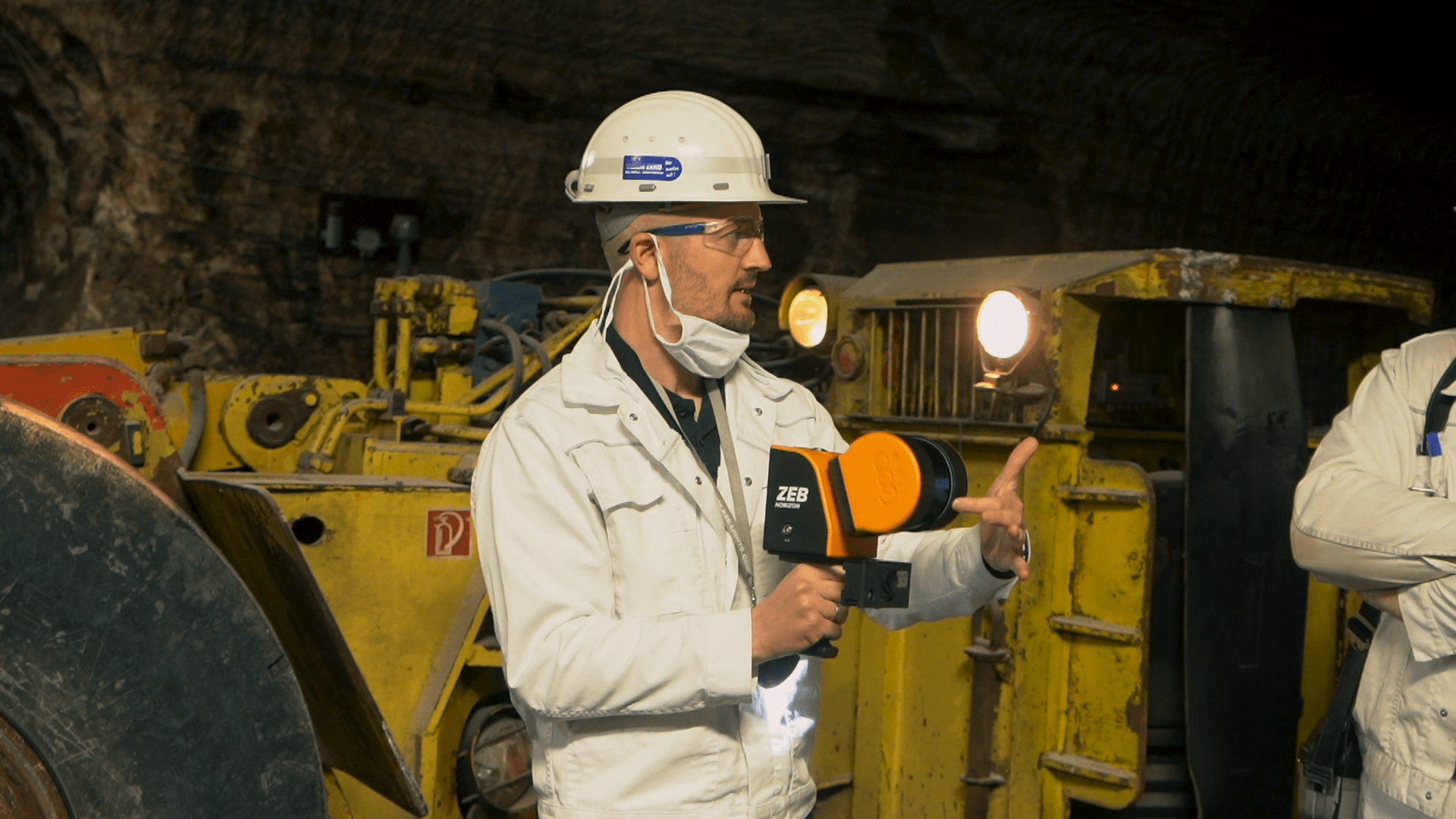
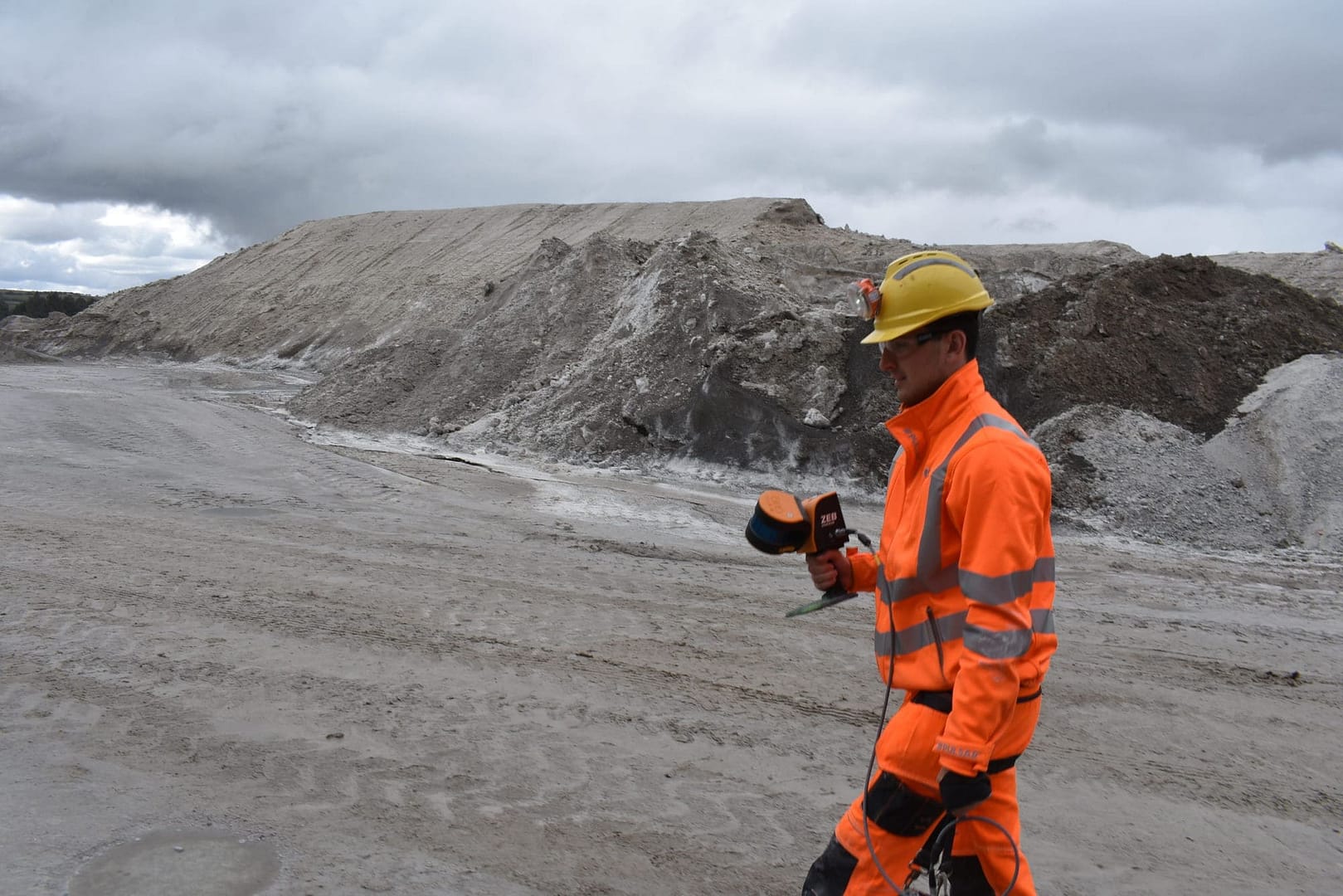
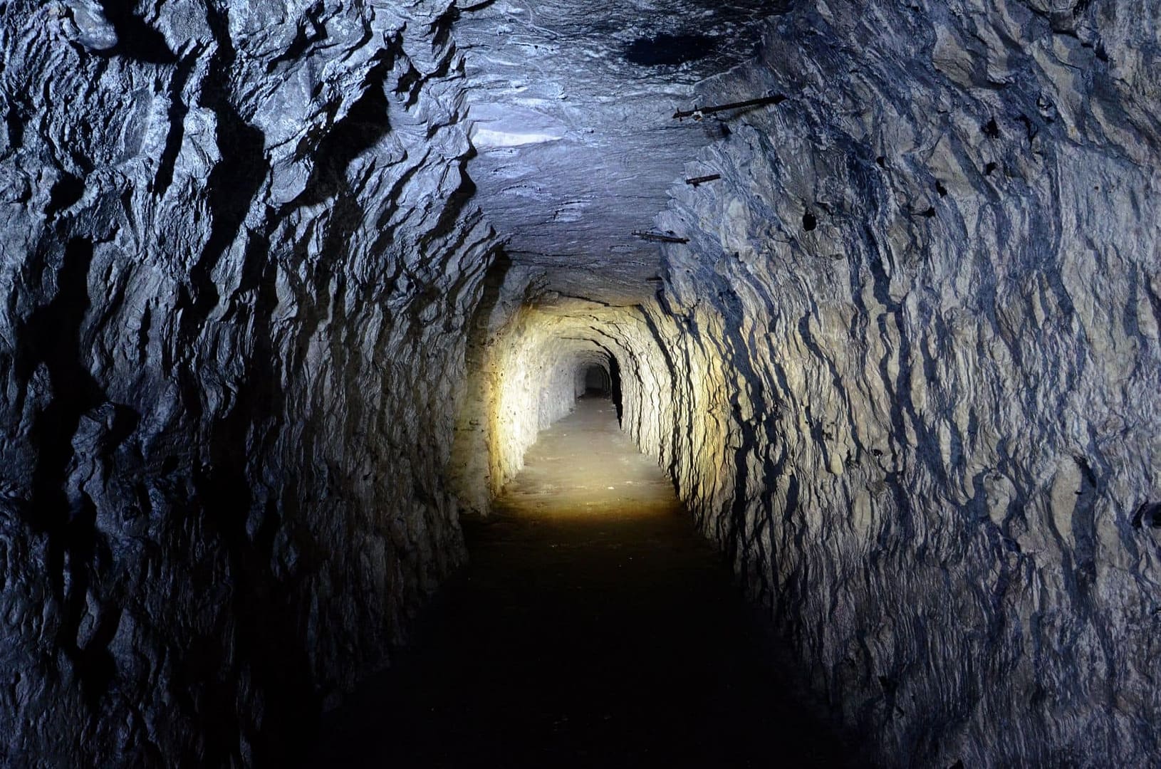
A handheld LiDAR scanner, suitable for drone mapping applications as well as indoor use. This powerful tool helps make the mapping process simple. With a range of 100m, the ZEB Horizon is great for outdoor use including spaces where features are positioned further apart.
Specifications and Features
Its lightweight and compact design also make it perfect for indoor surveys. If you want flexibility in your data capture methods, the ZEB Horizon is the solution for you. Here’s the low-down on the ZEB Horizon:
Points per second
Number of Sensors
Relative accuracy
Range
Speed
With 300,000 scanner points per second, it’s fast work scanning both simple and complex environments. You can carry out high-quality scans in less time.
Portability
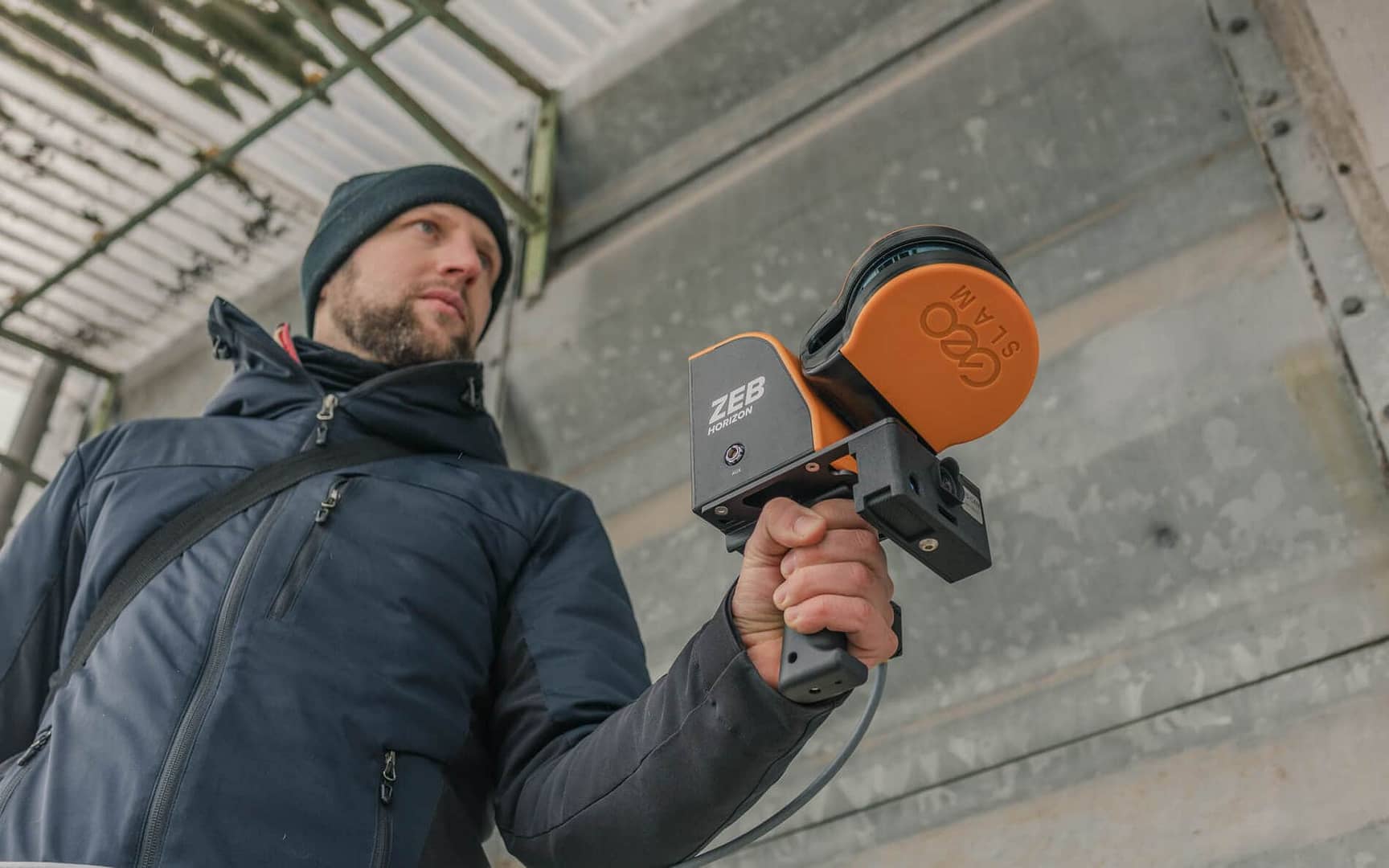
Light weight and portable, you can move freely whilst using this device. This portable 3D scanner features a rotating LiDAR sensor for the widest field of view. Its compact size and ergonomic design make it a delight to use.
Accuracy
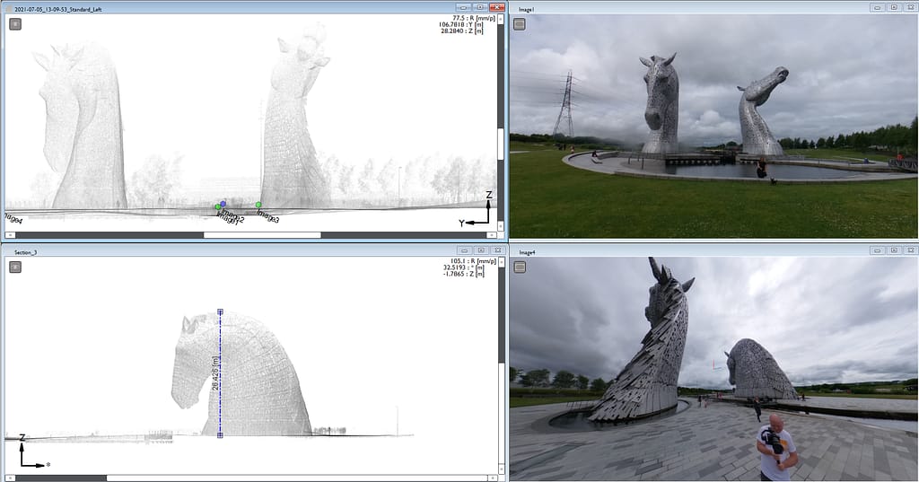
The ZEB Horizon provides 3D scanning with a survey grade relative accuracy of up to 6mm dependant on the environment. This gives you accurate scans and fine details.
Versatility
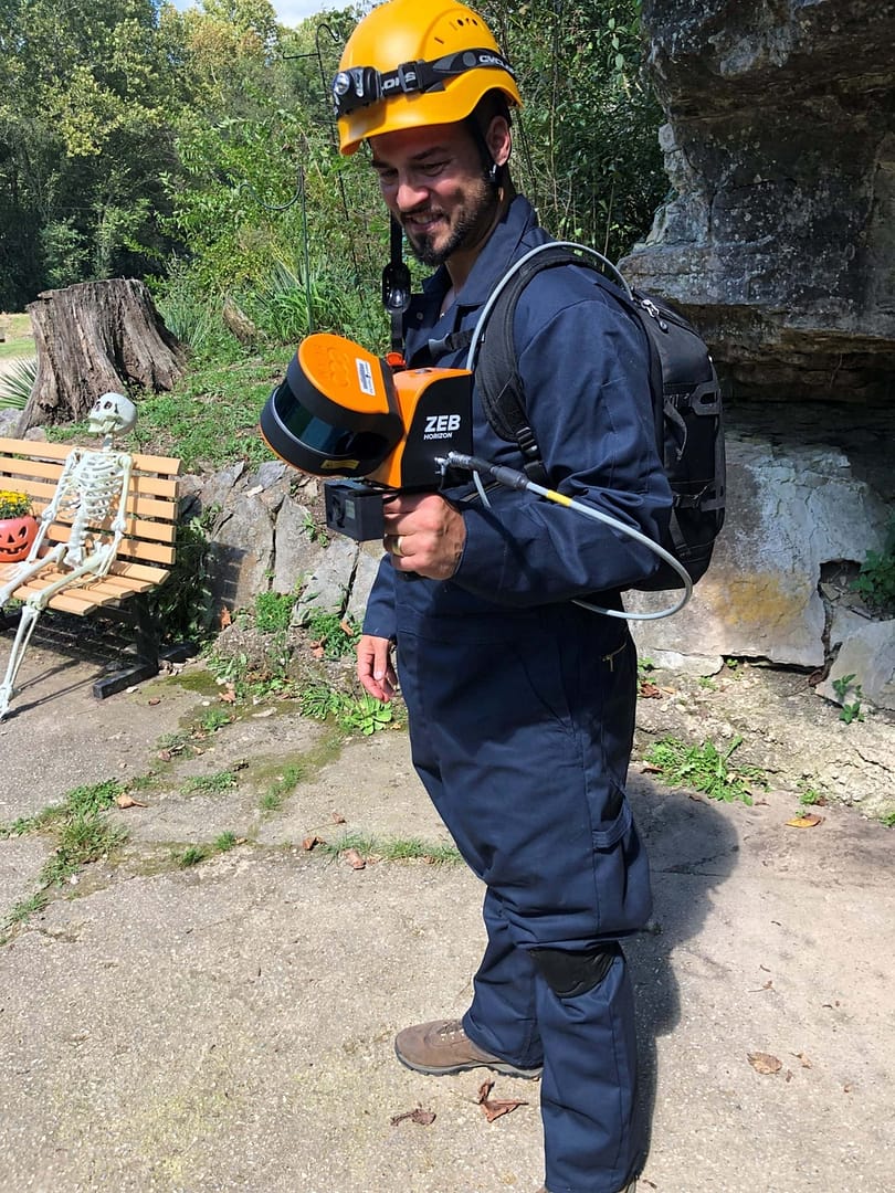
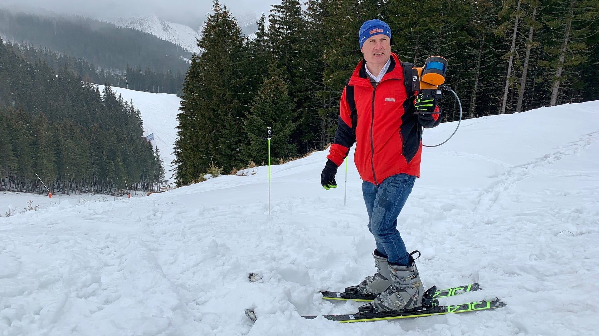
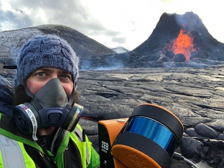
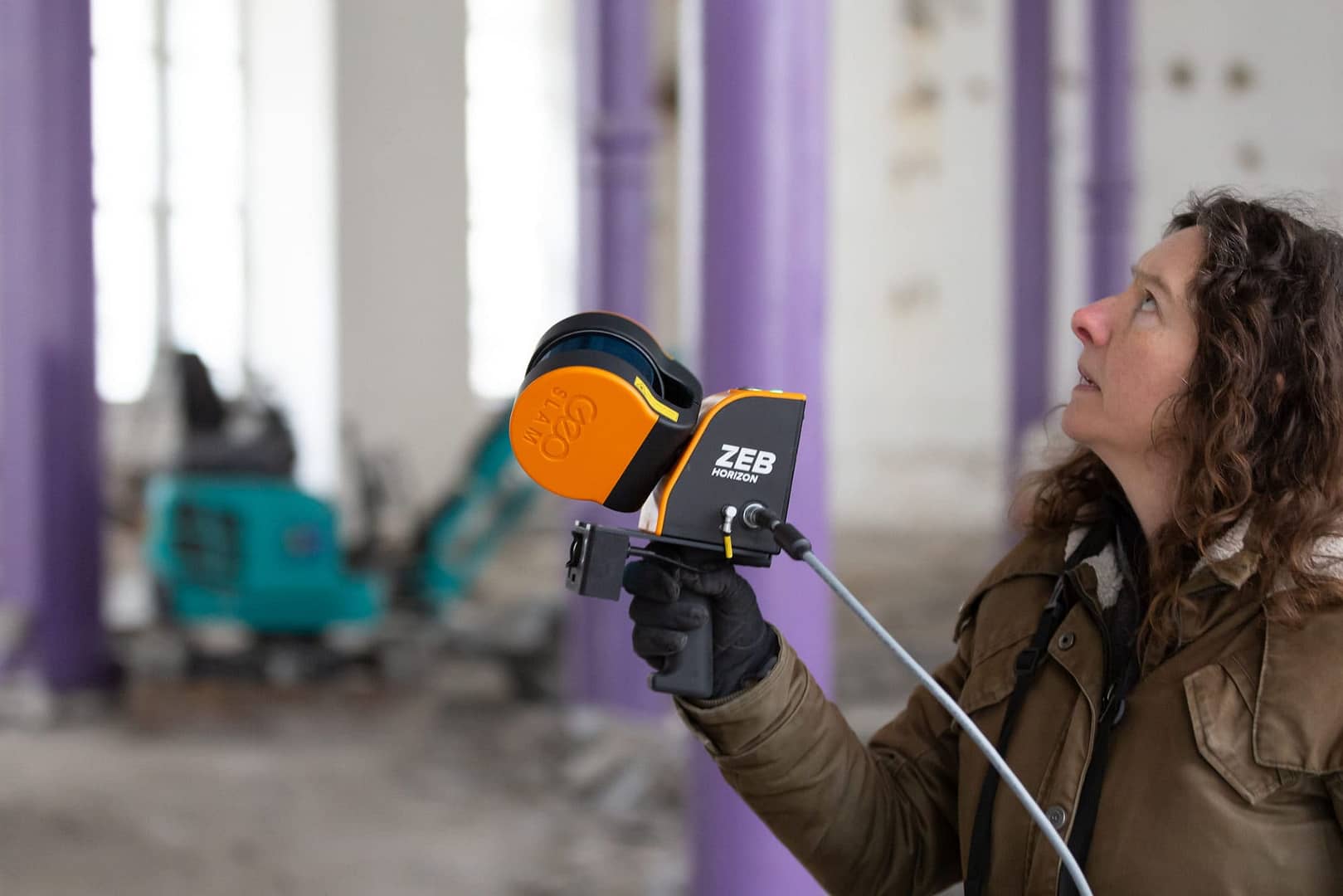
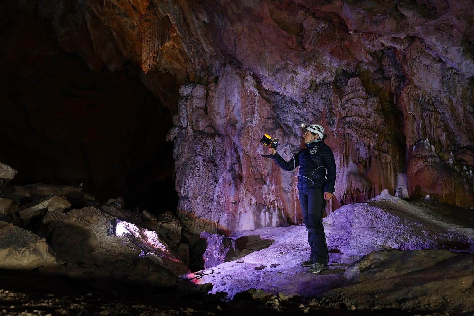
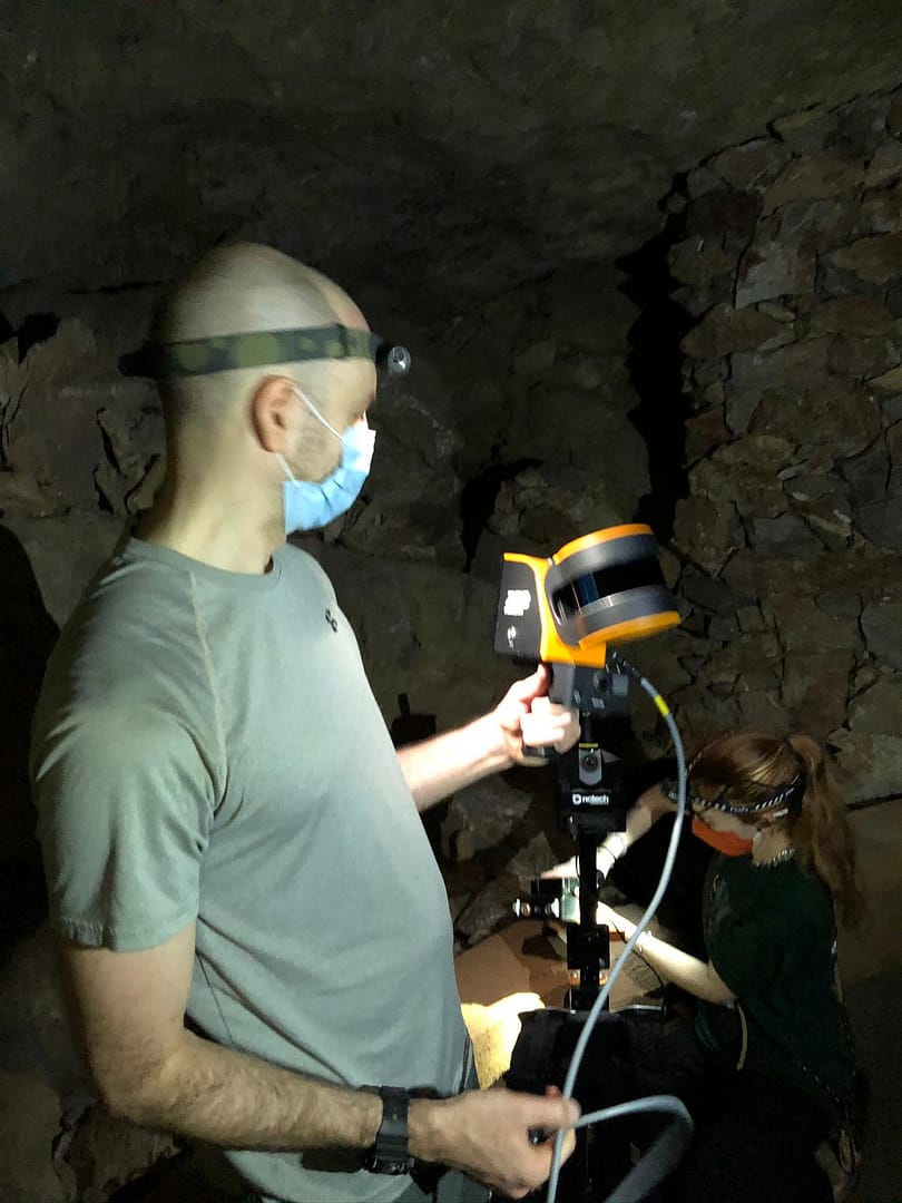
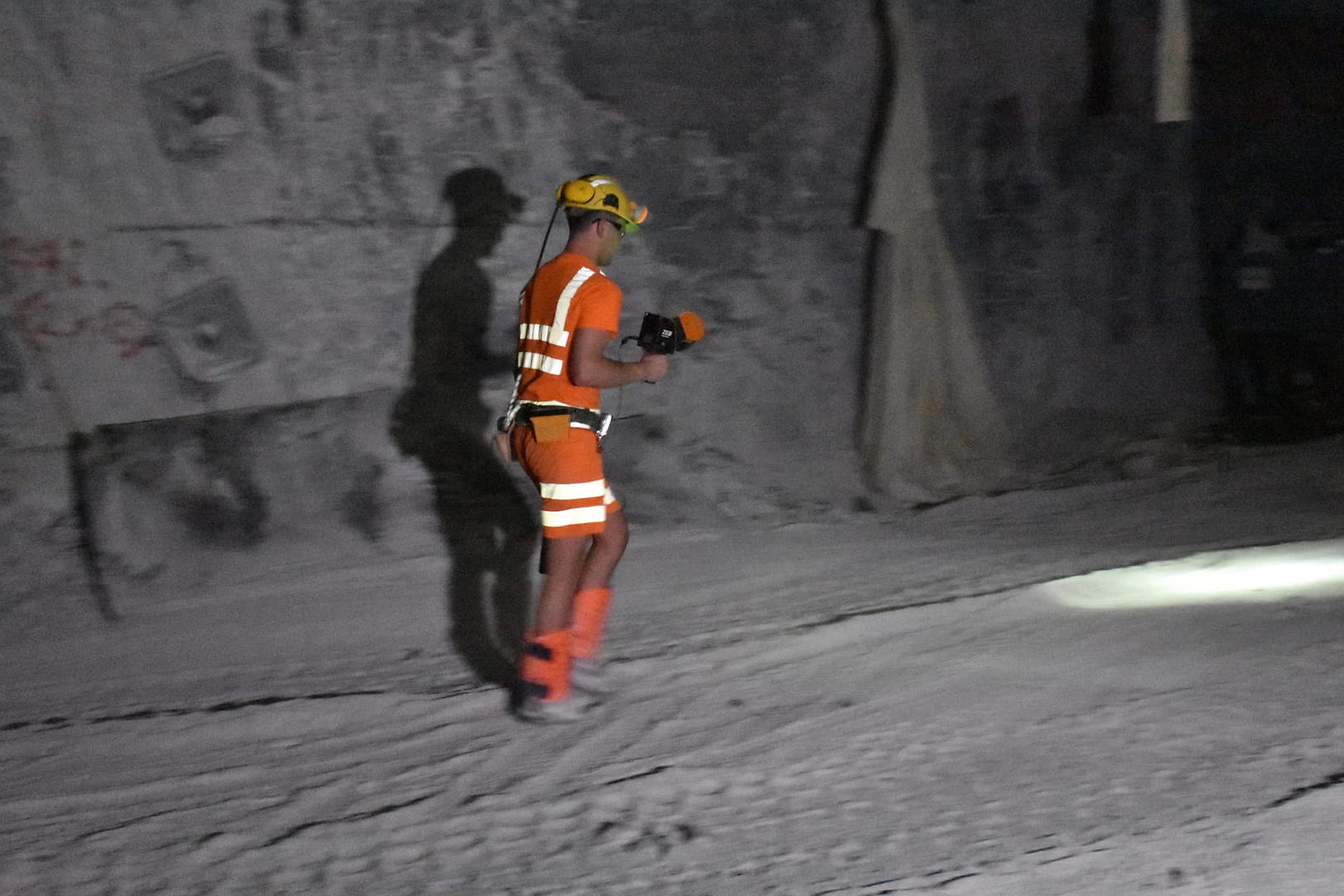
With a range of 100m, the ZEB Horizon is our most flexible 3D laser scanner yet. Use it outdoors, indoors or underground. Mount it to a drone, a backpack or a vehicle.
The ZEB Horizon
Now available in real-time
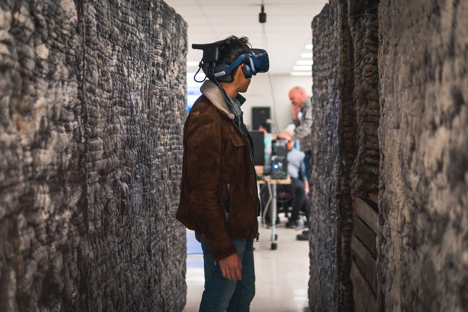
Our most flexible scanner now available with real-time data previews. The ZEB Horizon RT allows you to track your progress as you scan. It is the ideal, easy-to-use tool to gain real-time insight into your scans and to see your point cloud being created as you walk.
Your tool to capture, process and understand the world around you
With powerful SLAM technology at its heart (we call it GeoSLAM Beam), the ZEB Horizon can be used in areas with poor GPS – such as indoors, underground or outdoors.


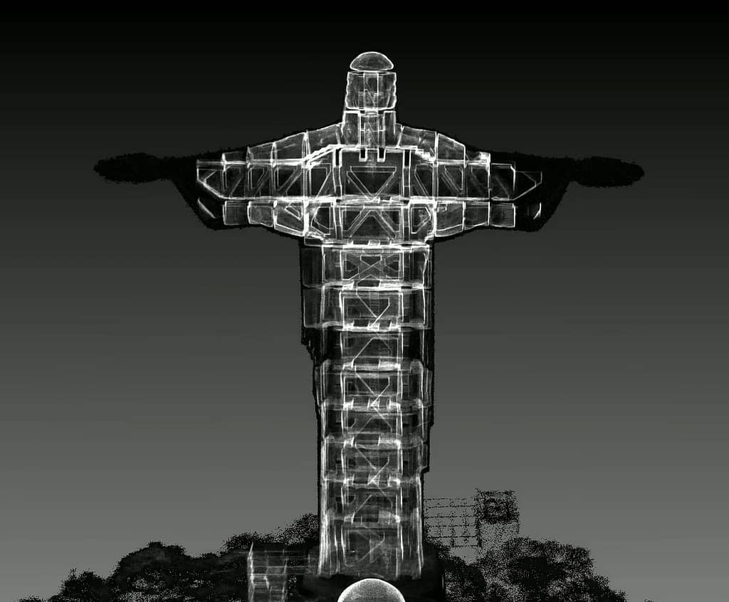
Build a highly accurate 3D model within minutes
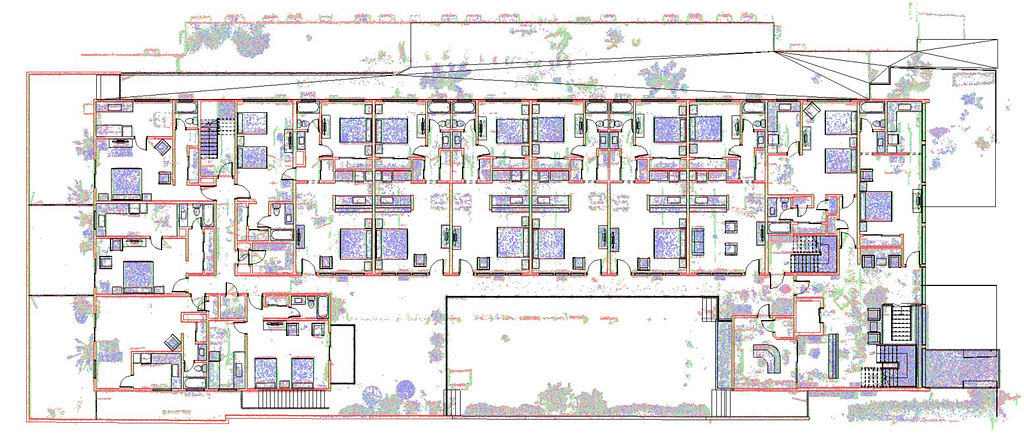
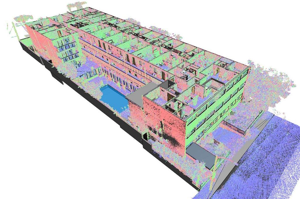
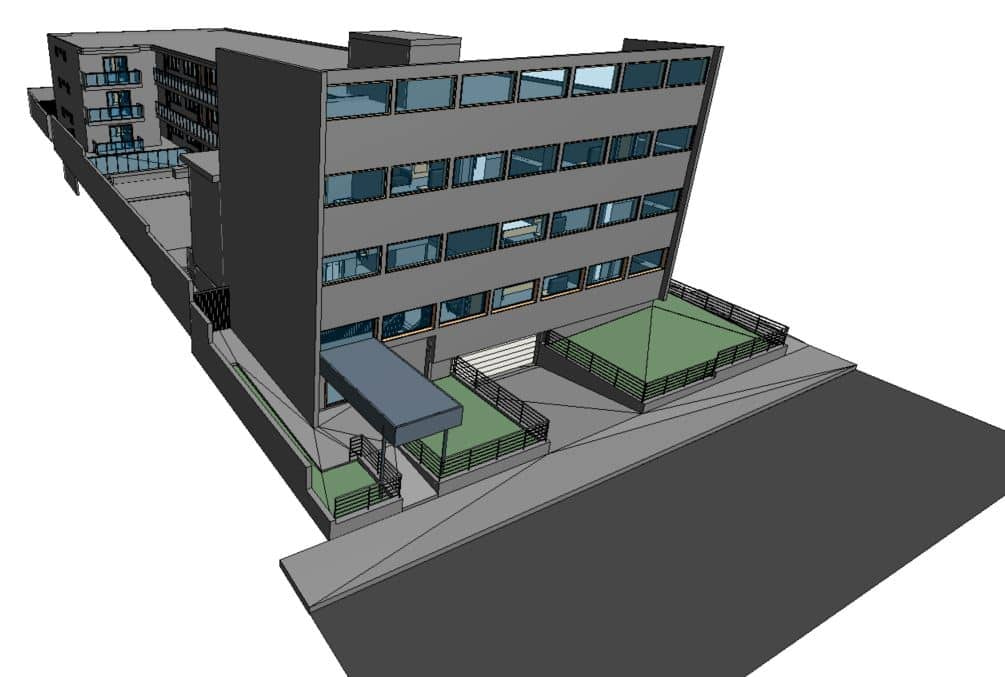
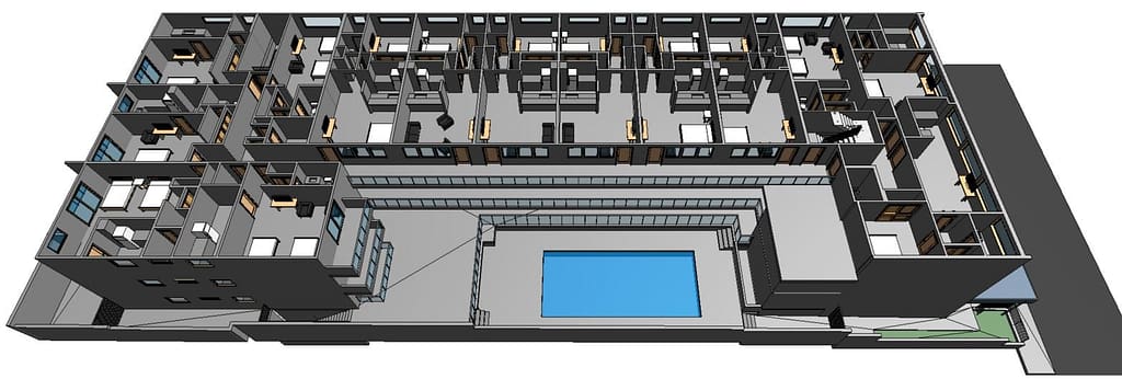
One handheld 3D scanner
so many ways to use it
Lightweight and rugged, simple to use, fast to capture and easy to process giving you the most accurate information you need to make the most important decisions. The ZEB Horizon is a complete 3D scanning solution for accurate, high quality and professional results.
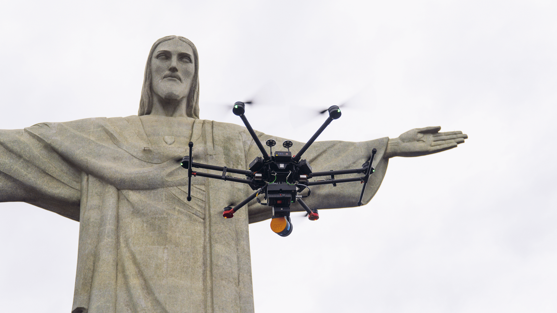
The ZEB Horizon is as flexible as you are. Use handheld or pair with one of our many mounting options. Take your ZEB to the skies by mounting to a UAV or reach those difficult places with the cradle or pole.
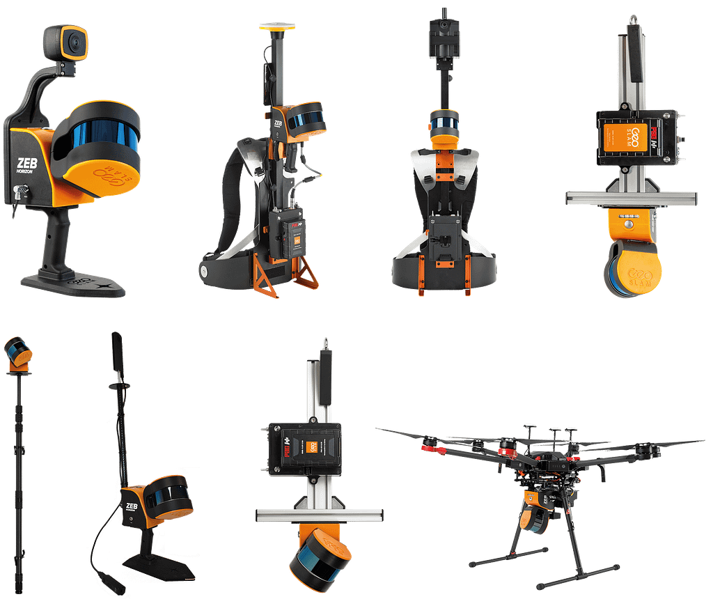
Easily capture and colourise data with the ZEB Vision accessory
With simple and easy deployment, the ZEB Vision attaches quickly to the ZEB Horizon to capture colourised data and 360° panoramic images in minutes. Get a new perspective on your data.
3D scanners powered by
next generation SLAM technology
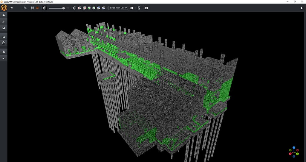
Create clean, georeferenced point clouds automatically with FARO Connect
With the press of one button, your data will be automatically processed, saved in a folder of your choice, and prepared for the next step of your workflow. Connect comes as standard with all our ZEB 3D laser scanners.
All photographs and data you capture are yours to own and manage – keeping it safe, simple and secure.
GeoSLAM data is compatible with software that works for you with universal file formats (LAZ/LAS/PLY/TXT/e57).
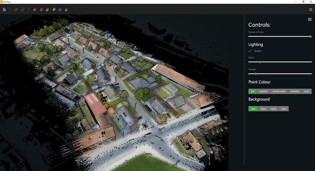
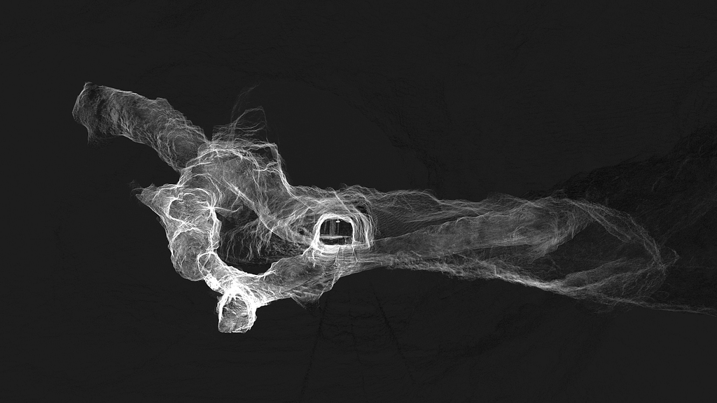
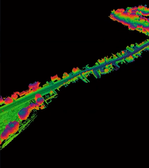
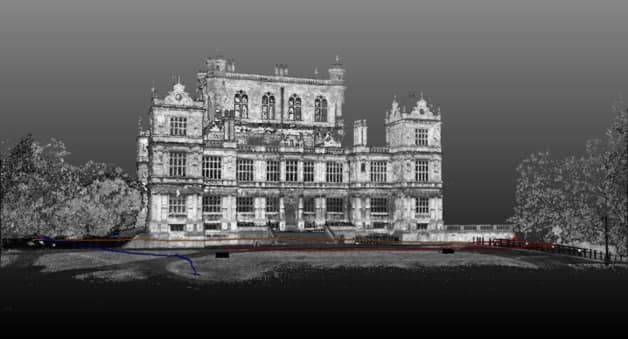
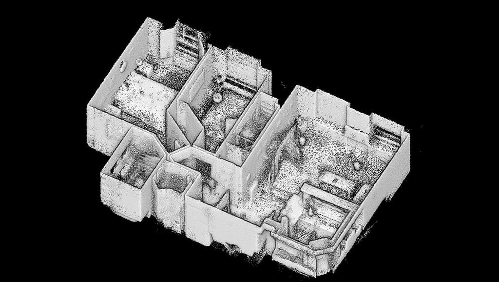
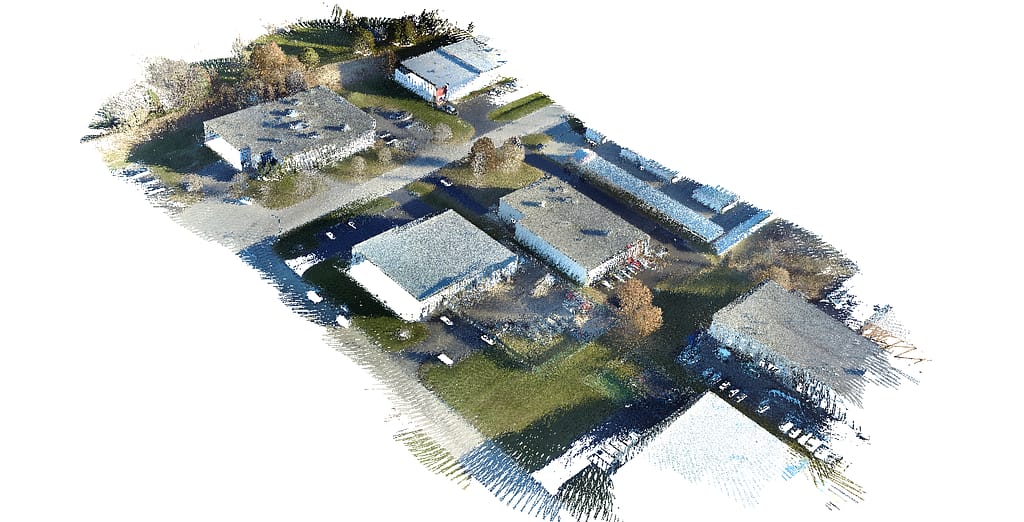
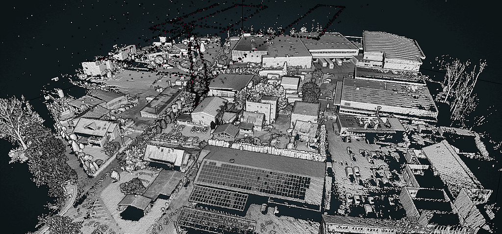
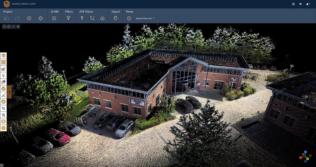
Sample data from our ZEB Horizon handheld 3D scanner
Click the links below to view ZEB Horizon data in our online viewer.
Harbour
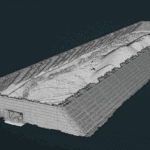
Stockpile
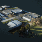
Urban
The ZEB Horizon handheld 3D scanner in action


GeoSLAM success stories


What our customers say
“Thanks for making one of the most amazing tools ever invented, I have been dreaming about this kind of product and you have actually made it possible.”
Fredrik Stenström
3D artist/BIM-coordinator, WSP Group Sweden
“We use the ZEB Horizon very often, mainly for measuring the volume of material dumps and measuring forest areas and so far it has proven to be an outstanding piece of equipment.”
Igor Nađvinski
Geokarta
“Moving to mobile lidar technology has allowed PPM to gather accurate field data crucial to our architectural As-Built surveys at a speed much faster than our previous processes. We bought our first ZEB Revo in 2017 and we now have a fleet of 5 Revos and 4 ZEB Horizons. GeoSLAM laser scanners have transformed our As-Built production workflow in a way that has allowed us to scale our business Nationwide.”
“This new addition to our surveying tool arsenal opens up a whole new field for us and the possibility to expand into other areas of the surveying industry. In the short time we have had the scanner, new and existing clients have been amazed at how quickly we can produce detailed 3D images and impossible views, that can easily be imported into CAD platforms. We are still learning and discovering the full capabilities of the kit, but once we have got to grips with it on ‘terra firma’ we intend to take to the skies with a heavy lift drone.”
Neil Walton
Managing Director , CPS Drainage
“This is an amazing state of the art unit that’s allowing us to build a three dimensional model of 8km worth of underground mine workings at sub centimetre accuracy. It’s very cost effective and much faster than standard surveying, collecting 300,000 points per second. The technology and the level of detail produced from the data is really quite remarkable!”
Bob Archer
CEO & Director , Newrange Gold Corp
“The ZEB Horizon was a gamechanger… it’s just amazing in terms of scanning distance, power of the sensor and the ability to easily capture the entire plaza.”
Peter Garran
Founder, Aerial Genomics
Want to know more about the ZEB Horizon?
News
Keep up to date with the latest news and thought leadership from GeoSLAM.
FARO Acquires Mobile Scanning Market Leader, GeoSLAM
FARO® Technologies, Inc. a global leader in 4D digital reality solutions, today…
The ZEB Horizon: Now available with real-time preview
Available to order from today, 15th of August, the ZEB Horizon is…


