The way we understand buildings is changing.
The digitalisation of buildings is here, and its set to revolutionise the way we understand our spaces. Use GeoSLAM Floorplans for the rapid and automatic creation of 2D floorplans using mobile LiDAR and analytics.
Lost income
Estimated due to undervalued property globally
Buildings scanned
Using GeoSLAM
The data
You own
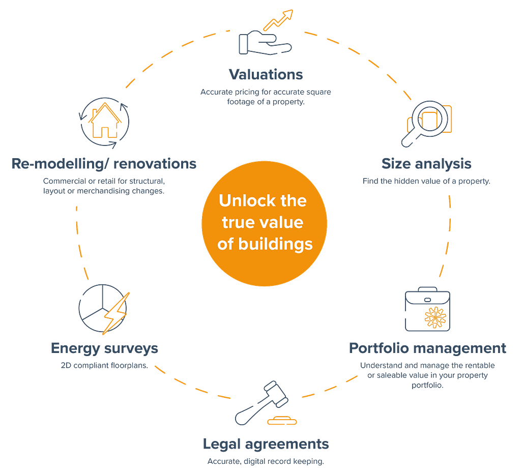
Why GeoSLAM Floorplans?
How does Floorplans work?
GeoSLAM Floorplans combines hardware, advanced SLAM and analytics to give you the information you need to create accurate, rapid floorplans.

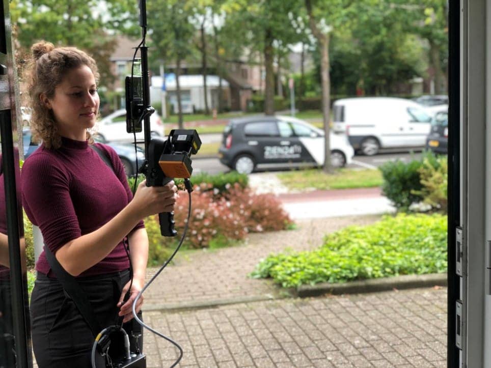
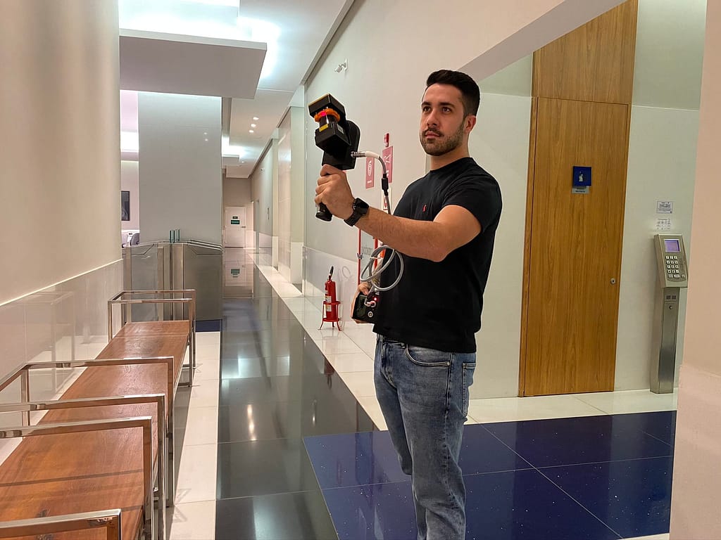
1.It starts with SLAM
SLAM (Simultaneous Localisation and Mapping) creates a digital model of a site, by using a handheld mobile scanner. The SLAM technology used inside GeoSLAM’s product portfolio was developed by some of the smartest people on our planet.

2.Capture
Using GeoSLAM’s mobile mapping system, capture measurements by walking freely between rooms and floors. As you walk around a property, 43,000 invisible, harmless laser beams are emitted each second, and this is what forms a digital map.

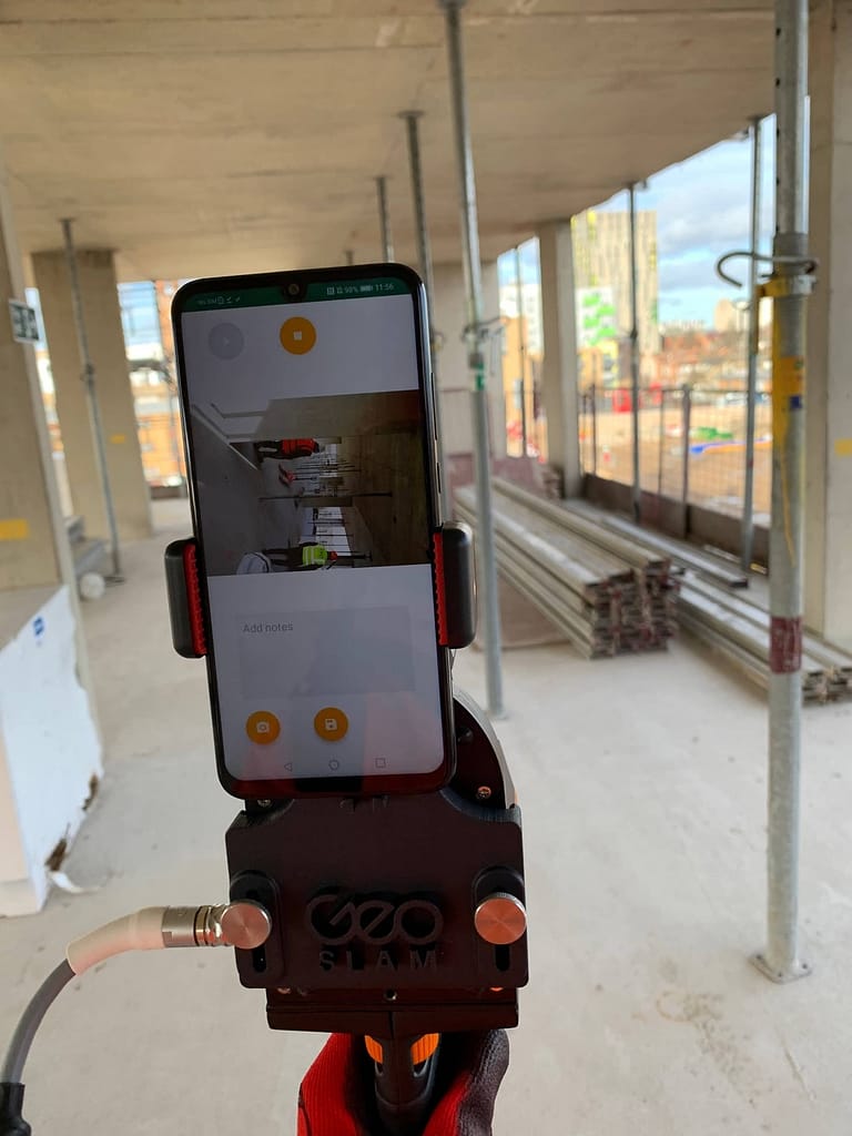
3.Process
Plug your ZEB scanner into a computer, and we’ll automatically process the data using our smart data platform, Connect. We can set the file to be automatically saved to a network folder of your choice, each time a scan is completed.

4.View
See your digital capture in minutes.

5.Create
Automatic slices of each floor are extracted from your 3D model, and your floorplans are ready.

6. Where next?
Your floorplans can be exported and uploaded to other software, such as Floorplanner.com
Floorplans in action
The Real Estate sector is on the move
With ever accelerating technological advances year on year, businesses across all sectors cannot afford to become complacent. We only have to think of companies who have failed to innovate and have been left behind as rapid digitalisation overtook their dated business models, with examples like Blockbuster and Kodak easily coming to mind.
Real estate is not immune to technological advances and those that move to adopt new technology quickly enough, often end up being the biggest beneficiaries. Traditionally real estate businesses tend to fall behind when it comes to adopting new trends, however in recent years with the introduction of PropTech, more companies in this sector are exploring what technology could do for them.
Want to learn more about GeoSLAM Floorplans and how it could transform your business?
Learn more about our ZEB scanners
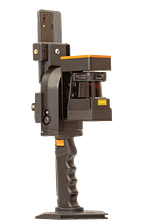
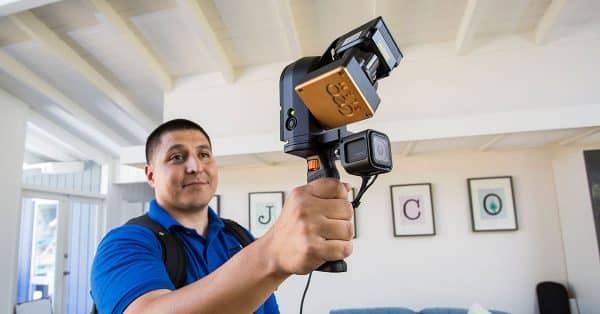
ZEB Revo RT
Handheld, lightweight and easy to use, the ZEB Revo RT allows you to build highly accurate 3D models within minutes, while on the move.
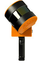
ZEB Go
If you’re looking for a reliable way to map and understand spaces, meet the ZEB Go – your first step in SLAM handheld technology.
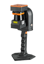
ZEB Horizon
With a range of 100m, the ZEB Horizon is great for outdoor use. Its lightweight and compact design also make it perfect for indoor surveys.
News
Keep up to date with the latest news and thought leadership from GeoSLAM.
Powering the future of SLAM
As the adoption of SLAM rockets, and new applications for…
GeoSLAM takes a stroll down mystery lane
Revealing the fascination of a unique historic treasure A…
How Builders by Design are integrating GeoSLAM into their workflow
Established in 2001, Builders by Design Ltd are a multi-disciplinary…


