The way we understand buildings is changing
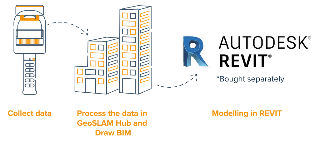
“Scan to BIM” means capturing a space, and turning it into a digital model that can be used for planning, monitoring or managing the built environment, and communicating and sharing project information with stakeholders.
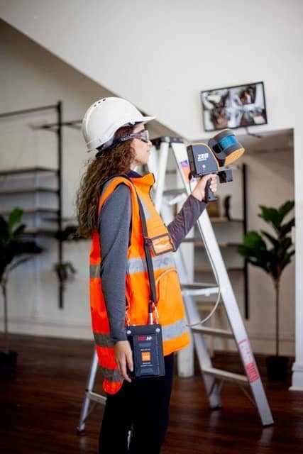
With a GeoSLAM lidar scanner for buildings the scan to BIM process is a simple way of rapidly capturing essential information about a space, creating a point cloud and importing the data into a BIM software, like Autodesk REVIT.
Why GeoSLAM Scan to BIM?
Compatible BIM software
Take your GeoSLAM data into the following BIM software packages.


We’re a member of
We understand the challenges
Save time
Use GeoSLAM for all data capture on site for rapid information when you need it
Save money
No outsourcing required, easy and simple handheld scanners

Digitalise your spaces
Unlock valuable information about buildings through their lifecycle using a digital representation
Compatibility
Easily export GeoSLAM data to third party software packages
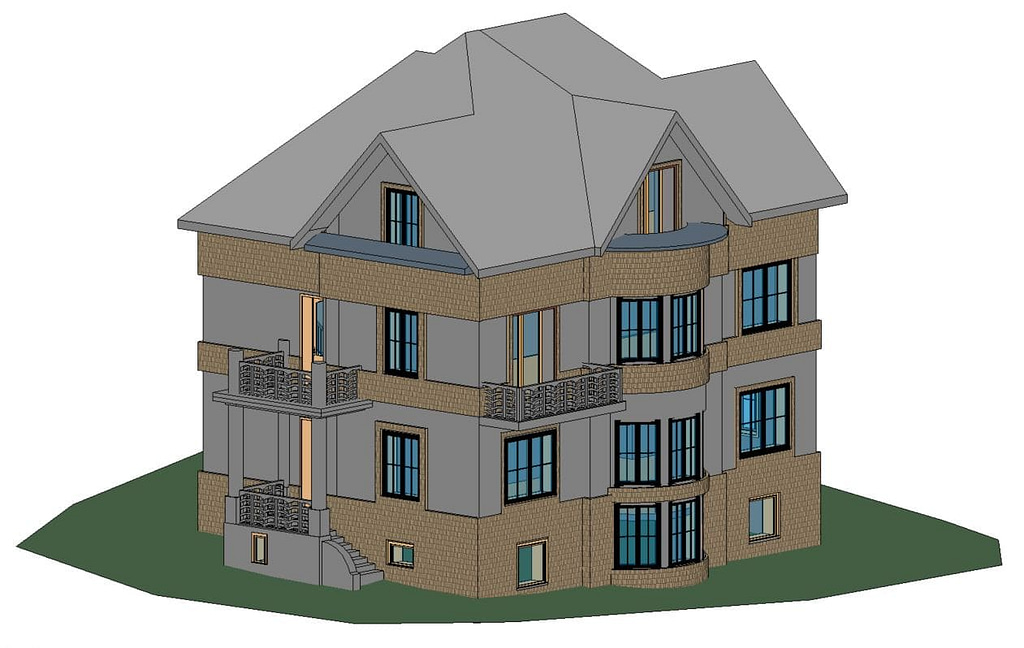
Case study 1:
Large family home
Step 1 : Collect data
Where: A large family home in the outskirts of Prague, Czech Republic
Goal : Create a 3D model in REVIT to assist in the redesign of the property
Products used: ZEB Go, Draw BIM , Autodesk REVIT
The ZEB Go, handheld mobile mapping system was used to collect all data required over three storeys within 8 minutes of turning the scanner on.
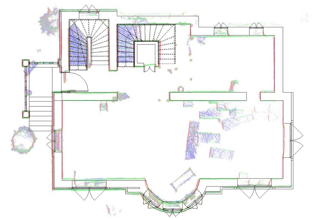
Step 2 : Process the data in GeoSLAM Hub and Draw BIM
The data is uploaded to GeoSLAM Hub on site, which creates a 3D point cloud. The point cloud is natively opened in Draw BIM, an add on package to GeoSLAM Hub. Floorplans and sections are extracted, so the data could be aligned and walls squared up. The data is exported in RCP format, ready to be loaded into REVIT.
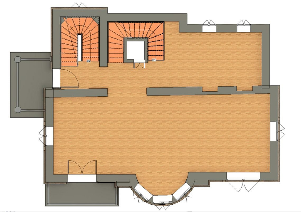
Step 3 : Modelling in REVIT
A new REVIT project is created, and the technician creates levels and corresponding views, using the point cloud for reference. Walls, doors, windows, the roof, and other key architectural and structural components were modelled. The finished model is LOD (level of design) 300.
Scan to BIM time: 8 hours
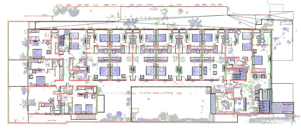
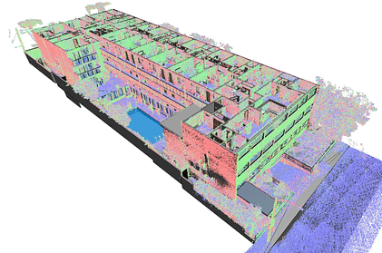
Case study 2:
45,000 sqft hotel
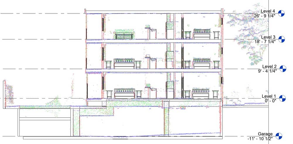
Where: Hotel, Southern California. 3 floors, parking garage, 40 suites over 45,000 square feet.
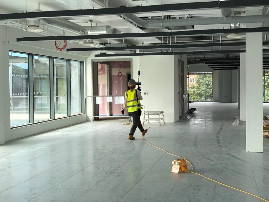
The data was collected in 5 scans, each between 15-25 minutes, using the ZEB Horizon.
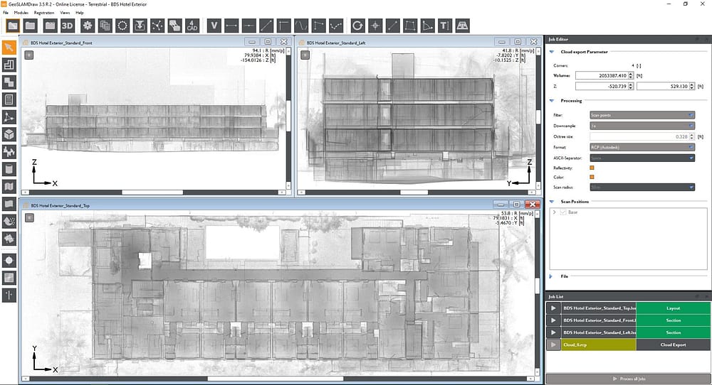
Each capture is then imported to GeoSLAM Hub, processed with SLAM, and registered together with the merge tool. The merged data is then brought into Draw BIM to be aligned and prepared for use in Revit.
The point cloud is exported as an Autodesk ReCap RCP project out of Draw BIM. That RCP project is then inserted into Revit to be used as an underlay for accurate and detailed BIM development.
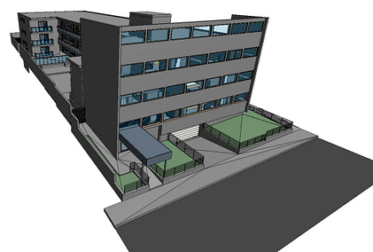
The data is then modelled in REVIT using only native Revit tools.
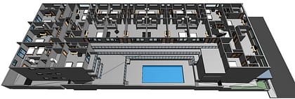
Modelled to LOD (Level of Development) 300 – Architectural, Structural, Casework and Furniture (No MEP).
Scan to BIM time: 4 days
Case study 3:
University pump room
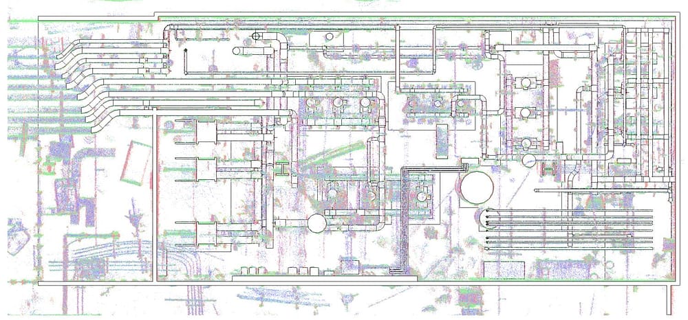
Where: Pump room at a large university campus.
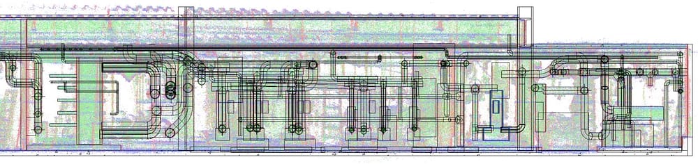
The data was collected in 10 minutes using the ZEB Horizon and imported into GeoSLAM Hub.
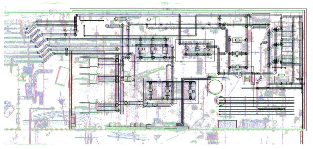
The data is uploaded to GeoSLAM Hub on site, which creates a 3D point cloud.
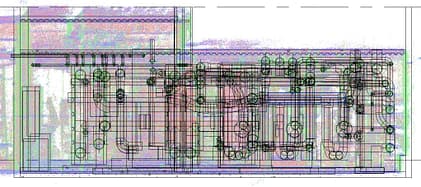
The point cloud is then natively opened in Draw BIM, an add on package to GeoSLAM Hub.
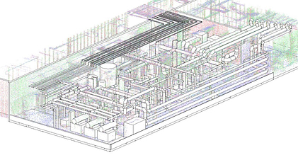
The data is then modelled in REVIT using the native MEP modelling tools.
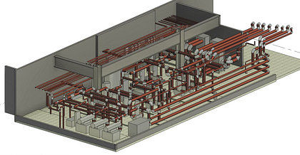
Modelled to LOD (Level of Development) 200, all pipes with a diameter larger than 1 inch are included.
Scan to BIM time: 10 hours
Greg Davies of PPM tells us how they use GeoSLAM for As-Built surveys
What is the Scan to BIM process?
The lidar-to-BIM process combines hardware, advanced SLAM and our Draw BIM software to rapidly deliver accurate 3D models for construction projects.

1. It starts with SLAM
SLAM [Simultaneous Location and Mapping] creates a digital model of a site, by using a handheld mobile scanner.

2. Capture
Walk freely between
rooms and floors.

3. Process
Transfer the data to
GeoSLAM HUB.
4. View
View your digital capture
in minutes.

5. Create
Using GeoSLAM Draw BIM, prep
your point clouds.

6. Where next
Import your data straight from
Draw to Revit or any other compatible BIM software.
Scan to BIM in action

Greg Davies of PPM tells us how they use GeoSLAM for As-Built surveys
“What really stood out was the quality of information captured, which was easily incorporated into a BIM representation using REVIT software. The device was really easy to handle and it was remarkable how much detail we were able to captured in the point clouds. It enabled us to achieve a level of accuracy that would have been impossible with manual techniques.”

BIM Technology Consultant
Paragram
“It has exceeded our expectations. We’re seeing a 10 fold increase in building survey productivity.”

Russell Klein
Archidata
“The first improvement with the GeoSLAM laser scanner was time saving, you’re just walking at a relaxed pace through the building, and its doing the magic for you a far as capturing all of that data.
I don’t think that I’ve ever had one project where I got all the information that I needed, that’s another attractive piece about the GeoSLAM, that you can take one tool out into the field and get everything that you needed. For us GeoSLAM was the perfect fit for architecture.”

Jordan JD Dixon
Architect Project Manager at SLA Architects
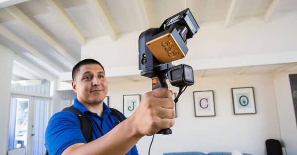
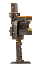
Learn more about our ZEB scanners
Choose one of the following scanners to pair with our Draw BIM software.
ZEB Revo RT
Handheld, lightweight and easy to use, the ZEB Revo RT allows you to build highly accurate 3D models within minutes, while on the move.
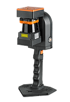
ZEB Go
If you’re looking for a reliable way to map and understand spaces, meet the ZEB Go – your first step in SLAM handheld technology.
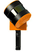
ZEB Horizon
With a range of 100m, the ZEB Horizon is great for outdoor use. Its lightweight and compact design also make it perfect for indoor surveys.
News
Keep up to date with the latest news and thought leadership from GeoSLAM.
What is BIM and how does it impact the construction industry?
What is BIM and how does it impact the construction industry? There’s…
Laser scanning with Pointknown CEO Jim Foster
Jim Foster has worked in the surveying industry for over 18 years,…
Laser Scanning in Southern California
SLAM scanning is becoming more commonplace in the surveying industry due to…


