Last Updated on 25th April 2022
Harvey Wright is sales manager at Seiler Design Solutions, a GeoSLAM dealer based in the US Midwest. In this Q&A, we explore how GeoSLAM products are helping the American architecture, engineering and construction (AEC) sectors, the origins of Seiler, and what could be the next big thing in surveying.
Can you tell us about Seiler Design Solutions and your own role with the company?
Originally founded as Seiler Instrument and Manufacturing Company in 1945, Seiler is a distributor of surveying software and instruments, microscopes, and Zeiss Planetarium equipment.
With manufacturing, geospatial, medical, planetarium and design solutions divisions, we are based in St Louis, Missouri, with additional sales offices in Indianapolis, Kansas City, Milwaukee, Omaha, and Chicago.
I joined the company in 2006 and my role is as a sales manager for Seiler Design Solutions, which has been a reseller of Autodesk software to the AEC sector for more than 30 years.
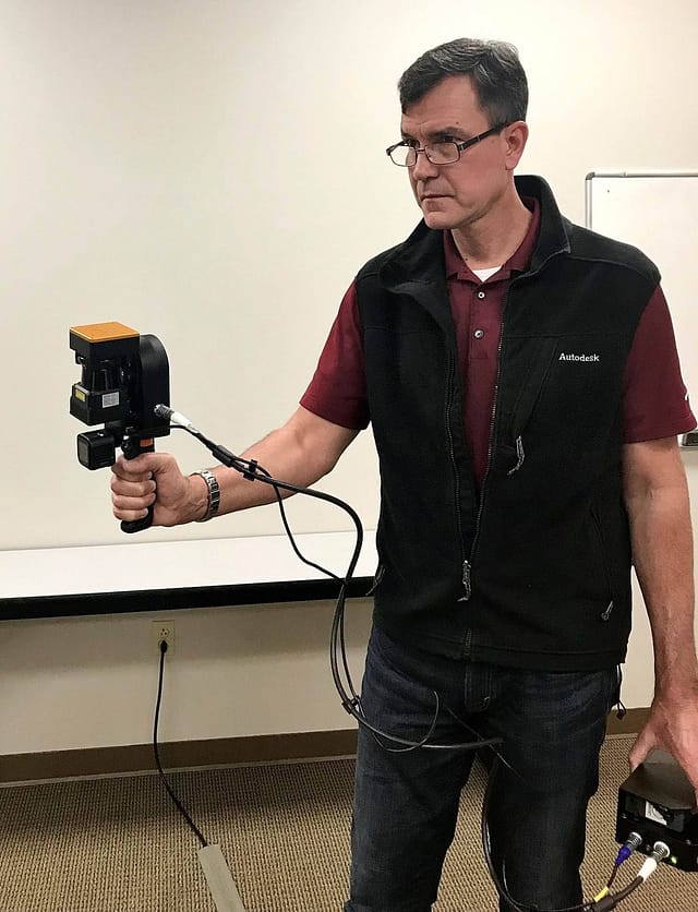
Harvey scanning Seiler’s headquarters in St. Louis, Mo with a ZEB Revo
How long have you been working with GeoSLAM?
We began working with GeoSLAM two years ago. Our geospatial division has a long tradition with static based scanning and when Seiler Design Solutions adopted hardware and software workflows into its portfolio, GeoSLAM was a natural fit.
We started out with the ZEB Revo and have adopted every new product since then, with the most recent addition being the ZEB Locate. This new device has been received really well, with the ability to create an accurate point cloud and integrate it with GPS data in minutes proving to be invaluable for surveyors.
The utility and ease of use of GeoSLAM’s handheld devices makes them a fantastic solution for the sectors our customers operate in. I also really enjoy working with the whole GeoSLAM team, whether it’s the marketing, sales or product departments, it’s a really proactive partnership and we get great representation.
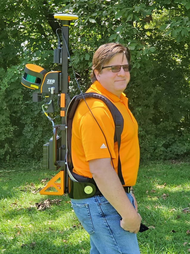
Mark Schnesk, Sr. Application Engineer for Seiler Design Solutions with the ZEB Locate
What challenges are your customers facing and how do GeoSLAM products help?
Many of our customers are held back by the constraints of static scanning. Traditional scanners tend to be heavy to move around, must have targets arranged and also require multiple set ups. With GeoSLAM products, as long as you can walk in a straight line you are away – it’s that easy!
Effective construction and engineering projects depend on each stage being completed to strict deadlines and surveyors only have a short amount of time to be able to take measurements and compare them to plans. This means that delays caused by using static scanners can be very frustrating for all involved.
Using a handheld SLAM scanner on site has been revolutionary for many Seiler customers. They are easy to use, can be taken anywhere and allow architects, engineers and surveyors to complete projects on time and on budget.
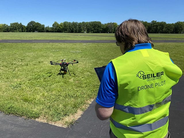
Mark is also a drone pilot for Seiler and is pictured here using a ZEB Horizon mounted on a UAV
What makes GeoSLAM stand out from its competitors?
For me, it’s the combination of speed of capture alongside the accuracy that is inherent in the SLAM algorithm.
When you see the integrity of the data as well as the ease of use and speed of capture it becomes clear why GeoSLAM products are so popular. If an architect, for example, forgets to get certain measurements on site, this can be incredibly frustrating and time consuming. The joy of laser scanning, and GeoSLAM in particular, is that you don’t miss anything – or if you need to re-scan, it doesn’t take long.
What do you think is the next big thing for the surveying sector?
The sector is becoming increasingly mobile and I expect this trend to continue, even for hyper-accurate scanning.
I also expect to see photogrammetry provide a growing challenging to the surveying sector. The ability to do photo capture could leapfrog all kinds of LiDAR.


