Mapping a gold mine with the ZEB Horizon


Industry
Mining
Scan time
15 minutes
per scan
Location
Nevada,
USA
Size
5 miles of
mine tunnels
Scanned
Pamlico
Ridge
Words by Robert Carrington | Newrange Gold
The state of Nevada is currently the fifth largest gold producer in the world. First discovered in 1849 by prospectors on their way to the California gold rush, gold and later silver caused several booms, with production really picking up in the 1960s thanks to new metallurgical techniques which meant recovery of more gold than ever before. Looking at old mines from the 1800s with our modern perspective provides great opportunities.
Newrange Gold is bringing new things to old places at the Pamlico project, which was one of the highest-grade gold districts in Nevada in the 1880s. Records of the mine workings are lost and the workings have never been systematically studied, leaving an enormous opportunity to map, survey, and sample the old exposures. With 5 miles or more of historic mine tunnels dating from the period of 1884 to about 1928, you can understand why no-one has done it before: it would be too time-consuming and costly to do with conventional surveying.
My company, Carrington Consulting, invested in the ZEB Horizon to expedite surveying, mapping and sampling at our client company, Newrange Gold Corp., at the Pamlico project. Systematically scanning the complex, interconnected workings has generated an unprecedented 3D map of the mine workings and has resulted in greater than 50% savings to date over conventional surveying and mapping techniques.
“Our experience with the ZEB Horizon so far is vastly superior to traditional methods and is an indispensable part of my exploration toolkit.“
In addition to revealing very subtle structural details of the geology, this mapping will form an essential part of modelling historic production and the remaining gold resource at the project going forward. This revolutionary hand held LIDAR scanning technology allows us to complete extremely accurate underground geological and sampling maps, volume analysis of material moved, and careful planning of exploration drilling to better calculate mineral resources in preparation for possible resource definition and mining at Pamlico.
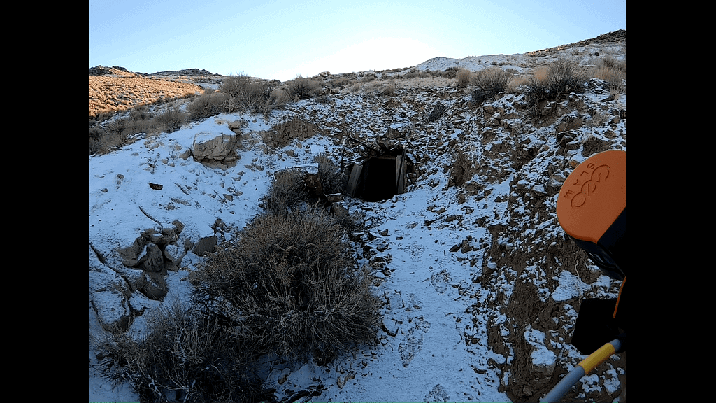
Carrington Consulting’s team is scanning more than 5 miles of tunnels at Pamlico for Newrange. These workings extend over an area more than 1,500 feet long and 800 feet wide with a vertical depth of roughly 300 feet and form an extensive network of adits, tunnels, stopes and raises with at least 30 major entrances that are largely interconnected. Scanning is tied to established surface survey control for registration and orientation so the scan can be accurately carried underground. Underground survey control points are established using a series of spheres to allow Newrange’s geologists to later reoccupy the points to complete the geological mapping.
Many of the mine workings are less than a metre wide and in some cases, they are also less than a metre high following the gold vein, wherever it goes, forming a very irregular, complex network of tunnels and stopes. It would be prohibitively slow and expensive to do this essential mapping with conventional surveying or terrestrial scanning, but the ZEB Horizon makes it realistic for Newrange to accomplish this ambitious goal.
As always safety is paramount, especially when entering old mine tunnels and stopes. With the 100 meter distance capability of the Horizon no one needs to go into unsafe areas. In addition virtually every timber, ladder, and detail are recorded.
We have produced highly accurate data of mine workings up to ¼ mile in length in less than 15 minutes, which changes the game for Newrange at Pamlico. As Newrange gathers information on gold grades from sampling throughout these workings, we are integrating additional layers of information to build a comprehensive 3D model of the geology across the entire area of old underground workings.