Last Updated on 21st July 2023
Boosting efficiency with mobile LiDAR for urban planning
Over 50% of the global population lives in urban environments, with estimates suggesting it will increase to 6 billion people by 20451. City developers are starting to react to these levels of growth and beginning to provide the services, infrastructures, and other sustainable developments needed. Various digital technologies have benefited developers, boosting efficiency and productivity for urban planning. One such technology is mobile LiDAR.
This article explores how mobile LiDAR is utilised in urban planning to increase the sustainability of environments and quality of life for residents.
What is urban planning?
Urban planning is the process of creating layouts and plans for urban areas, including building development, land design, and risk management. It’s a key process in helping to improve the lives of inhabitants by ensuring suitable education, work, and recreation opportunities. Urban planning aims to create sustainable cities, both for the environment and the communities within. It also allows urban areas to react to potential risks faster and with accurate information- due to the creation of accurate documents and information.
How is LiDAR used in urban planning?
The accuracy and versatility of LiDAR means it has an important role in urban planning by providing more information to city developers. This, in turn, can influence a range of factors within urban environments which include:
Road planning and traffic control
LiDAR scanners create accurate 3D digital replicas of roads and intersections which help to monitor traffic analytics. This actionable data is useful for examining near misses between vehicles, pedestrians, and cyclists to increase safety measures on roads.
Environmental monitoring
Using LiDAR sensors, city planners can track air quality which allows for the identification of highly polluted parts of a town or city. The lasers emitted by the LiDAR device illuminate certain particles in the atmosphere and analyse the light reflected back to the sensor, known as backscatter. This then determines the quantity of pollutants in the air.
Emergency planning and disaster management
LiDAR helps communities prepare and mitigate in case of emergencies. An example would include creating accurate floorplans of a building to highlight entrances, exits, or passageways to aid both the public and rescue teams during or after a disaster.
Construction
Access to LiDAR is important for construction teams as it gives them the ability to produce 3D point clouds of buildings and spaces. This is valuable in urban planning as it allows for the creation of BIM (Building Information Modelling) or CAD (Computer Aided Design) for carrying out renovations or redesigns.
Safety measure implementation
Law enforcement uses LiDAR scanners to increase safety measures within urban environments for a variety of reasons, such as recreating crime scenes or monitoring crowds at large public events to alert them to security threats and emergencies.
How is mobile LiDAR used for urban planning?
Using mobile LiDAR for urban planning is becoming increasingly adopted as its versatility makes project completion quicker and cost-effective. Mobile LiDAR scanners can collect accurate data of urban environments whilst causing minimal disruption to residents’ daily lives. Examples include:
Precise measurements from mobile LiDAR provide spatial information around roads, bridges, and tunnels which is useful for assessing existing infrastructure. Scans using mobile LiDAR are easily repeatable, due to its speed of capture and ease of use, which makes tracking structural movement or deterioration simpler.
Furthermore, mapping roads using mobile LiDAR shows potential for informing future transport projects and identifying issues like areas at high risk of bottlenecks. In turn, helping to reduce the overall carbon production levels, contributing to cleaner air for residents.
UrbanArk worked with PhD student Dr Aaron Miller to scan Belfast, Ireland’s, narrow streets to create flood inundation models. Dr Miller also scanned underground basements below the streets to assess what areas would flood and how quickly. He then merged the individual datasets into one point cloud to create accurate 2D maps and VR walkthroughs to share within communities for safety.
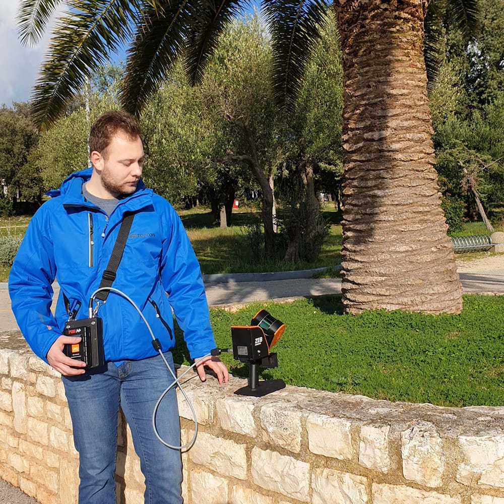
Infrastructure planning
Precise measurements from mobile LiDAR provide spatial information around roads, bridges, and tunnels which is useful for assessing existing infrastructure. Scans using mobile LiDAR are easily repeatable, due to its speed of capture and ease of use, which makes tracking structural movement or deterioration simpler.
Furthermore, mapping roads using mobile LiDAR shows potential for informing future transport projects and identifying issues like areas at high risk of bottlenecks. In turn, helping to reduce the overall carbon production levels, contributing to cleaner air for residents.
UrbanArk worked with PhD student Dr Aaron Miller to scan Belfast, Ireland’s, narrow streets to create flood inundation models. Dr Miller also scanned underground basements below the streets to assess what areas would flood and how quickly. He then merged the individual datasets into one point cloud to create accurate 2D maps and VR walkthroughs to share within communities for safety.
Mobile LiDAR is ideal for capturing large areas of land, especially mounted to UAVs. Gathering information about terrain, vegetation, or trees provides a source of truth for land patterns and suitable areas of development. This is beneficial within urban planning for the creation of new housing developments, parking lots, or parks.
The Maistra Group, a tourist company in Croatia, used mobile LiDAR to capture up-to-date information from one of their 6 campsites. They created a digital terrain model which included contours of the land. With the walk-and-scan method of handheld laser scanners, they were able to make light work of the task, successfully mapping the campsite and collecting the data needed.
Land use
Mobile LiDAR is ideal for capturing large areas of land, especially mounted to UAVs. Gathering information about terrain, vegetation, or trees provides a source of truth for land patterns and suitable areas of development. This is beneficial within urban planning for the creation of new housing developments, parking lots, or parks.
The Maistra Group, a tourist company in Croatia, used mobile LiDAR to capture up-to-date information from one of their 6 campsites. They created a digital terrain model which included contours of the land. With the walk-and-scan method of handheld laser scanners, they were able to make light work of the task, successfully mapping the campsite and collecting the data needed.
Managing and maintaining large urban projects is important, and therefore accurate record-keeping is a must. Mobile LiDAR is a suitable and repeatable way of capturing large areas fast, leaving surveyors with the up-to-date information they need now and in the future. Mobile laser scanners are a beneficial tool for asset management as their capabilities allow teams to scan residential and commercial buildings easily with minimal disruption.
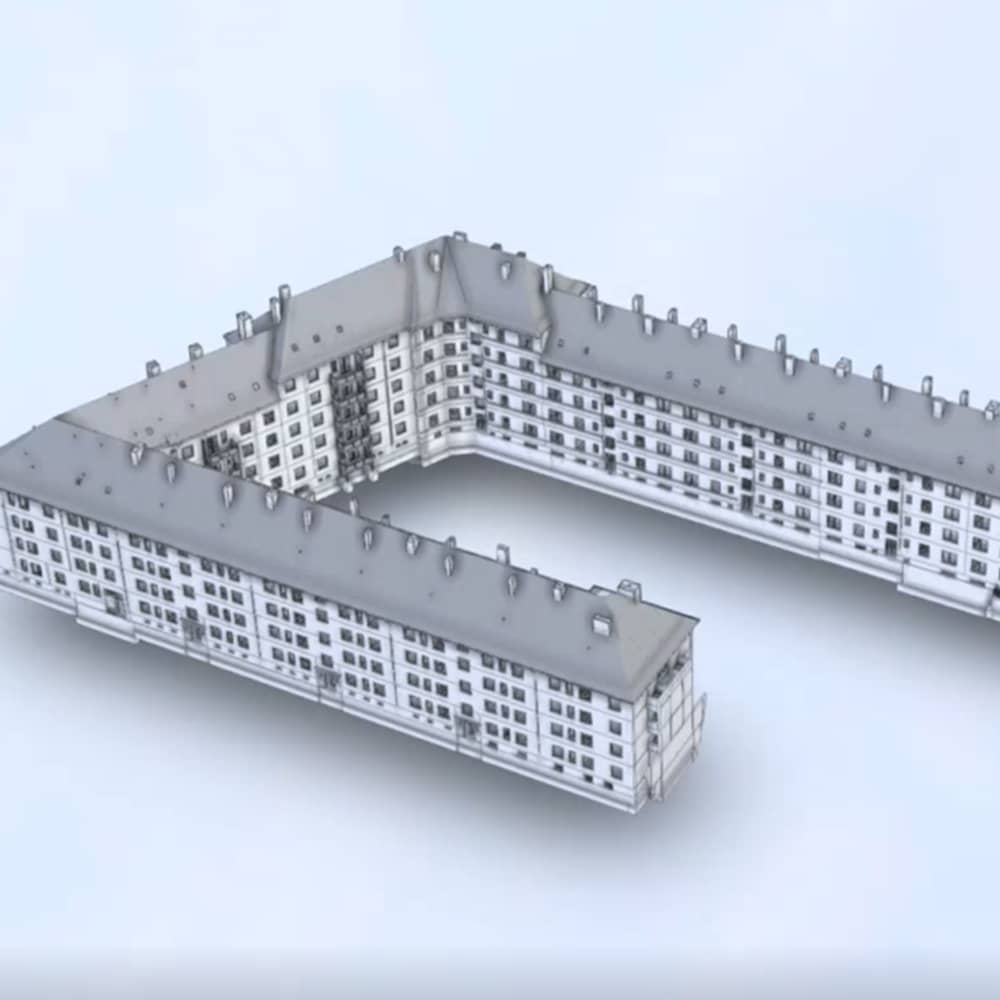
Danish company Eseebase used mobile LiDAR to collect data of a large building in Hamburg to create floorplans for renovations and for BIM. The building has 163 individual apartments, occupied at the time, and 13 staircases across 7 floors. Due to the ease of use of mobile LiDAR scanners, the team scanned all the spaces in just 3 days, massively reducing time and costs for this project.
Asset management
Managing and maintaining large urban projects is important, and therefore accurate record-keeping is a must. Mobile LiDAR is a suitable and repeatable way of capturing large areas fast, leaving surveyors with the up-to-date information they need now and in the future. Mobile laser scanners are a beneficial tool for asset management as their capabilities allow teams to scan residential and commercial buildings easily with minimal disruption.
Danish company Eseebase used mobile LiDAR to collect data of a large building in Hamburg to create floorplans for renovations and for BIM. The building has 163 individual apartments, occupied at the time, and 13 staircases across 7 floors. Due to the ease of use of mobile LiDAR scanners, the team scanned all the spaces in just 3 days, massively reducing time and costs for this project.
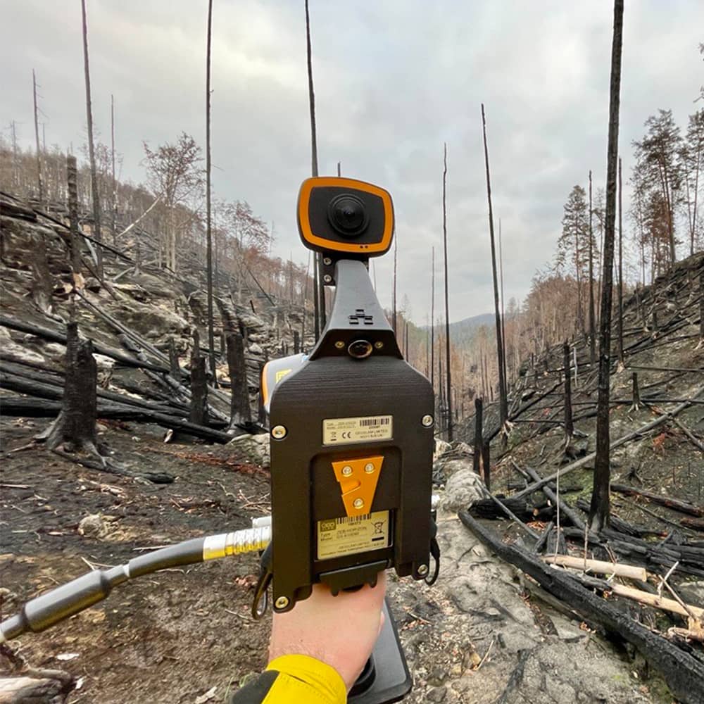
Mapping urban environments with mobile LiDAR allows surveyors to model potential risks such as flooding by creating accurate flood models. Using handheld laser scanners makes scans repeatable as often as necessary, without incurring high costs and causing sites to shut down for long time periods. Being able to react to both natural and man-made disasters easily and efficiently makes mobile LiDAR an ideal tool for risk management and could help save lives.
Additionally, mobile LiDAR has a variety of benefits in the disaster management cycle, all the way from prevention to response and recovery, find out more here.
Risk Management
Mapping urban environments with mobile LiDAR allows surveyors to model potential risks such as flooding by creating accurate flood models. Using handheld laser scanners makes scans repeatable as often as necessary, without incurring high costs and causing sites to shut down for long time periods. Being able to react to both natural and man-made disasters easily and efficiently makes mobile LiDAR an ideal tool for risk management and could help save lives.
Additionally, mobile LiDAR has a variety of benefits in the disaster management cycle, all the way from prevention to response and recovery, find out more here.
Mapping large areas allows for a way to show blueprints of an area, thus understanding the accurate boundaries of buildings. This is useful for collecting up-to-date information on the layouts of residential environments, commercial buildings, and urban environments. With mobile LiDAR this process is more streamlined as capturing multiple scans is quicker and easier, often with just one person.
As Bengaluru, India, goes through a period of modernisation the local government wished to map the informal settlements with their narrow lanes and complex layouts. With mobile LiDAR, the team tasked with this project captured data of 40-45 different areas of the informal settlements. The walk-and-scan method allowed one individual to navigate the complicated passageways easily and deliver the required information to their client.
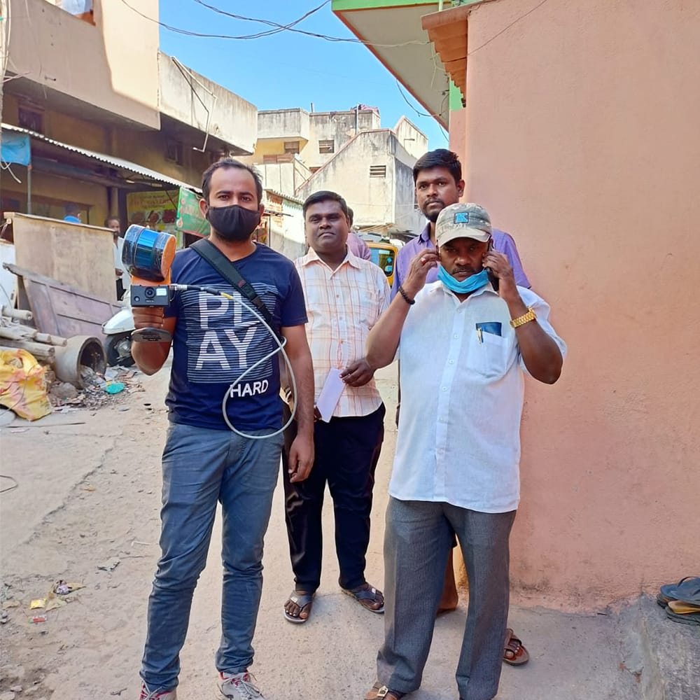
Measurements and boundaries
Mapping large areas allows for a way to show blueprints of an area, thus understanding the accurate boundaries of buildings. This is useful for collecting up-to-date information on the layouts of residential environments, commercial buildings, and urban environments. With mobile LiDAR this process is more streamlined as capturing multiple scans is quicker and easier, often with just one person.
As Bengaluru, India, goes through a period of modernisation the local government wished to map the informal settlements with their narrow lanes and complex layouts. With mobile LiDAR, the team tasked with this project captured data of 40-45 different areas of the informal settlements. The walk-and-scan method allowed one individual to navigate the complicated passageways easily and deliver the required information to their client.
Benefits of mobile LiDAR for urban planning
No matter the urban project or stage of completion, mobile LiDAR has the capacity to deliver the correct information and fulfil requirements. The handheld nature and speed of capture of mobile laser scanners mean project completion is more efficient and does not interrupt the general running of an urban environment.
As cities become increasingly reliant on technology, urban planners should consider mobile LiDAR as an option to produce deliverables faster for the benefit of both residents and businesses.
References
- Urban Development Overview (worldbank.org)
Get in touch
If you’d like to learn more about how GeoSLAM solutions can help you, submit the form below.