Last Updated on 25th April 2022
How can we use laser scanning for historic preservation?
Laser scanning plays a major role in the work of many industries, but perhaps one of the most exciting is heritage preservation.
With hundreds of organisations around the world dedicated to preserving historic sites, buildings and objects, people are always looking out for new opportunities or technologies to help.
Whether it’s creating architecture references for restoration work or 3D models for immersive education, the heritage sector has fully embraced the possibilities that laser scanning for historic preservation can bring. It’s fast becoming one of the key tools in the important struggle to preserve our heritage for future generations.
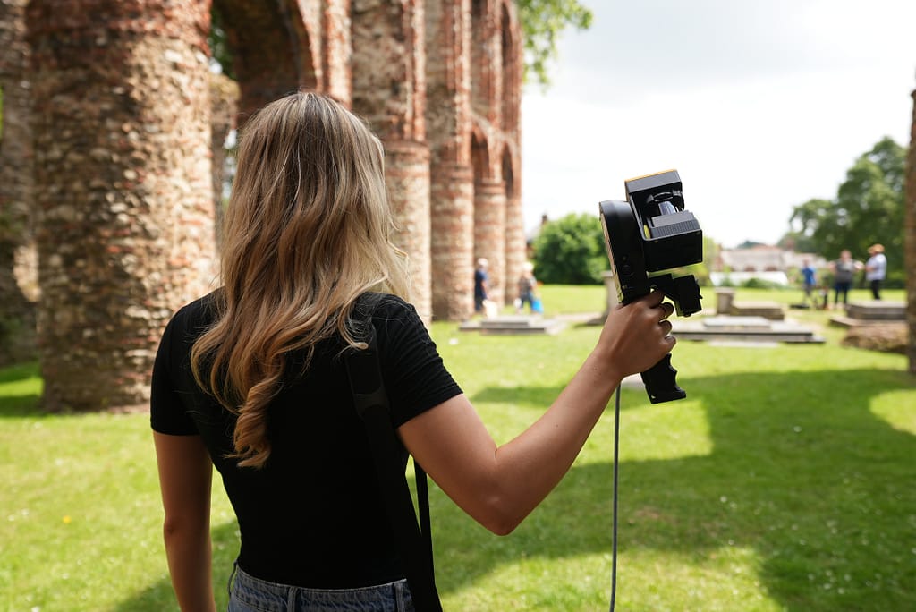
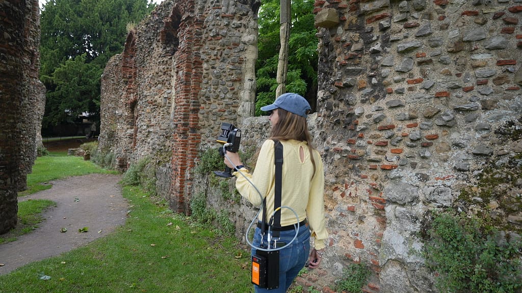
Using Point Cloud Data To Preserve Historic Sites
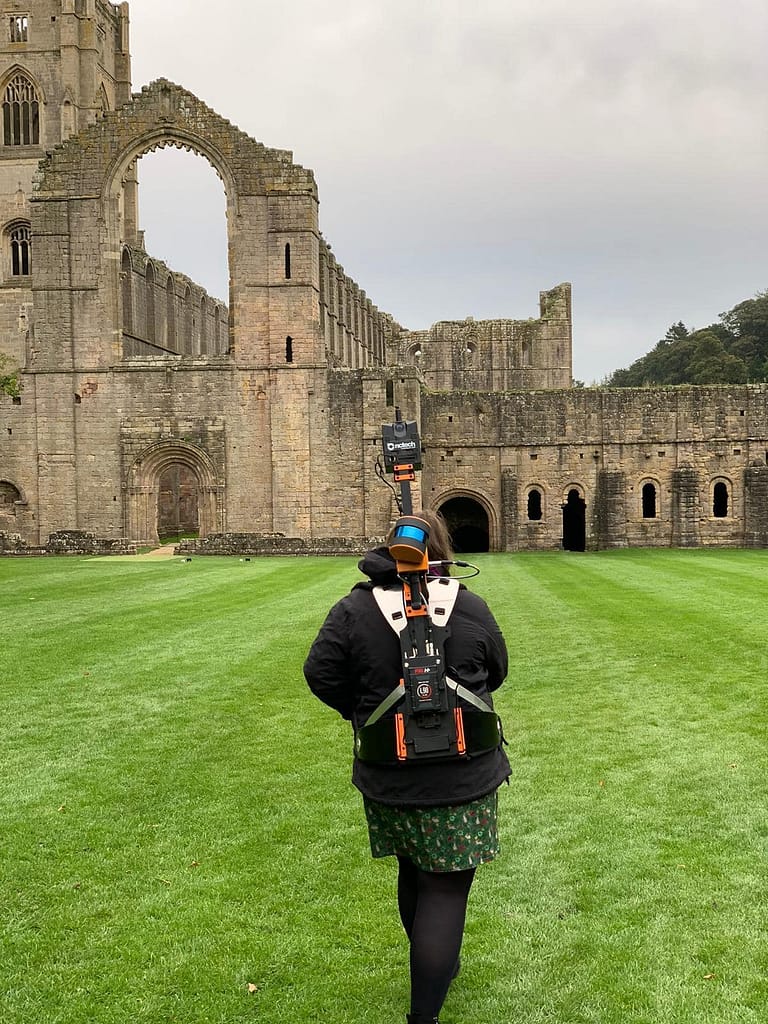
One challenge that will always face the heritage sector is the preservation of historic places and structures.
Even with the most diligent maintenance and support programmes, it can be a struggle to preserve historic buildings indefinitely. Ageing architecture can have long-buried structural defects, while modern weather can conduct vicious assaults producing unpredictable risks.
Datasets and documentation created using laser scanning technology give us a way to protect historic sites through accurate restoration, as well as helping to identify potential future issues.
Restoring Christ The Redeemer From A Point Cloud
Recently, GeoSLAM was involved in a project to create reference datasets of the renowned Christ the Redeemer statue.
As the statue celebrated its 90th birthday in October this year, a restoration project has begun to repair some of the weather damage this breathtaking heritage site has suffered. To help restorers keep their work accurate, laser scanning was used to capture a complete set of point cloud data before the restoration work began.
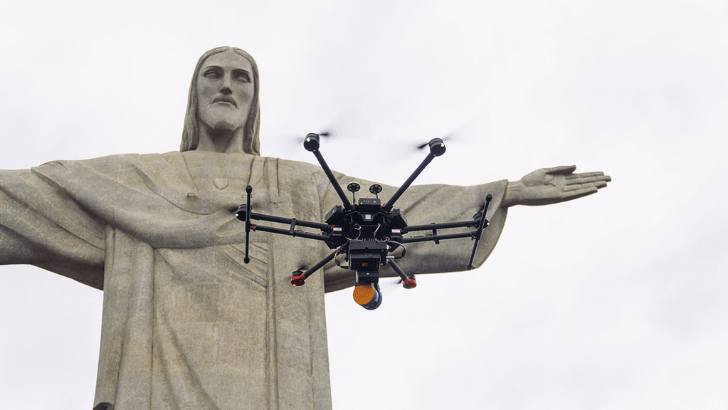

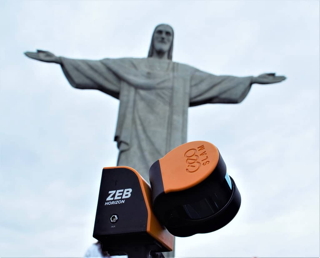
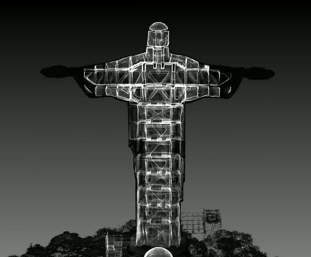
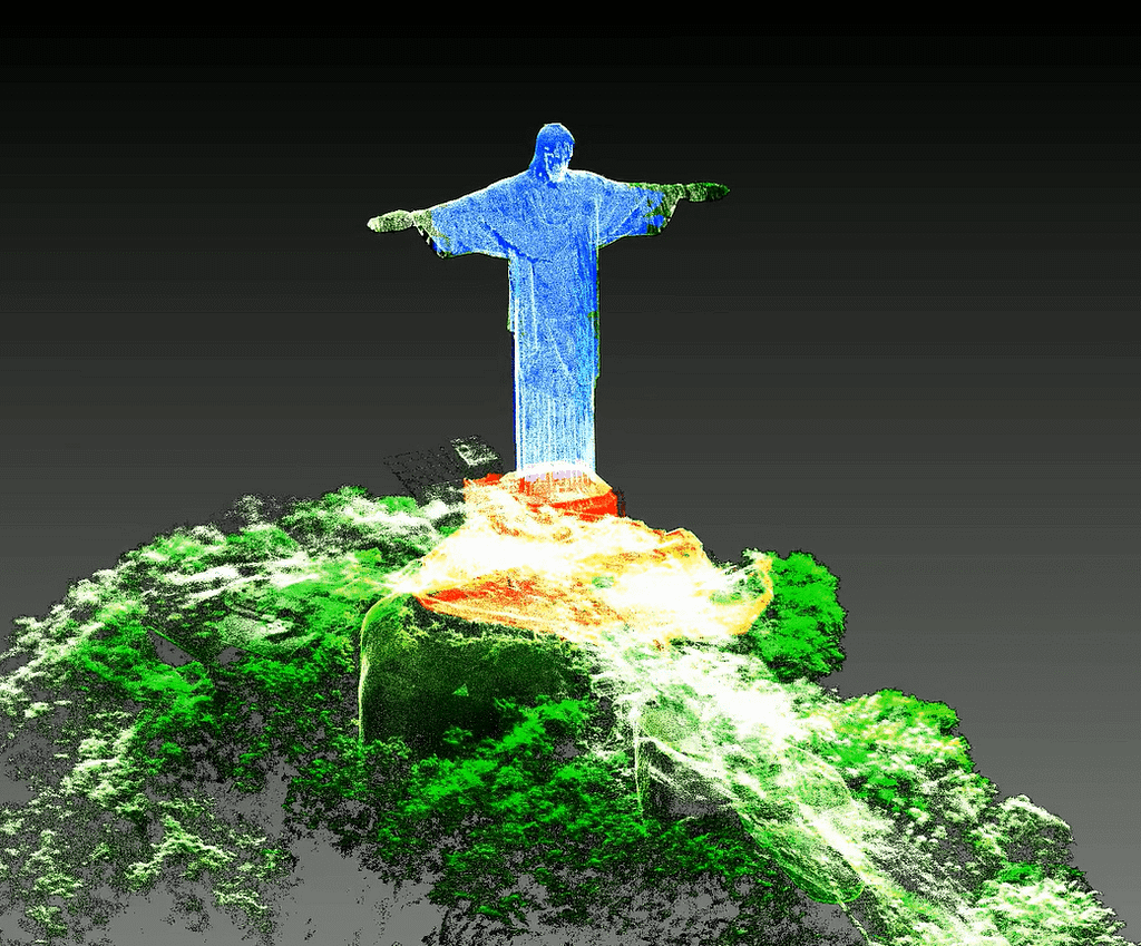
As well as external reference imagery, a laser scan was even taken of the internal structure of the statue, to help assess its future stability. This complex laser scan is proving to be a defining development in the process to restore the statue.
Read More on our Christ the Redeemer Project.
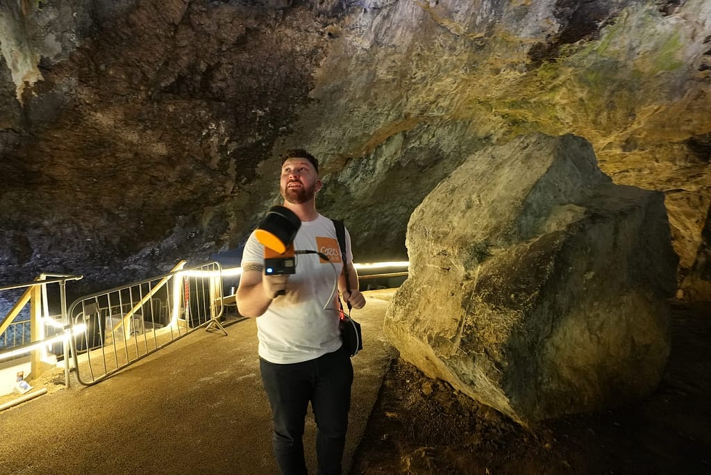
Mapping Out Underground Tunnels With Laser Scanning
Laser scanning was also used to assess the potential for the development of a World War Two heritage site in Ramsgate.
Previously used for railway transport, the Ramsgate tunnels became the largest underground shelter system in the world during the Second World War. Though the site is still a historical tourist landmark, parts of the structure have collapsed over the years and are now impossible to access.
With a major redevelopment planned for the tunnels, Historic England user GeoSLAM laser scanning equipment to map out the extent of the damage to the inaccessible tunnels.
See the case study here.
Recreating Historical Sites In Virtual And Augmented Reality
Laser scanning of buildings and architecture can also support heritage preservation beyond restoration work.
Some heritage sites are already lost. Others remain without the details or situations that define their heritage importance. In a location such as this, point cloud data can be used to recreate the original historical environment and allow people to experience the site as it was.
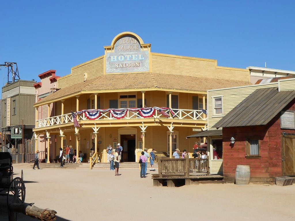
Recreating The Old Tuscan Studios
Many of Hollywood’s iconic Western movies were filmed in The Old Tucson Studios in Arizona, and the decision has been made to preserve the facades of the studios as an important cinematic heritage site in the world.
This will eventually take the form of virtual and augmented reality versions of the studios during key points across its history from its beginning in the late 1930s when the studio was built to its sixties heyday when no less than four John Wayne films were shot there.
When the project is completed, visitors will be able to wear a headset at the studio and experience exactly how it looked when films such as Rio Bravo were shot.
To help them create this virtual world, a core data set has been made using a combination of technological techniques. Details collected from archived photos and drone imagery, as well as measurements from original films, will be used alongside a set of extensive 3D laser scans that were taken by a ZEB Cam.
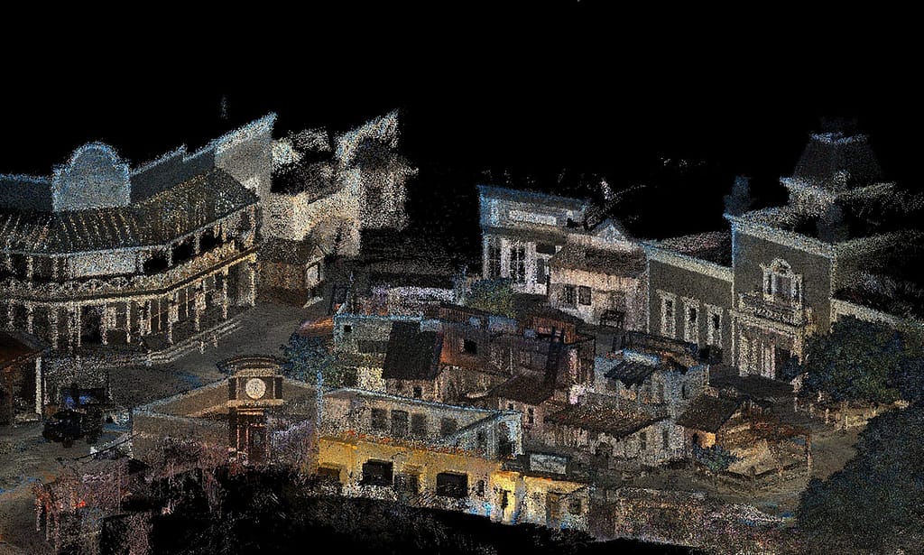
The complete point clouds that these scans were able to produce will provide valuable assistance and detail to the team building the virtual versions of this iconic studio.
See the case study here.
Generating A Battlefield For VR Education Experience
Another team using lasers to capture point clouds for heritage preservation is Phat Nguyen and his fellow researchers at Virginia Tech.
They recently turned heads in the historic education field by using the GeoSLAM handheld unit to scan cramped World War I tunnels in Vauqios, France in order to create an immersive simulation.
This team realised the only way to truly learn about the desperate conditions that soldiers faced while building miles of tunnels beneath a French country village was to experience them. So they have combined a virtual reality version of the tunnels with physical structures to make an immersive experience. All based on 3D laser scans taken by a ZEB Horizon Scanner.
Find out more here.
Using Laser Scanning To Record And Recreate Historic Artefacts And Objects
It isn’t simply historic sites that are being captured and preserved using laser scanners either. Institutions like The Smithsonian are also using laser scanning to preserve millions of historic artefacts.
Across the museums and heritage sector, laser scanning technologies are being used to record objects relating to history, culture, art and aviation. Preservation teams have been laser scanning their relics and artefacts, then using the point cloud data to create 3D digital versions that can be viewed anywhere.
Institutes such as the Smithsonian in Washington have already been doing this for decades, on items such as spacesuits from the Apollo 11 mission.
More than simply helping to preserve history, these virtual reality experiences are helping to democratise it. They are ensuring important historical moments, relics and learning are accessible to anyone, wherever they are in the world.
Leading The Way Using Laser Scanning Technology
It is hard to explain the excitement that has developed around the possibilities of scan data in the field of conservation. Historians, researchers, and academics are using laser scanners for projects that don’t just preserve history for future generations. They’re also giving current generations a deeper understanding of their impact, changing the way people view them and maximising the way people learn from them.
These are just some of the preservation projects that have employed the use of laser scanning technology. If you’re interested in finding out more about how laser scanning can be used to support historic preservation, the construction industry and more, take a look at some of our case studies.
Want to see how GeoSLAM could help your projects?
Get in touch below to talk to us about your projects


