Last Updated on 25th April 2022
In this blog, Robert Vargo, Northeast Mobile Imaging and GIS Consultant at Keystone Precision Solutions, shares his thoughts on the partnership between GeoSLAM, the technology’s impact on an ‘unlimited’ list of sectors, and Keystone’s plans for the future.
What business do you work for and what is its background?
At Keystone, we help our customers increase productivity, become safer and more profitable. We offer a range of total-service solutions, including training and seminars, rentals, repairs and education. For example, we have previously offered a series of seminars at some of the region’s largest PLS Conferences, allowing land surveying professionals to obtain education credits to maintain their licences, while learning about mobile LiDAR.
For the last 30 years, we have operated under the name of Keystone Precision Instruments. Under this title, we’ve grown and adapted, tailoring our offerings to a wide variety of customer needs. These changes have led us to become multidisciplinary in our consultations, making the list of products and services on offer far outreach what we have in our catalogues. For this reason, we’ll be heading into our 30th year in business under a new name, Keystone Precision Solutions.

Keystone’s HQ in Pennsylvania
How long have you been working with GeoSLAM?
We began working together in March 2019, and since then, both parties have had the opportunity to explore one another’s capabilities and work on a clear road map for the future.
The ethos of the ZEB product line fits in so well with our other products and offerings and we’re excited to embark down this path with some of the brightest SLAM minds in the world. GeoSLAM’s relentless pursuit of innovation always keeps us on our toes.
How receptive has the US-market been towards GeoSLAM technology?
With the amount of information accessible today, and the large number of products out there, making a purchasing decision in today’s world can be a challenge.
However, it has been a great process exploring our Northeastern territory with GeoSLAM’s products in mind. With SLAM technology still a relatively new face in the market, we have spent a large amount of time educating our customers and other prospective partners about where these tools fit into their workflow.
As we uncover the benefits – such as the speed and ease of use – and share the results with our clients, we are seeing a great reception to the technology.
What sort of sectors are your customers working in?
Although we have been working with the ZEB product line for some months now, I’m yet to define the limits of our target market for these products. The interest in the speed of the capture has led to some unique conversations across multiple sectors.
For instance, you have interest from surveyors, architects, civil engineers and traditional AEC channels. But then, I’ve also spent days speaking with an organisation pitching the ability of SLAM to work in tight spaces like caves, with little to no light.
Speed has also sparked real interest in emergency response conversations, as well as rapid capture of manholes and underground vaults. The go-anywhere nature of the equipment really helps keep its ‘defined uses’ door wide open.

Robert Vargo
What challenges are your customers facing in their industries?
Customer obstacles, depending on industry, tend to manifest themselves in different ways. For the most part though, with some simple translation, you can see that they boil down to three main categories.
Firstly, customers want to make sure they optimise their time out in the field, and do not want to have to return to site. This is especially prevalent as COVID-19 is impacting everyone’s projects and developments.
Second, you have the discussion around workflow. For the most part, this requires the longest investigation because we want to ensure the customer and its end users are getting to their final goal with the least amount of steps. No organisation wants its data to be translated through seven different interfaces before making it to its end form.
Lastly, we like to uncover each customer’s field / office team makeup. As these tools – built to rapidly absorb data out in the field – continue to improve, what does that mean for the office workflow? How do we better prepare our customers for making that transition from field to office workflow? Some industries are used to seeing a ratio of 6:1, for field vs. office. Now we find ourselves seeing that ratio perform a 180-degree flip.
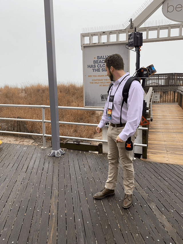
At the beach with ZEB Discovery
How does GeoSLAM technology help to solve these challenges?
Well, luckily, it’s all pretty straightforward and simple. GeoSLAM’s devices centre around three pillars – speed, simplicity and quality. When it comes to optimising field deployments, the key benefit the ZEB line brings to the table is the ability to qualitatively gather the large portions of the site, mildly replicating that of an existing conditions survey.
This data set will offer numerous intangible benefits later on in the project. What happens when you want to see what was there at the start, or gather measurements on features and locations you may have missed with traditional methods.
Next on the list is workflow optimisation. GeoSLAM Hub does a great job in the speed category here, emphasising the ability to get straight to some measurement tools for quick checks. After you realise the benefits of the speed of capture, we must look at the field, office staff and data export. Neither the field operator, or the designer back in the office, will have any issue getting the data into their software of choice. From there, the office team will be able to make easy work of the point cloud.


