Last Updated on 25th April 2022
Amidst all the new consumer tech developments of the last 10 years, there’s nothing that quite excites forward-thinking surveyors as a drone! To be able to use aerial technology to easily map areas that were previously off-limits to humans is ground-breaking. Unmanned aerial vehicles (UAVs, or commonly referred to as ‘drones’), were originally used in military operations for missions “too dull, dirty or dangerous” for humans.1 But new laws allow for people to operate UAVs for commercial purposes, and demand has now expanded to the civilian sector – so much so, that millions are sold each year.2
The negative connotations associated with drones (namely, warfare, attacks and spying) are reducing as businesses get excited about the ways drone technology can help them. From crop monitoring in agriculture, and helping security personnel discreetly map large areas for threats, to easily carrying out construction site inspections and delivering small parcels to consumers (yes, your next pizza could well be delivered by a drone!), new opportunities have opened that drive efficiency and reduce cost. It’s no surprise that the global commercial drone market is growing year on year as industries embrace the power of aerial data.
Driving a mapping revolution
One area where drones are driving a cost-effective mapping revolution is in Africa. The Zanzibar Mapping Initiative3 is creating a high-resolution map of the islands of Zanzibar and Pemba, over 2300 square km, using low-cost drones instead of satellite images or manned planes. The data will be used for better planning, land tenure and environmental monitoring.
Despite UAV mapping making scanning easier and faster, there are still a number of myths associated with capturing accurate spatial data. Here we look at how GeoSLAM helps mapping professionals bust the top 7 myths:
- Myth 1 – you need to be a trained surveyor. Wrong! GeoSLAM’s technology is highly accessible and within minutes anyone can be using it for effortless data capture. You don’t need to be a surveyor to survey – with our user-friendly scanners the setup is simple and requires minimal training. Providing you have the required drone permissions and licenses in your regions you can almost instantly start mapping the world around with you with a UAV.
GeoSLAM’s user-friendly scanning equipment
- Myth 2 – the UAV must stay within close range of the ground for accurate data capture. Not necessarily! Although a lower altitude will result in a higher point cloud density, our scanners have a maximum range up to 100m. So you can be creating accurate scans from way above the tree canopy.

ZEB Horizon point density table
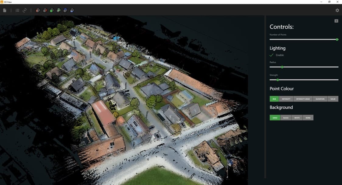
High quality point clouds captured from over 35m
- Myth 3 – you need to stay within GPS range. No, you don’t! Our fully-mobile technology is adaptable to any environment, without the need for GPS. This completely opens up areas which are ordinarily off-limits to human survey teams such as mines, stockpiles and forests.
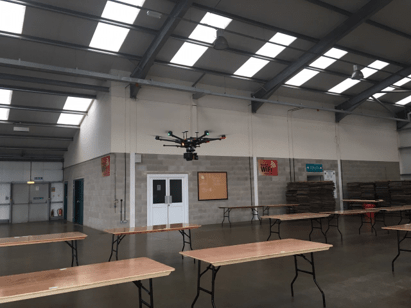
The ZEB Horizon can be used inside and in GNSS denied areas
- Myth 4 – UAV SLAM data takes a long time to process. Not ours! GeoSLAM Hub, our innovative, award-winning software, turns data into real-time 3D information, delivering accurate results with fully automated SLAM. Gain even greater insight by overlaying with other data by exporting files in a range of industry-standard formats.
- Myth 5 – you can’t capture images at the same time. Incorrect! The advancement of camera technology means you can now add vision, context and colour to 3D data. GeoSLAM’s camera helps visualise synchronised imagery alongside point cloud models.
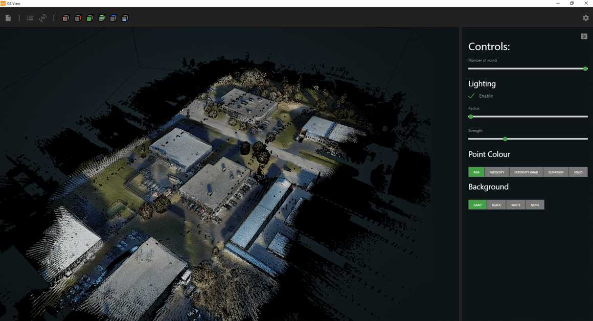
Colourised data in GeoSLAM Hub
- Myth 6 – you can’t capture terrain data in wet or low light conditions. We can! While sunny, warm weather is ideal for scanning, it is still possible to map terrains in inclement weather due to the ZEB Horizon‘s IP 54 rating – provided your drone has an increased wind-resistance factor. Our splash-proof, dust-tight laser scanners operate inside, outside, in daylight and darkness.
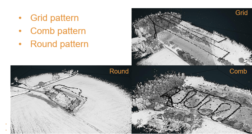
- Myth 7 – all flight patterns must be the same. Not so! Depending on the terrain and mission, you can deploy different patterns. Our strong SLAM algorithm will enable you to fly in grid patterns for for large area scanning, manual loop scans or vertical round pattern for a scan of a single object (like towers). Each mission is unique, and we provide flexible options for you to get the best results whether it’s a large automated mission, manual flight or you are capturing aerial footage of a feature-poor terrain.
Thanks to the rapid hardware and software development we are now witnessing a shift in surveying and mapping technology. If one of these myths was preventing you from using an airborne application, think again. For the first time, surveyors can accurately map forests, railways, farmlands, power lines and estates with UAV technology. How can we help you map the world around you today? Find out more contact us.
References:
1 Unmanned Aerial Vehicles – Brian Tice
2 Drone Sales Have Tripled – fortune.com
3 Africa’s mapping challenges are being answered with drones – Adam Hartley


