Skip to content

Accelerating Processes and Streamlining Fieldwork at Cabot Survey Partnership

Location

Johannesburg, South Africa

Scan time

Approx. 10 minutes per scan

Size

Range from 400m2 to 20ha

Scanned

Large exterior spaces

Industry

Surveying

Cabot Survey Partnership is a leading South African surveying company that provides civil and structural surveys, and CAD services, to a range of clients in the AEC and mining industries. To stay ahead of the competition, Cabot is always looking to innovate, implementing technology that can help deliver accurate and comprehensive results faster.

In this case study, we’ll explore Cabot’s use of handheld LiDAR scanners to speed up processes and reduce fieldwork.

The decision to use handheld LiDAR

Traditional methods for surveying

Cabot originally used static-based LiDAR solutions to carry out surveys and collect data for their clients. While this method is highly accurate, they realised that they needed to produce similarly accurate results faster, to reduce overall fieldwork. They required a solution that could easily and efficiently capture large spaces ranging from 400m2 to 20ha.

Transforming a small business

As a small business, balancing workload with capacity is vital for Cabot Survey Partnership.

To stay competitive, Cabot invested in handheld LiDAR technology, that would have a direct and positive impact on their business by:

  • Streamlining their workflows and completing jobs faster, allowing them to take on more projects
  • Understanding their customer needs and diversifying business offerings accordingly
  • Requiring fewer resources to complete projects

Gustav Fick, Segment Manager at OPTRON (Pty) Ltd, the local supplier of GeoSLAM technology in South Africa, understood Cabot’s business requirements and recommended a GeoSLAM solution to help their business expand. Consequently, Cabot made the switch to handheld LiDAR, resulting in streamlined projects and enhanced time efficiency.

How Cabot use the ZEB Horizon

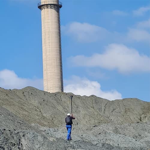
In 2019, Cabot acquired a ZEB Horizon and became the first private surveying company in South Africa to use the technology. The ZEB Horizon’s ease of use and lightweight nature help Cabot deliver accurate and comprehensive results faster, with only one person needed onsite to capture data. This allows Cabot to cover multiple sites simultaneously, reducing the overall time spent collecting data.

The laser scanner’s adaptability to the range of solutions Cabot offers means they can carry out 50-60 scans per month, with most scans taking under 10 minutes, depending on the particular solution and scanning environment.  

Clients have commented on the quality of the scan deliverables, stating that they can now visualise the data points better. They are also impressed with the overall results of the project.

Solutions

Cabot uses the ZEB Horizon for a variety of applications resulting in reduced fieldwork, by roughly 80%. The laser scanner now works across three primary surveying solutions.

Stockpile measurements

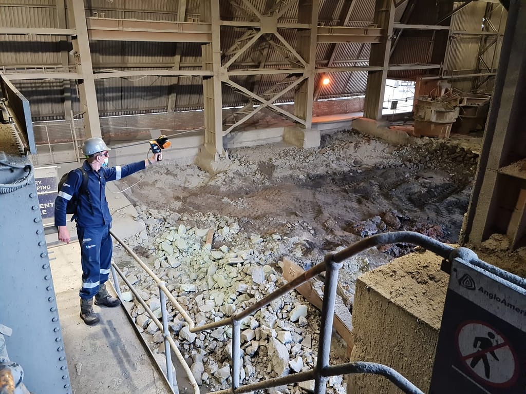
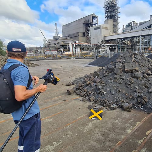
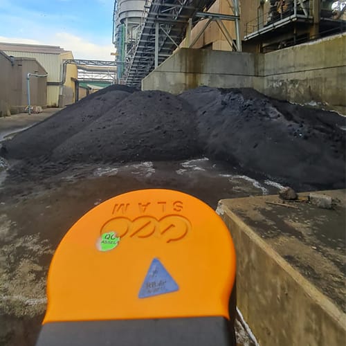
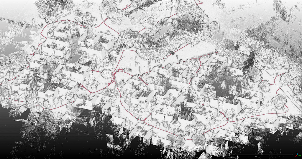
They carry out 10-15 scans of stockpiles per client, each month. The walk-and-scan method of GeoSLAM technology is vital for scanning stockpiles, especially those inside buildings or in between multiple structures. Within an hour of processing the data, Cabot begin calculating measurements of the stockpile, delivering a fast end-to-end solution.

According to Arnold Bothma, Managing Director of Cabot Survey Partnership, surveying a concentrated area in a platinum processing plant used to take about two hours with a robotic total station. However, with the ZEB Horizon, the process now takes about eight minutes, and the actual model takes around 30-40 minutes, resulting in significant time savings for the team. This increased efficiency allows them to spend more time analysing the data rather than capturing it.
Infrastructure applications

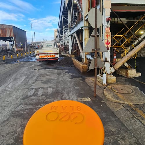
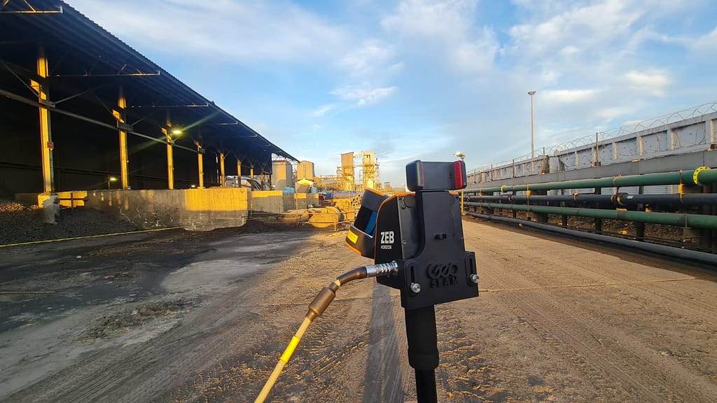
Cabot utilises the ZEB Horizon to determine the precise distance of cable racks, which are structures designed to organise long distances of cables or wires, across large areas. The accuracy of these measurements is critical, especially in cases where the cables are one-piece, and the lead time for ordering a new cable is as long as six months. With the ZEB Horizon, they were able to obtain the necessary data promptly, and provide clients with the exact measurements required for cable orders. Thanks to the scanner, clients were able to order cables with confidence, knowing that their measurements were precise and accurate.

Cabot create their deliverables, including stockpile calculations and topographical detail contour plans, using Trimble Business Centre.
Conclusion

The speed, accuracy, and flexibility of the ZEB Horizon have been extremely beneficial for Cabot Survey Partnership. The laser scanner’s capabilities have reduced their time onsite, increased productivity, and expanded the total amount of projects they can undertake. The speed of capture has led to safer data collection for surveyors, and clients receive deliverables faster. Using GeoSLAM technology, Cabot has carried out approximately 1000 scans, and this number continues to grow.

With handheld LiDAR technology, Cabot Survey Partnership is setting the bar for efficiency and accuracy in the survey industry.

Get in touch

If you’d like to learn more about how GeoSLAM solutions can help you, submit the form below.


    Industry

    Primary Application Interest

    Primary Application Interest

    Country

    State

    State

    State

    State

    State

    State

    State

    State

    State

    State

    State

    State


    GeoSLAM and its authorised partner network will use the information you provide to contact you about products and services. You may unsubscribe from these communications at any time. For information on how to unsubscribe, as well as our privacy practices and commitment to protecting your privacy, please review our Privacy Policy.

    Opt in to the FARO mailing list for updates and offers.


    Using LiDAR for site documentation

    Location

    Rovinj, Croatia

    Scan time

    20 minutes per scan

    Size

    1110m x 700m

    Scanned

    Campsite

    Industry

    Surveying

    Whether you are cruising down the Adriatic coast, visiting the famous Game of Thrones filmsets in Dubrovnik or experiencing some of Croatia’s famous cities; with visitors to Croatia more than doubling since 2010, tourism has become an important part of the Croatian economy.


    In the North sits the Istrian peninsula, a place known for its beauty, history, amazing food, and a place tourists flock to year on year both domestically and internationally. A sharp increase in visitors has meant that tourism sector has needed to adapt to the exponential growth.


    The Maistra group is one of Croatia’s leading tourist companies. They manage 18 hotels, 11 tourist villages and 6 campsites in sought out destinations such as Rovinj, Vrsar, Zagreb and Dubrovnik. With so much property to manage, they need quick and efficient ways to keep their site documentation up to date. In early 2021 they approached GeoSLAMs Croatian dealer, Geocentar, requesting a scan of one of their campsites in Rovinj on the Istrian peninsula.

    Working with the ZEB Horizon in Rovinj

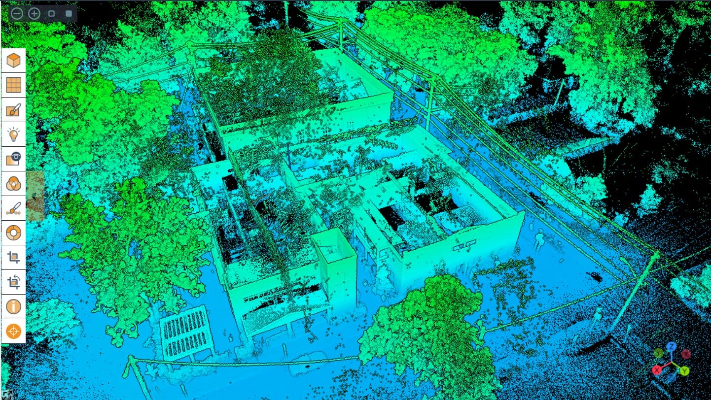
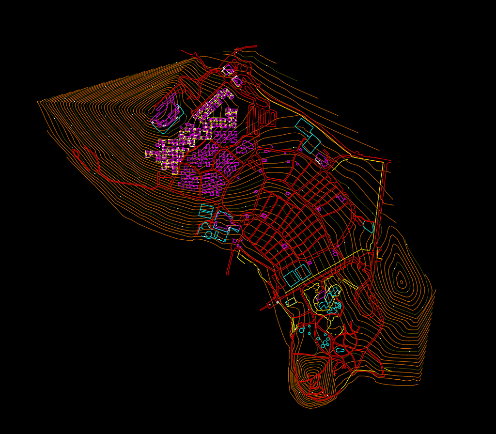
    Due to the size of the site, 1100m x 700m, the team at Geo-Centar opted to tackle the scan using GeoSLAMs ZEB Horizon, plus aerial photogrammetry. The aim of the survey was to create up to date campsite documentation in the form of 2D vector maps, high resolution 2D raster maps, georeferenced imagery, and a digital terrain model with contours. As a result of the campsites age and need to modernisation, the documentation will serve as a reference for design purposes.


    Combining both high resolution orthophotos of the area with the point cloud from the ZEB Horizon, the team were able to capture data quickly, accurately and without disruption. By utilising the walk-and-scan method of capturing data, they were able to make light work of the task.

    Being able to walk and scan is a true blessing in such situations since any other scanning method is either much slower or much more expensive.

    In total, 10 scans were conducted which mainly focused on buildings, terrain covered with vegetation and other objects that would be tough to capture with aerial photography. Each scan took approximately 20 minutes, so the team were able to cover the entire 1100m x 700m in just over 3 hours. Using the scans, the team were able to extract roads, sports fields, fences, stairs buildings and roads.

    Post Scan

    During the scan, the team used a survey grade GNSS receiver to georeference the data. The team used GeoSLAM software to accurately georeference the scans which enabled them to correct any trajectory drifts that may have occurred during the scan. This further ensured that accurate and quality data was delivered to the client.

    In addition, the team were able to georeference images taken alongside the scan and open them in GeoSLAM Draw. The software was then used to export the web version (HTML) of the top view layout containing the location of the images. This HTML was easily shared with investors and engineers working on the same project, providing a visual impression.

    The pointcloud data was exported to 3rd party software, where the team were able to create the documentation and maps for their client.

    Results

    The team were successfully able to map the campsite and extract the data needed to create high quality survey maps, a digital terrain model and contours, which will now be used to modernise the campsite.

    Get in touch

    If you’d like to learn more about how GeoSLAM solutions can help you, submit the form below.


      Industry

      Primary Application Interest

      Primary Application Interest

      Country

      State

      State

      State

      State

      State

      State

      State

      State

      State

      State

      State

      State


      GeoSLAM and its authorised partner network will use the information you provide to contact you about products and services. You may unsubscribe from these communications at any time. For information on how to unsubscribe, as well as our privacy practices and commitment to protecting your privacy, please review our Privacy Policy.

      Opt in to the FARO mailing list for updates and offers.


      GeoSLAM Sample Data

      View and download data in our free point cloud viewer

      Here’s some helpful tips for the best viewing experience

      • If your internet connection allows, move the Point Budget slider to the maximum amount available to view all the points in the cloud.
      • Making the point size smaller using the Point Size slider makes the data easier to view and interpret.
      • In the tools section of the viewer, you can measure the distance and angles of features within the pointcloud.
      • Using the materials section of the viewer, you can use the Select Attributes dropdown to view by intensity, elevation and RGB (if point cloud is coloured).

      Railway Line

      Location: Norway
      ZEB Scanner: ZEB Horizon
      Scan time:
      15 Minutes

      Would you like to see a specific dataset that’s not on this page? Contact [email protected]

      Providing innovative solutions using UAVs

      and LiDAR scanners

      Location

      Savannah,
      USA

      Scan time

      From 10-30 minutes

      Size

      Varies depending on scan

      Scanned

      Large exterior spaces

      Industry

      Surveying

      Delivering accurate representations of built environments

      Shamrock+, based in Savannah Georgia, provides creative and visual solutions to individuals and businesses through photography and 3D data collection services. Using UAVs, cameras, sensors and software, Shamrock+ delivers accurate representations of built environments for their clients.

      Shamrock+ largely works within Architecture, Engineering and Construction (AEC), however, they also assist professionals with projects in the Real Estate sector. Their solutions include photography, progress documentation, creating 3D data visualisations, and as-built.

      Shamrock+ originally used a static-based LiDAR solution to produce their 3D point clouds. Though highly accurate, they needed a faster solution for collecting data. Additionally, they needed a versatile scanner that can be mounted to UAVs and cars to capture larger areas.

      As a result, Shamrock+ chose to work with GeoSLAM’s ZEB Horizon scanner.

      What used to take hours to scan, is now taking us significantly less time to cover more areas.

      Using the ZEB Horizon laser scanner on UAVs

      The ZEB Horizon has significantly reduced the time needed to scan, whilst simultaneously delivering accurate data. The easy-to-use solution and simple setup mean the team could immediately begin scanning.

      Many of the areas Shamrock+ capture are large exterior spaces, and the 100m range of the ZEB Horizon make it the ideal solution. The team carried out an architectural scan of an approximately 10,000 sq. ft Community Bible Church (CBC) in Savannah, GA. This project consisted of 3 individual scans of the interior building and its surrounding area, with the scan time ranging from 10 to 30 minutes.

      Shamrock+ uses the ZEB Horizon laser scanner on UAVs, handheld and with GeoSLAM’s car mount accessories. The versatile solution provides Shamrock+ with the ability to switch from air based data capture to scanning large areas in a very short amount of time.

      Creating 3D BIM files, floorplans and more with GeoSLAM technology

      Shamrock+ has completed more than a dozen projects to date, each with its own challenges. From scanning building interiors for renovation, to mapping acres of land for topographical data, the ZEB Horizon has proven to be a tool that can overcome the challenges it has faced so far.

      Shamrock+ processes the ZEB Horizon’s data using GeoSLAM Connect. They also internally integrate the point clouds into other software platforms to create 3D BIM files, floorplans, elevations, contours, and much more.

      By using GeoSLAM’s technology, Shamrock+ can capture large acres of land in a short period of time. This speeds up their data collection process without sacrificing accuracy, which allows them to spend more time on creating high quality visual solutions for their clients.

      If you’d like to learn more about how GeoSLAM solutions can help you, submit the form below.


        Industry

        Primary Application Interest

        Primary Application Interest

        Country

        State

        State

        State

        State

        State

        State

        State

        State

        State

        State

        State

        State


        GeoSLAM and its authorised partner network will use the information you provide to contact you about products and services. You may unsubscribe from these communications at any time. For information on how to unsubscribe, as well as our privacy practices and commitment to protecting your privacy, please review our Privacy Policy.

        Opt in to the FARO mailing list for updates and offers.


        GeoSLAM Sample Data

        View and download data in our free point cloud viewer

        Here’s some helpful tips for the best viewing experience

        • If your internet connection allows, move the Point Budget slider to the maximum amount available to view all the points in the cloud.
        • Making the point size smaller using the Point Size slider makes the data easier to view and interpret.
        • In the tools section of the viewer, you can measure the distance and angles of features within the pointcloud.
        • Using the materials section of the viewer, you can use the Select Attributes dropdown to view by intensity, elevation and RGB (if point cloud is coloured).

        Clifton Suspension Bridge, UK

        Location: Bristol, UK
        ZEB Scanner: ZEB Horizon and ZEB Vision
        Total Scan time:
        16 Minutes

        Would you like to see a specific dataset that’s not on this page? Contact [email protected]

        GeoSLAM Sample Data

        View and download data in our free point cloud viewer

        Here’s some helpful tips for the best viewing experience

        • If your internet connection allows, move the Point Budget slider to the maximum amount available to view all the points in the cloud.
        • Making the point size smaller using the Point Size slider makes the data easier to view and interpret.
        • In the tools section of the viewer, you can measure the distance and angles of features within the pointcloud.
        • Using the materials section of the viewer, you can use the Select Attributes dropdown to view by intensity, elevation and RGB (if point cloud is coloured).

        Africa Museum

        Location: Belgium
        ZEB Scanner: ZEB Horizon and ZEB Vision
        Total Scan time:
        20 Minutes

        Would you like to see a specific dataset that’s not on this page? Contact [email protected]

        GeoSLAM Sample Data

        View and download data in our free point cloud viewer

        Here’s some helpful tips for the best viewing experience

        • If your internet connection allows, move the Point Budget slider to the maximum amount available to view all the points in the cloud.
        • Making the point size smaller using the Point Size slider makes the data easier to view and interpret.
        • In the tools section of the viewer, you can measure the distance and angles of features within the pointcloud.
        • Using the materials section of the viewer, you can use the Select Attributes dropdown to view by intensity, elevation and RGB (if point cloud is coloured).

        Laman Mahkota Bukit Serene

        Location: Johor Bahru, Malaysia
        ZEB Scanner: ZEB Horizon and ZEB Vision
        Scan time:
        5 Minutes

        See the data flythrough video here.

        Would you like to see a specific dataset that’s not on this page? Contact [email protected]

        Surveying Interior and Exterior Environmental Features

        Location

        Kansas,

        USA

        Scan time

        Approx. 20 minutes per scan

        Size

        Over 1 million sq/ft per year

        Scanned

        Buildings and Underground Oil Tanks

        Industry

        Surveying

        Collecting Accurate Measurements of Buildings for the Military

        The Kansas Adjutant General’s Department coordinates resources for local, state, and federal use. They also develop internal use documents for the military, including surveying building interiors to create up-to-date and accurate floorplans for military members within Kansas.  

        They have about 35 sites throughout the state, with some locations 100s of miles away from the headquarters. Further, the Adjutant General’s Department manages approximately 250 buildings state-wide, totaling around 2 million sq. ft. of interior space. These factors have led to some difficulties in keeping up with projects, and any changes to the buildings and layouts.

        The team found that when remodelling buildings, they were having issues getting as-builts completed in time. As-builts are documents that are used to compare a building’s design plan versus its final measurements. They also provide accurate blueprints of the building, and the surrounding land, as actually constructed at the end of the project.

        Being able to have one person go out to capture all of the data and have the most current floorplans, along with the accuracy of the scanners is a gamechanger

        Kansas Adjutant General’s Department Use of the ZEB Revo

        Scanning Properties to Keep on Top of Changes Made

        To tackle these issues, the team decided to adopt LiDAR laser scanning technology to aid them in their projects and found GeoSLAM’s ZEB Revo to be the best option. By acquiring GeoSLAM’s technology, the Kansas Adjutant General’s Departments’ goal was to scan over half of their 2 million sq. ft. of interior space every year.

        The ZEB Revo is handheld, accurate and fast, providing the team with a perfect tool. In addition, the simplicity and ease of use means only one team member needs to travel to a site, when necessary. Previous methods of data capture were not as quick or accurate. The ZEB Revo data capture leads to a faster return on projects, higher levels of accuracy, and a high return on investment.

        By using the ZEB Revo, the Kansas Adjutant General’s Department have updated over 1 million sq. ft. of interior space, achieving their overall goal, with just one technician visiting half of the sites per year. The speed of capture of the ZEB means that the average time it takes the team to carry out a scan is just 20 minutes. By collecting accurate measurements, they can now regularly update their GIS database, which provides up to date floorplans throughout the state.

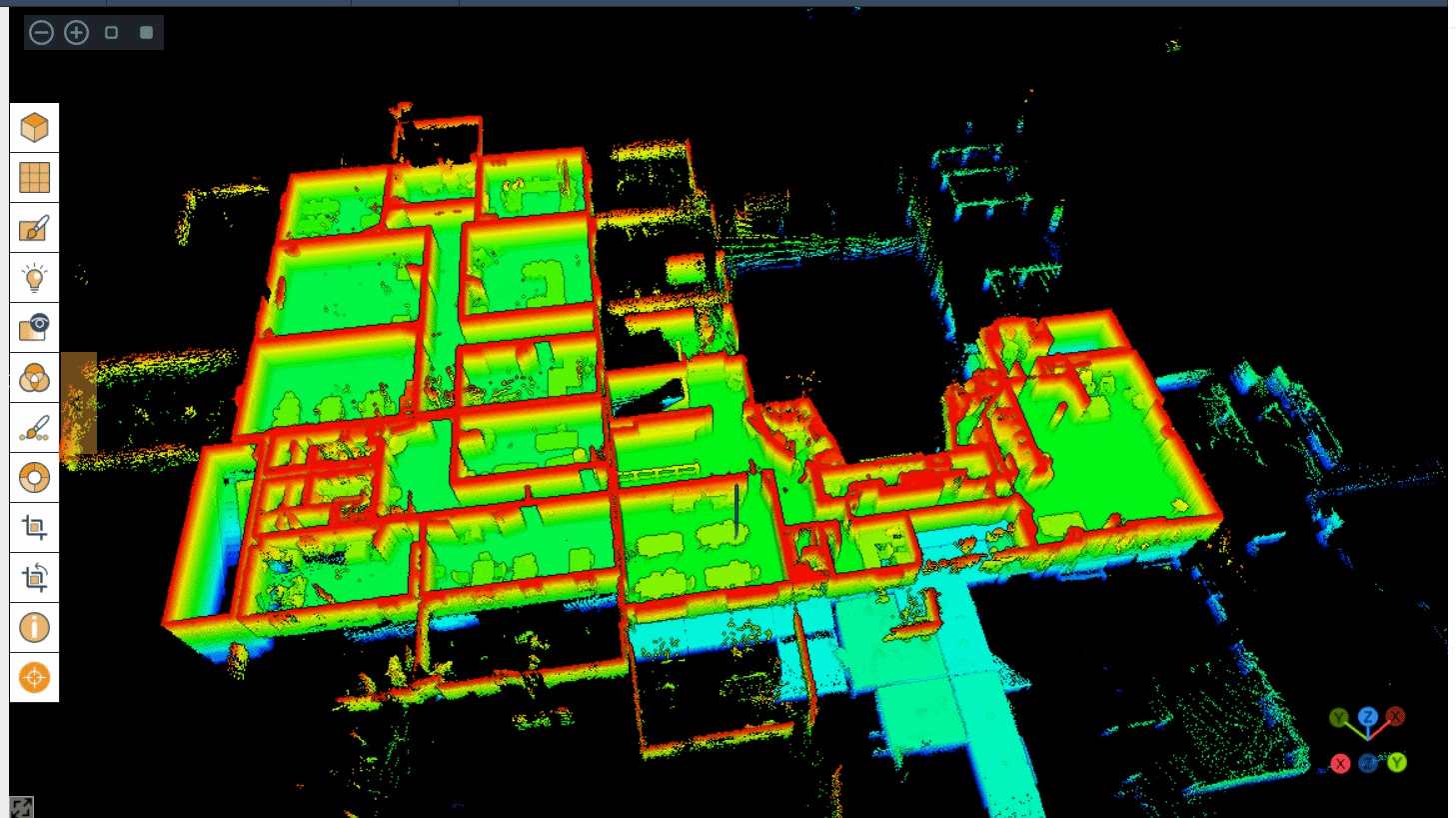
        Data from the ZEB Revo is also used to create ‘X-Ray’ views of their properties for future plans and layouts.

        team member collecting accurate measurements with the ZEB Revo

        Collecting Accurate Measurements with the ZEB Horizon

        Recently, they have expanded their use of handheld LiDAR technology by acquiring a ZEB Horizon, which they use for a variety of reasons. The increased range and data capture points make the ZEB Horizon a great option for large exterior scanning. This is important to the Adjutant General’s Department as they cover land of up to 50 acres.

        Scanning Environmental Features to Work out Contour Lines

        The Kansas Adjutant General’s Department also have tanks that contain hazardous material which they need to track carefully. Using the ZEB Horizon, they scan exterior environmental factors to figure out contour lines within their complex. This helps them work out where any spillages of hazardous material would be, should one occur.

        Using the ZEB Horizon to Ensure Current Asset Management

        With the ZEB Horizon, the team also carry out exterior scans for asset management. Due to the scanners ease-of-use, one engineer can attach it to a truck and drive around their complex. This enables Kansas Adjutant General’s Department to scan their entire site and keep on top of their buildings and resources.

        The team are also looking to expand this by attaching the ZEB Horizon to a UAV in the future.

        Collecting Accurate Measurements of Underground Oil Tanks

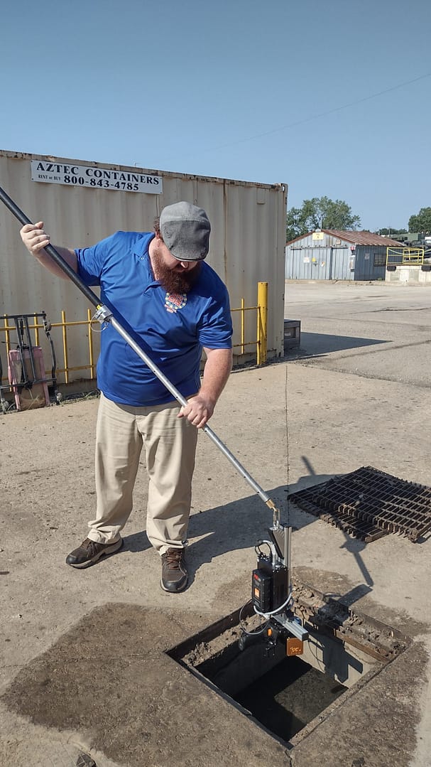
        The ZEB Horizon’s time saving, and accurate scans have proven to be a cost-effective method of data capture. For example, scans of underground empty oil storage tanks showed that the Kansas Adjutant General’s Department had been over estimating the tanks collection capacity, leading to an adjustment of the servicing contract.

        Processing Data into Point Clouds and Third Party Integration

        Since The Kansas Adjutant General’s Department acquired GeoSLAM’s technology four years ago, they have carried out approximately 2000 scans, and this number continues to rise.

        Further, the contractors and architects that create as-builts are now using The Kansas Adjutant General’s Department to quality check their work for accuracy. Using GeoSLAM laser scanners, they help find errors in specifications and relay that information to the contractors.

        floorplans created after collecting accurate measurements

        With the help of Seiler Geospatial Division, Kansas Adjutant General’s Department have been able to significantly improve their workflow. To find out more about Seiler, click here.

        seiler logo

        If you’d like to learn more about how GeoSLAM solutions can help you, submit the form below.


          Industry

          Primary Application Interest

          Primary Application Interest

          Country

          State

          State

          State

          State

          State

          State

          State

          State

          State

          State

          State

          State


          GeoSLAM and its authorised partner network will use the information you provide to contact you about products and services. You may unsubscribe from these communications at any time. For information on how to unsubscribe, as well as our privacy practices and commitment to protecting your privacy, please review our Privacy Policy.

          Opt in to the FARO mailing list for updates and offers.


          GeoSLAM Sample Data

          View and download data in our free point cloud viewer

          Here’s some helpful tips for the best viewing experience

          • If your internet connection allows, move the Point Budget slider to the maximum amount available to view all the points in the cloud.
          • Making the point size smaller using the Point Size slider makes the data easier to view and interpret.
          • In the tools section of the viewer, you can measure the distance and angles of features within the pointcloud.
          • Using the materials section of the viewer, you can use the Select Attributes dropdown to view by intensity, elevation and RGB (if point cloud is coloured).

          Klagenfurt Cathedral

          Location: Austria
          ZEB Scanner: ZEB Horizon
          Scan time:
          18 Minutes

          Would you like to see a specific dataset that’s not on this page? Contact [email protected]

          GeoSLAM Sample Data

          View and download data in our free point cloud viewer

          Here’s some helpful tips for the best viewing experience

          • If your internet connection allows, move the Point Budget slider to the maximum amount available to view all the points in the cloud.
          • Making the point size smaller using the Point Size slider makes the data easier to view and interpret.
          • In the tools section of the viewer, you can measure the distance and angles of features within the pointcloud.
          • Using the materials section of the viewer, you can use the Select Attributes dropdown to view by intensity, elevation and RGB (if point cloud is coloured).

          Chemical Plant

          Location: Europe
          ZEB Scanner: ZEB Horizon/ ZEB Discovery
          Scan time:
          15 Minutes

          Colourised data was captured using the ZEB Discovery backpack solution.

          Would you like to see a specific dataset that’s not on this page? Contact [email protected]

          How do you colourise a point cloud?

          With ever-increasing research and development in the technology, the advances in both scanning hardware and processing software are improving the detail, scale and use of point cloud data. One of these improvements is colourisation. Adding colour has plenty of benefits when viewing and analysing point cloud data.